Kodiak Mountain Goat Hunting Area DG/RG 476
Kiliuda Bay
(USGS Maps - Kodiak B-3 & B-4)
Location:
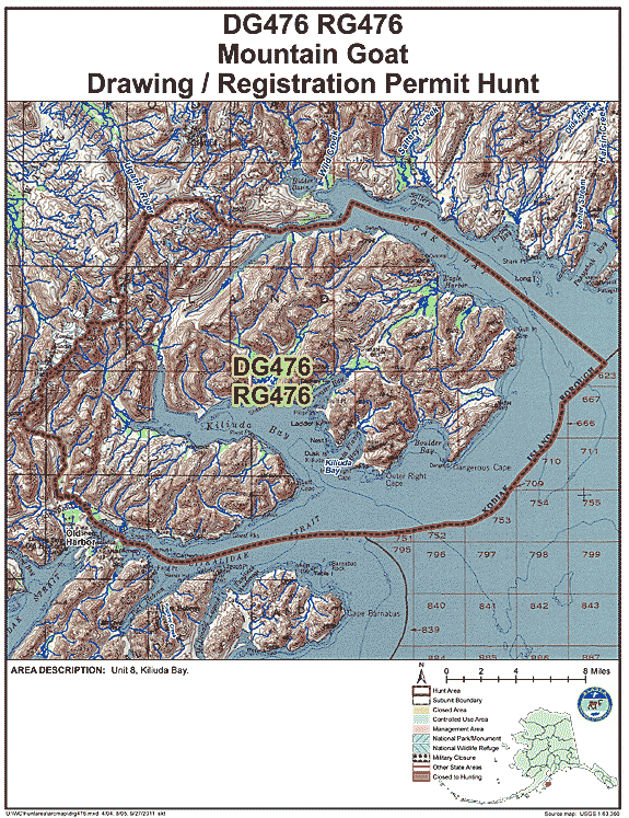
Northeast Kodiak, includes area north and east of Midway Creek to the headwaters which ends approximately one mile east of Windy Lake (Lake 2073'), and east of a line running on the east side of Koniag Glacier to the upper headwaters of Spiridon River and heading northeast along the Uganik Gorge, which is just north of Lake 1945, to the snowfield just south of Lake 2250 turning east down the headwaters of the western arm of South Ugak Bay. Area includes all of Shearwater Peninsula and the Left Cape Peninsula. See area map (Image file 132 kB) for more information.
Land Ownership:
The majority of hunt area is State land with Kodiak National Wildlife Refuge lands occupying the south half of the hunt area. Some private and Old Harbor Native Corporation lands occupy the lowland coastal areas. www.dnr.alaska.gov/mlw/planning/easmtatlas/kodiak/.
Access:
Hunt area has good alpine lake access as well as good access from coastal areas.
Population Trend:
From 2013 to 2017 the population of goats in this area has ranged from 180 to 220 goats.
| Area | Hunt No. | Permits | % Draw (2017) |
|---|---|---|---|
| Kiliuda Bay | DG476 | 20 | 15% |
Mountain Goat Harvest Data:
DG476 (Draw Hunt)
| Year | Permits Issued | Hunters Afield | Harvest | % Success |
|---|---|---|---|---|
| 2017 | 30 | 10 | 10 total (10 male) | 100% |
| 2016 | 30 | 15 | 10 total (6 male, 4 female) | 67% |
| 2015 | 30 | 15 | 6 total (5 male, 1 female) | 40% |
| 2014 | 30 | 9 | 5 total (3 male, 2 female) | 56% |
| 2013 | 30 | 15 | 4 total (4 male) | 27% |
| 2012 | 30 | 17 | 3 total (3 male) | 18% |
| 2011 | 30 | 20 | 11 total (9 male, 2 female) | 55% |
| 2010 | 30 | 13 | 3 total (1 male, 2 female) | 23% |
RG476 (Registration Hunt)
| Year | Permits Issued | Hunters Afield | Harvest | % Success |
|---|---|---|---|---|
| 2017 | 14 | 4 | 1 total (1 male) | 25% |
| 2016 | 19 | 9 | 3 total (3 male) | 33% |
| 2015 | 8 | 7 | 3 total (3 male) | 43% |
| 2014 | 19 | 6 | 2 total (2 female) | 33% |
| 2013 | 11 | 6 | 3 total (3 male) | 50% |
| 2012 | 18 | 7 | 2 total (1 male, 1 female) | 29% |
| 2011 | 0 | 0 | 0 | NA |
| 2010 | 8 | 3 | 1 total (1 male) | 33% |