Maps & GIS
Commercial Fisheries
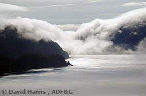
Fog rolling in over mountains into Cross Sound in Southeast Alaska
GIS Data Downloads
Maps by Fishery Type
- Salmon Commercial Fishing Maps
- Herring Commercial Fishing Maps
- Shellfish Commercial Fishing Maps
- Groundfish Commercial Fishing Maps
- Dive Fisheries Maps
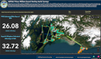
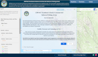
Interactive Maps
Shorebased Processor Maps
- 2025 Arctic-Yukon-Kuskokwim Region Shorebased Processors by Port (PDF 1,145 kB)
- 2025 Bristol Bay Shorebased Processors by Port (PDF 791 kB)
- 2025 Cook Inlet and Prince William Sound Shorebased Processors by Port (PDF 1,830 kB)
- 2025 Southeast Alaska Shorebased Processors by Port (PDF 3,205 kB)
- 2025 Westward Region Shorebased Processors by Port (PDF 1,564 kB)