Interior & Northern Alaska Subsistence & Personal Use Fisheries
Closed Areas
In addition to the Nonsubsistence use areas listed below other specific areas are closed to subsistence and/or personal use fishing. For specific information on closures contact the local ADF&G office.
Fairbanks Nonsubsistence Area
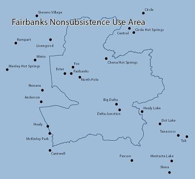
The Fairbanks Nonsubsistence Area is comprised of the following: within Unit 20(A), as defined by 5 AAC 92.450(20) (A), east of the Wood River drainage and south of the Rex Trail but including the upper Wood River drainage south of its confluence with Chicken Creek; within Unit 20(B), as defined by 5 AAC 92.450(20) (B), the North Star Borough and that portion of the Washington Creek drainage east of the Elliot Highway; within Unit 20(D) as defined by 5 AAC 92.450(20) (D), west of the Tanana River between its confluence with the Johnson and Delta Rivers, west of the east bank of the Johnson River, and north and west of the Volkmar drainage, including the Goodpaster River drainage; and within Unit 25(C), as defined by 5 AAC 92.450(25) (C), the Preacher and Beaver Creek drainages.