Hunting Maps
By Game Management Unit (GMU)
Note: Use of these maps indicates that you have read and understand the liability statement.
Select a Game Management Unit for a list of hunts.
Game Management Unit
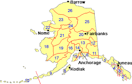
Game Management Unit 20
Bison
| Hunt Number(s) |
Unit(s) | Hunt Description | Static PDF Map |
Custom Map |
|---|---|---|---|---|
|
DI403 |
20D | Unit 20D, Delta |
View Map
(637 kB) |
Make a Custom Map |
|
DI404 DI403 |
20D | Unit 20D, Delta |
View Map
(637 kB) |
Make a Custom Map |
Black Bear
| Hunt Number(s) |
Unit(s) | Hunt Description | Static PDF Map |
Custom Map |
|---|---|---|---|---|
|
General Season |
20 |
Unit 20
Residents and non-residents Bag limit: Three bears Season dates: no closed season Hunt requires harvest ticket |
View Map
(839 kB) |
Make a Custom Map |
Brown/Grizzly Bear
View brown/grizzly bear range map
| Hunt Number(s) |
Unit(s) | Hunt Description | Static PDF Map |
Custom Map |
|---|---|---|---|---|
|
RB640 |
20D | Unit 20D |
View Map
(2,164 kB) |
Make a Custom Map |
|
General Season |
20A, 20B |
Units 20A; and 20B, remainder
Residents and non-residents Bag limit: One bear every regulatory year Season dates: Sept 1 – June 15 |
View Map
(4,076 kB) |
Make a Custom Map |
|
General Season |
20B |
Unit 20B, that portion of the drainage of the Middle Fork of the Chena River and that portion of the Salcha River drainage upstream from and including Goose Creek
Residents and non-residents Bag limit: One bear every regulatory year Season dates: Aug 10 – June 30 |
View Map
(691 kB) |
Make a Custom Map |
|
General Season |
20C, 20D, 20F |
Units 20C, 20D and 20F
Residents and non-residents Bag limit: One bear every regulatory year Season dates: Aug 10 – June 30 |
View Map
(4,913 kB) |
Make a Custom Map |
|
General Season |
20E |
Unit 20E
Residents and non-residents Bag limit: Two bears every regulatory year Season dates: Aug 10 – June 30 |
View Map
(458 kB) |
Make a Custom Map |
Caribou
| Hunt Number(s) |
Unit(s) | Hunt Description | Static PDF Map |
Custom Map |
|---|---|---|---|---|
|
AC999 |
20B, 20D, 20E, 20F, 25C |
Unit 20B and 20F, east of the Richardson, Steese, Elliott and Dalton Hwys; 20D, north of the south bank of the Tanana R; 20E; 20F east of Dalton Hwy and south of the Yukon R; and 25C Targeted Hunt Residents Only |
View Map
(3,320 kB) |
Make a Custom Map |
|
DC826 |
20A |
Unit 20A, Central Alaska Range Nonresidents Nonguided Only |
View Map
(2,683 kB) |
Make a Custom Map |
|
DC827 |
20A |
Unit 20A, Central Alaska Range Residents Only |
View Map
(2,683 kB) |
Make a Custom Map |
|
DC828 |
20A |
Unit 20A, Central Alaska Range Nonresidents Guided Only |
View Map
(2,683 kB) |
Make a Custom Map |
|
YC831 |
20B, 20E, 25C | Unit 20B; 20E, Fortymile Taylor Highway (Zone 3); and 25C, Fortymile Steese Highway - Chena Hot Springs Road (Zone 1), Youth Hunt |
View Map
(3,735 kB) |
Make a Custom Map |
|
RC835 |
12, 20D |
Unit 12, west of the Glenn Hwy, south of the Alaska Hwy, excluding the Tok River drainage; and 20D, south of the Tanana River, east of Jarvis Creek Macomb herd Residents Only |
View Map
(640 kB) |
Make a Custom Map |
|
RC860 |
20B, 20D, 20E, 20F, 25C |
Unit 20B and 20F, east of the Richardson, Steese, Elliott and Dalton Hwys; 20D, north of the south bank of the Tanana R; 20E; 20F east of Dalton Hwy and south of the Yukon R; and 25C Fortymile-White Mtn herd Zone info: View additional information |
View Map
(3,320 kB) |
Make a Custom Map |
|
RC867 |
20B, 20D, 20E, 20F, 25C |
Unit 20B and 20F, east of the Richardson, Steese, Elliott and Dalton Hwys; 20D, north of the south bank of the Tanana R; 20E; 20F east of Dalton Hwy and south of the Yukon R; and 25C Fortymile-White Mtn herd Residents Only Zone info: View additional information |
View Map
(3,320 kB) |
Make a Custom Map |
|
General Season |
20B |
Unit 20B, remainder
Residents and non-residents Bag limit: One bull Season dates: Aug 10 – Sept 20 Hunt requires harvest ticket |
View Map
(874 kB) |
Make a Custom Map |
|
General Season |
20F |
Unit 20F, north of the Yukon River
Non-Residents Bag limit: One caribou Season dates: Aug 10 – Sept 30 Hunt requires harvest ticket |
View Map
(830 kB) |
Make a Custom Map |
|
General Season |
20F |
Unit 20F, north of the Yukon River
Residents only Bag limit: One caribou Season dates: Aug 10 – Mar 31 Hunt requires harvest ticket |
View Map
(830 kB) |
Make a Custom Map |
|
General Season |
20F |
Unit 20F, west of the Dalton Highway and south of the Yukon River
Residents and non-residents Bag limit: One bull Season dates: Aug 10 – Sept 20 Hunt requires harvest ticket |
View Map
(597 kB) |
Make a Custom Map |
Dall Sheep
| Hunt Number(s) |
Unit(s) | Hunt Description | Static PDF Map |
Custom Map |
|---|---|---|---|---|
|
DS003 |
13B, 20A, 20D |
Unit 20D, 13B, and 20A, Delta Controlled Use Area Nonresidents guided by resident relatives Only View additional information |
View Map
(2,192 kB) |
Make a Custom Map |
|
DS004 |
13B, 20A, 20D |
Unit 20D, 13B, and 20A, Delta Controlled Use Area Nonresidents guided by resident relatives Only View additional information |
View Map
(2,192 kB) |
Make a Custom Map |
|
DS102 |
12, 13C, 20D |
Unit 12, 13C, and 20D, Tok Management Area
View additional information |
View Map
(667 kB) |
Make a Custom Map |
|
DS203 DS204 |
13B, 20A, 20D |
Unit 20D, 13B, and 20A, Delta Controlled Use Area Residents Only View additional information |
View Map
(2,192 kB) |
Make a Custom Map |
|
DS205 DS207 |
13B, 20A, 20D |
Unit 20D, 13B, and 20A, Delta Controlled Use Area Nonresidents Guided Only View additional information |
View Map
(2,192 kB) |
Make a Custom Map |
|
DS206 |
20D, 20E | Unit 20D, that portion north of the Alaska Highway; 20E within the Middle Fork (Middle Fork North Fork) Fortymile River drainage north and west of the north bank upstream from and including the Joseph Creek drainage |
View Map
(573 kB) |
Make a Custom Map |
|
General Season |
20 |
Unit 20, remainder
Non-Residents Bag limit: One ram with full-curl horn or larger every four regulatory years Season dates: Aug 10 – Sept 20 Hunt requires harvest ticket |
View Map
(5,871 kB) |
Make a Custom Map |
|
General Season |
20 |
Unit 20, remainder
Residents only Bag limit: One ram with full-curl horn or larger Season dates: Aug 10 – Sept 20 Hunt requires harvest ticket |
View Map
(5,871 kB) |
Make a Custom Map |
|
General Season |
20 |
Unit 20, remainder Youth Hunt Non-Residents Bag limit: One ram with full-curl horn or larger every four regulatory years Season dates: Aug 1 – Aug 5 Hunt requires harvest ticket |
View Map
(5,871 kB) |
Make a Custom Map |
|
General Season |
20 |
Unit 20, remainder Youth Hunt Residents only Bag limit: One ram with full-curl horn or larger Season dates: Aug 1 – Aug 5 Hunt requires harvest ticket |
View Map
(5,871 kB) |
Make a Custom Map |
Moose
| Hunt Number(s) |
Unit(s) | Hunt Description | Static PDF Map |
Custom Map |
|---|---|---|---|---|
|
AM751 |
20A, 20B |
Unit 20A; and 20B, west of Butte Creek and Middle Fork Salcha River drainages and excluding Minto Flats Management Area and Creamer’s Field Migratory Wildlife Refuge Targeted hunt Residents Only By bow and arrow, crossbow or muzzleloader only |
View Map
(3,617 kB) |
Make a Custom Map |
|
DM766 |
20A |
Unit 20A, Wood River CUA, East Central Certified Muzzleloader Hunters Only |
View Map
(352 kB) |
Make a Custom Map |
|
DM768 |
20A |
Unit 20A, Western Tanana Flats Residents Only |
View Map
(634 kB) |
Make a Custom Map |
|
DM769 |
20A |
Unit 20A, Central Tanana Flats Residents Only |
View Map
(503 kB) |
Make a Custom Map |
|
DM770 |
20A |
Unit 20A, Western Mtns. Residents Only |
View Map
(491 kB) |
Make a Custom Map |
|
DM771 |
20A |
Unit 20A, Central Mtns. Residents Only |
View Map
(369 kB) |
Make a Custom Map |
|
DM772 |
20A |
Unit 20A, East Central Tanana Flats and Mtns. Residents Only |
View Map
(397 kB) |
Make a Custom Map |
|
DM773 |
20A |
Unit 20A, Eastern Tanana Flats and Mtns. Residents Only |
View Map
(477 kB) |
Make a Custom Map |
|
DM774 |
20A |
Unit 20A, Yanert CUA Residents Only |
View Map
(416 kB) |
Make a Custom Map |
|
DM783 |
20B |
Unit 20B, Richardson By bow and arrow, crossbow or muzzleloader only Residents Only |
View Map
(510 kB) |
Make a Custom Map |
|
DM784 |
20B |
Unit 20B, Minto Flats Management Area Nonresidents Only |
View Map
(444 kB) |
Make a Custom Map |
|
DM786 |
20B |
Unit 20B, Fairbanks Management Area Certified Bowhunters Only Qualified Disabled Veterans and Qualified Disabled Active Duty Military Only |
View Map
(508 kB) |
Make a Custom Map |
|
DM788 |
20B |
Unit 20B, Fairbanks Management Area Certified Bowhunters Only |
View Map
(508 kB) |
Make a Custom Map |
|
DM789 |
20B |
Unit 20B, Creamers Field Migratory Waterfowl Refuge Certified Muzzleloader Hunters Only |
View Map
(405 kB) |
Make a Custom Map |
|
DM790 |
20D | Unit 20D, Delta Junction Management Area |
View Map
(473 kB) |
Make a Custom Map |
|
DM791 |
20D | Unit 20D, Southwest |
View Map
(461 kB) |
Make a Custom Map |
|
DM794 |
20E |
Unit 20E, Prindle Volcano and Lower Ladue Residents Only |
View Map
(609 kB) |
Make a Custom Map |
|
DM795 |
20D |
Unit 20D, Delta Junction Management Area Qualified Disabled Veterans and Qualified Disabled Active Duty Military Only |
View Map
(473 kB) |
Make a Custom Map |
|
YM763 YM765 |
20D |
Unit 20D, that portion south of the north bank of the Tanana River and west of the west bank of the Johnson River. Residents Only See Drawing Permit Hunt Paper Supplement for applicant requirements |
View Map
(380 kB) |
Make a Custom Map |
|
RM749 |
20D |
Unit 20D
View additional information |
View Map
(623 kB) |
Make a Custom Map |
|
RM781 |
20A, 20B, 20C, 20F, 25C |
Units 20A, 20B, 20C, 20F, 25C
View additional information |
View Map
(6,082 kB) |
Make a Custom Map |
|
RM865 |
20E |
Unit 20E, remainder
View additional information |
View Map
(488 kB) |
Make a Custom Map |
|
General Season |
20E |
Unit 20E, drainages of the Middle Fork of the Fortymile River upstream from and including the Joseph Creek drainage
Non-Residents Bag limit: One bull with 50-inch antlers or antlers with 4 or more brow tines on at least one side Season dates: Sept 8 – Sept 17 Hunt requires harvest ticket |
View Map
(320 kB) |
Make a Custom Map |
|
General Season |
20E |
Unit 20E, drainages of the Middle Fork of the Fortymile River upstream from and including the Joseph Creek drainage
Residents only Bag limit: One bull total (see details in season dates below) Season dates: Aug 24 – Aug 28 OR: Sept 8 – Sept 17 Hunt requires harvest ticket |
View Map
(320 kB) |
Make a Custom Map |
Wolf
| Hunt Number(s) |
Unit(s) | Hunt Description | Static PDF Map |
Custom Map |
|---|---|---|---|---|
|
General Season |
20 |
Unit 20, remainder
Residents and non-residents Bag limit: Ten wolves total Season dates: Aug 1 – Apr 30 |
View Map
(899 kB) |
Make a Custom Map |
|
General Season |
20C |
Unit 20C, west of a line beginning at 63° 48.146’ N. lat., 148° 59.934’ W. long., north to 63° 49.445’ N. lat., 148° 59.935’ W. long., then west to 63° 49.445’ N. lat., 149° 12.699’ W. long., then north to 63° 54.642’ N. lat., 149° 12.699’ W. long., and bounded on the south, west, and north by Denali National Park
Residents and non-residents Bag limit: Ten wolves total Season dates: Aug 10 – April 15 |
View Map
(522 kB) |
Make a Custom Map |
Wolverine
| Hunt Number(s) |
Unit(s) | Hunt Description | Static PDF Map |
Custom Map |
|---|---|---|---|---|
|
General Season |
20 |
Unit 20
Residents and non-residents Bag limit: One wolverine Season dates: Sept 1 – Mar 31 |
View Map
(842 kB) |
Make a Custom Map |