Karluk River
Overview
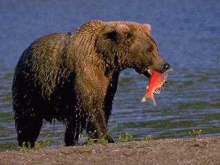
Located on the southwest end of Kodiak Island approximately one hour by air from the city of Kodiak, the Karluk River area provides excellent opportunities for fishing, hunting, hiking, wildlife viewing, and other wilderness activities.
The Karluk River is 22 miles long. Though all but the lower 8 miles of the river are located within the boundary of the Kodiak National Wildlife Refuge (KNWR), all of the lands adjacent to the river and most of the land surrounding Karluk Lagoon are privately owned. Public use trail and site easements have been reserved at intervals along the river to provide reasonable access to the remaining public land and major waterways. In addition, Koniag, Inc., and Karluk Tribal Council, the owners of most of the lands adjacent to the river, have implemented permit programs to allow the use of their landsalong the river.
This web site will attempt to answer questions regarding access to, and use of, private and public land, and assist the visitor in planning a trip to the Karluk River. The Karluk River Land Status Map provided on this site depicts the land ownership pattern and the location of public use easements. The inset on that map provides additional details for visitors beginning or ending their trip at Karluk Village.
No matter where you go or how long you stay, we hope you have a safe and memorable trip. Please remember to be a courteous camper by packing out your waste and, if possible, leaving this beautiful area in better shape than when you arrived.