Ayakulik River
Overview
 The Ayakulik River, located on the southwestern shore of Kodiak Island, is the largest river system on the island. It drains an area of 186 square miles, and includes 25 streams, 271 lakes, and an estimated 1,000 ponds, making this watershed one of the largest salmon producing watersheds on Kodiak Island. From the headwaters, the Ayakulik River flows 28 miles to the shore of Kodiak Island and terminates at the Pacific Ocean, midway between Low Cape and Cape Ikolik. All but the lower one mile of the river is located within the Kodiak National Wildlife Refuge (KNWR).
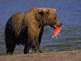
The Ayakulik River is a slow moving, clear stream characterized by a series of pools and riffles running over gravel and rocky beds. The first eleven and one-half miles of the river, from the mouth upstream to its confluence with Bare Creek, has a well defined channel with an average depth of 4-6 feet. The remainder of the river meanders through large flat marshlands which range in width from two to three miles wide. The river is slow moving with a gentle gradient, except for some short reaches that drop 25 feet per mile. Water levels are usually low mid-June to mid-August with peak flows occurring in mid-May to mid-June and mid-August to October. The Ayakulik River supports five species of salmon and provides excellent sport fishing opportunities as well as contributing to a strong commercial fishery. Along with sport fishing, the Ayakulik River offers recreational floating, and access to hunting, berry picking, wildlife viewing and photographic opportunities.
Currently, the only way to access the river is by small plane. The most commonly used drop-off and pick-up points are located on Red Lake, at the confluence of Bare Creek and the Ayakulik River, or on the ocean side of a sand spit at the mouth of the Ayakulik River. Rafters generally float from the confluence of the Ayakulik River and Bare Creek to the ocean. Several years ago, a storm added so much debris to the lagoon at the mouth of the river that it became dangerous to land a floatplane unless wind and tide conditions are favorable. As a result, it has been problematic for rafters to arrange for pick-up after completing their float trip at the ocean beach. Most rafters resort to being shuttled from the beach by small wheel plane or charter helicopter.
Anyone wishing to access the uplands along that portion of the river within the boundaries of the KNWR should contact the refuge staff for appropriate use information. The uplands along the lower one mile of the river are outside the refuge and have a complicated land ownership pattern. The lands denoted in light pink on the Ayakulik River Land Status Map are owned by Ayakulik, Inc. Land above the ordinary high water mark is private property. Any use of these uplands requires the permission of Ayakulik, Inc. The corporation has agreed to provide the public access easements on their property. The first is a trail on the left bank of the river to allow the public to portage around the ADF&G weir site. The second easement is located on the sand spit at the mouth of the Ayakulik River.
Except for Lot 2, U.S. Mineral Survey (MS) 247 is private property (depicted in yellow). Each lot belongs to a different owner, although Tract A (the spit) is jointly owned. Lot 2, shown in blue, is owned by the State of Alaska. Public use of this area is restricted to Lot 2 and one 10' wide public access easement along the shoreline of Lots 1-6 and Tract A.
U.S. Survey (USS) 1790, also shown in blue, was recently purchased by the Conservation Fund and donated to the State of Alaska for public use. Other state lands available for use by the public include land below the ordinary high water mark of the river, or below the mean high tide line.
Location and allowable uses on Public Access Easements:
The Trail Easement 25 feet wide by 100 feet long allows members of the public to portage around the ADF&G weir.
The Site Easement approximately 75 feet long by the width of the spit on land adjacent to MS 247 is reserved to allow staging and camping by members of the public. Camping, loading or unloading should be limited to 24 hours.
A 10 foot wide public access easement along the shoreline of MS 247 allows linear access along the river and coast line.