Areas With Restrictions
Search By Game Management
Unit (GMU)
Note: Use of these maps indicates that you have read and understand the liability statement.
Select a Game Management Unit.
Game Management Unit
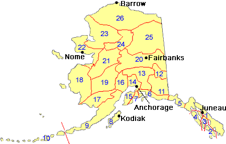
Results for Game Management Unit 9
The following restrictions are those specific to GMU 9. Be sure to check the hunting regulations for additional state-wide hunting and trapping restrictions.
Areas Closed to Hunting
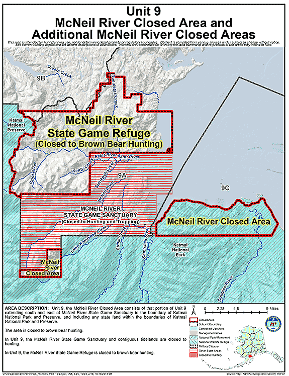
Additional McNeil River Area Closures
- Restriction: Closed to brown bear hunting
- View Map: GIF Map (101 K) PDF Map (316 K)
- Area Description: Unit 9 that portion of Unit 9 extending south and east of McNeil River State Game Sanctuary to the boundary of Katmai National Park and Preserve, and including any state land within the boundaries of Katmai National Park and Preserve
McNeil River State Game Sanctuary Closed Area
- Restriction: Closed to hunting
- View Map: GIF Map (101 K) PDF Map (316 K)
- Area Description: Unit 9, the McNeil River State Game Sanctuary and contiguous tidelands
Controlled Use Areas
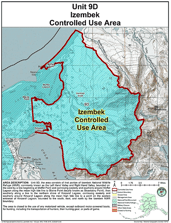
Izembek Controlled Use Area
- Restriction: Closed to the use of any motorized vehicle, except outboard motor-powered boats, for hunting, including the transportation of hunters, their hunting gear, or parts of game
- View Map: GIF Map (124 K) PDF Map (510 K)
- Area Description: Izembek Controlled User Area: the area consists of that portion of Izembek National Wildlife Refuge (NWR), commonly known as the Left Hand Valley and Right Hand Valley, bounded on the west by a line beginning at Moffet Point and continuing easterly and southerly around Moffet Lagoon along the mean high tide line to Blaine Point (locally known as Strawberry Point), then southerly along a line to the northern shore of Kinzarof Lagoon, continuing easterly and southerly around Kinzarof Lagoon along the mean high tide line to a point on the eastern entrance of Kinzarof Lagoon; bounded to the south, east, and north by the Izembek NWR boundary
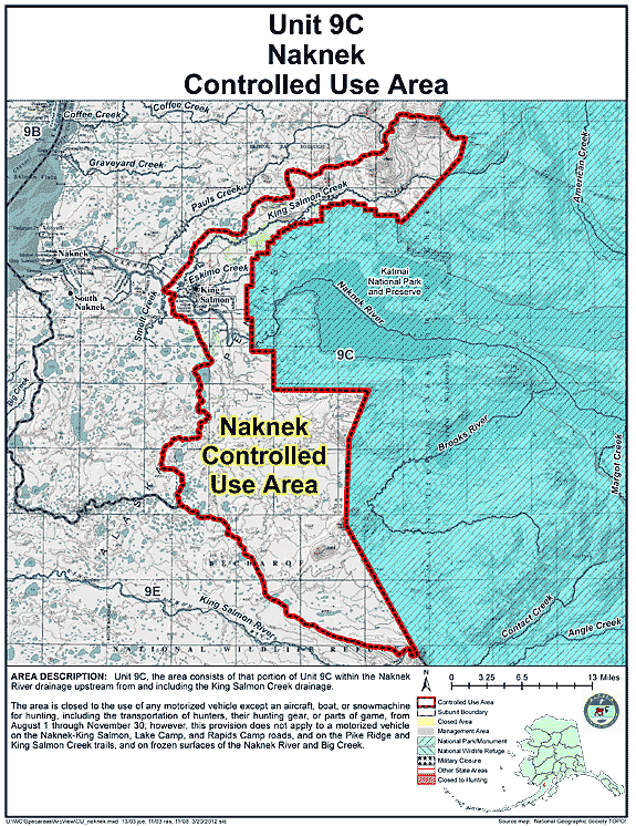
Naknek Controlled Use Area
- Restriction: Closed to the use of any motorized vehicle except an aircraft, boat, or snowmachine for hunting, including the transportation of hunters, their hunting gear, or parts of game, from August 1 through November 30; however, this provision does not apply to a motorized vehicle on the Naknek-King Salmon, Lake Camp, and Rapids Camp roads, and on the Pike Ridge and King Salmon Creek trails, and on frozen surfaces of the Naknek River and Big Creek
- View Map: GIF Map (136 K) PDF Map (487 K)
- Area Description: Naknek Controlled Use Area: the area consists of that portion of Unit 9(C) within the Naknek River drainage upstream from and including the King Salmon Creek drainage
State Refuges
McNeil River State Game Refuge
- Restriction: Closed to brown bear hunting
- View Map: GIF Map (146 K) PDF Map (451 K)
- Area Description: Unit 9 - The McNeil River State Game Refuge
Areas Closed to Trapping
McNeil River State Game Sanctuary Closed Area
- Restriction: Closed to trapping
- View Map: GIF Map (130 K) PDF Map (373 K)
- Area Description: Unit 9, the McNeil River State Game Sanctuary and contiguous tidelands
Note: Changes to area restrictions for hunting and trapping by Emergency Orders may not be shown on this page. Please be sure to check the Emergency Orders page for the most current list of changes.