Areas With Restrictions
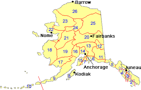
Search By Game Management
Unit (GMU)
Note: Use of these maps indicates that you have read and understand the liability statement.
Select a Game Management Unit.
Game Management Unit
Results for Game Management Unit 7
The following restrictions are those specific to GMU 7. Be sure to check the hunting regulations for additional state-wide hunting and trapping restrictions.
Areas Closed to Hunting
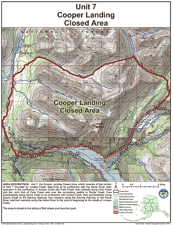
Cooper Landing Closed Area
- Restriction: Closed to the taking of Dall sheep and mountain goat
- View Map: GIF Map (161 K) PDF Map (483 K)
- Area Description: Unit 7 the Cooper Landing Closed Area, which consists of that portion of Unit 7 bounded by Juneau Creek, beginning at its confluence with the Kenai River, then upstream to the confluence of Juneau Creek and Falls Creek, then easterly along Falls Creek and the north fork of Falls Creek and over the connecting saddle to Devils Creek, then southeasterly along Devils Creek to its confluence with Quartz Creek, then southwesterly along Quartz Creek to the Sterling Highway, then westerly along the Sterling Highway to the Kenai River, and then westerly along the Kenai River to the point of beginning at the mouth of Juneau Creek
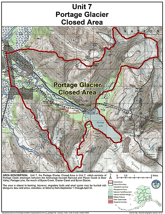
Portage Glacier Closed Area
- Restriction: Closed to hunting; however, migratory birds and small game may be hunted with shotguns, bow and arrow, crossbow, or falconry from September 1 through April 30
- View Map: GIF Map (154 K) PDF Map (372 K)
- Area Description: Unit 7 the Portage Glacier Closed Area in Unit 7, which consists of Portage Creek drainages between the Anchorage-Seward Railroad and Placer Creek in Bear Valley, Portage Lake, the mouth of Byron Creek, Glacier Creek and Byron Glacier
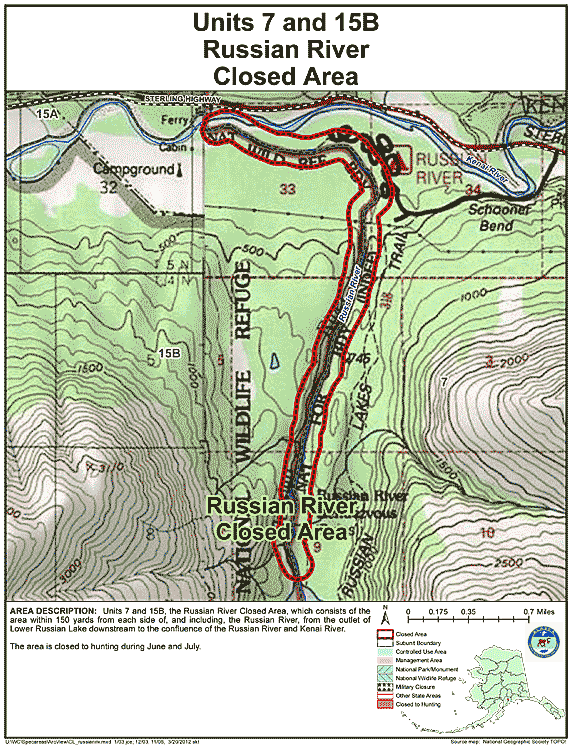
Russian River Closed Area
- Restriction: Closed to hunting during June and July
- View Map: GIF Map (135 K) PDF Map (274 K)
- Area Description: Russian River Closed Area, which consists of the area within 150 yards from each side of and including the Russian River, from the outlet of Lower Russian Lake downstream to the confluence of the Russian River and Kenai River
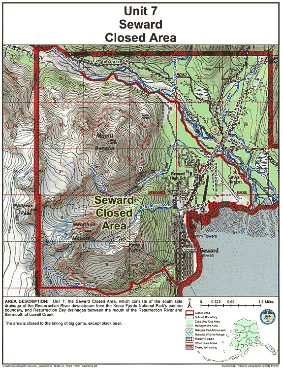
Seward Closed Area
- Restriction: Closed to the taking of big game, except black bear
- View Map: GIF Map (148 K) PDF Map (402 K)
- Area Description: Unit 7 the Seward Closed Area in Unit 7, which consists of the south side drainage of the Resurrection River downstream from the Kenai Fjords National Park's eastern boundary, and Resurrection Bay drainages between the mouth of the Resurrection River and the mouth of Lowell Creek
Note: Changes to area restrictions for hunting and trapping by Emergency Orders may not be shown on this page. Please be sure to check the Emergency Orders page for the most current list of changes.