Walrus Tracking Maps Archive
08/213/2014 – 08/223/2014
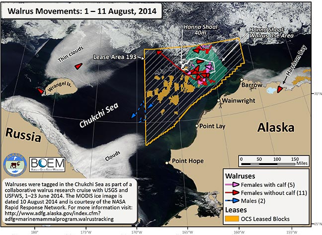
Over the last ten days we received transmissions from 18 walruses (2 male and 16 female). Two walruses are still in Russian waters, near Wrangel Island, and 1 is still in coastal waters of northern Alaska near Harrison Bay and the Kogru River. The remaining 15 were located within the boundaries of Lease Area 193 during these 10 days, of which 13 spent more than one day within the Hanna Shoal Walrus Use Area. The two males are still in the central Chukchi Sea.
In addition to the movement tracks of these walruses we mapped the boundary of Lease Area 193 (orange outline), Hanna Shoals (white outline based on the 40m isobaths), and the Hanna Shoal Walrus Use Area (green). The MODIS ice image is courtesy of the NASA Rapid Response Network, dated 10 August (https://earthdata.nasa.gov/). Funding for this project is provided by the Bureau of Ocean Energy Management (BOEM). Walruses were tagged in the Chukchi Sea from 1–23 June, 2014.
In addition to the movement tracks of these walruses we mapped the boundary of Lease Area 193 (orange outline), Hanna Shoals (white outline based on the 40m isobaths), and the Hanna Shoal Walrus Use Area (green). The MODIS ice image is courtesy of the NASA Rapid Response Network, dated 10 August (https://earthdata.nasa.gov/). Funding for this project is provided by the Bureau of Ocean Energy Management (BOEM). Walruses were tagged in the Chukchi Sea from 1–23 June, 2014.