Walrus Tracking Maps Archive
06/178/2015 – 07/187/2015
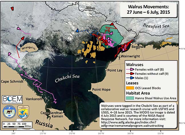
Over the last ten days we received transmissions from 18 walruses (1 male and 17 female). Nine of the 18 walruses were located within the Hanna Shoal Walrus Use Area at least once during the last 10 days.
In addition to the movement tracks of these walruses we mapped the OCS leased blocks (orange cubes), the Hanna Shoal Walrus Use Area (green), and the 200 m isobath (black line). Sea ice data are courtesy of the NASA Rapid Response Network, dated 4 July (http://rapidfire.sci.gsfc.nasa.gov/). Funding for this project is provided by the Bureau of Ocean Energy Management (BOEM). Walruses were tagged in the Chukchi Sea as part of a collaborative walrus research cruise with USFWS and USGS, 4–18 June, 2015.
In addition to the movement tracks of these walruses we mapped the OCS leased blocks (orange cubes), the Hanna Shoal Walrus Use Area (green), and the 200 m isobath (black line). Sea ice data are courtesy of the NASA Rapid Response Network, dated 4 July (http://rapidfire.sci.gsfc.nasa.gov/). Funding for this project is provided by the Bureau of Ocean Energy Management (BOEM). Walruses were tagged in the Chukchi Sea as part of a collaborative walrus research cruise with USFWS and USGS, 4–18 June, 2015.