Ice Seal Tracking Maps Archive
11/321/2017 – 11/331/2017
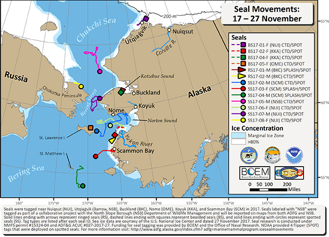
During the last 10 days we have received locations for 4 bearded, 2 ringed, and 7 spotted seals. The seals range north to south from near Utqiaġvik to south of St. Matthew Island in the central Bering Sea. Also during this period four seals restricted their movements to a localized area of smaller than roughly 12x12 miles (20x20 km), including bearded seal BS17-04-F (green square) and ringed seal RS17-01-M (red arrow) in southwest Kotzebue Sound, BS17-05-F (orange square) near St. Lawrence Island, and ringed seal RS17-02-M (yellow arrow) near the mouth of the Yukon River. Sea ice data are courtesy of the U.S. National Ice Center, dated 27 November (http://www.natice.noaa.gov/products/daily_products.html).