Ice Seal Tracking Maps Archive
01/16/2015 – 01/30/2015
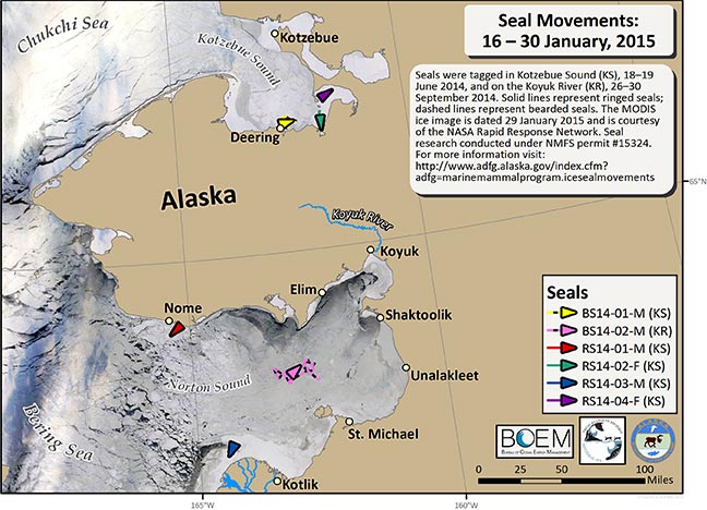
Over the last 14 days we have received transmissions from 4 ringed (solid lines) and 2 bearded (dashed lines) seals. The seals continue to maintain small areas and have not moved far in the last month. Sea ice data are courtesy of the NASA Rapid Response Network, dated 29 January (https://earthdata.nasa.gov/). A thin cloud layer is covering Kotzebue and Norton sounds but you can still see the ice coverage.