
Sandy River Weir
Alaska Peninsula Management Area
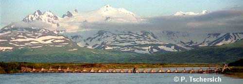
Sandy River weir is located about three miles below Sandy Lake, 56° 07' N. latitude, 159° 55' W. longitude and is about 200 feet in length and varies from 2 to 5 feet in depth. Salmon were first counted through a weir constructed in 1994 and operated annually by two ADF&G employees from early June through late July. From 1962 through 1964, state employees counted salmon past a tower.