Matanuska Valley —
Moose Range
Area Overview
Area Overview
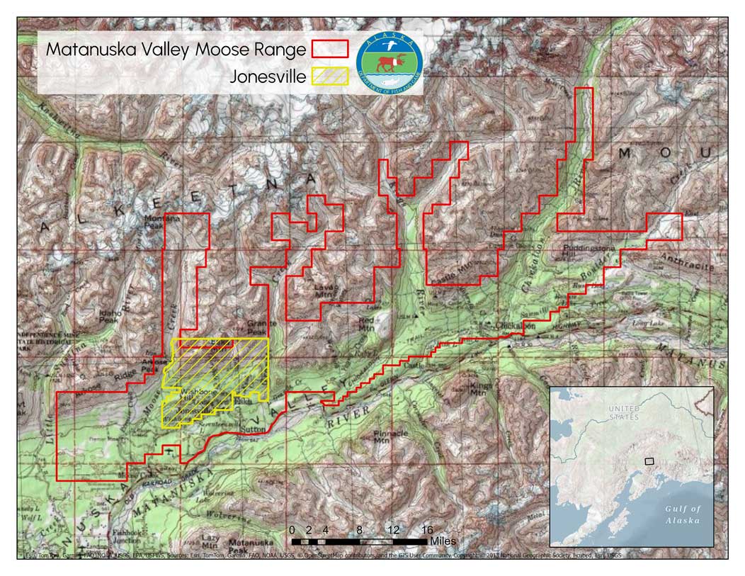
 The 130,000-acre Matanuska Valley Moose Range was created by the Alaska State Legislature in 1984 to maintain, improve, and enhance moose populations and habitat, along with other wildlife resources of the area, and to perpetuate public multiple-use of the land. In 2018, the Jonesville Public Use Area (JPUA) was established to address the public safety concerns, helping to distribute public use more effectively and safely, adding 14,614 acres. The total area, including both the Moose Range and the JPUA exceeds 131,500 acres, with the JPUA lying almost entirely within the Moose Range. The Department of Natural Resources (DNR) manages the area in cooperation with the Alaska Department of Fish & Game. More information is available at DNR’s Matanuska Valley Moose Range and Jones Public Use Area Management Plan website.
For more information, please refer to the Matanuska Valley Moose Range and JPUA Management Plan. For current land status information, see the Matanuska Valley Land Status Map.
Located in Southcentral Alaska, the Matanuska Valley Moose Range stretches from the Glenn Highway near Palmer to the foothills of the Talkeetna Mountains. It features diverse habitats including wetlands, forests, and meadows, supporting abundant wildlife, particularly moose. The nearby Jonesville Public Use Area, accessed by N. Jonesville Mine Road near Sutton, offers rugged terrain, lakes, creeks, and established trails for recreation.