Areas With Restrictions
Search By Game Management
Unit (GMU)
Note: Use of these maps indicates that you have read and understand the liability statement.
Select a Game Management Unit.
Game Management Unit
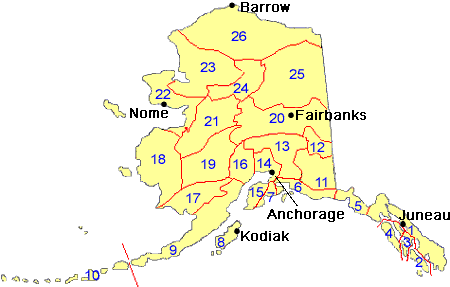
Results for Game Management Unit 3
The following restrictions are those specific to GMU 3. Be sure to check the hunting regulations for additional state-wide hunting and trapping restrictions.
Areas Closed to Hunting
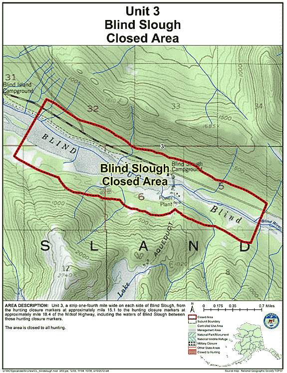
Blind Slough Closed Area
- Restriction: Closed to all hunting
- View Map: GIF Map (127 K) PDF Map (215 K)
- Area Description: Unit 3 Blind Slough Closed Area: the area consists of a strip one-fourth mile wide on each side of Blind Slough, from the hunting closure markers at approximately mile 15.1 to the hunting closure markers at approximately mile 18.4 of the Mitkof Highway, including the waters of Blind Slough between those hunting closure markers
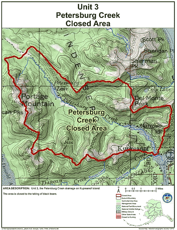
Petersburg Creek Closed Area
- Restriction: Closed to the taking of black bears
- View Map: GIF Map (135 K) PDF Map (329 K)
- Area Description: Unit 3 the Petersburg Creek drainage on Kupreanof Island
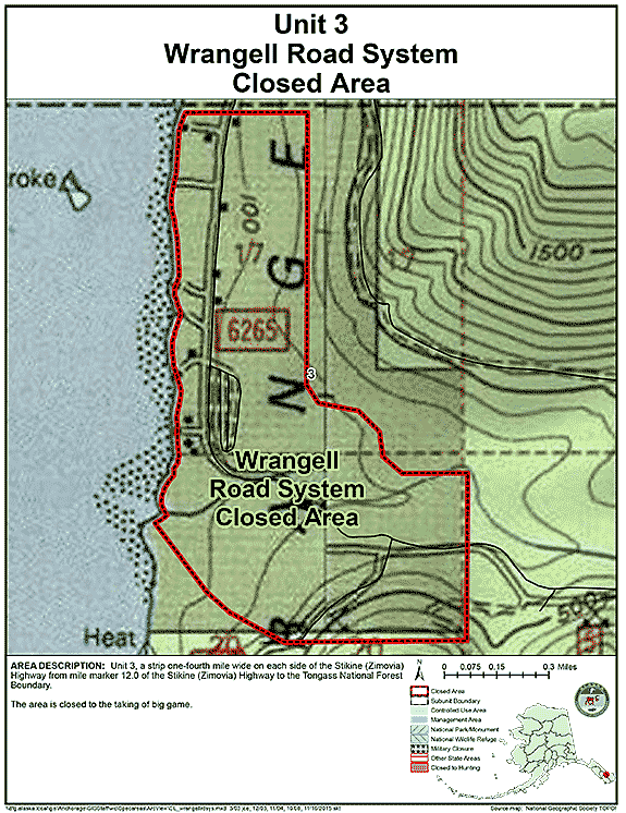
Wrangell Road System Closed Area
- Restriction: Closed to the taking of big game;
- View Map: GIF Map (114 K) PDF Map (214 K)
- Area Description: Unit 3 a strip one-fourth mile wide on each side of the Stikine (Zimovia) Highway from mile marker 12.0 of the Stikine (Zimovia) Highway to the Tongass National Forest Boundary
Management Areas
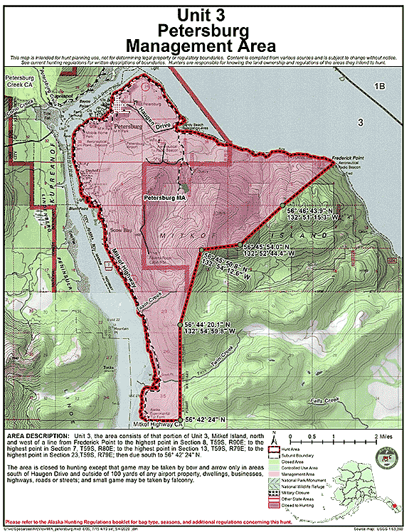
Petersburg Management Area
- Restriction: The area is closed to hunting except that game may be taken by bow and arrow only in areas south of Haugen Drive and outside of 100 yards of any airport property, dwellings, businesses, highways, roads or streets; and small game may be taken by falconry.
- View Map: GIF Map (132 K) PDF Map (323 K)
- Area Description: Unit 3, the area consists of that portion of Unit 3, Mitkof Island, north and west of a line from Frederick Point to the highest point in Section 8, T59S, R90E; to the highest point in Section 7, T59S, R80E; to the highest point in Section 13, T59S, R79E; to the highest point in Section 23,T59S, R79E; then due south to 56° 42' 24" N, and a strip 1/4 mile wide on each side of the Mitkof Hwy from mile marker 8.75 of the Mitkof Highway to mile marker 17.22.
Note: Changes to area restrictions for hunting and trapping by Emergency Orders may not be shown on this page. Please be sure to check the Emergency Orders page for the most current list of changes.