Areas Closed to Hunting
Note: Use of these maps indicates that you have read and understand the liability statement.
Click on an area name for additional details, or use the dropdown box below.
| Name | GMU | Restrictions | View Map |
|---|---|---|---|
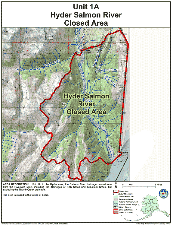
| Hyder Salmon River Closed Area | 01A | Closed to the taking of bears |
GIF Map
(126 K)
PDF Map (327 K) |
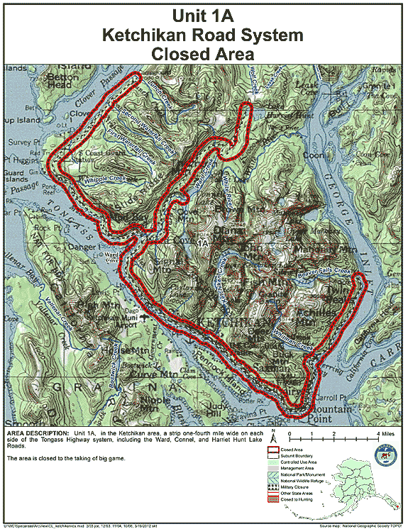
| Ketchikan Road System Closed Area | 01A | Closed to the taking of big game |
GIF Map
(151 K)
PDF Map (428 K) |
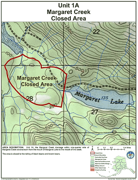
| Margaret Creek Closed Area | 01A | Closed to taking any bear |
GIF Map
(124 K)
PDF Map (218 K) |
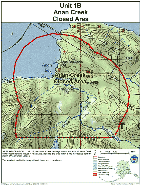
| Anan Creek Closed Area | 01B | Closed to the taking of black bears and brown bears |
GIF Map
(131 K)
PDF Map (254 K) |
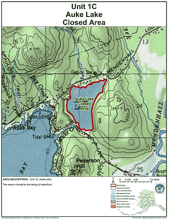
| Auke Lake Closed Area | 01C | Closed to the taking of waterfowl |
GIF Map
(127 K)
PDF Map (229 K) |
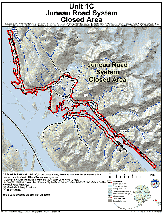
| Juneau Road System Closed Area | 01C | Closed to the taking of big game |
GIF Map
(129 K)
PDF Map (449 K) |
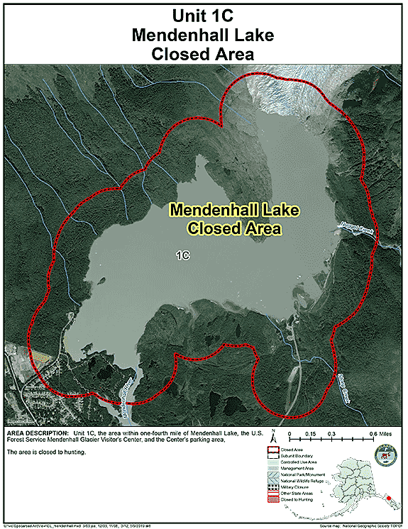
| Mendenhall Lake Closed Area | 01C | Closed to hunting |
GIF Map
(108 K)
PDF Map (251 K) |
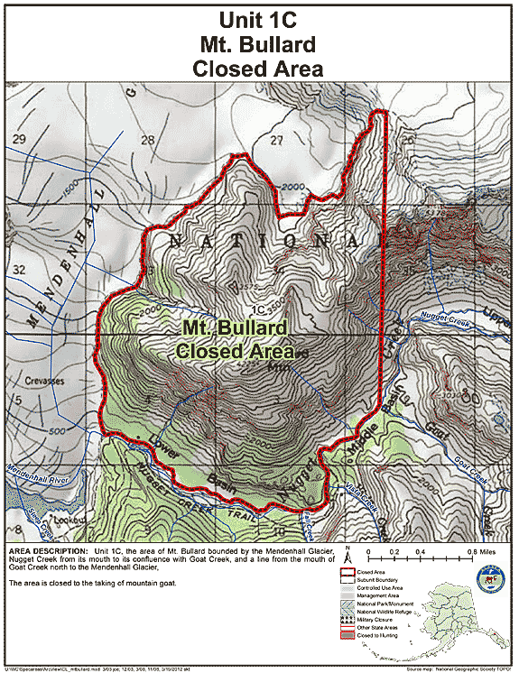
| Mt. Bullard Closed Area | 01C | Closed to the taking of mountain goat |
GIF Map
(143 K)
PDF Map (298 K) |
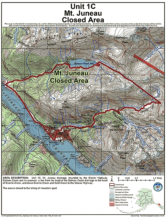
| Mt. Juneau Closed Area | 01C | Closed to the taking of mountain goat |
GIF Map
(157 K)
PDF Map (324 K) |
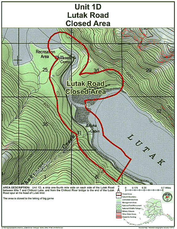
| Lutak Road Closed Area | 01D | Closed to the taking of big game |
GIF Map
(132 K)
PDF Map (251 K) |
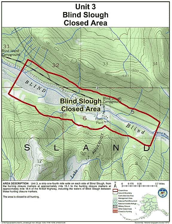
| Blind Slough Closed Area | 03 | Closed to all hunting |
GIF Map
(127 K)
PDF Map (215 K) |
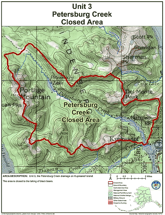
| Petersburg Creek Closed Area | 03 | Closed to the taking of black bears |
GIF Map
(135 K)
PDF Map (329 K) |
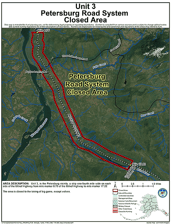
| Petersburg Road System Closed Area | 03 | Closed to the taking of big game, except wolves |
GIF Map
(111 K)
PDF Map (322 K) |
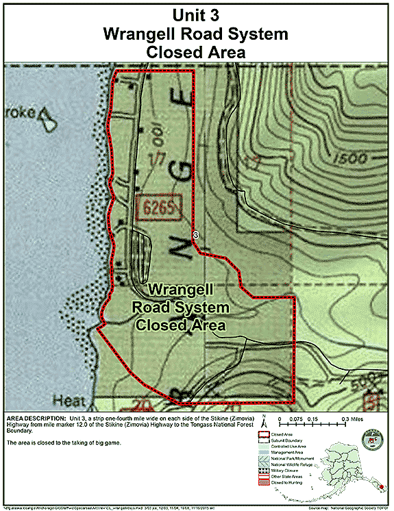
| Wrangell Road System Closed Area | 03 | Closed to the taking of big game; |
GIF Map
(114 K)
PDF Map (214 K) |
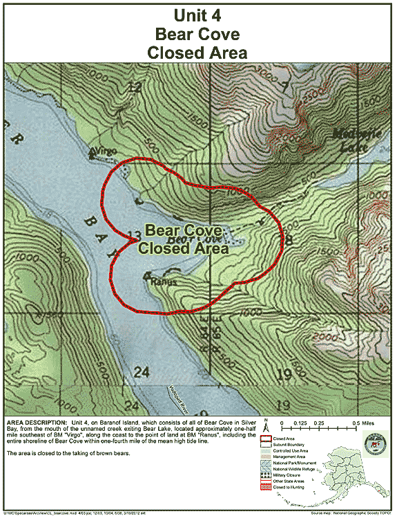
| Bear Cove Closed Area (Baranof Island) | 04 | Closed to the taking of brown bears |
GIF Map
(133 K)
PDF Map (244 K) |
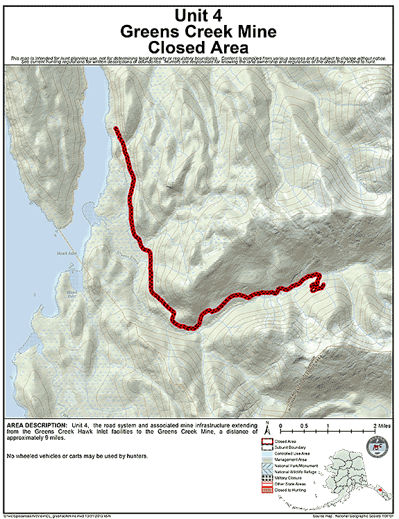
| Greens Creek Mine Closed Area | 04 | No wheeled vehicles or carts may be used by hunters |
GIF Map
(121 K)
PDF Map (276 K) |
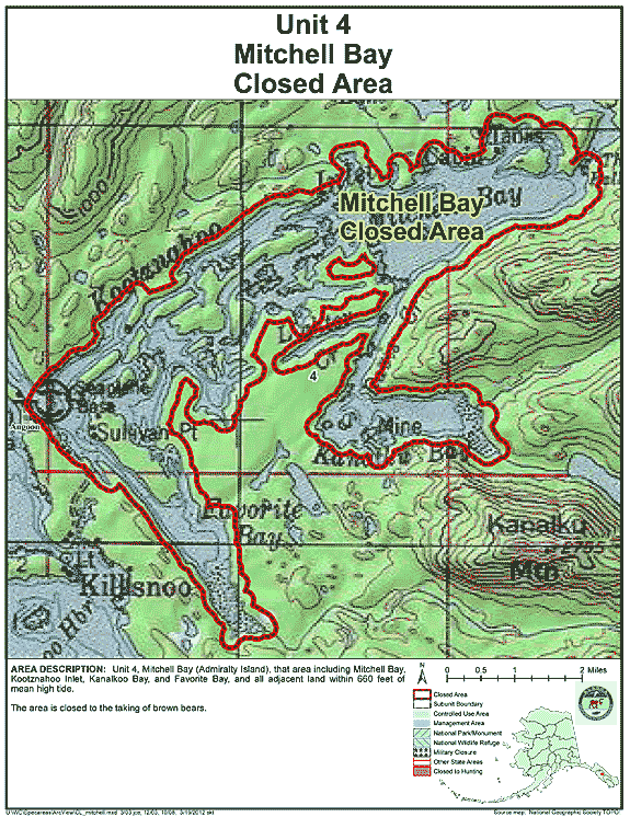
| Mitchell Bay Closed Area | 04 | Closed to the taking of brown bears |
GIF Map
(143 K)
PDF Map (340 K) |
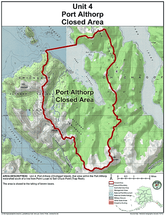
| Port Althorp Closed Area | 04 | Closed to the taking of brown bears |
GIF Map
(121 K)
PDF Map (283 K) |
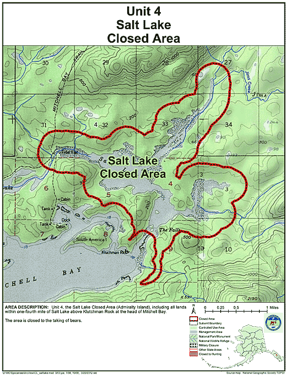
| Salt Lake Closed Area | 04 | Closed to the taking of bears |
GIF Map
(136 K)
PDF Map (243 K) |
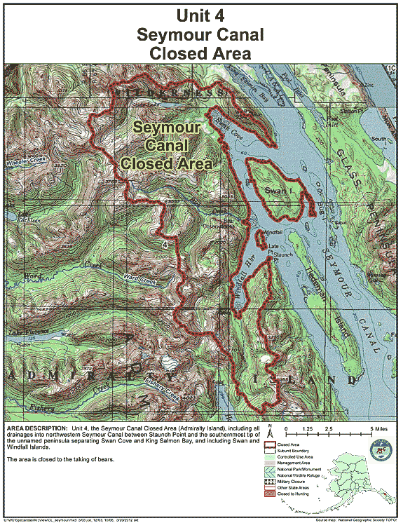
| Seymour Canal Closed Area | 04 | Closed to the taking of bears |
GIF Map
(156 K)
PDF Map (459 K) |
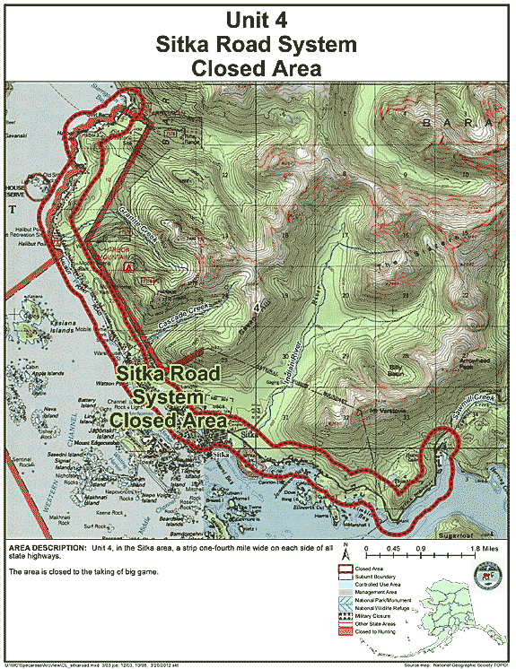
| Sitka Road System Closed Area | 04 | Closed to the taking of big game |
GIF Map
(142 K)
PDF Map (395 K) |
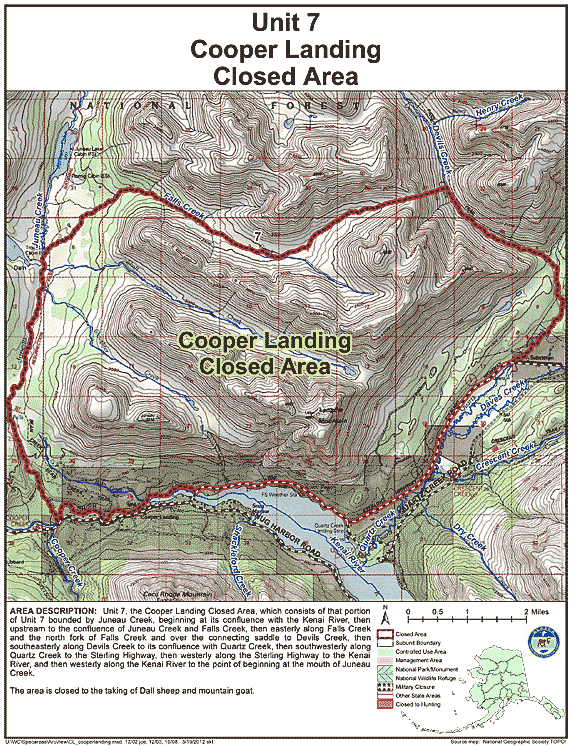
| Cooper Landing Closed Area | 07 | Closed to the taking of Dall sheep and mountain goat |
GIF Map
(161 K)
PDF Map (483 K) |
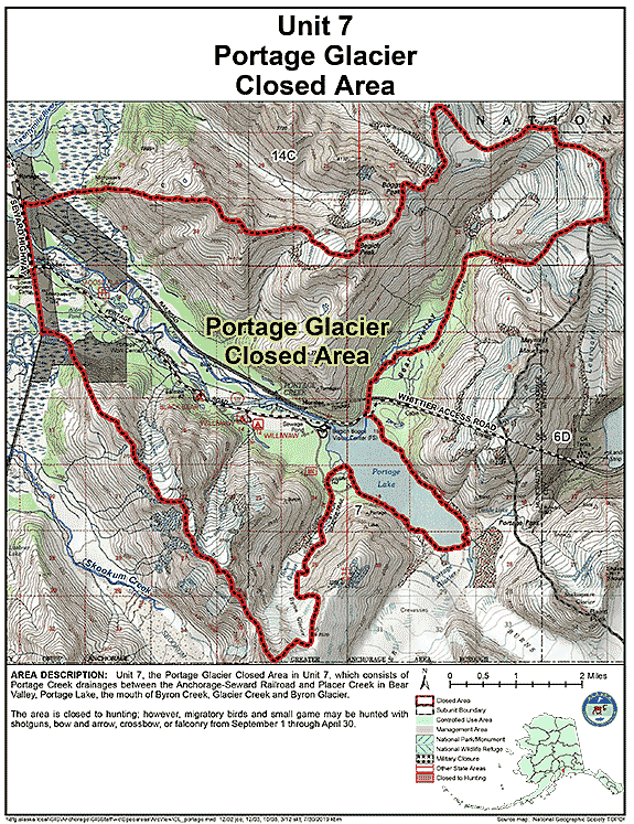
| Portage Glacier Closed Area | 07 | Closed to hunting; however, migratory birds and small game may be hunted with shotguns, bow and arrow, crossbow, or falconry from September 1 through April 30 |
GIF Map
(154 K)
PDF Map (372 K) |
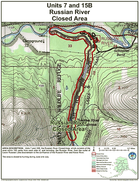
| Russian River Closed Area | 07 | Closed to hunting during June and July |
GIF Map
(135 K)
PDF Map (274 K) |
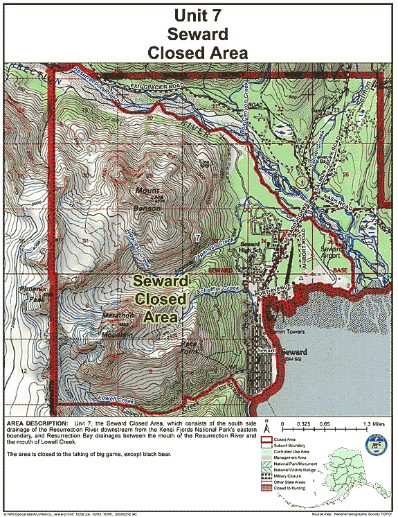
| Seward Closed Area | 07 | Closed to the taking of big game, except black bear |
GIF Map
(148 K)
PDF Map (402 K) |
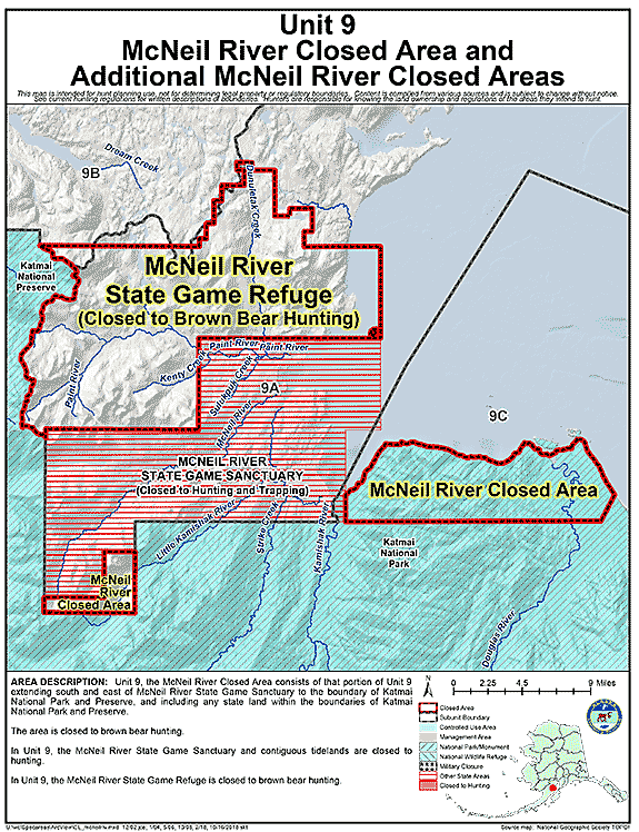
| Additional McNeil River Area Closures | 09 | Closed to brown bear hunting |
GIF Map
(101 K)
PDF Map (316 K) |
| McNeil River State Game Sanctuary Closed Area | 09 | Closed to hunting |
GIF Map
(101 K)
PDF Map (316 K) |
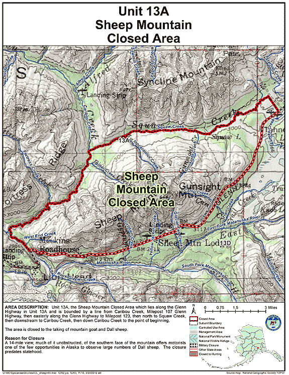
| Sheep Mountain Closed Area | 13A | Closed to the taking of mountain goat and Dall sheep |
GIF Map
(155 K)
PDF Map (432 K) |
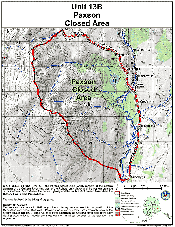
| Paxson Closed Area | 13B | Closed to the taking of big game |
GIF Map
(136 K)
PDF Map (271 K) |
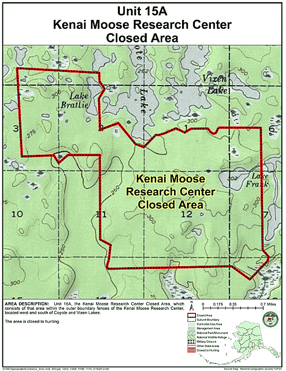
| Kenai Moose Research Center Closed Area | 15A | Closed to hunting |
GIF Map
(118 K)
PDF Map (199 K) |
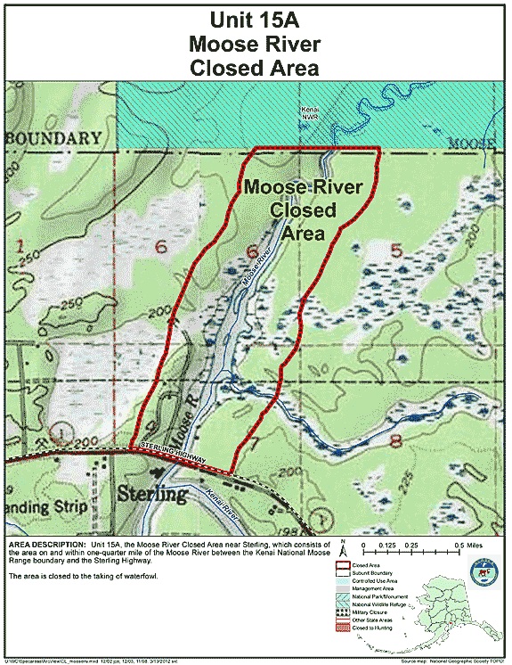
| Moose River Closed Area | 15A | Closed to the taking of waterfowl |
GIF Map
(117 K)
PDF Map (235 K) |
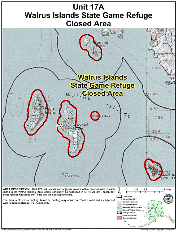
| Walrus Islands State Game Refuge Closed Area | 17 | Closed to hunting; however, hunting may occur on Round Island and its adjacent waters from September 10 - October 20 |
GIF Map
(111 K)
PDF Map (202 K) |
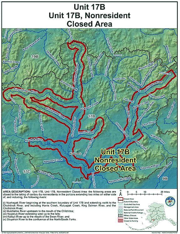
| Unit 17(B), Nonresident Closed Area | 17B | Closed to taking of caribou by nonresidents |
GIF Map
(133 K)
PDF Map (605 K) |
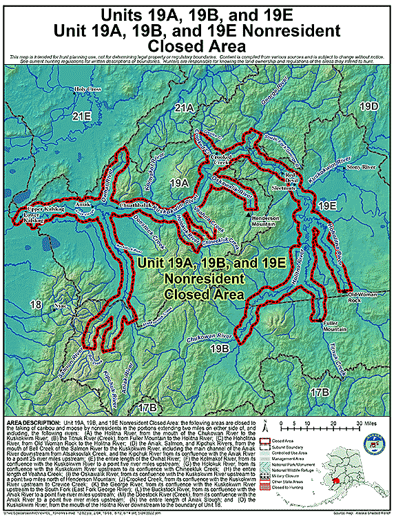
| Unit 19(A), 19(B), and 19(E) Nonresident Closed Area | 19A, 19B, 19E | Closed to the taking of caribou and moose by nonresidents |
GIF Map
(143 K)
PDF Map (852 K) |
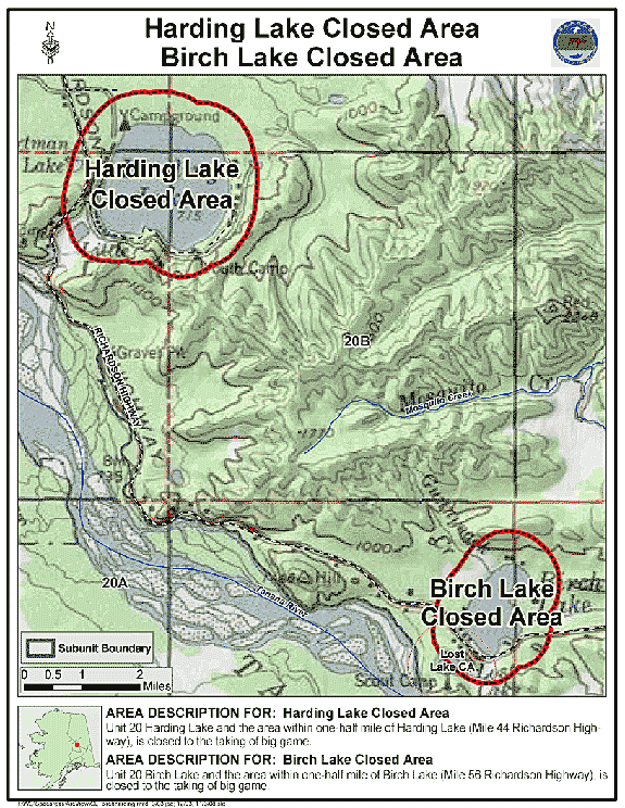
| Birch Lake Closed Area | 20 | Closed to the taking of big game |
GIF Map
(137 K)
PDF Map (307 K) |
| Harding Lake Closed Area | 20 | Closed to the taking of big game |
GIF Map
(132 K)
PDF Map (324 K) |
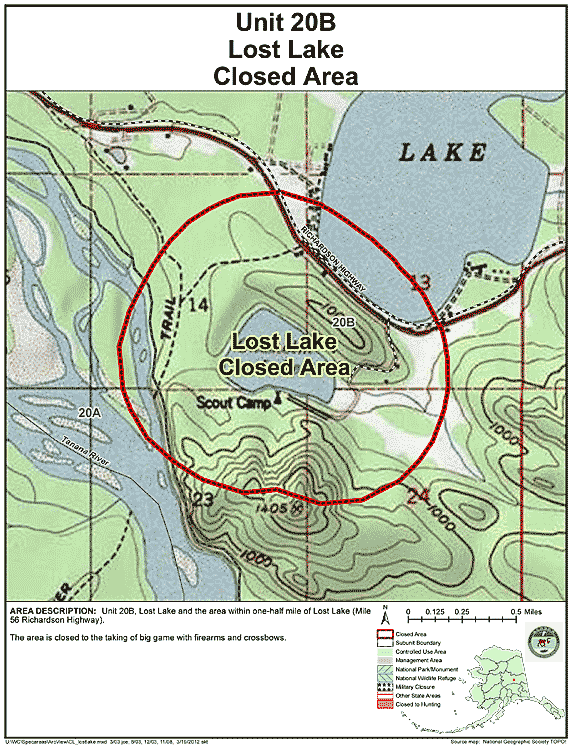
| Lost Lake Closed Area | 20 | Closed to the taking of big game with firearms and crossbows |
GIF Map
(126 K)
PDF Map (229 K) |
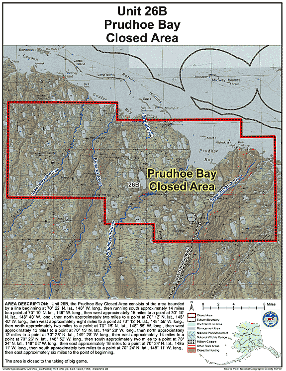
| Prudhoe Bay Closed Area | 26 | Closed to the taking of big game |
GIF Map
(136 K)
PDF Map (332 K) |