Harbor Seal Research
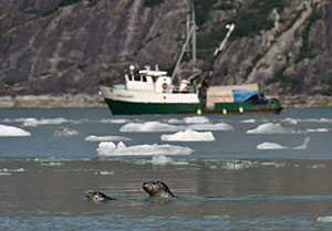
Vessel Interactions - Study Results
Harbor Seal Tagging
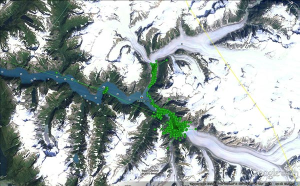
In May 2014, 30 female harbor seals were captured in Tracy Arm and radio tags were temporarily attached to their fur (for approximately 2–3 months). The tags used GPS satellites to determine the seal’s location every three minutes, and dive instruments recorded whether seals were wet or dry every one minute, and the depth and temperature every one minute when seals were diving. The tags store the data and must be recovered to obtain the data. Seals were also equipped with VHF radio tags that allowed researchers to track seals in the field and to retrieve the GPS/dive tags when they were shed by the seal during their annual molt. Twenty-three tags were recovered and 22 of those seals spent considerable time in the study area, where seal-vessel interactions were likely to occur.
Vessel Monitoring
Movements of vessels were monitored in two ways:
- All cruise ships and many of the larger tourism vessels are equipped with maritime Automatic Identification Systems (AIS). AIS-equipped vessels transmit vessel ID, position (based on GPS coordinates), course, speed, and other data, via a VHF radio built into the AIS transponder. Vessel position is transmitted every 2–30 seconds depending on how fast the vessel is moving and the type of AIS transponder on board. AIS data-logging stations were established at the heads of Tracy and Endicott Arms in late April 2014 to continuously record presence and movements of AIS-equipped vessels until late August.
- Movements of vessels that were not equipped with AIS were documented by using a theodolite. A theodolite is a surveyor's instrument that is used to determine the position (latitude and longitude) of an object that is sighted through the instrument. When placed on an elevated shore-based vantage point, a theodolite can be used to periodically determine the position of a moving object such as a vessel, thereby creating a track of the moving vessel. A software program stores the position “fixes”, adjusts for tide stage and elevation of the theodolite, and calculates the longitude and latitude each time a fix is obtained for a vessel. Theodolite technology has been used for several decades to track interactions between vessels and marine mammals. A field camp was established in Tracy Arm overlooking South Sawyer glacier in early June 2014 and 3 observers tracked the movements of non-AIS vessels that visited the area through mid-August.
Weather and other environmental factors
Numerous environmental factors can affect behavior of harbor seals, including ice availability, weather, and tide stage.
- Weather stations were installed at the heads of Tracy and Endicott Arms at each of the AIS data-logging sites to record wind speed and direction, air temperature, and barometric pressure every second.
- Throughout each day, field camp personnel in Tracy Arm periodically recorded additional weather factors such as occurrence and intensity of rainfall, fog, and percent cloud cover.
- Field camp personnel also periodically recorded ice availability in Tracy Arm, dividing the viewing area into 6 zones and estimating the percentage of ice cover in each zone, whether it was densely packed or not, and the percentage of ice within each zone that was suitable for seals to haul out on.
- Tide height and current velocity data for the area were obtained at 1 minute intervals.
Data Management and Analysis
Immense volumes of data were collected in association with this research project. Before analyses can be conducted to achieve the objectives, the data must be entered into a database and time stamps for all of the vessel data (AIS and theodolite) must be matched with time stamps from the seal data. Environmental data (e.g., weather, ice, and tides) collected on different time scales must also be paired with timing of seal behavior to collectively evaluate a suite of factors that could influence a seal’s decision about when to end a haul-out bout and a seal’s response to an approaching vessel.
Data management is currently underway. Analysis of data is expected to begin in late 2014 or early 2015, and results are expected to be available by mid-2015. In the interim, results from our analysis of factors affecting haul-out behavior of seals that were radio-tagged with less informative instruments in 2008–2010 in Endicott Arm (see Importance of Glacial Habitats) will be made available to NMFS. Those results may be useful to NMFS as they establish voluntary guidelines for vessel operators in Tracy and Endicott Arms to reduce the potential for disturbance of seals.