Hunter Access
Completed Projects
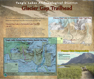
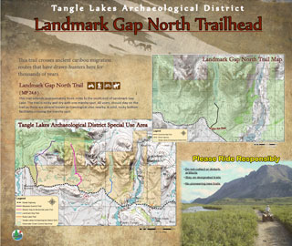
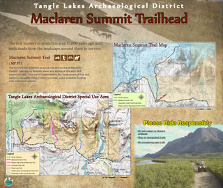
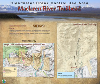
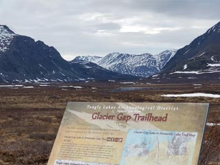
Denali Highway Trailhead Kiosks — Tangle Lakes Archaeological District
Game Management Unit: 13B
Land Manager: Department of Natural Resources (DNR); Division of Mining, Land, and Water
Description
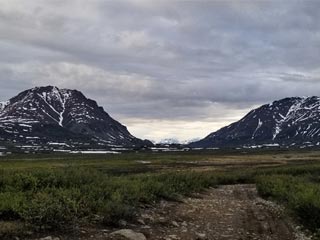
This project took place at multiple trailheads along the Denali Highway in the foothills of the Amphitheater Mountains within the Tangle Lakes Archaeological District and Clearwater Creek Controlled Use Area. The trails are used by the public for hiking, fishing, hunting, camping, berry picking, and off-road vehicle use. Hunters primarily use the area to hunt the Nelchina caribou herd and moose.
Purpose
The objective for this project was to provide users of the area with regional information with rules and regulations.
Multiple trailheads along this stretch of the Denali Highway lacked any information for legal access and safe recreation in the Tangle Lakes Archaeological District or Clearwater Creek Controlled Use Area.
Outcome
This project was completed in summer 2019. Informational kiosks were placed at the Maclaren River Road, Maclaren Summit, Glacier Gap, and Landmark Gap trailheads. These kiosks provide relevant information for multi-use recreation and important regulatory information for legal hunting practices. The approximate coordinates for each trailhead are as follows:
- Maclaren River
63.11775, -146.57174 - Maclaren Summit
63.08708, -146.43361 - Glacier Gap
63.08877, -146.2455 - Landmark Gap
63.06896, -146.10366
Project Partner
Trailhead Kiosk Locations
Useful Links
- Clearwater Creek Controlled Use Area map
- Tangle Lakes Archaeological District brochure
- Maclaren Summit Trail Map
- Glacier Gap Trail Map