Ice Seal Tracking Maps Archive
03/88/2017 – 04/100/2017
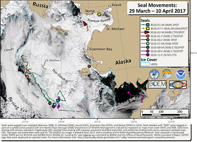
During the last 14 days we have received locations for 2 bearded seals, 1 ringed seal, and 6 spotted seals. All tagged seals are in the Bering Sea, from Norton Sound south to the ice edge and Bristol Bay. Five of the 9 tagged seals are within 40 miles of the ice edge in the central Bering Sea; 4 of these are within 35-60 miles of St. Paul Island. Sea ice data are courtesy of the NASA Rapid Response Network, dated 9 April (https://earthdata.nasa.gov/earth-observation-data/near-real-time/rapid-response/modis-subsets). Cloudy conditions in the Bering Sea have prevented clear images across the region, however, ice can still be seen through the thin clouds in the map. To help visualize the ice edge, sometimes obstructed by clouds, the edge of 80% sea ice concentration is mapped with a blue line using sea ice data from the U.S. National Ice Center, dated 9 April (http://www.natice.noaa.gov/index.html).