Hunter Access
Completed Projects
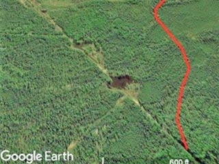
Rex Trail — Clear, AK
Coordinates: 64.234539, -149.044498
Game Management Unit: 20A
Land Manager: Department of Natural Resources (DNR); Division of Mining, Land, and Water
Description
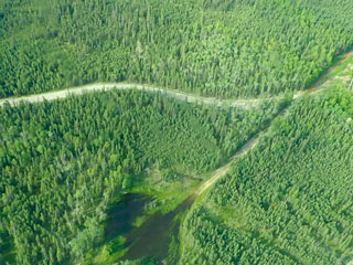
The eastern Rex Trail, located just north of Milepost 280 on the Parks Highway, is an important recreational, residential, and commercial access route located north of the foothills of the Alaska Range. Intense seasonal use of ATVs and increased numbers of large off-road vehicles (ORVs) has become the norm during fall hunting season. The resulting severe trail damage had compromised the opportunity for reasonable and safe travel for trail users in fall and winter — seasons when travel had historically been very dependable.
Purpose
The project objective was to by-pass a severely degraded and nearly impassable portion of the trail at Seven Mile Lake by moving the trail south. An additional advantage of this new route is that the trail alignment is moved entirely onto state land; a portion of the original trail crossed private property.
Outcome
This project was completed and open to the public in May 2019. A portion of the trail was improved and now exists as a primitive gravel road. The result is safe and legal access for the public to this multiuse sustainable trail through what was previously a poorly drained area that severely impeded travel.
Project Partner
Rex Trail Reroute Location