Hunter Access
Completed Projects
Chilkoot Lake Access Improvements — Chilkoot Lake State Recreation Site
Coordinates: 59.33573, -135.56350
Game Management Unit: 1D
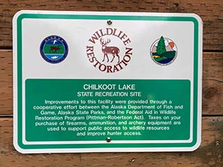
Land Manager: Department of Natural Resources (DNR); Division of Parks and Outdoor Recreation
Description
Chilkoot Lake State Recreation Site (SRS) is located 10 miles north of Haines at the end of Lutak Road, which provides the only road access to the southeast end of Chilkoot Lake. This SRS serves as a launching point for popular harvest sites in the area.
The perimeter of Chilkoot Lake provides opportunities for harvesting large game, such as mountain goat, moose, and black and brown bear, as well as small game, such as beaver, marten, and wolverine. Some hunters walk or bike along the south side of the lake, while trappers utilize areas around the entire lake.
Note: Beginning at Mile 7 and extending to the Chilkoot Lake SRS, the Lutak Road Closed Area does not allow the harvest of big game animals within ¼ mile of Lutak Road.
Purpose
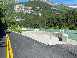
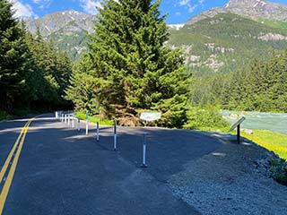
The Chilkoot Lake access corridor is currently a primitive 1.1-mile road that terminates at a boat launch facility. The road is narrow and riddled with potholes, making it difficult to navigate - especially for vehicles hauling boat trailers. Occasional widenings in the road serve as makeshift parking spots.
The purpose of this project is to enhance access to harvest sites for hunters and trappers in the Chilkoot Lake area. Safety, drivability, and overall road access to Chilkoot Lake needs improvement through the enhancement of the road and parking area. Doing so will provide increased hunting and trapping opportunities for residents and non-residents alike.
Outcome
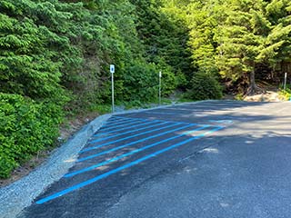
This project was completed summer 2021. The leveled and paved road surface improves safety and provides a smooth and stable driving surface while drainage culverts allow the water to drain and reduce potential damage to the roadway. The road surface was striped and marked to clearly delineate between motorist, parking, and pedestrian spaces which maximize parking opportunities and help prevent conflicts between roadside parking and driving lanes. And new signage was installed along the corridor to convey relevant roadway information to users along with new interpretive education panels installed at bear viewing platforms. Overall the enhanced road and parking improves safety, drivability, and overall road access to the Chilkoot Lake boat launch.