Hunter Access
Completed Projects
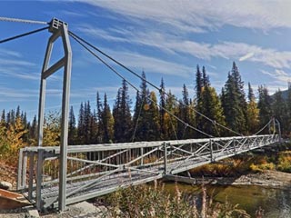
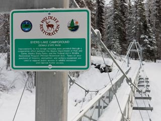
Byers Lake Bridge — Denali State Park
Coordinates: 62.74866, -150.09095
Game Management Unit: 13E
Land Manager: Department of Natural Resources (DNR); Division of Parks & Outdoor Recreation
Description
The trail network within Denali State Park is used extensively by hunters and trappers to access backcountry harvest areas. Located near Trapper Creek, this area provides opportunities for hunting large game, such as black and grizzly bears, caribou, and moose and trapping furbearers, such as beaver, lynx, wolf, wolverine, and marten.
In early 2016, the iconic suspension bridge north of Byers Lake collapsed, disrupting the continuity of the popular Byers Lake trail system and hindering access to the Upper Troublesome Creek and K'esugi Ridge trails. Users interested in accessing Denali State Park were faced with the choice of hiking an additional three miles or attempting a dangerous ford through Byers Creek and risking their own safety.
Purpose
The objective of this project was to restore the continuity of the Byers Lake trail system by installing a bridge over Byers Creek capable of withstanding heavy, year-round foot traffic. A suspension bridge was deemed necessary to span the width of the creek and avoid constructing a center pier in the anadromous creek.
Outcome
This project was completed in May 2019. A 140-foot clear span suspension bridge was installed in place of the collapsed bridge north of Byers Lake, restoring the Byers Lake trail system continuity and improving hunting and trapping access to Denali State Park. Vegetation on the surrounding banks was also reestablished to resist erosion.