Westward Region Research
Mapping Tanner Crab Habitat
Mapping Tanner Crab Habitat

Purpose
Alaska Department of Fish and Game (ADF&G) manages commercial fisheries for Tanner crabs (Chionoecetes bairdi) in the Gulf of Alaska
(GOA) and conducts annual bottom trawl surveys
to assess the populations and provide data to set harvest limits. The current practice of expanding Tanner crab densities from trawlable
habitat to large areas of unknown habitat can potentially create bias in overall population estimates; this is critical because state
regulations require that population estimates exceed a lower threshold before opening Tanner crab fisheries. The goal of this project
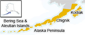
is to map and describe important Tanner crab habitat northeast of Kodiak Island in the GOA. We will
use multibeam sonar and a towed benthic imaging system (CamSled) to deliver full-coverage maps of bathymetry and seafloor acoustic backscatter
and to provide both classified substrates and biological observations for Tanner crab habitat. This information will be used to increase
understanding of the spatial distribution of Tanner crab and their habitat and will aid in interpretation of stock assessment data.