Select Regulatory Map

ATTU - 5 sub-maps KISKA - 3 sub-maps RAT ISLANDS - 5 sub-maps GARELOI ISLAND - 2 sub-maps ADAK - 11 sub-maps ATKA - 5 sub-maps SEGUAM - 3 sub-maps AMUKTA - 0 sub-maps SAMALGA ISLAND - 1 sub-maps UMNAK - 4 sub-maps UNALASKA - 14 sub-maps UNIMAK - 6 sub-maps FALSE PASS - 11 sub-maps SIMEONOF ISLAND - 1 sub-maps COLD BAY - 12 sub-maps PORT MOLLER - 23 sub-maps STEPOVAK BAY - 6 sub-maps CHIGNIK - 24 sub-maps SUTWIK ISLAND - 8 sub-maps TRINITY ISLANDS - 8 sub-maps KAGUYAK - 3 sub-maps KODIAK - 32 sub-maps KARLUK - 12 sub-maps UGASHIK - 22 sub-maps BRISTOL BAY - 3 sub-maps PRIBILOF ISLANDS - 0 sub-maps HAGEMEISTER ISLAND - 8 sub-maps NUSHAGAK BAY - 8 sub-maps NAKNEK - 20 sub-maps MT KATMAI - 22 sub-maps AFOGNAK - 22 sub-maps KENAI - 2 sub-maps ILIAMNA - 30 sub-maps DILLINGHAM - 32 sub-maps GOODNEWS BAY - 20 sub-maps BETHEL - 5 sub-maps TAYLOR MTS - 23 sub-maps LAKE CLARK - 27 sub-maps

Southwest Region maps

Get the reference index of all Anadromous Water Atlas (1:63,360 scale maps) for the Southwest region with quad names (137 Kb PDF)

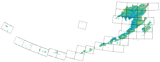
You can ‘mouse-over’ the quads in the image below to show the quad names. Clicking on a quad will select the 1:250,000 scale index map PDF for downloading. Use the drop-down menu above to select the 1:63,360-scale and other maps.