Select Regulatory Map

KWIGUK - 2 sub-maps UNALAKLEET - 14 sub-maps ST MICHAEL - 5 sub-maps ST LAWRENCE - 2 sub-maps NORTON BAY - 20 sub-maps SOLOMON - 14 sub-maps NOME - 8 sub-maps TELLER - 19 sub-maps BENDELEBEN - 22 sub-maps CANDLE - 23 sub-maps KATEEL RIVER - 2 sub-maps HUGHES - 11 sub-maps SHUNGNAK - 14 sub-maps SELAWIK - 20 sub-maps KOTZEBUE - 11 sub-maps SHISHMAREF - 4 sub-maps NOATAK - 19 sub-maps BAIRD MTS - 17 sub-maps AMBLER RIVER - 17 sub-maps SURVEY PASS - 10 sub-maps TABLE MTN - 4 sub-maps ARCTIC - 6 sub-maps PHILIP SMITH MTS - 12 sub-maps CHANDLER LAKE - 15 sub-maps KILLIK RIVER - 4 sub-maps HOWARD PASS - 4 sub-maps MISHEGUK MTN - 12 sub-maps DE LONG MTS - 13 sub-maps POINT HOPE - 5 sub-maps POINT LAY - 9 sub-maps UTUKOK RIVER - 13 sub-maps LOOKOUT RIDGE - 0 sub-maps IKPIKPUK RIVER - 13 sub-maps UMIAT - 15 sub-maps SAGAVANIRKTOK - 12 sub-maps MT MICHELSON - 15 sub-maps DEMARCATION POINT - 13 sub-maps BARTER ISLAND - 2 sub-maps FLAXMAN ISLAND - 4 sub-maps BEECHEY POINT - 8 sub-maps HARRISON BAY - 11 sub-maps TESHEKPUK - 19 sub-maps MEADE RIVER - 11 sub-maps WAINWRIGHT - 10 sub-maps BARROW - 2 sub-maps

Arctic Region maps

Get the reference index of all Anadromous Water Atlas (1:63,360 scale maps) for the Arctic region with quad names (158 Kb PDF)

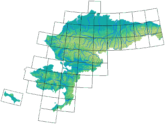
You can ‘mouse-over’ the quads in the image below to show the quad names. Clicking on a quad will select the 1:250,000 scale index map PDF for downloading. Use the drop-down menu above to select the 1:63,360-scale and other maps.