Location
- Latitude: 60.29551
- Longitude: -151.26841
- USGS Map: KENAI B-4
- Elevation (m): 60
- MTRS: S002N011W06
- Management Area: Homer (Lower Kenai Peninsula)
Access
- Latitude: 60.29551
- Longitude: -151.26841
- Directions: Mile 110.5 Sterling Hwy. East on Johnson Lake Road 0.5 mile to Tustumena Lake Road. Left on Tustumena Lake Rd. 0.1 mile to Johnson Lake State Recreation Area entrance on the right with camping, toilets, water, picnic shelters, and boat launch. Non-motorized or electric motors only). NOTE: Please respect property. Keep lake and access sites free of litter.
- Improvements:
- parking
- outhouse
- camping
- boat launch
- picnic area
- trash receptacle
- Notes: *Electric motors only!
- Status: State Rec. Area
Lake Characteristics
- Surface Area (ha): 34.4
- Bathymetric Map: JohnsonK.gif
- Lake Category: Landlocked
- Maximum Depth (m): 4.6
- Most Recent Survey Date: 4/16/2024
- Most Recent Survey Notes: Lake size and area data date unknown. Lake category entered 4/16/2024.
Photos
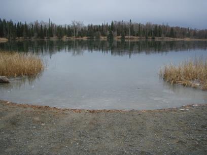
Download Linked Documents
- Johnson Lake site evaluation.pdf
- 2000-2007_Lake_Assessment_ Report.pdf
- Johnson_Historic_Fish_Sampling_Summary.pdf
- Johnson_Historic_Net_Record.pdf
- Johnson_Historic_Stocking_Record.pdf
- Johnson_Historic_Lake_Survey_Summary.pdf
- Johnson_Historic_Lake_Restoration.pdf
- Johnson_Historic_Water_Analysis.pdf
- Johnson_Historic_Bathymetric_Map.pdf
- Johnson_Historic_Temp_Profile.pdf
- Johnson_Brochure_2022.pdf