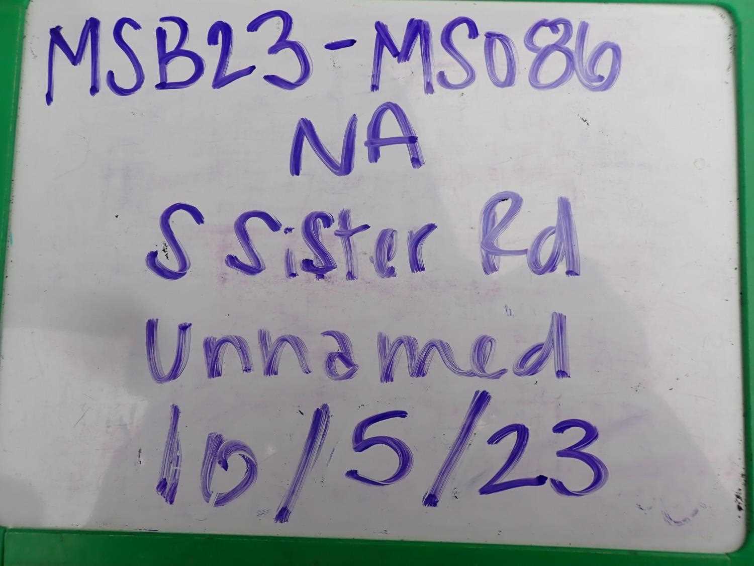
Fish Passage Site 20504064
Coordinates (dec. deg.): 62.18749°, -150.48818°
Legal Description: S024N007W12
Region: South Central
Road Name: S Sister Road
Datum:
Quad Name / ITM: Talkeetna A-1
AWC Stream #:
Stream Name: Unnamed
Elevation:
Site Comments: None
Survey MSB23-MS086
Project Supervisor: Michael Mazzacavallo, Alaska Department of Fish and Game
— Anchorage, AK
Observers: Michael Mazzacavallo, Kat Leavitt, Beth Evers
Overall Fish Passage Rating:
Tidal: No
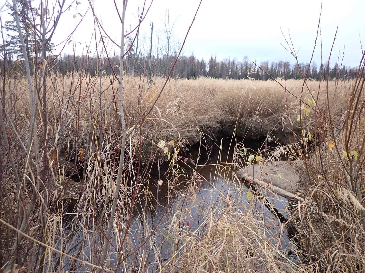
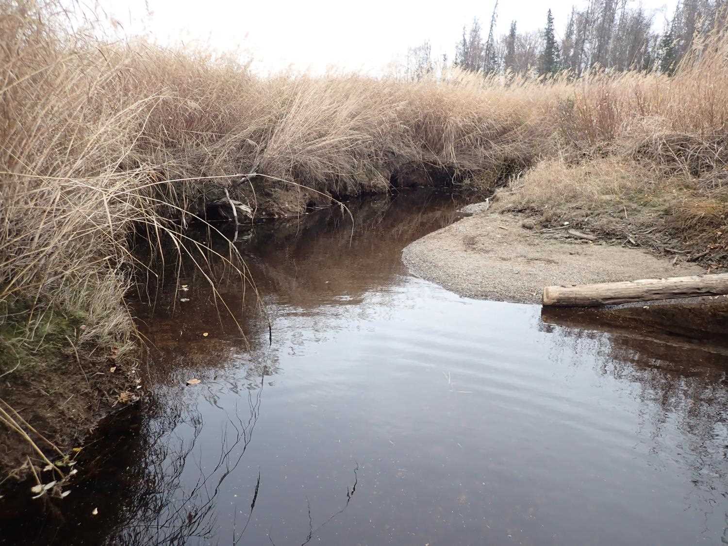
Backwatered: Yes
Step Pools: No
Construction Year:
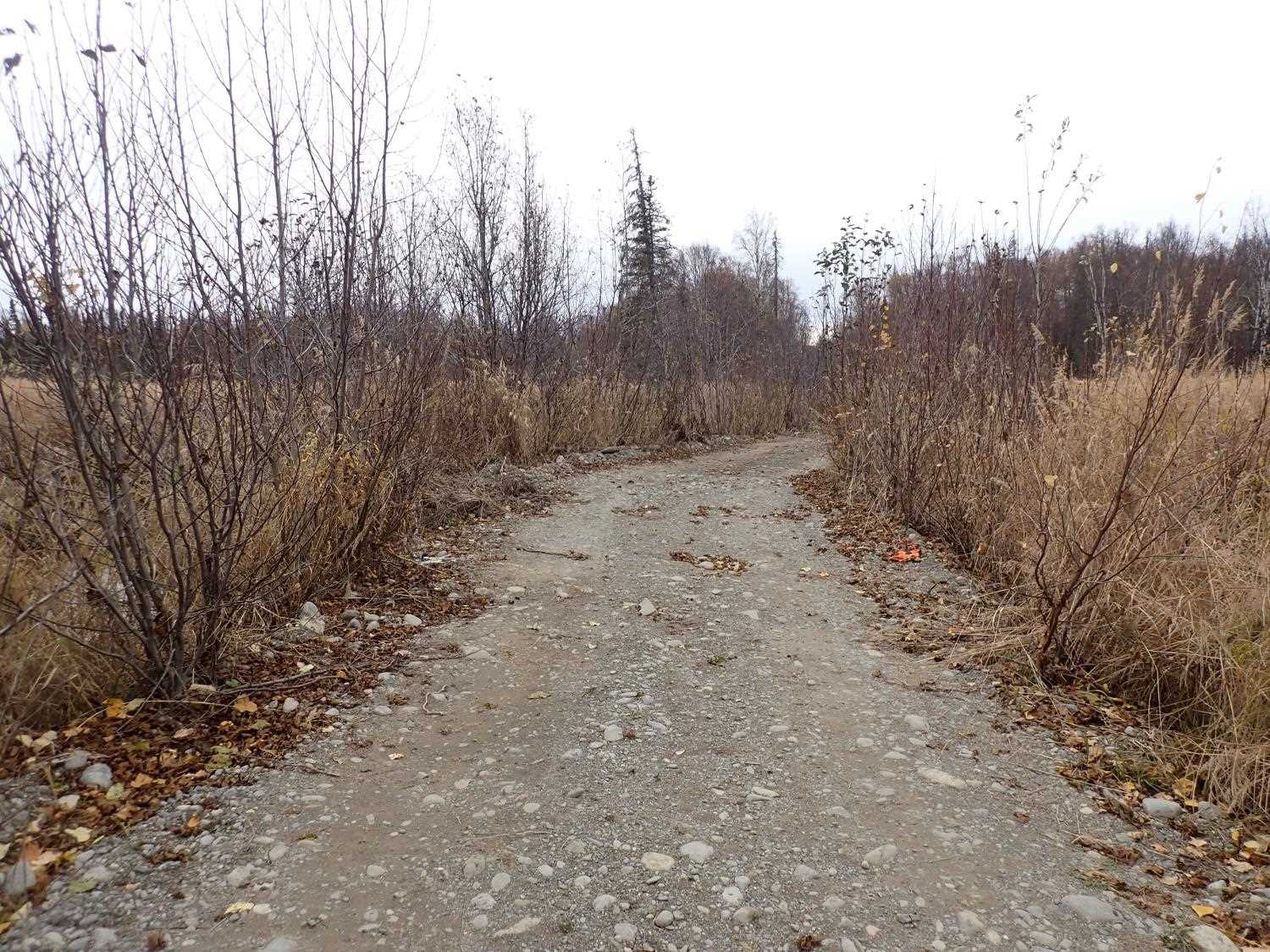
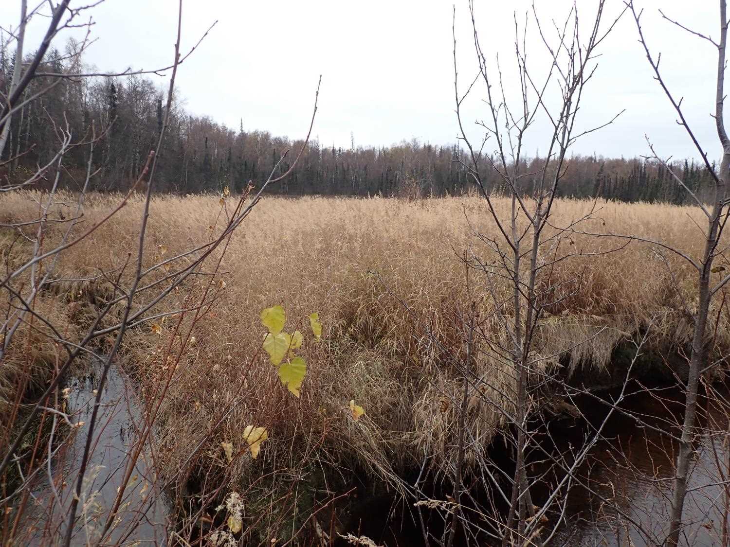
Site Observations:
- Beaver Activity
- Woody Debris
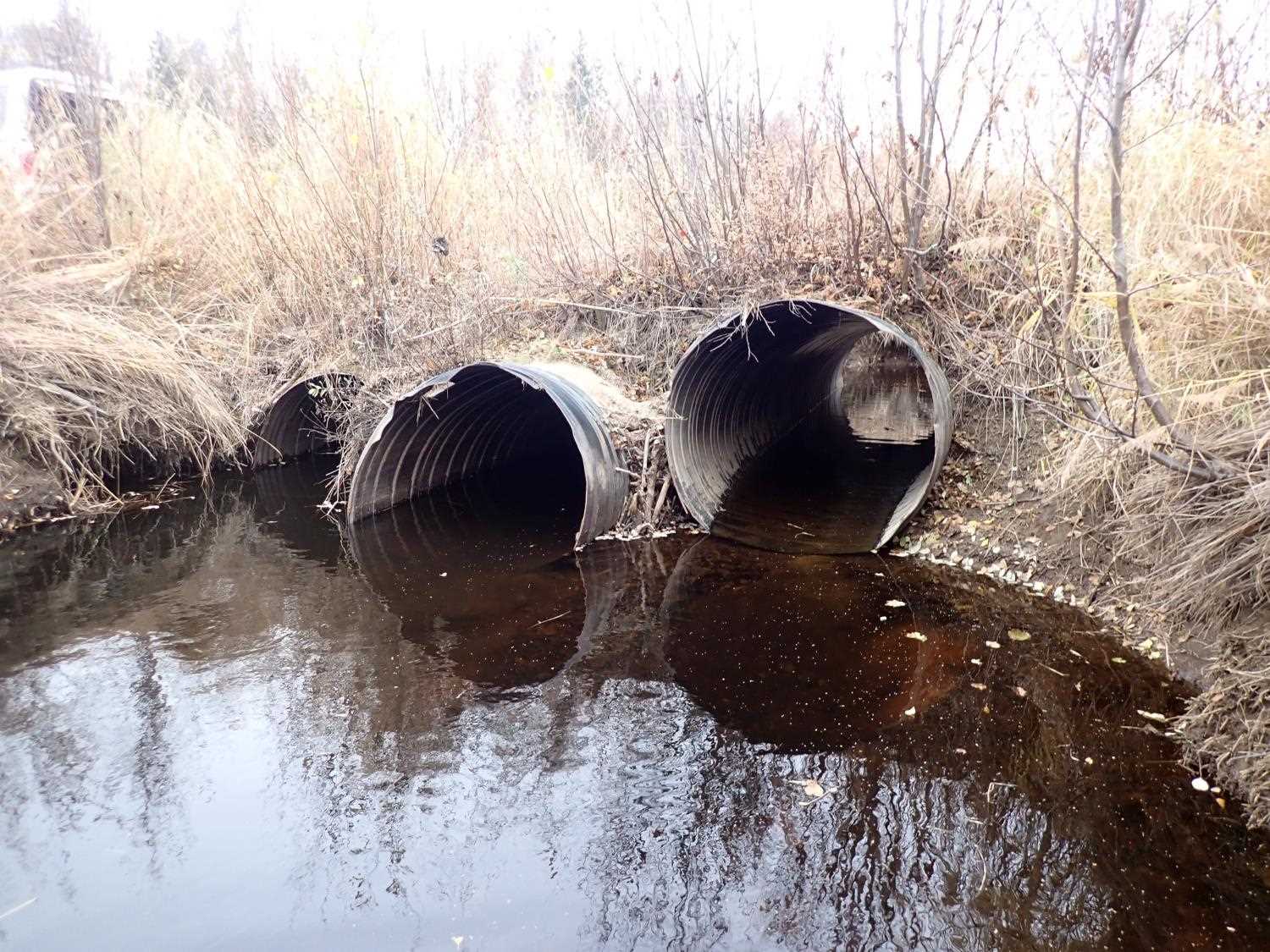
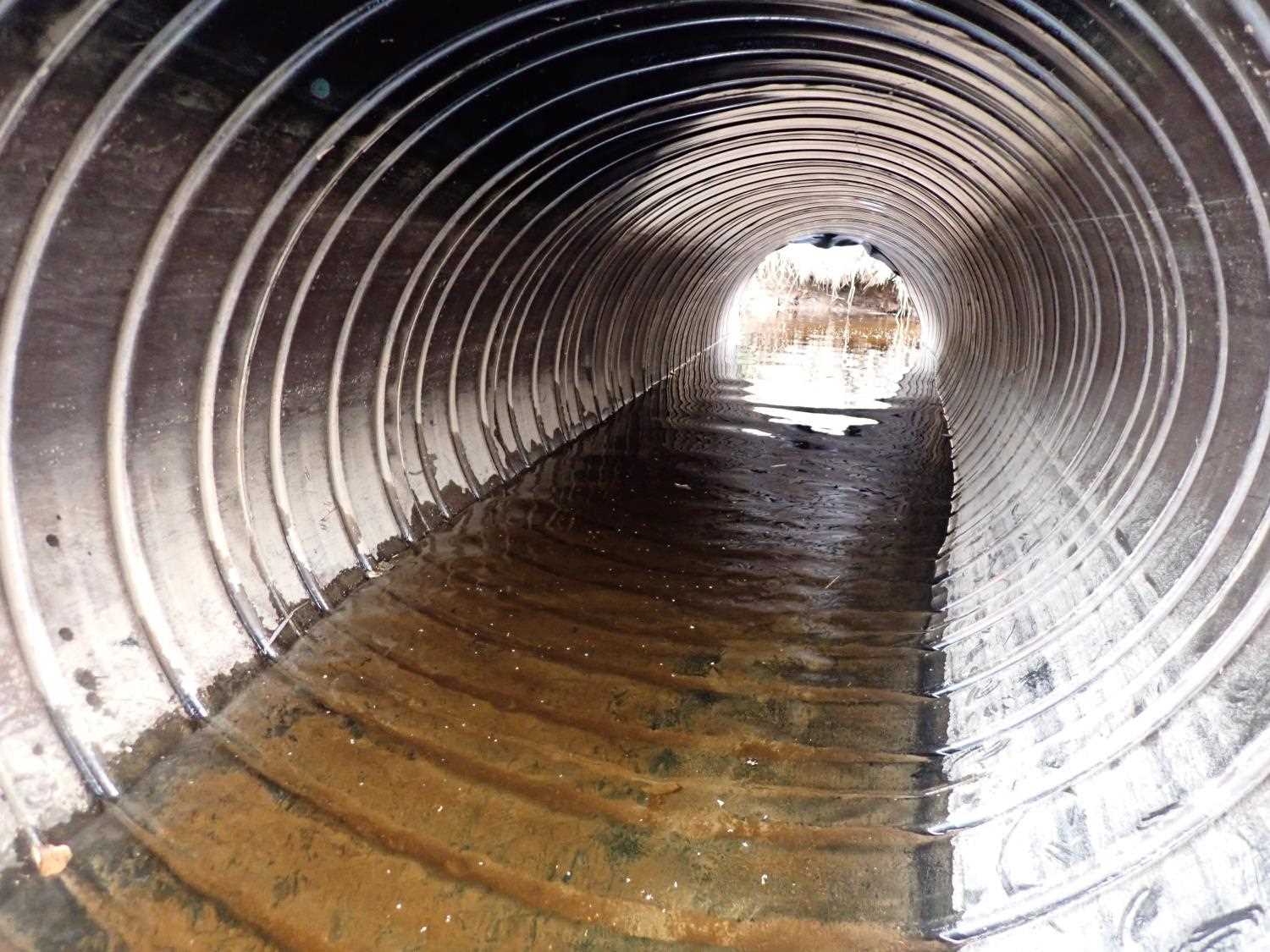
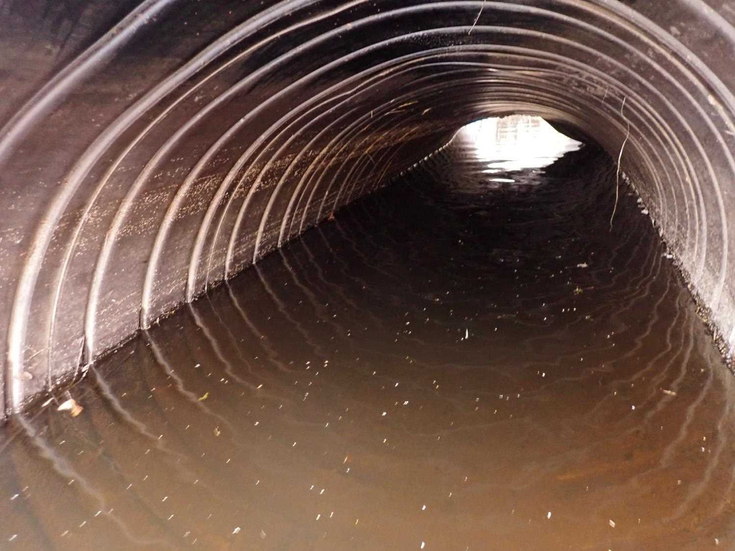
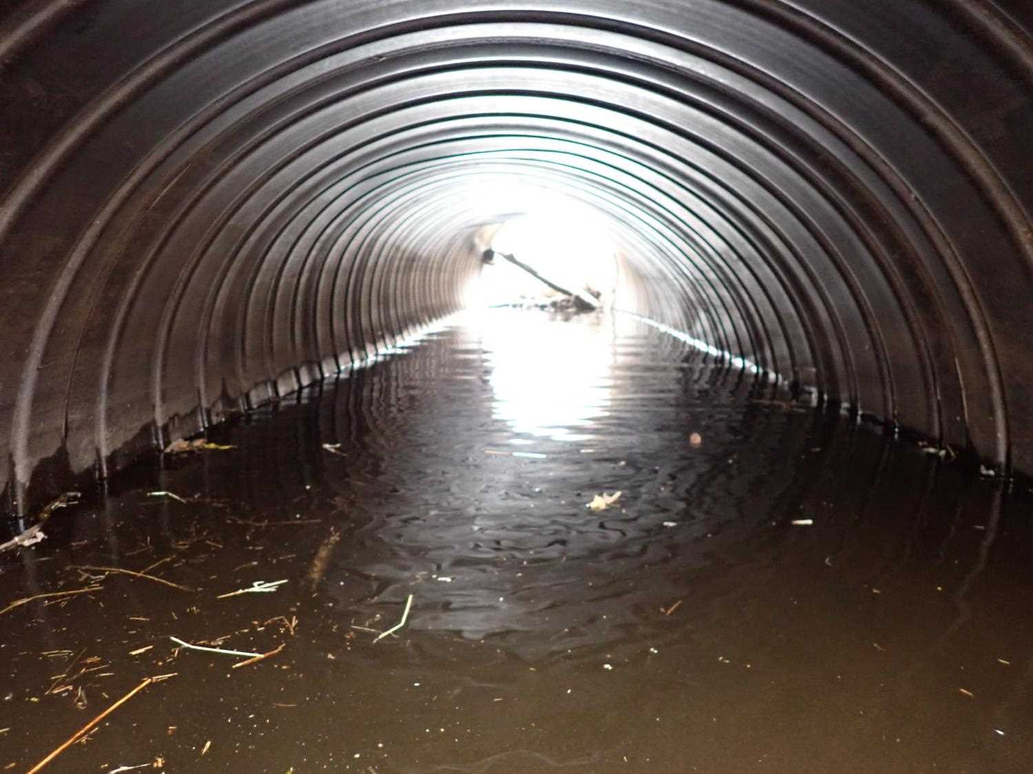
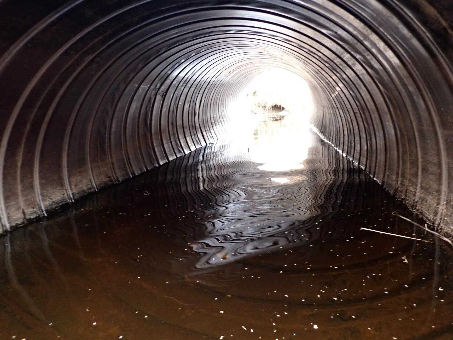
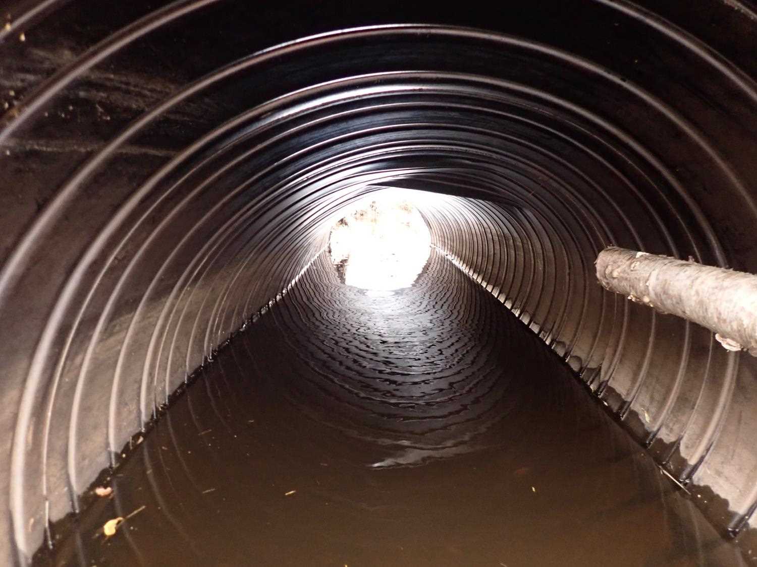
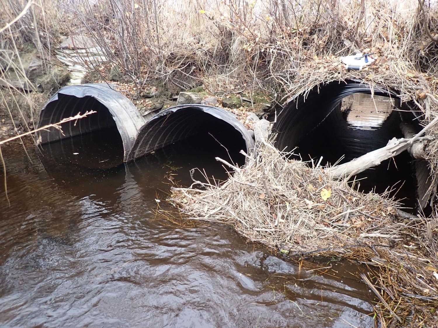
- Culvert sagging in middle
Comments: Juvenile fish sighted upstream.
Culvert Measurements
| ID: 1 | Structure Type: Circular pipe (Unknown) | Fish Passage Rating: | ||||||||||||||||||||||||||||||||||||||||||
|
|
|
||||||||||||||||||||||||||||||||||||||||||
Comments: Metal with coating on it, cannot see rustline. Irregular corregations. We used water surface to calculate all culvert gradients due to warp in pipe. Pipe gradient negative for culvert #1 & #2. |
||||||||||||||||||||||||||||||||||||||||||||
Culvert Observations:
|
||||||||||||||||||||||||||||||||||||||||||||
| ID: 2 | Structure Type: Circular pipe (Unknown) | Fish Passage Rating: | ||||||||||||||||||||||||||||||||||||||||||
|
|
|
||||||||||||||||||||||||||||||||||||||||||
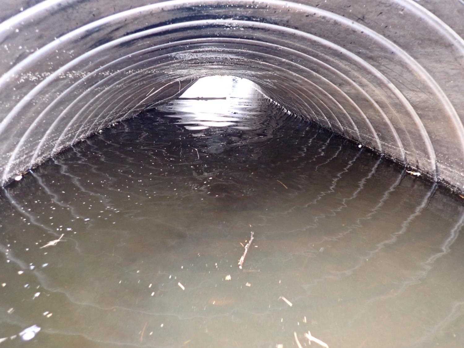
Comments: Top severely sagging for culvert #2.Metal with coating on it, cannot see rustline. Irregular corregations. |
||||||||||||||||||||||||||||||||||||||||||||
Culvert Observations:
|
||||||||||||||||||||||||||||||||||||||||||||
| ID: 3 | Structure Type: Circular pipe (Unknown) | Fish Passage Rating: | ||||||||||||||||||||||||||||||||||||||||||
|
|
|
||||||||||||||||||||||||||||||||||||||||||
Comments: Culvert #3 the top is sagging.Metal with coating on it, cannot see rustline. Irregular corregations. |
||||||||||||||||||||||||||||||||||||||||||||
Culvert Observations:
|
||||||||||||||||||||||||||||||||||||||||||||
Stream Measurements
|
|
| Stream Width Type | Distance From Crossing (ft) |
Stream Width (ft) |
|---|---|---|
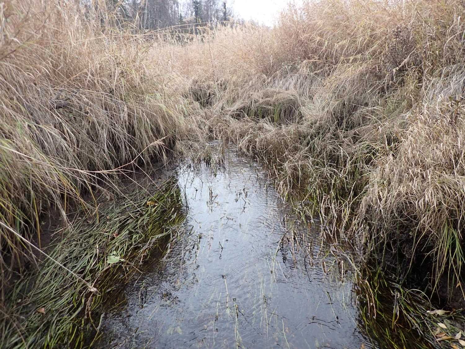
| Downstream ordinary high water | 60.0 | 10.50 |
| Downstream ordinary high water | 75.0 | 18.00 |
| Downstream ordinary high water | 110.0 | 13.40 |
Elevations
| Locator ID | Culvert Number |
River Distance (ft)1 |
Distance From Crossing (ft)2 |
Relative Elevation (ft) |
|---|---|---|---|---|
| Road Elev | 99.83 | |||
| U/S Water Surface Elev | 0.00 | 94.72 | ||
| U/S Water Surface Elev | 1 | 20.00 | 94.71 | |
| U/S Water Surface Elev | 3 | 20.00 | 94.71 | |
| Inlet Culvert Top | 2 | 20.00 | 96.88 | |
| Inlet Culvert Top | 1 | 20.00 | 97.32 | |
| Inlet Culvert Invert | 2 | 20.00 | 92.65 | |
| Inlet Culvert Invert | 1 | 20.00 | 92.88 | |
| Inlet Culvert Invert | 3 | 20.00 | 93.22 | |
| U/S Water Surface Elev | 2 | 20.00 | 94.62 | |
| Inlet Culvert Top | 3 | 20.00 | 97.94 | |
| Outlet Invert | 3 | 43.84 | 92.58 | |
| D/S Water Surface Elev | 3 | 43.84 | 94.68 | |
| Outlet Culvert Top | 3 | 43.84 | 96.92 | |
| Outlet Invert | 1 | 44.95 | 94.18 | |
| Outlet Culvert Top | 1 | 44.95 | 98.63 | |
| D/S Water Surface Elev | 1 | 44.95 | 94.72 | |
| Outlet Invert | 2 | 47.28 | 93.14 | |
| Outlet Culvert Top | 2 | 47.28 | 97.55 | |
| D/S Water Surface Elev | 2 | 47.28 | 94.72 | |
| D/S Water Surface Elev | 77.28 | 94.66 |
Notes:
- River distance is measured continuously throughout the survey reach along the thalweg of the stream.
- Measured from each end of the crossing along the thalweg of the stream.
Fish Sampling Efforts
No fish sampling occurred during this survey.
Fish Observations
No fish observations occurred during this survey.
Photos
Questions or comments about this report can be directed to dfg.dsf.webmaster@alaska.gov