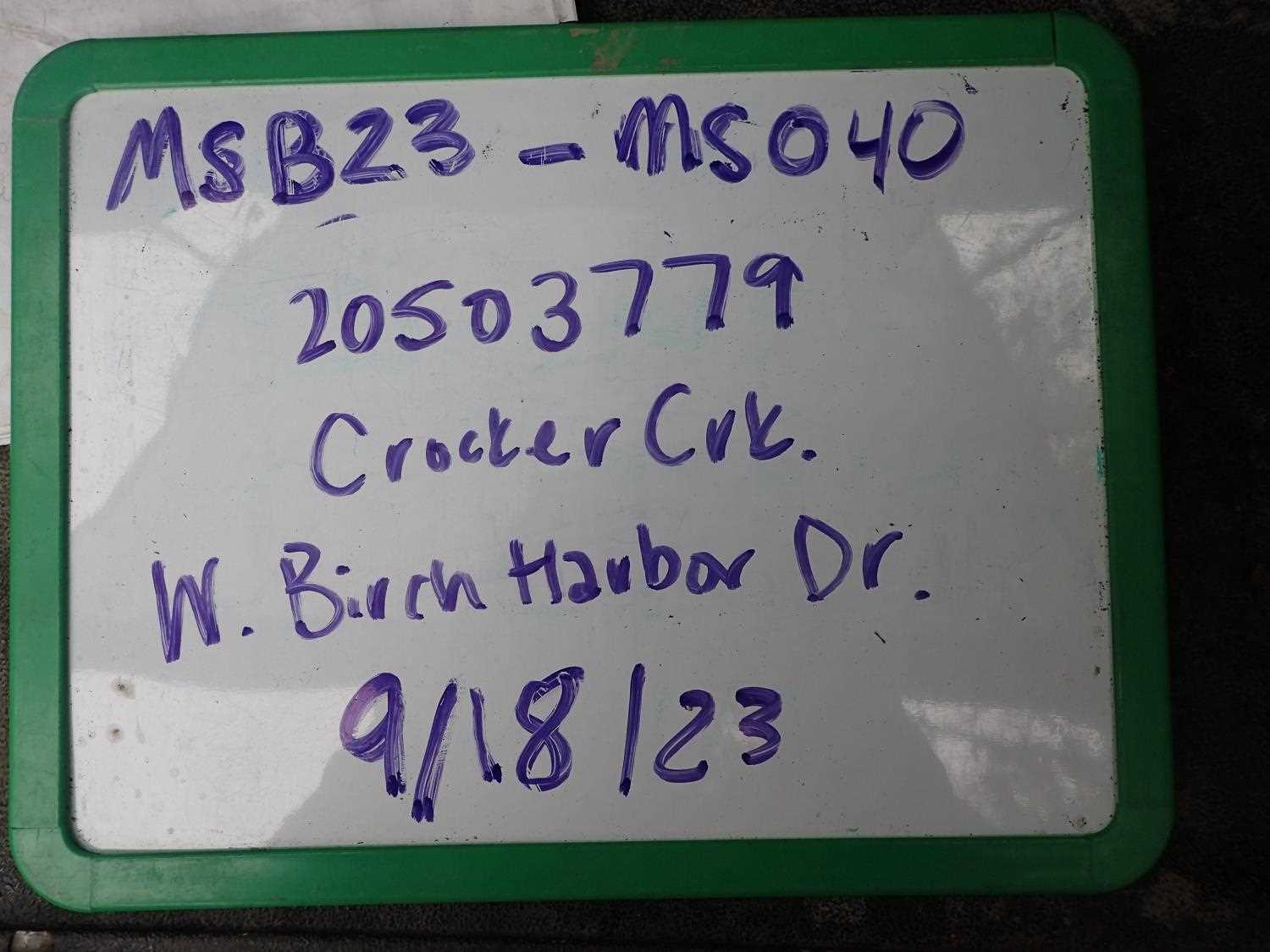
Fish Passage Site 20504059
Coordinates (dec. deg.): 61.52860°, -149.59921°
Legal Description: S017N002W26
Region: South Central
Road Name: W. Birch Harbor Drive
Datum: WGS84
Quad Name / ITM: Anchorage C-7
AWC Stream #:
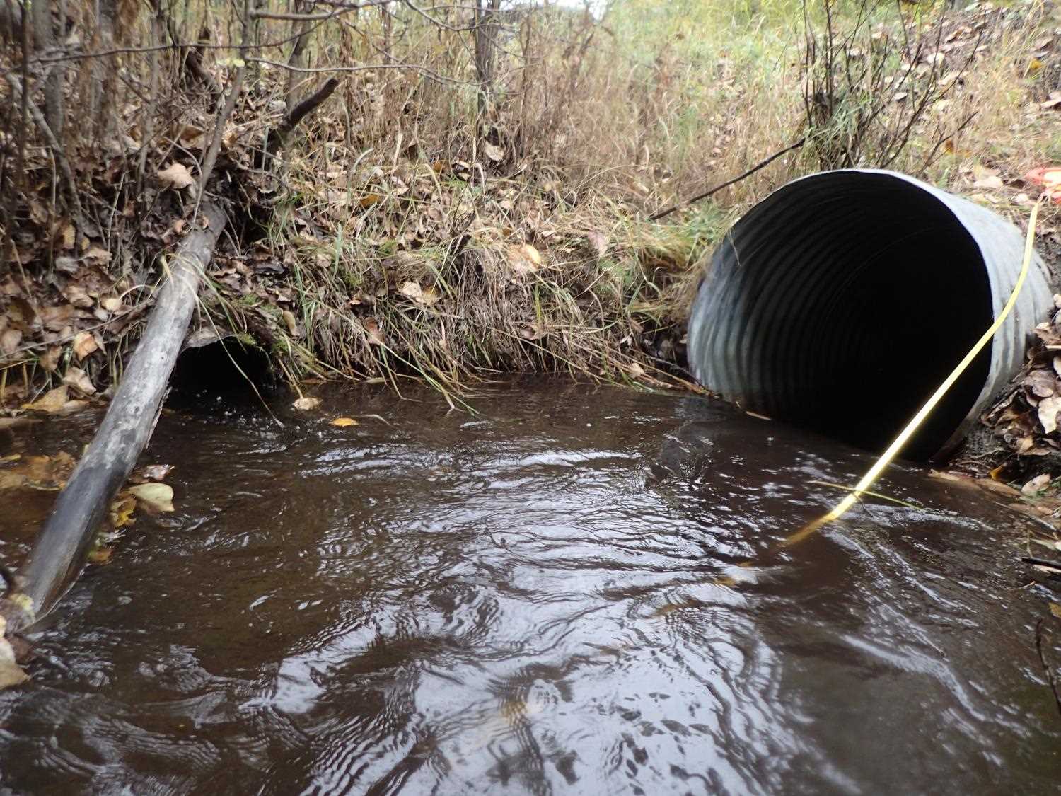
Stream Name: Crocker Creek
Elevation:
Site Comments: None
Survey MSB23-MS040
Project Supervisor: Michael Mazzacavallo, Alaska Department of Fish and Game
— Anchorage, AK
Observers: Michael Mazzacavallo, Kat Leavitt, Beth Evers
Overall Fish Passage Rating:
Tidal:
Backwatered:
Step Pools:
Construction Year:
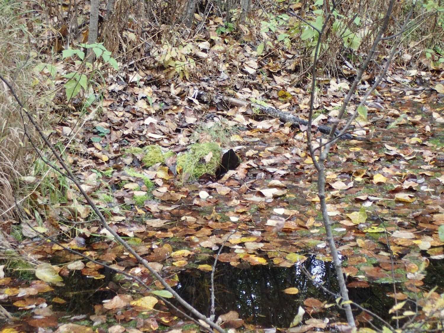
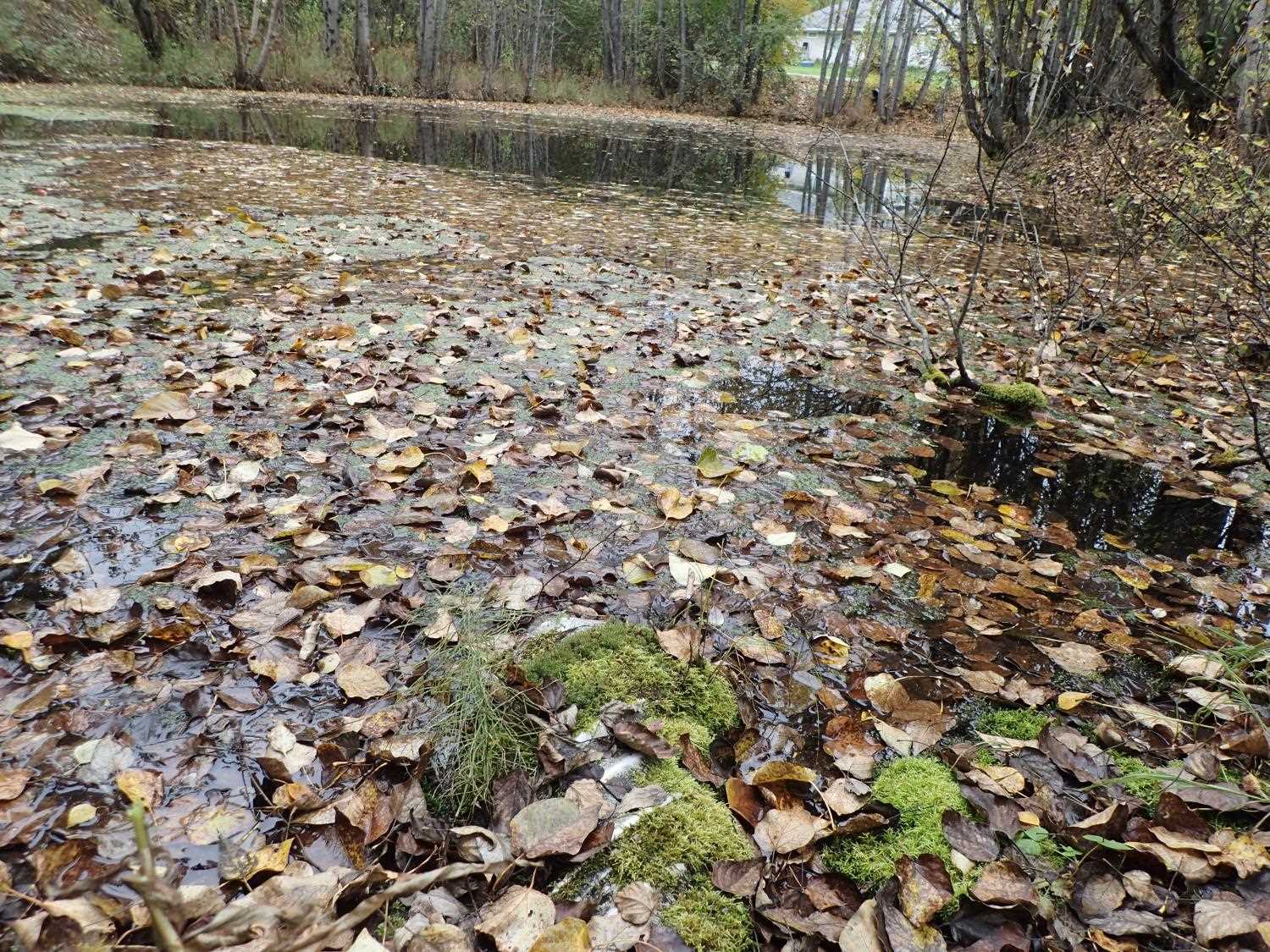
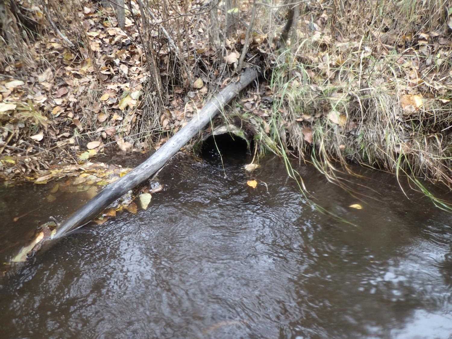
Comments: Small culvert used as pond elevation control. Looked adjacent to culvert 20503779. Outlet of this culvert is just U/S of inlet of 20503779. Pond has connection to crocker creek though channel.
Culvert Measurements
| ID: 1 | Structure Type: Circular pipe (Corrugated aluminum) | Fish Passage Rating: | ||||||||||||||||||||||||||||||||||||||||||
|
|
|
||||||||||||||||||||||||||||||||||||||||||
Stream Measurements
|
|
No stream width data available.
Elevations
No elevation data available.
Fish Sampling Efforts
No fish sampling occurred during this survey.
Fish Observations
No fish observations occurred during this survey.
Photos
Questions or comments about this report can be directed to dfg.dsf.webmaster@alaska.gov