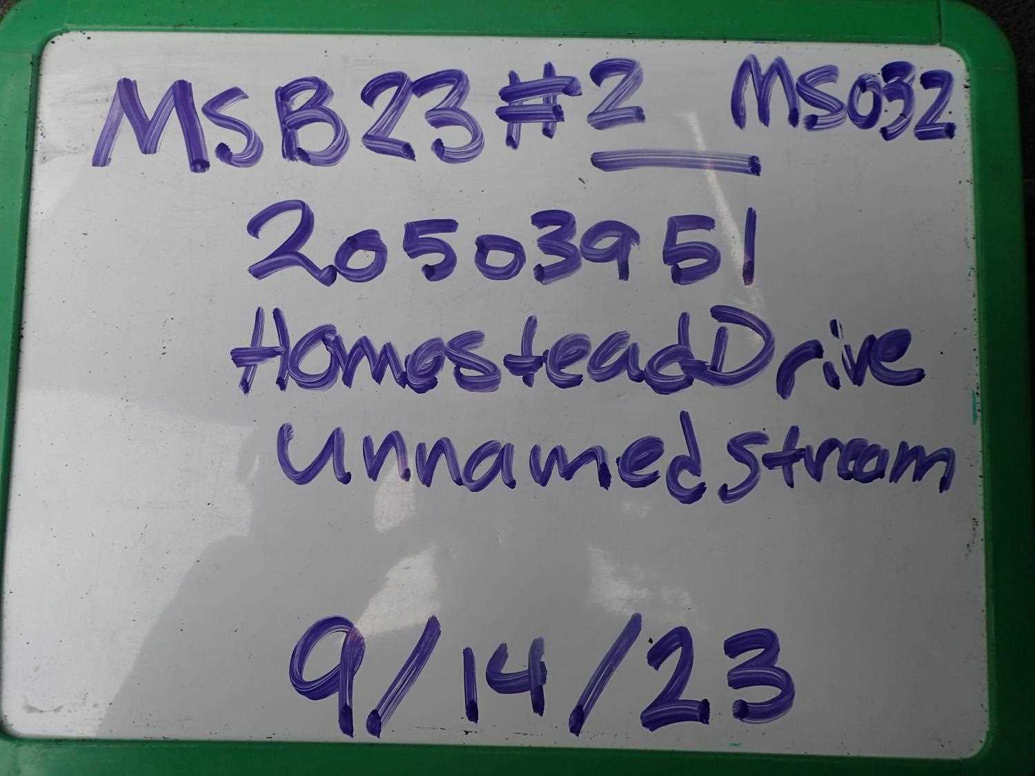
Fish Passage Site 20503951
Coordinates (dec. deg.): 61.45040°, -149.75940°
Legal Description: S016N003W26
Region: South Central
Road Name: South Homestead Road
Datum: WGS84
Quad Name / ITM: Anchorage B-8
AWC Stream #:
Stream Name: Unnamed
Elevation:
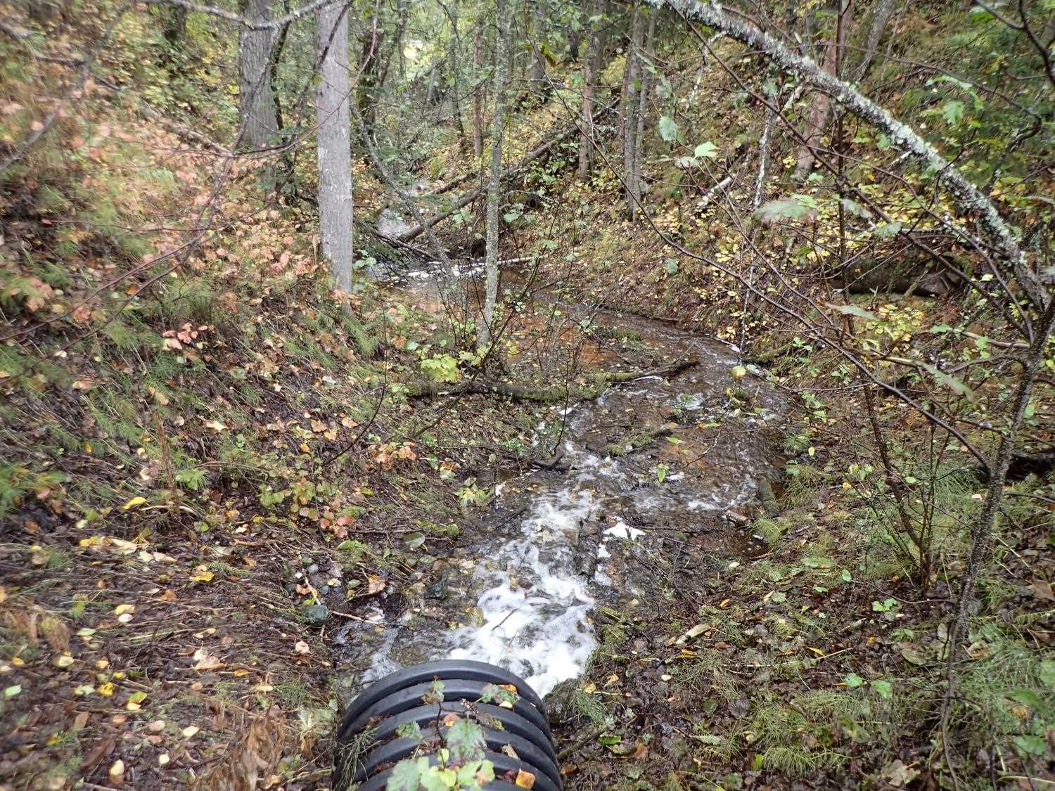
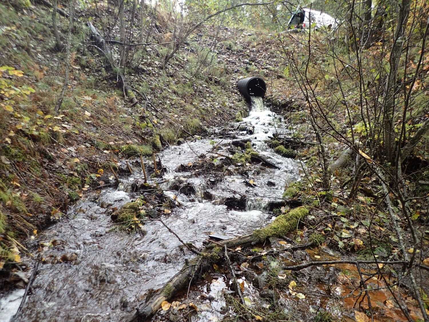
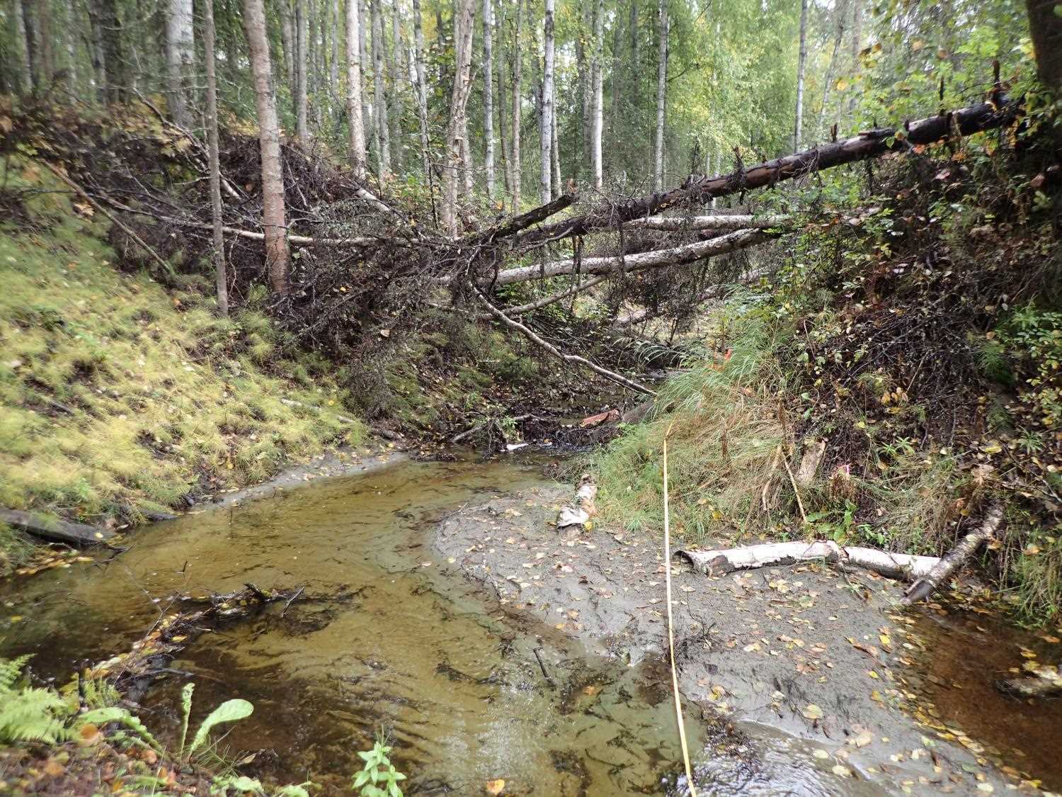
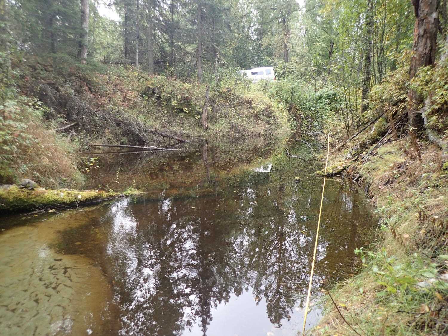
Site Comments: Crossing is under driveway. Drains White Lake to Cook Inlet.
arrow to the right of the survey date below to choose a different report for this site.
Survey MSB23-MS032
Project Supervisor: Michael Mazzacavallo, Alaska Department of Fish and Game
— Anchorage, AK
Observers: Michael Mazzacavallo, Kat Leavitt, Beth Evers
Overall Fish Passage Rating:
Tidal: No
Backwatered: No
Step Pools: No
Construction Year:
Site Observations:
- Constriction ratio red
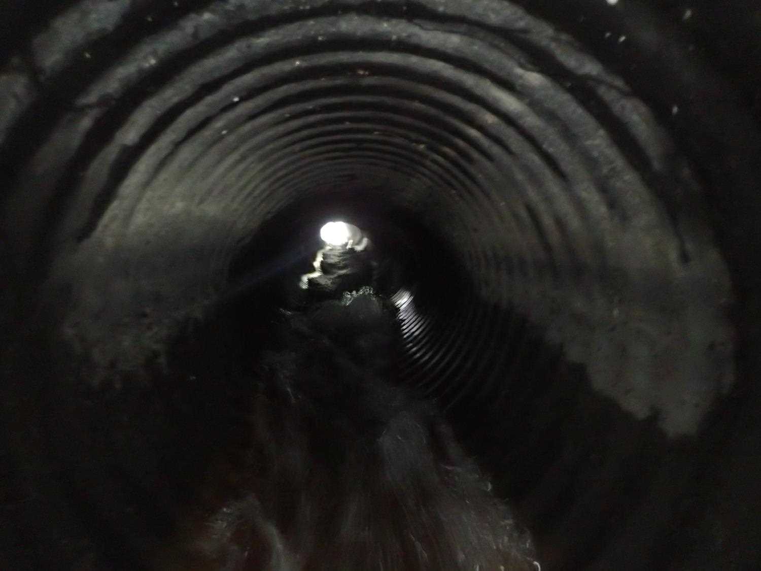
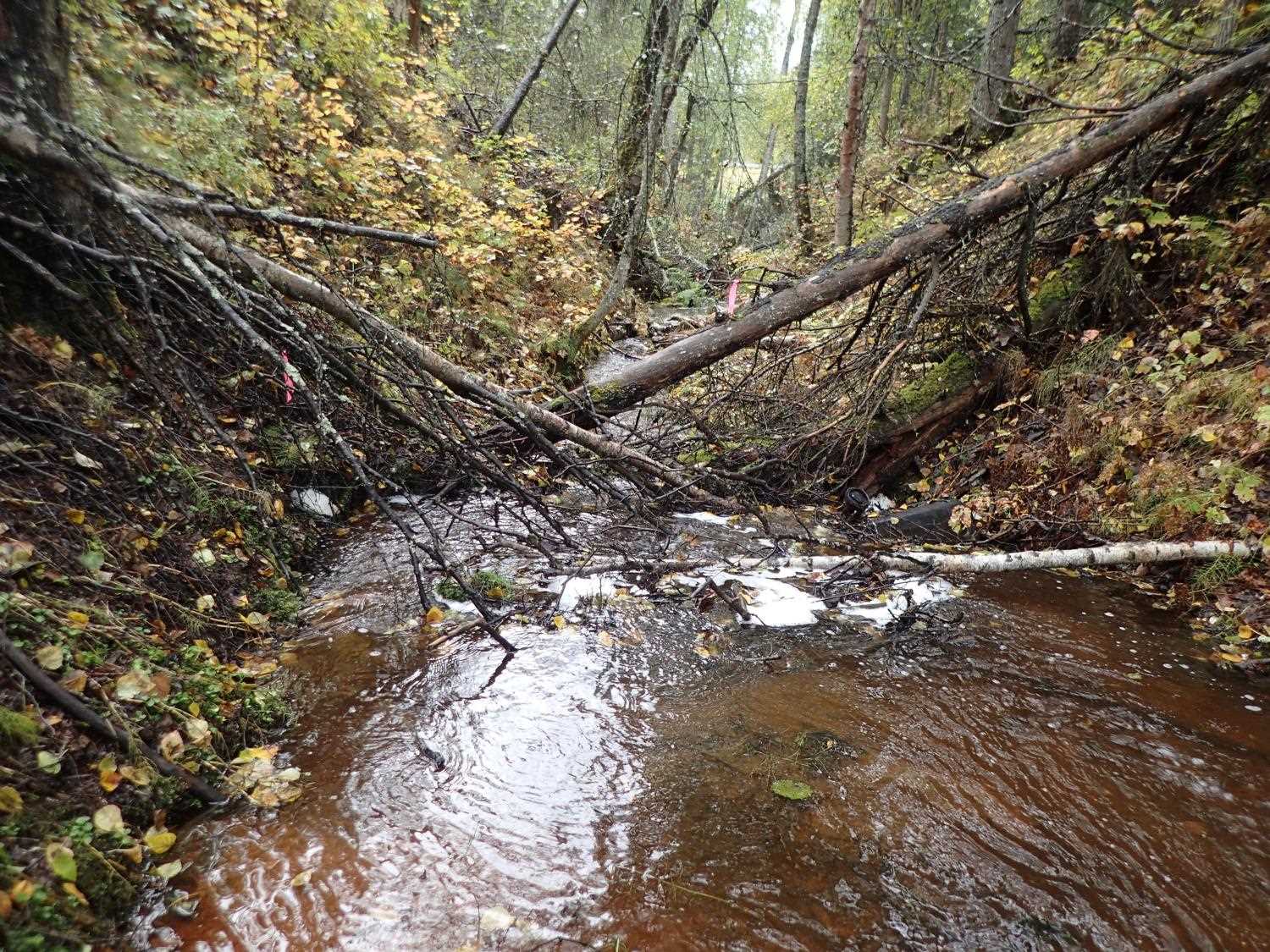
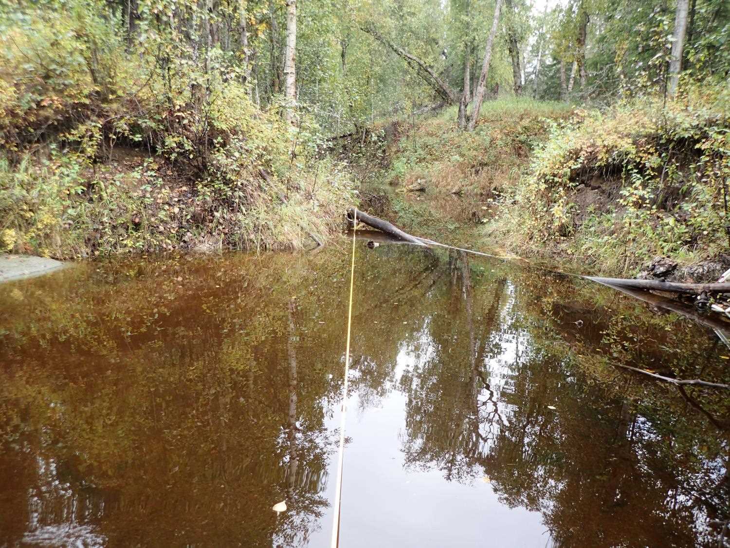
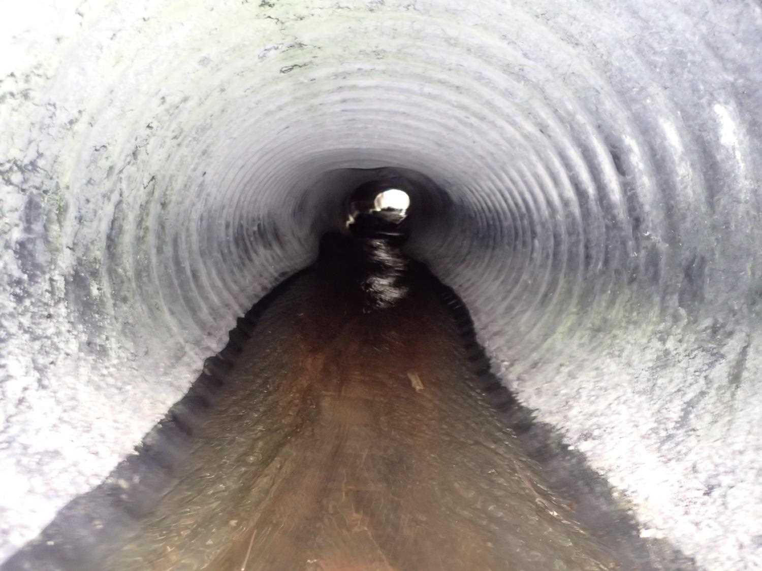
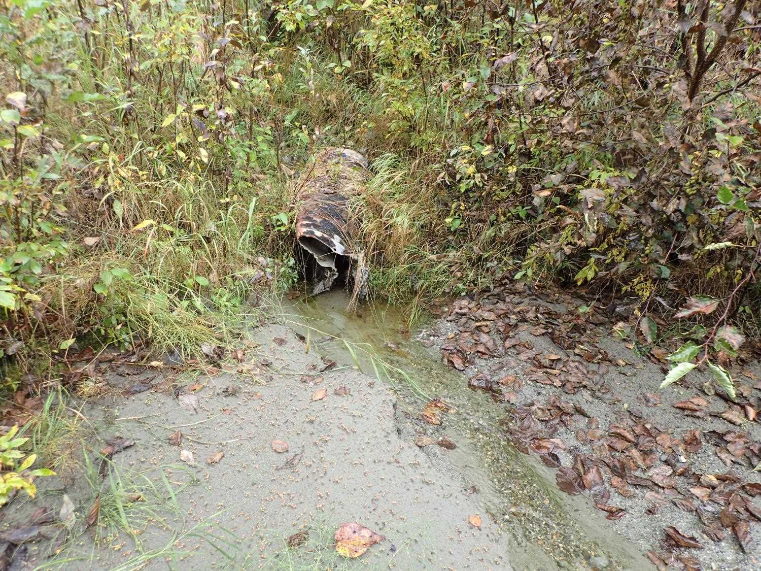
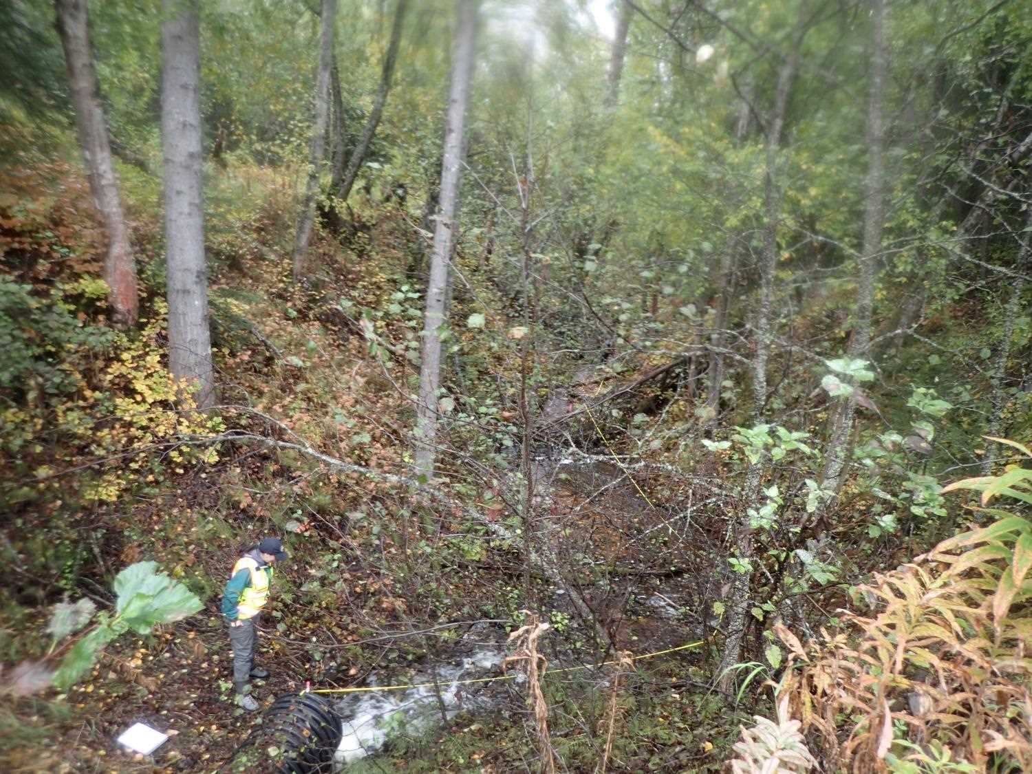
Comments: Lots of human trash and car parts. Stream upstream seems natural, road caused pond build up at inlet. Upstream was dammned for road construction. Sagging top in multiple locations inside culvert. Smooth corruguation on inside of culvert.
Culvert Measurements
| ID: 1 | Structure Type: Circular pipe (Corrugated plastic) | Fish Passage Rating: | ||||||||||||||||||||||||||||||||||||||||||
|
|
|
||||||||||||||||||||||||||||||||||||||||||
Comments: Inlet hieght: 0.5ft damage subtracted from total height; 0.55 clearance when plastic culvert torn piece is hanging down, potential fish passage limitation. (no picture of the damage in photo inventory) |
||||||||||||||||||||||||||||||||||||||||||||
Culvert Observations:
|
||||||||||||||||||||||||||||||||||||||||||||
Stream Measurements
|
|
| Stream Width Type | Distance From Crossing (ft) |
Stream Width (ft) |
|---|---|---|
| Downstream ordinary high water | 31.0 | 8.80 |
| Downstream ordinary high water | 73.0 | 4.50 |
| Downstream ordinary high water | 98.0 | 10.10 |
Elevations
| Locator ID | Culvert Number |
River Distance (ft)1 |
Distance From Crossing (ft)2 |
Relative Elevation (ft) |
|---|---|---|---|---|
| Road Elev | 99.66 | |||
| U/S Thalweg | 0.00 | 89.82 | ||
| U/S Water Surface Elev | 0.00 | 90.36 | ||
| U/S Water Surface Elev | 61.00 | 90.30 | ||
| U/S Thalweg | 61.00 | 87.02 | ||
| U/S Water Surface Elev | 108.00 | 90.24 | ||
| Inlet Culvert Invert | 108.00 | 89.79 | ||
| Inlet Culvert Top | 108.00 | 92.02 | ||
| Outlet Culvert Top | 157.92 | 90.37 | ||
| Outlet Invert | 157.92 | 88.14 | ||
| D/S Water Surface Elev | 157.92 | 88.28 | ||
| D/S Thalweg | 160.92 | 86.17 | ||
| D/S Water Surface Elev | 160.92 | 86.85 | ||
| D/S Thalweg | 181.92 | 83.42 | ||
| D/S Water Surface Elev | 181.92 | 83.74 | ||
| D/S Thalweg | 216.92 | 81.61 | ||
| D/S Water Surface Elev | 216.92 | 82.20 | ||
| D/S Thalweg | 261.92 | 79.45 | ||
| D/S Water Surface Elev | 261.92 | 80.70 |
Notes:
- River distance is measured continuously throughout the survey reach along the thalweg of the stream.
- Measured from each end of the crossing along the thalweg of the stream.
Fish Sampling Efforts
No fish sampling occurred during this survey.
Fish Observations
No fish observations occurred during this survey.
Photos

Questions or comments about this report can be directed to dfg.dsf.webmaster@alaska.gov