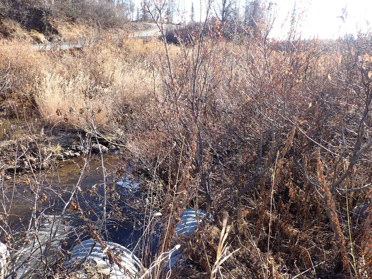
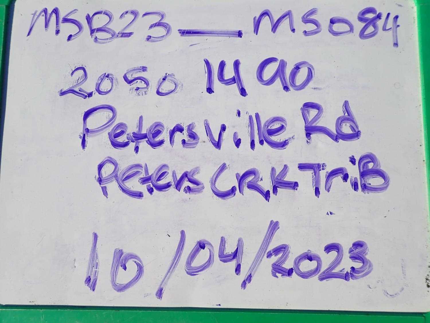
Fish Passage Site 20501490
Coordinates (dec. deg.): 62.47888°, -150.74772°
Legal Description: S028N008W34
Region: South Central
Road Name: Petersville Road
Datum: WGS84
Quad Name / ITM: Talkeetna B-2
AWC Stream #:
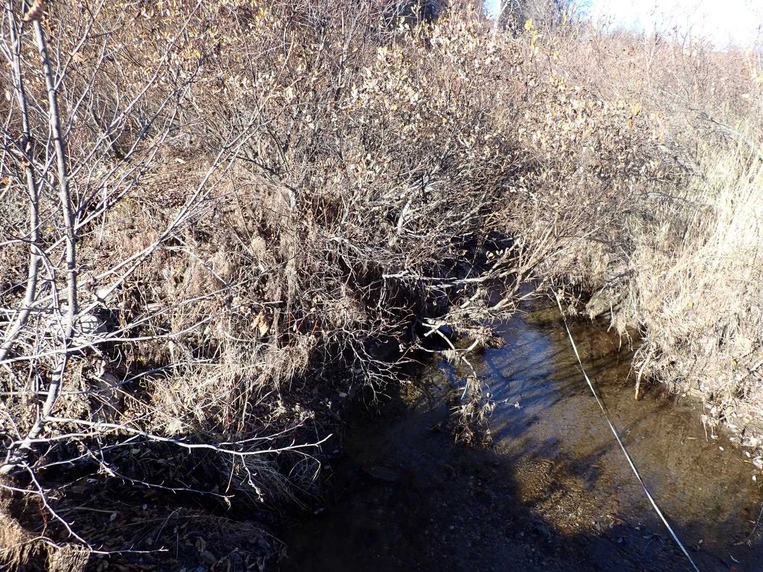
Stream Name: Peters Creek tributary
Elevation:
Site Comments: None
arrow to the right of the survey date below to choose a different report for this site.
Survey MSB23-MS084
Project Supervisor: Michael Mazzacavallo, Alaska Department of Fish and Game
— Anchorage, AK
Observers: Michael Mazzacavallo, Kat Leavitt, Beth Evers
Overall Fish Passage Rating:
Tidal:
Backwatered:
Step Pools:
Construction Year:
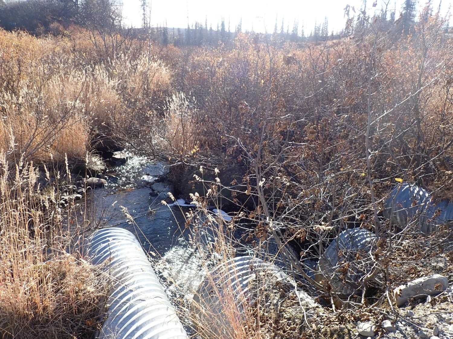
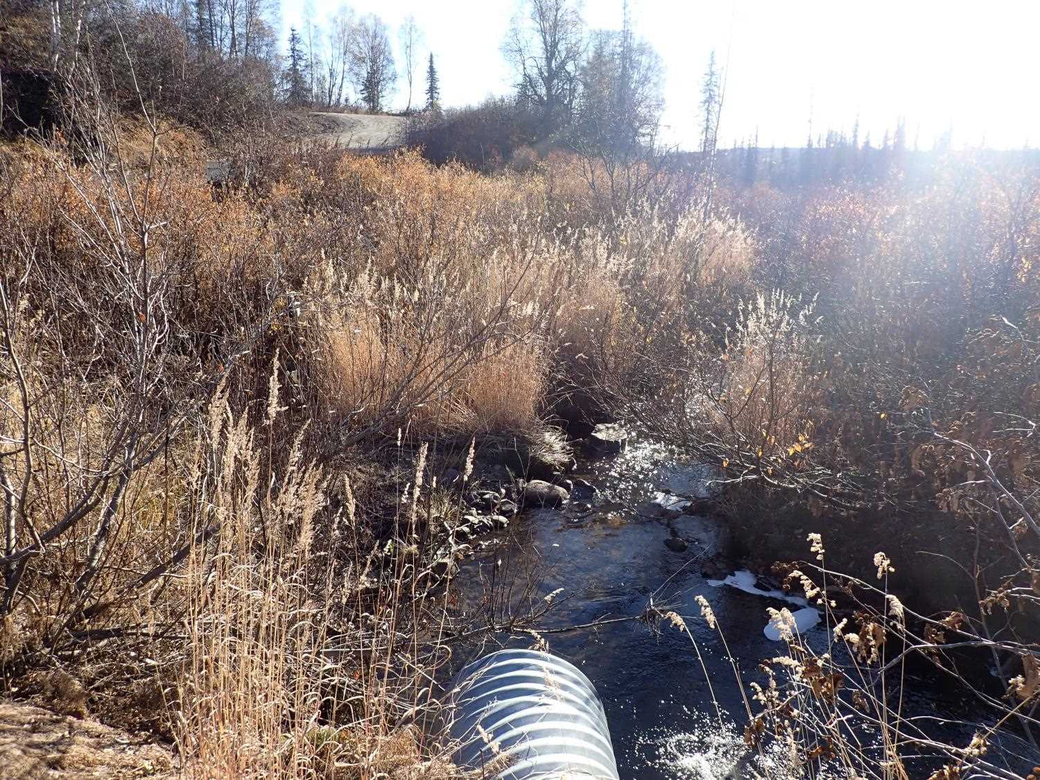
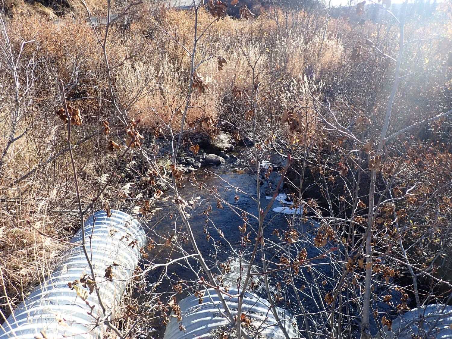
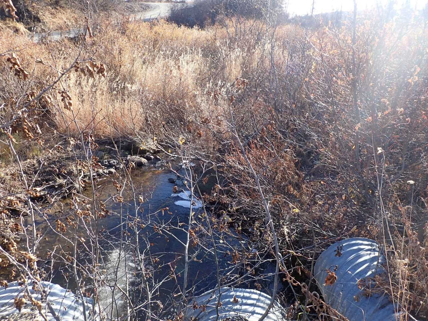
Site Observations:
- Culvert gradient red
- Outfall height red
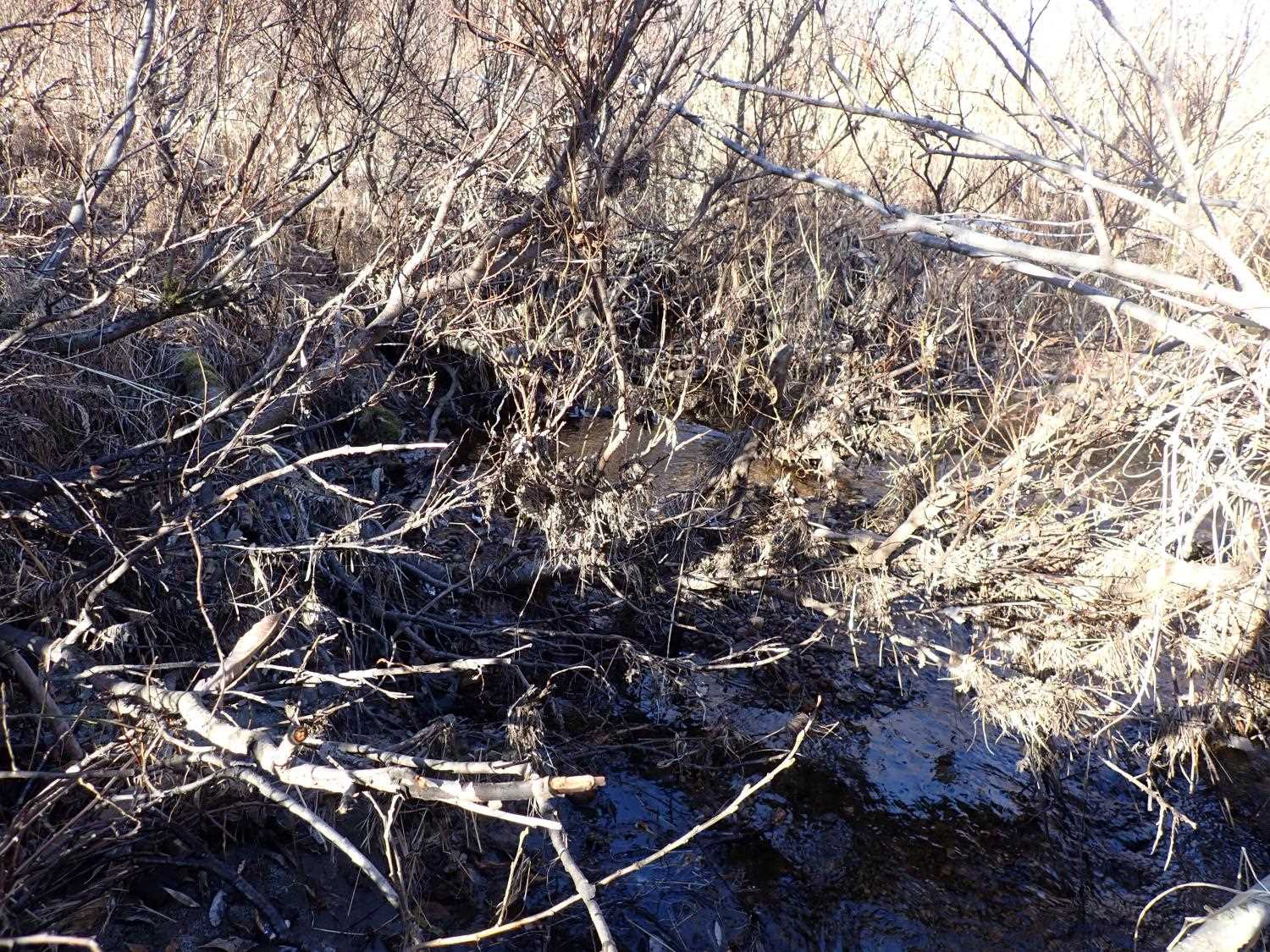
- Woody Debris
- Culvert sagging in middle
Comments: None
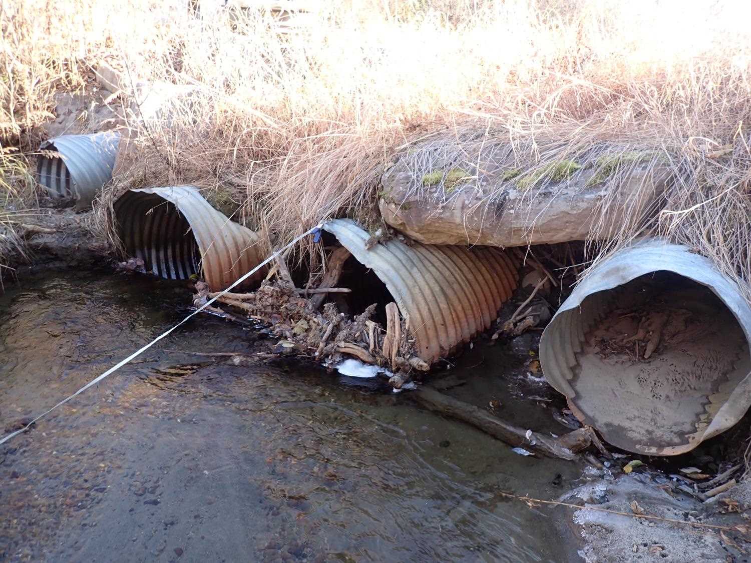
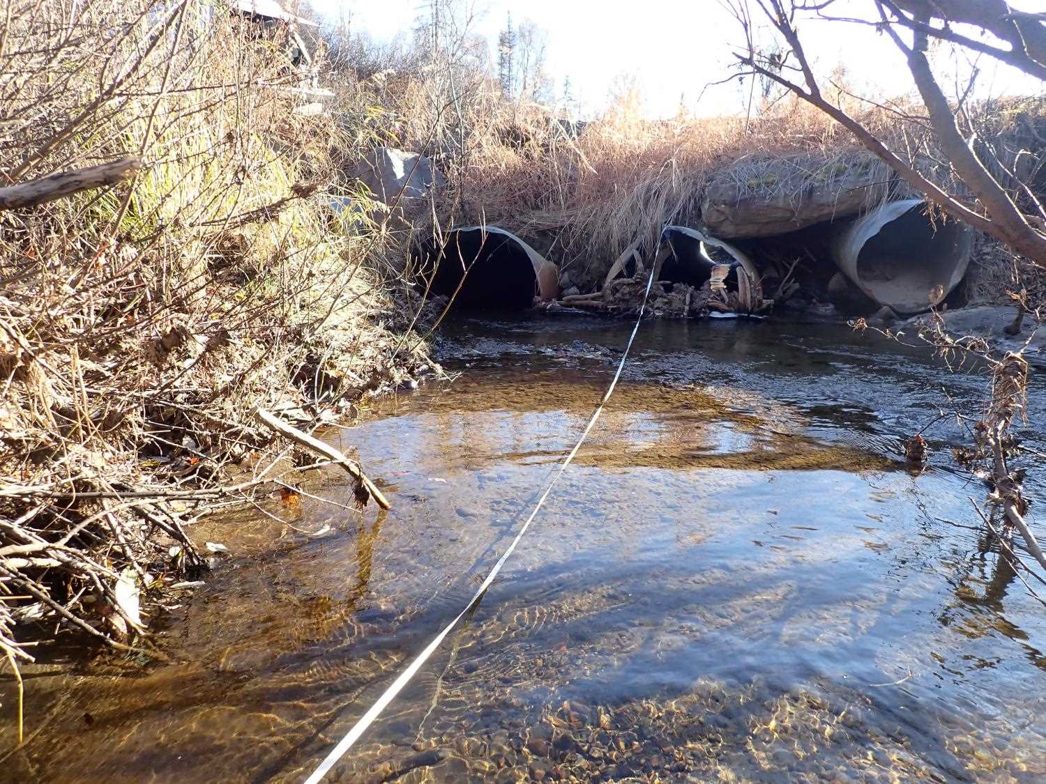
Culvert Measurements
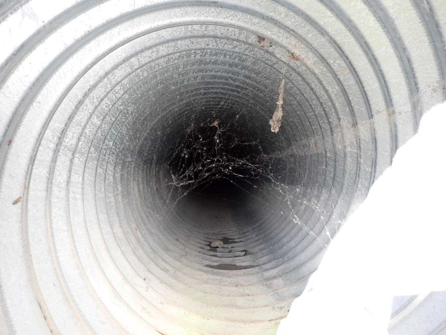
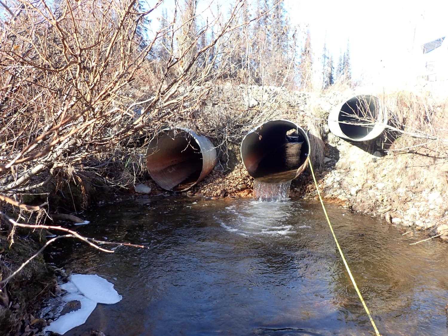
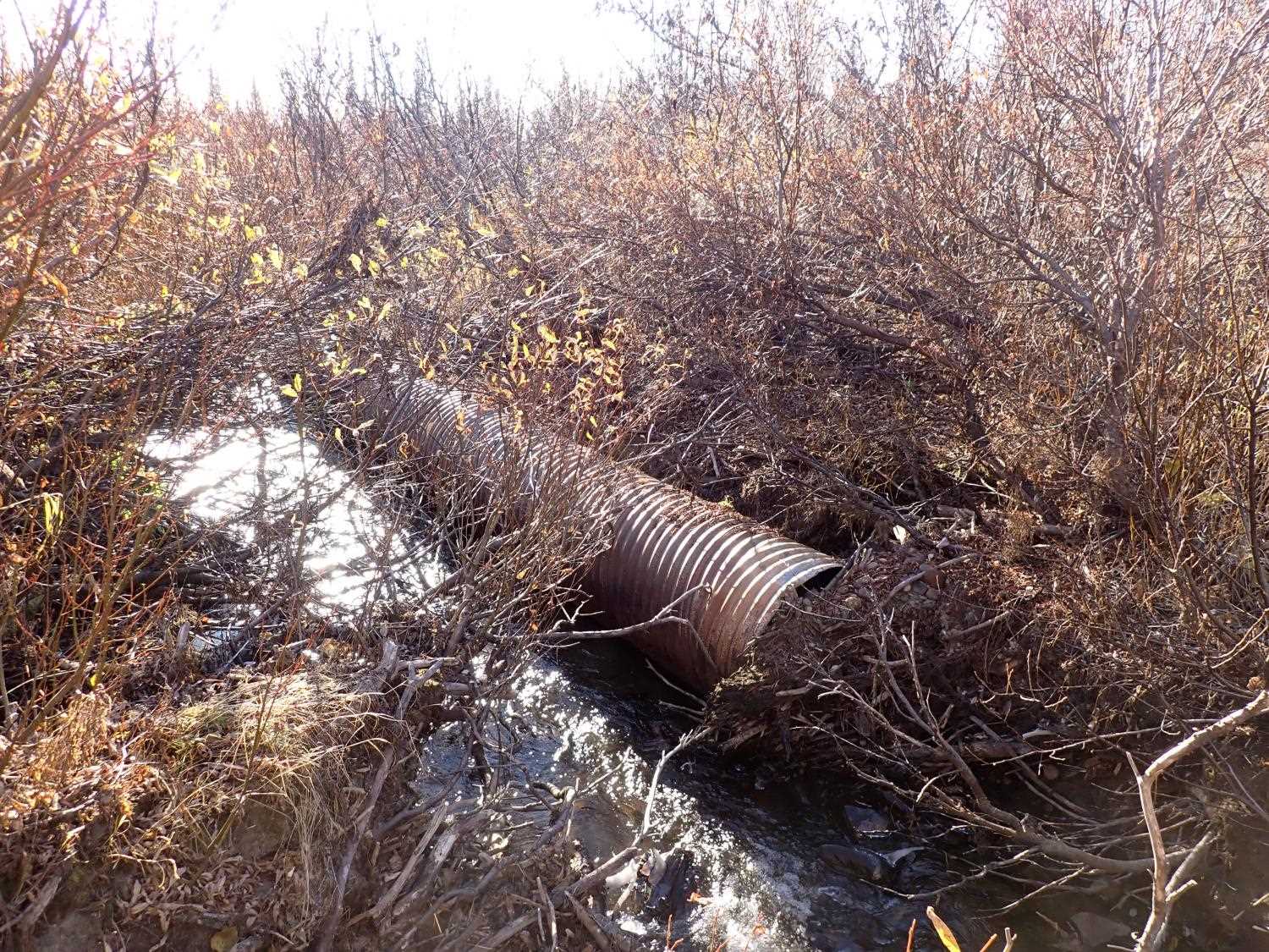
| ID: 1 | Structure Type: Pipe-arch (Corrugated steel) | Fish Passage Rating: | ||||||||||||||||||||||||||||||||||||||||||
|
|
|
||||||||||||||||||||||||||||||||||||||||||
Comments: Culvert #1 was dry, warped, and collapsed, no length measurement was taken. The pipe was warped for culvert #1 and culvert #4, unable to calculate culvert gradient. Would have outfall height If water was flowing through culvert gradient. |
||||||||||||||||||||||||||||||||||||||||||||
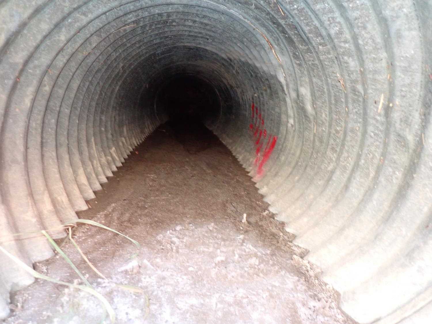
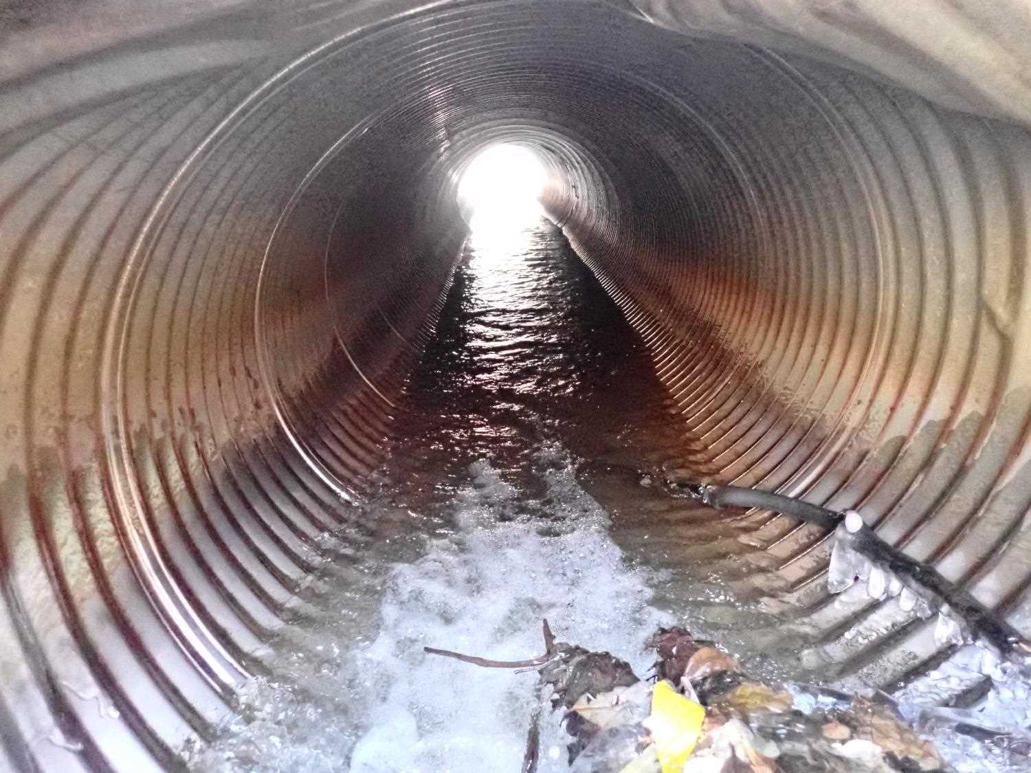
Culvert Observations:
|
||||||||||||||||||||||||||||||||||||||||||||
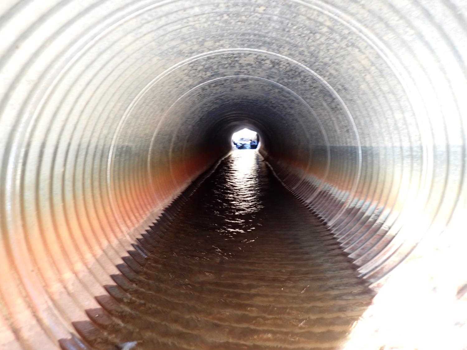
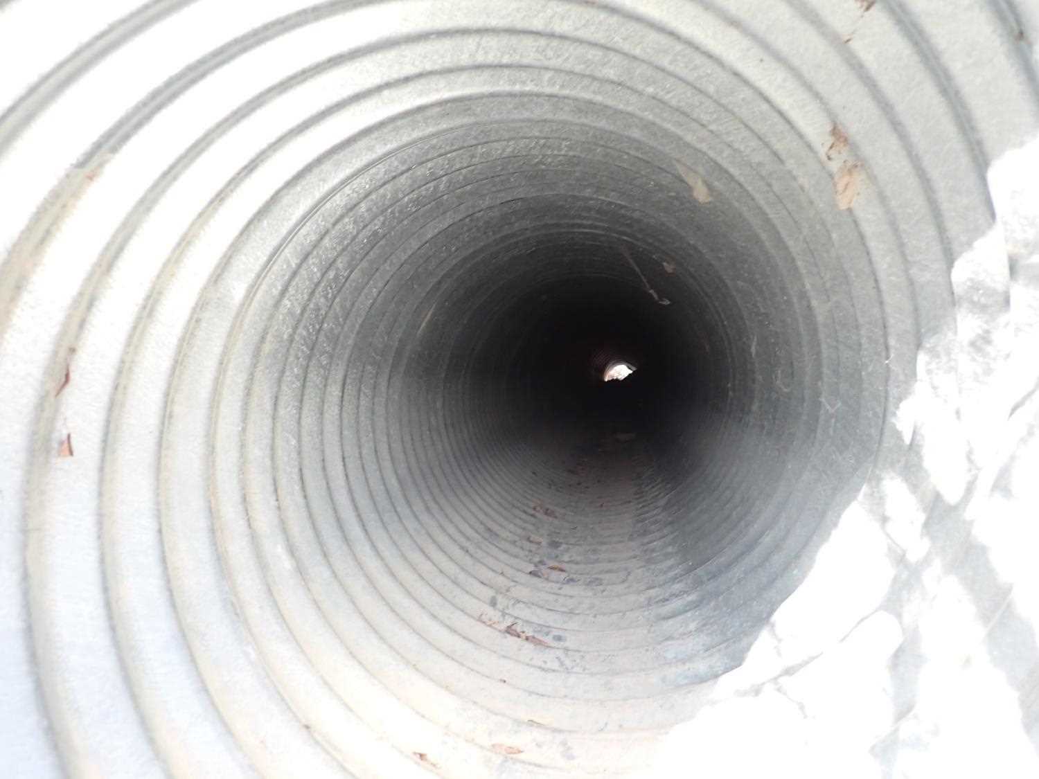
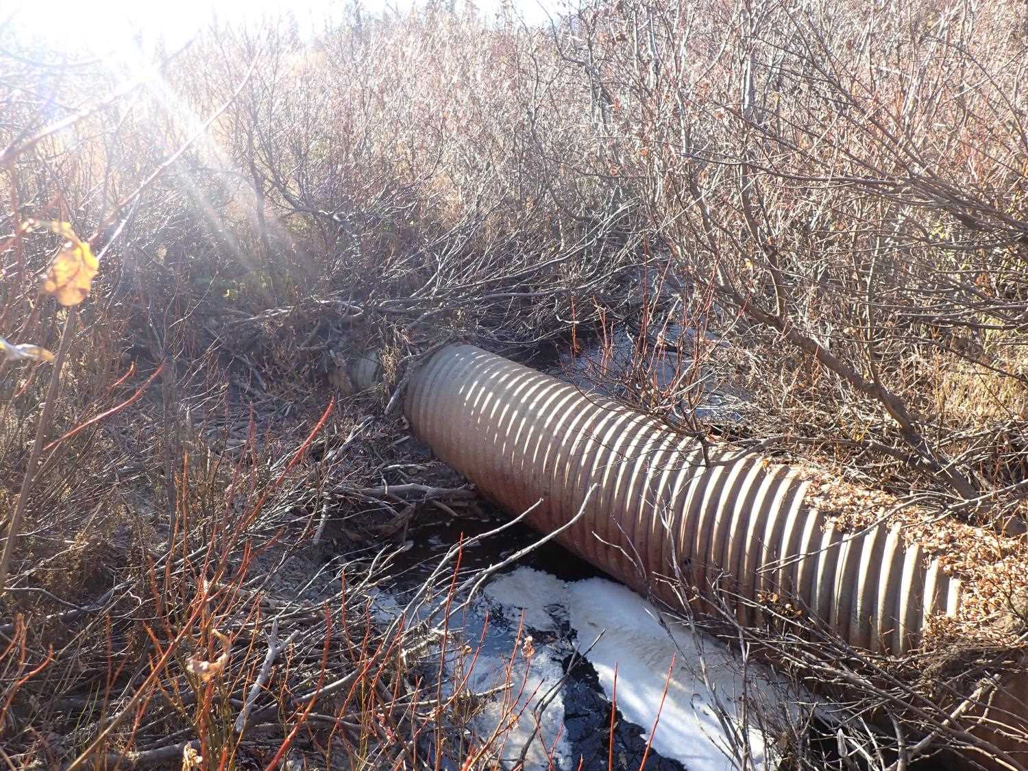
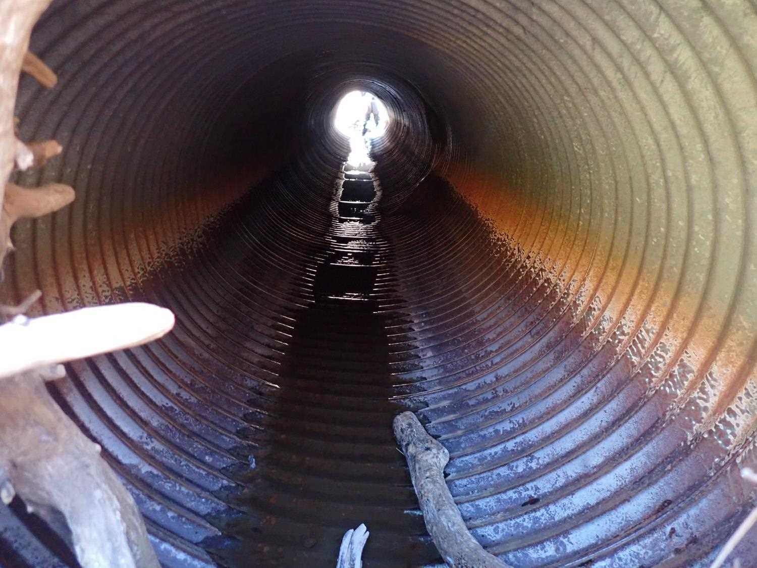
| ID: 2 | Structure Type: Circular pipe (Corrugated steel) | Fish Passage Rating: | ||||||||||||||||||||||||||||||||||||||||||
|
|
|
||||||||||||||||||||||||||||||||||||||||||
Comments: Culvert #2 is the primary culvert. |
||||||||||||||||||||||||||||||||||||||||||||
Culvert Observations:
|
||||||||||||||||||||||||||||||||||||||||||||
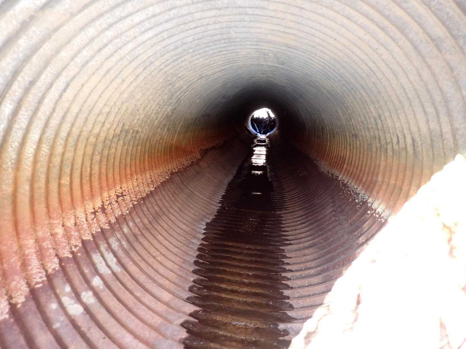
| ID: 3 | Structure Type: Pipe-arch (Corrugated steel) | Fish Passage Rating: | ||||||||||||||||||||||||||||||||||||||||||
|
|
|
||||||||||||||||||||||||||||||||||||||||||
Comments: Debris 2.1ft high stopping water flow at inlet, only small amount of water flowing through. |
||||||||||||||||||||||||||||||||||||||||||||
Culvert Observations:
|
||||||||||||||||||||||||||||||||||||||||||||
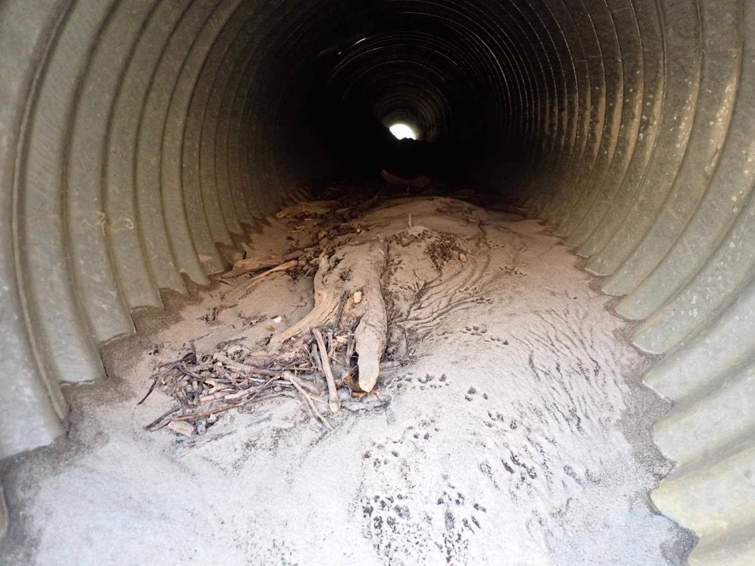
| ID: 4 | Structure Type: Circular pipe (Corrugated steel) | Fish Passage Rating: | ||||||||||||||||||||||||||||||||||||||||||
|
|
|
||||||||||||||||||||||||||||||||||||||||||
Comments: Culvert is dry, filled with sand, something blocking middle of pipe. Would have outfall height if water was flowing through culvert gradient, the pipe is warped. |
||||||||||||||||||||||||||||||||||||||||||||
Culvert Observations:
|
||||||||||||||||||||||||||||||||||||||||||||
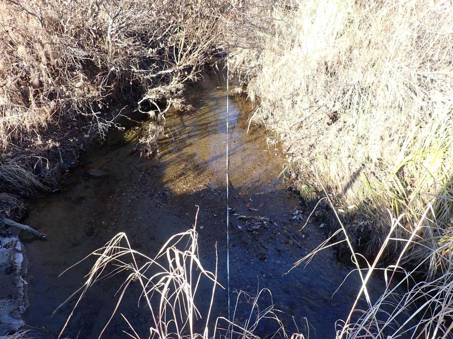
Stream Measurements
|
|
| Stream Width Type | Distance From Crossing (ft) |
Stream Width (ft) |
|---|---|---|
| Upstream ordinary high water | 43.0 | 8.10 |
| Upstream ordinary high water | 78.0 | 7.40 |
| Upstream ordinary high water | 87.0 | 7.20 |
| Upstream ordinary high water | 90.0 | 8.30 |
Elevations
| Locator ID | Culvert Number |
River Distance (ft)1 |
Distance From Crossing (ft)2 |
Relative Elevation (ft) |
|---|---|---|---|---|
| D/S Water Surface Elev | 0.00 | 89.71 | ||
| D/S Thalweg | 0.00 | 89.45 | ||
| D/S Thalweg | 56.00 | 91.05 | ||
| D/S Water Surface Elev | 56.00 | 91.44 | ||
| D/S Thalweg | 89.00 | 91.54 | ||
| D/S Water Surface Elev | 89.00 | 92.17 | ||
| D/S Water Surface Elev (Culvert #3 pool water surface) | 3 | 100.00 | 92.21 | |
| Max Pool Depth (Culvert #3 pool thalweg) | 3 | 100.00 | 91.68 | |
| D/S Water Surface Elev (Culvert #2 pool water surface) | 2 | 100.00 | 92.11 | |
| Max Pool Depth (Culvert #2 pool thalweg) | 2 | 100.00 | 89.49 | |
| Outlet Invert | 3 | 103.00 | 92.32 | |
| Outlet Invert | 2 | 103.00 | 92.91 | |
| U/S Water Surface Elev | 2 | 103.00 | 93.20 | |
| D/S Water Surface Elev | 3 | 103.00 | 93.27 | |
| Outlet Invert | 4 | 103.00 | 95.30 | |
| Outlet Invert | 1 | 103.00 | 95.31 | |
| Outlet Culvert Top | 3 | 103.00 | 95.93 | |
| Outlet Culvert Top | 2 | 103.00 | 96.29 | |
| Outlet Culvert Top | 1 | 103.00 | 97.30 | |
| Outlet Culvert Top | 4 | 103.00 | 97.35 | |
| Inlet Culvert Top | 2 | 151.00 | 96.44 | |
| Inlet Culvert Top | 4 | 151.00 | 97.05 | |
| Inlet Culvert Top | 1 | 151.00 | 97.09 | |
| Inlet Culvert Top | 3 | 151.00 | 94.59 | |
| U/S Water Surface Elev | 3 | 151.00 | 94.59 | |
| U/S Water Surface Elev | 2 | 151.00 | 94.61 | |
| Inlet Culvert Invert | 4 | 151.00 | 94.86 | |
| Inlet Culvert Invert | 1 | 151.00 | 95.25 | |
| Inlet Culvert Invert | 2 | 151.00 | 93.37 | |
| Inlet Culvert Invert | 3 | 151.00 | 93.91 | |
| U/S Thalweg | 181.00 | 94.15 | ||
| U/S Water Surface Elev | 181.00 | 94.74 | ||
| U/S Water Surface Elev | 201.00 | 95.02 | ||
| U/S Thalweg | 201.00 | 93.83 | ||
| U/S Thalweg | 221.00 | 94.26 | ||
| U/S Water Surface Elev | 221.00 | 94.99 |
Notes:
- River distance is measured continuously throughout the survey reach along the thalweg of the stream.
- Measured from each end of the crossing along the thalweg of the stream.
Fish Sampling Efforts
No fish sampling occurred during this survey.
Fish Observations
No fish observations occurred during this survey.
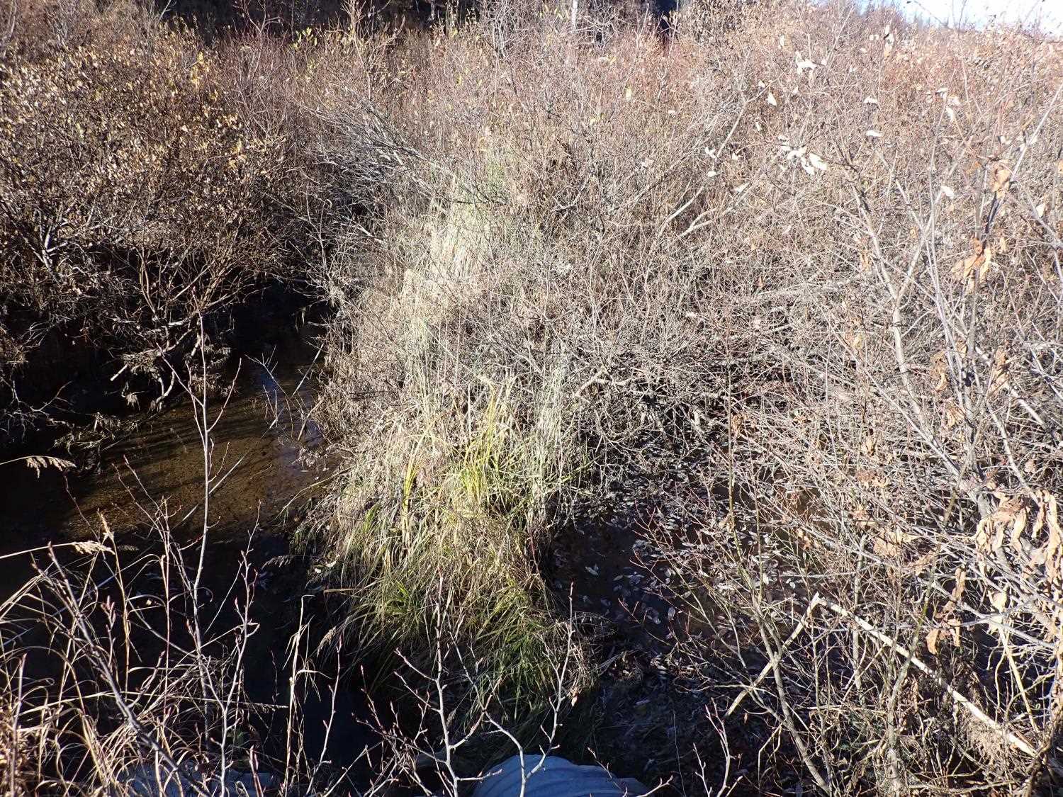
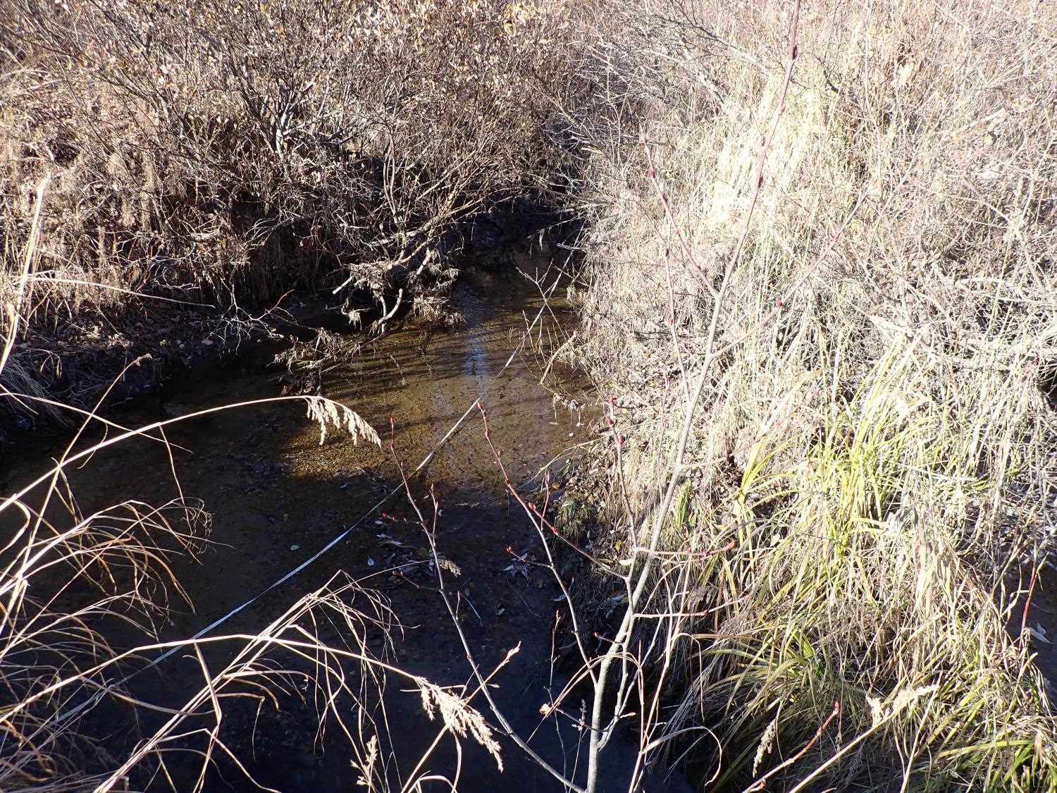
Photos
Questions or comments about this report can be directed to dfg.dsf.webmaster@alaska.gov