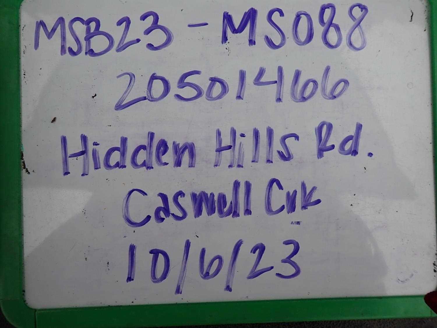
Fish Passage Site 20501466
Coordinates (dec. deg.): 61.98929°, -149.99706°
Legal Description: S022N004W22
Region: South Central
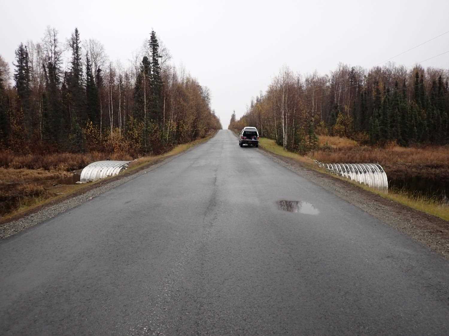
Road Name: Hidden Hills Road
Datum: WGS84
Quad Name / ITM: Anchorage D-8
AWC Stream #:
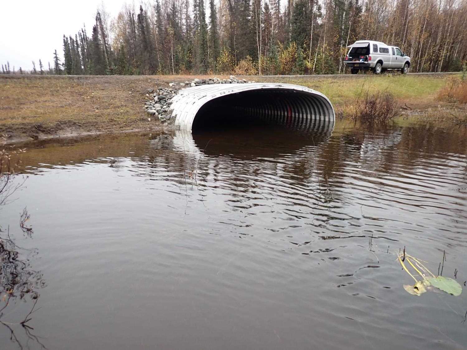
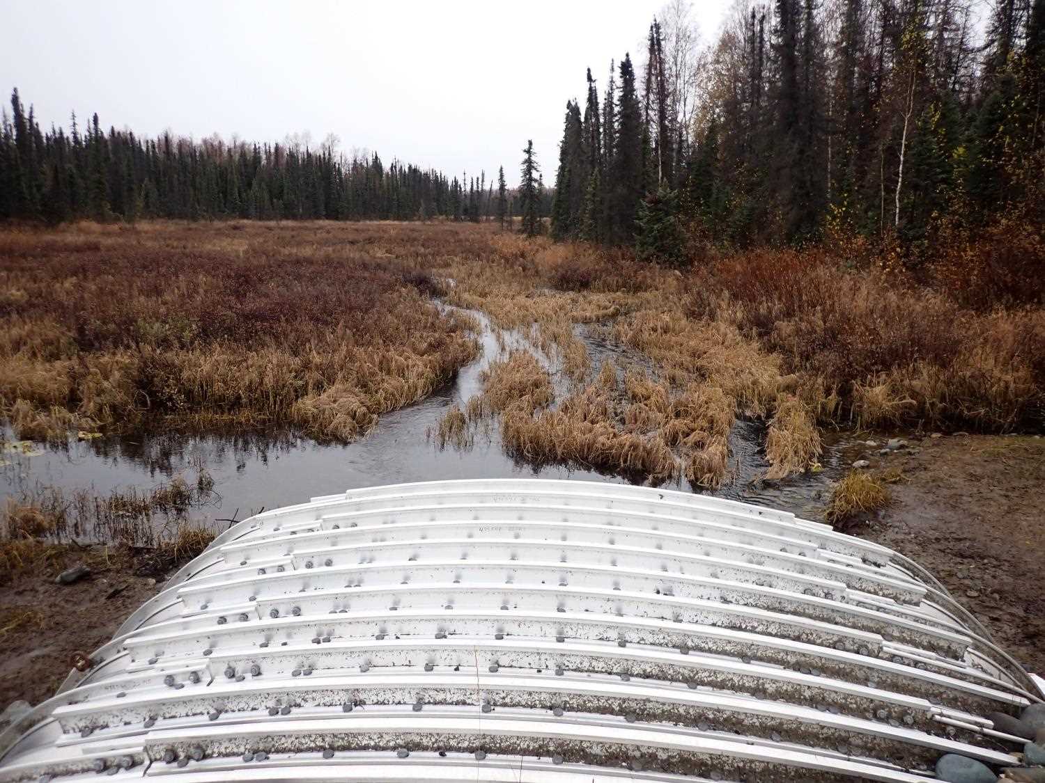
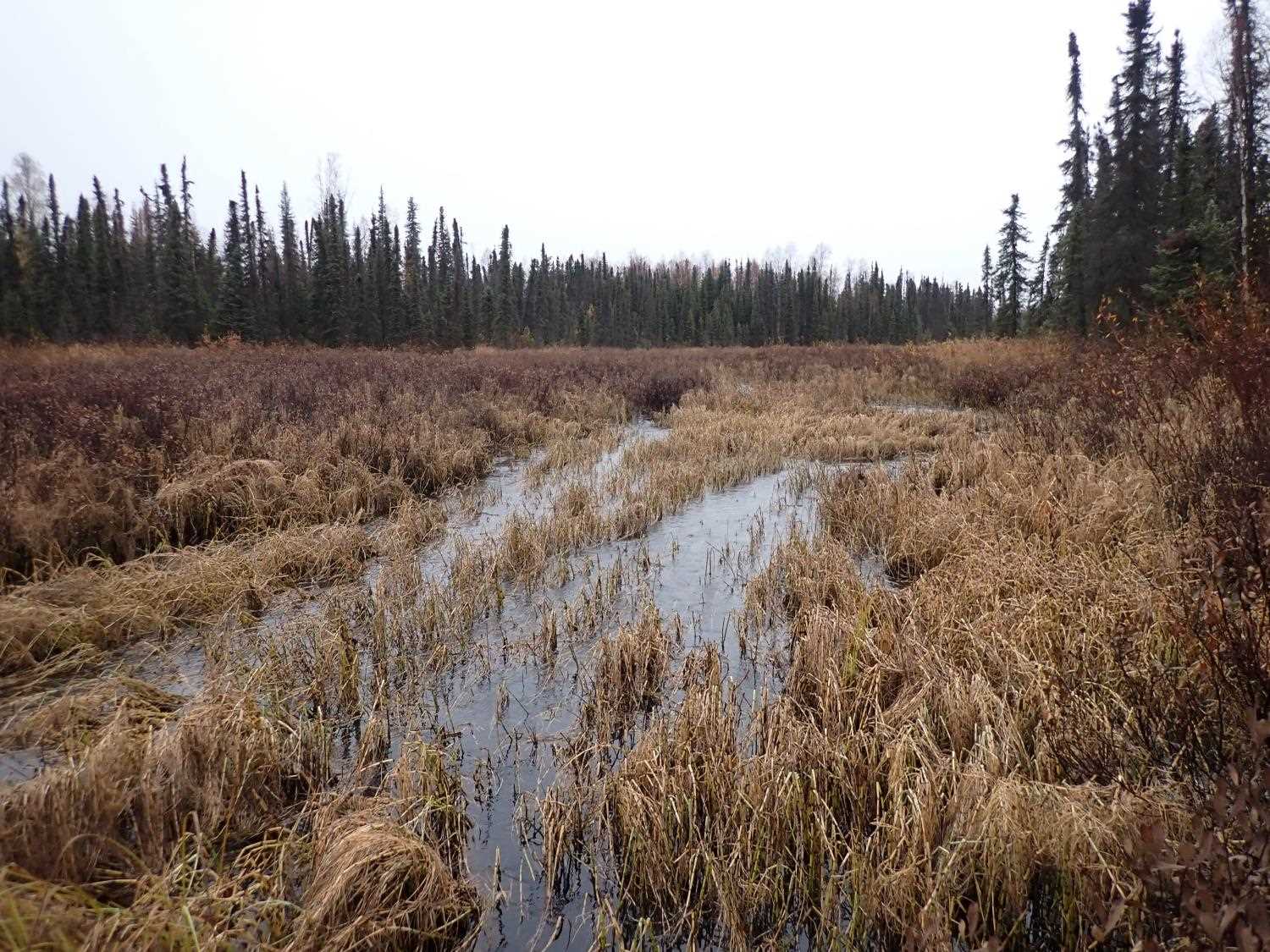
Stream Name: Caswell Creek
Elevation:
Site Comments: None
arrow to the right of the survey date below to choose a different report for this site.
Survey MSB23-MS088
Project Supervisor: Michael Mazzacavallo, Alaska Department of Fish and Game
— Anchorage, AK
Observers: Michael Mazzacavallo, Beth Evers, Kat Leavitt
Overall Fish Passage Rating:
Tidal: No
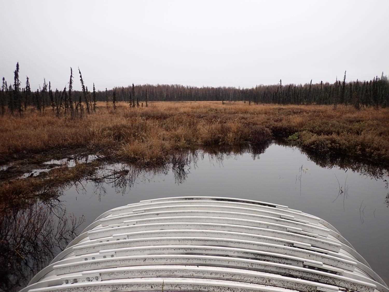
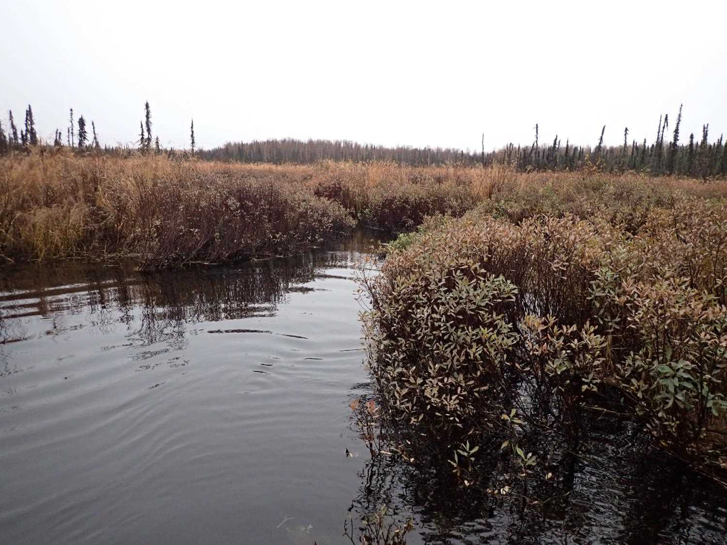
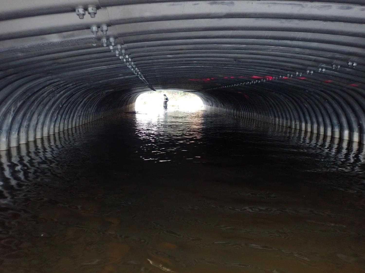
Backwatered: Yes
Step Pools: No
Construction Year: 2021
Site Observations:
- None of this type
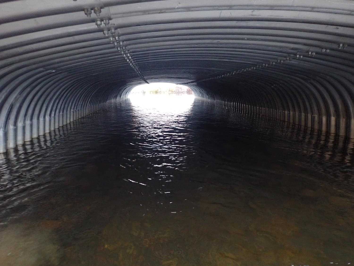
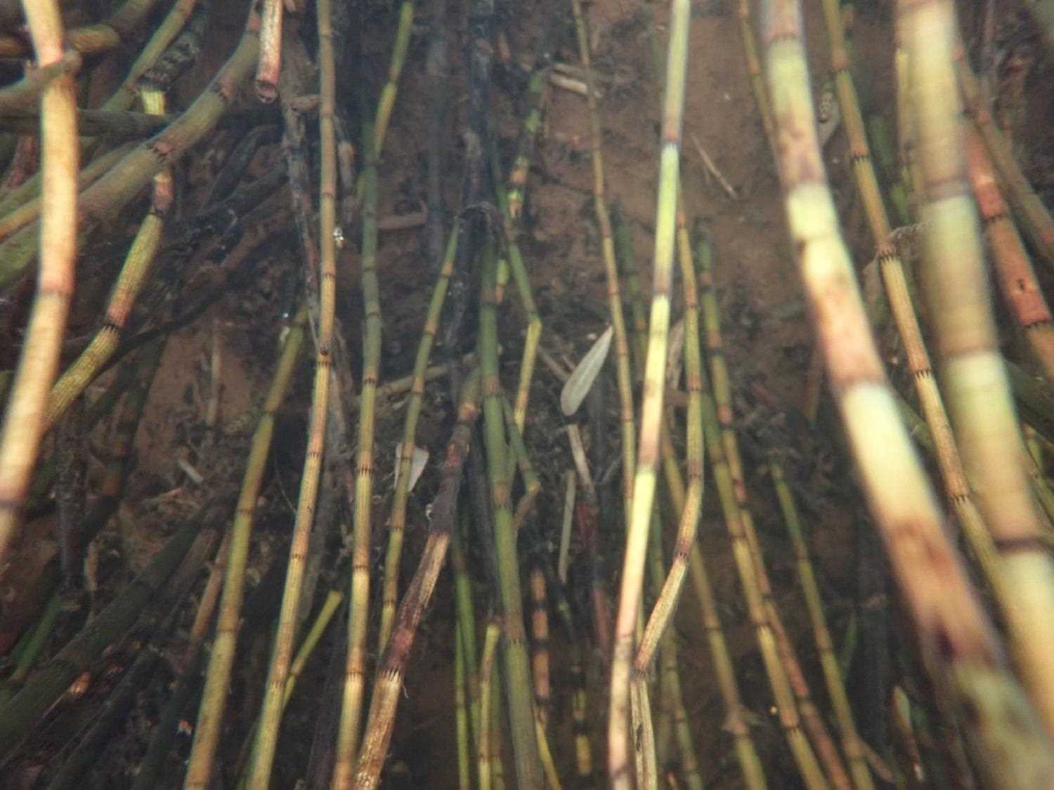
Comments: Juvenile fish spotted upstream. Current from upstream does not continue through pipe, backwatered. Multiple main channels upstream and downstream from culvert but flooded throughout area.
Culvert Measurements
| ID: 1 | Structure Type: Box culvert (Structural aluminum plate) | Fish Passage Rating: | ||||||||||||||||||||||||||||||||||||||||||
|
|
|
||||||||||||||||||||||||||||||||||||||||||
Culvert Observations:
|
||||||||||||||||||||||||||||||||||||||||||||
Stream Measurements
|
|
No stream width data available.
Elevations
| Locator ID | Culvert Number |
River Distance (ft)1 |
Distance From Crossing (ft)2 |
Relative Elevation (ft) |
|---|---|---|---|---|
| U/S Water Surface Elev | 0.00 | 95.78 | ||
| Inlet Culvert Top | 50.00 | 99.57 | ||
| Inlet Culvert Invert | 50.00 | 93.32 | ||
| U/S Water Surface Elev (Culvert water surface) | 50.00 | 95.47 | ||
| Outlet Invert | 102.90 | 92.73 | ||
| Outlet Culvert Top | 102.90 | 98.93 | ||
| D/S Water Surface Elev | 112.90 | 95.48 | ||
| D/S Water Surface Elev | 188.90 | 95.40 |
Notes:
- River distance is measured continuously throughout the survey reach along the thalweg of the stream.
- Measured from each end of the crossing along the thalweg of the stream.
Fish Sampling Efforts
No fish sampling occurred during this survey.
Fish Observations
No fish observations occurred during this survey.
Photos
Questions or comments about this report can be directed to dfg.dsf.webmaster@alaska.gov