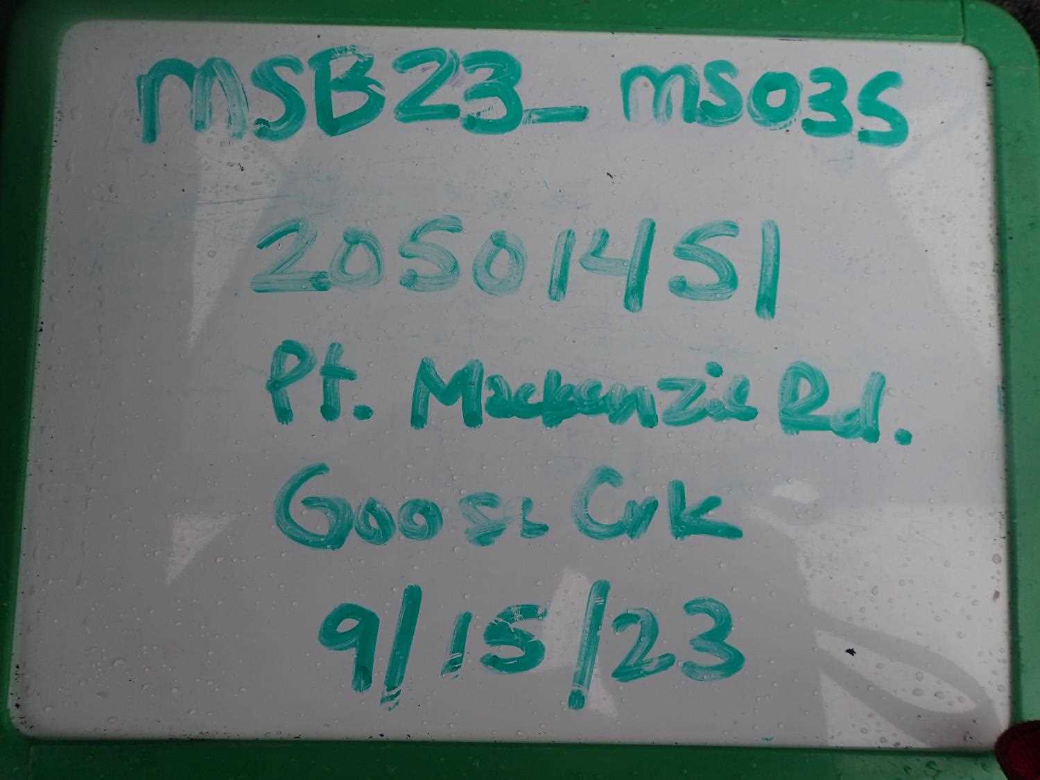
Fish Passage Site 20501451
Coordinates (dec. deg.): 61.42607°, -149.87202°
Legal Description: S015N003W06
Region: South Central
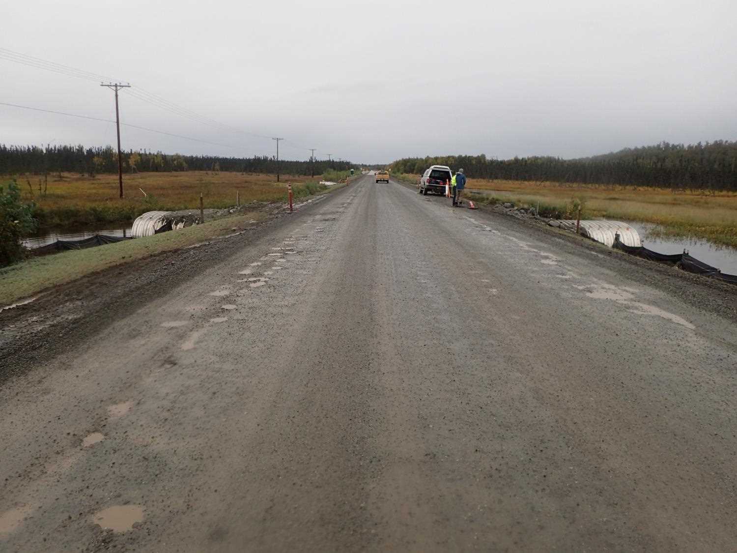
Road Name: Point MacKenzie Road
Datum: NAD83
Quad Name / ITM: Anchorage B-8
AWC Stream #:
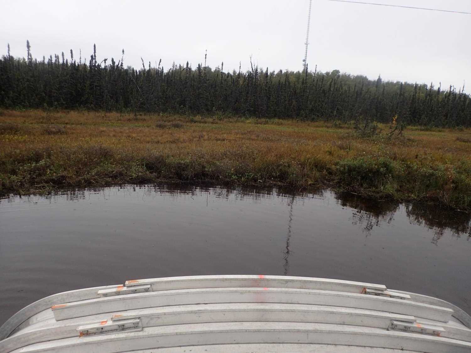
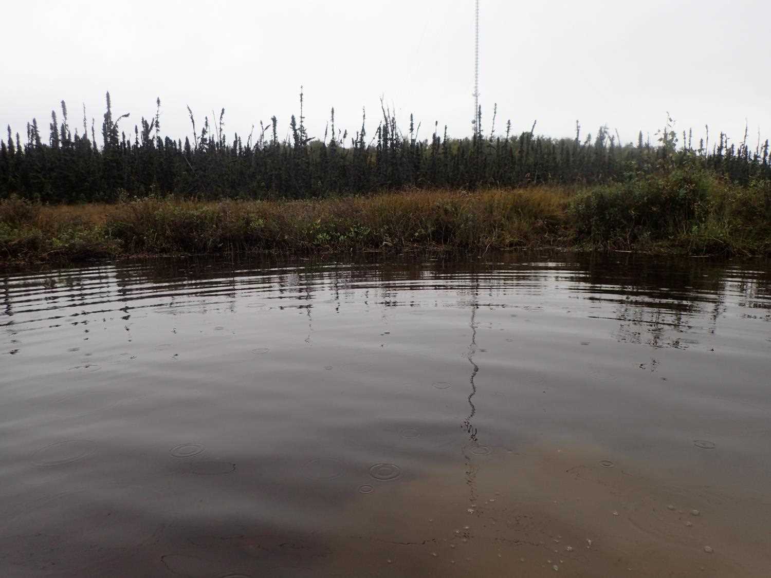
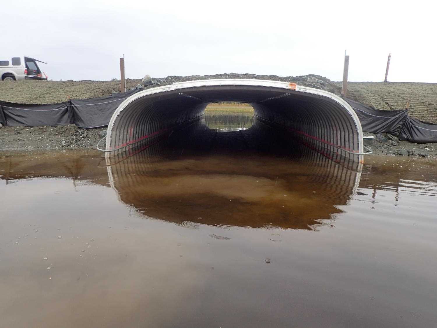
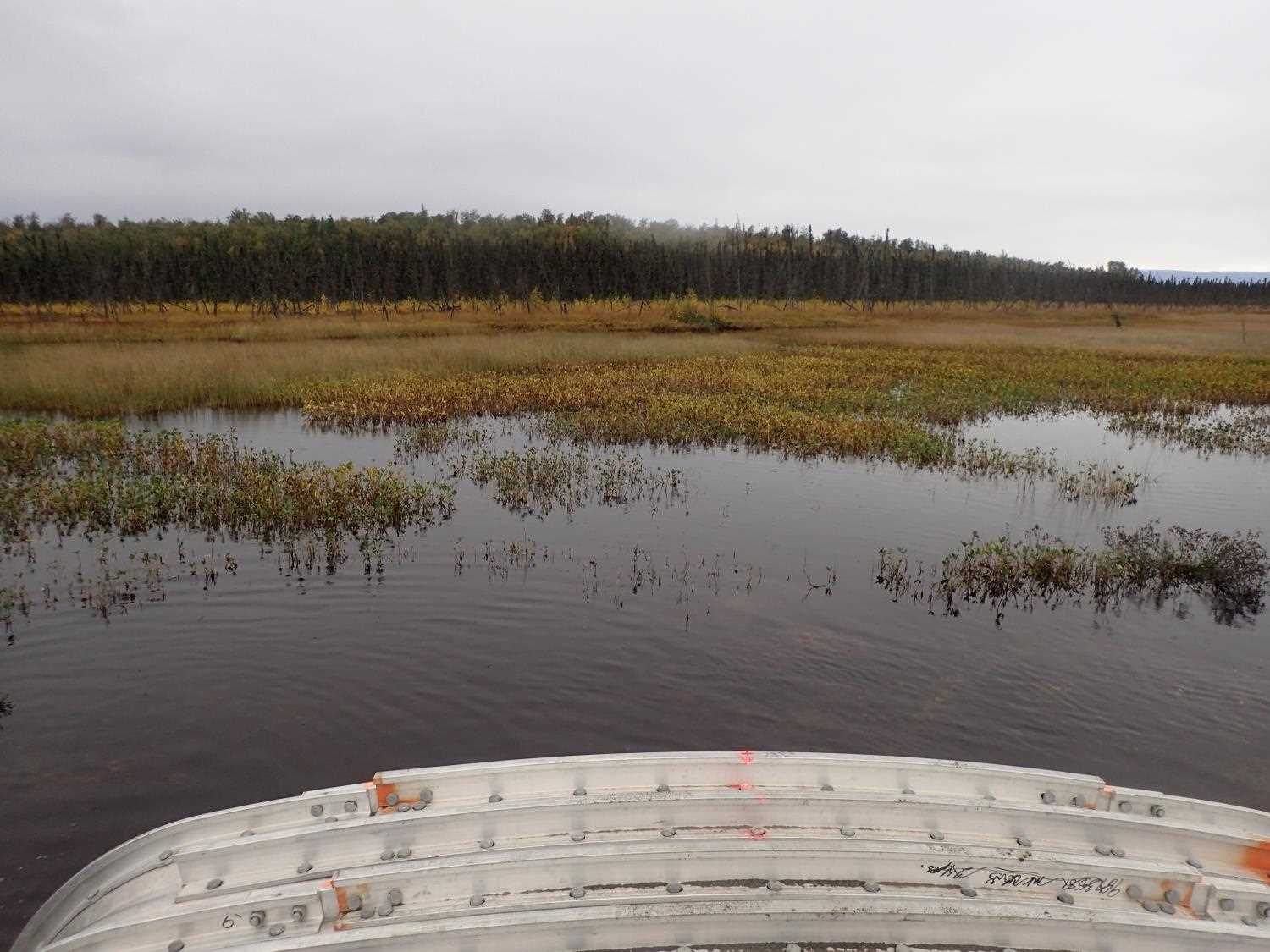
Stream Name: Goose Creek
Elevation:
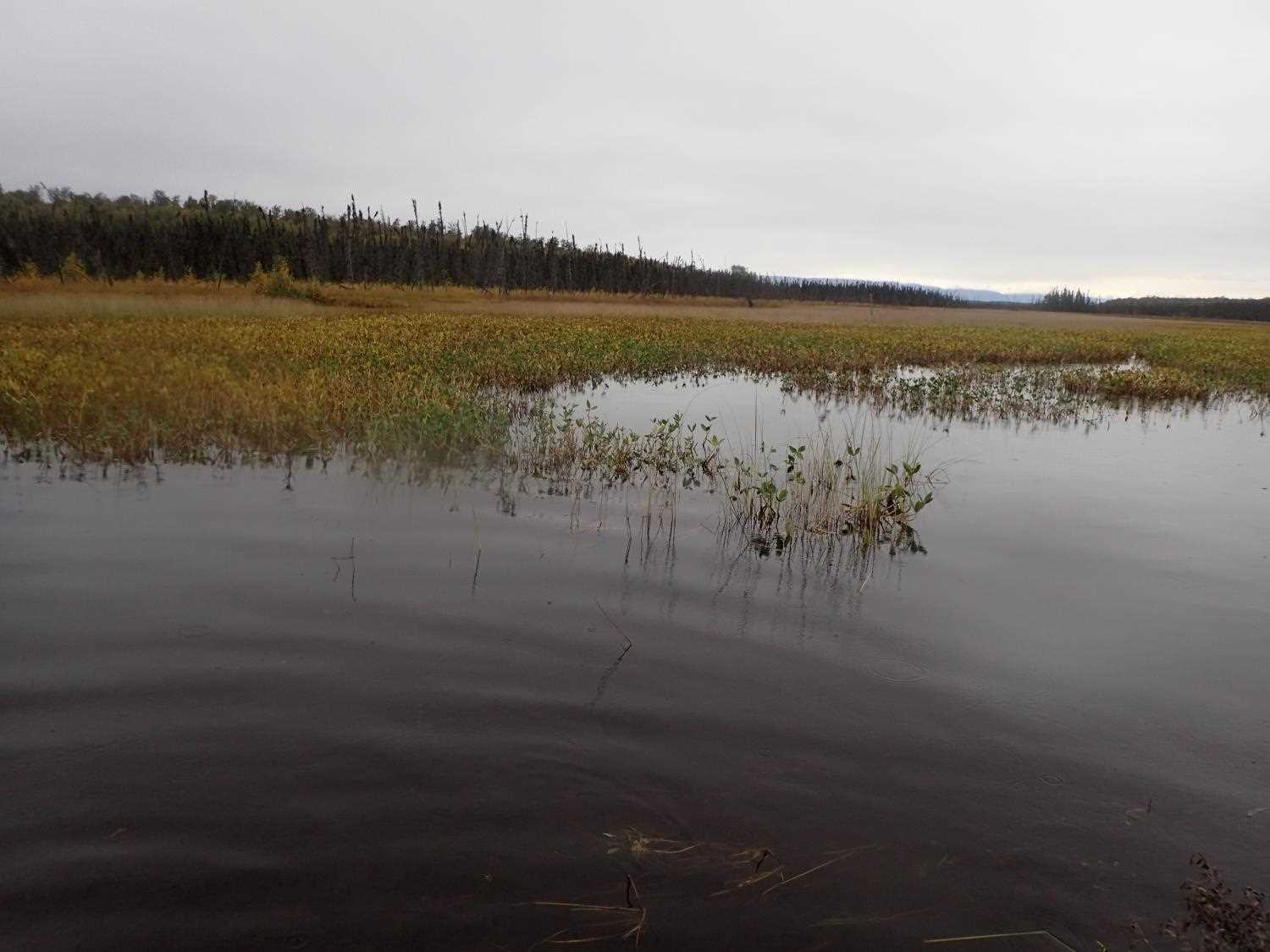
Site Comments: GOOSE CREEK WATERSHED, No distinct stream channel because of swamp/marsh
arrow to the right of the survey date below to choose a different report for this site.
Survey MSB23-MS035
Project Supervisor: Michael Mazzacavallo, Alaska Department of Fish and Game
— Anchorage, AK
Observers: Michael Mazzacavallo, Kat Leavitt, Beth Evers, Kevin Keith
Overall Fish Passage Rating:
Tidal: No
Backwatered: Yes
Step Pools: No
Construction Year: 2023
Site Observations:
- None of this type
Comments: None
Culvert Measurements
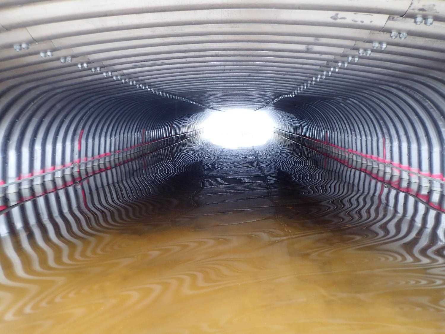
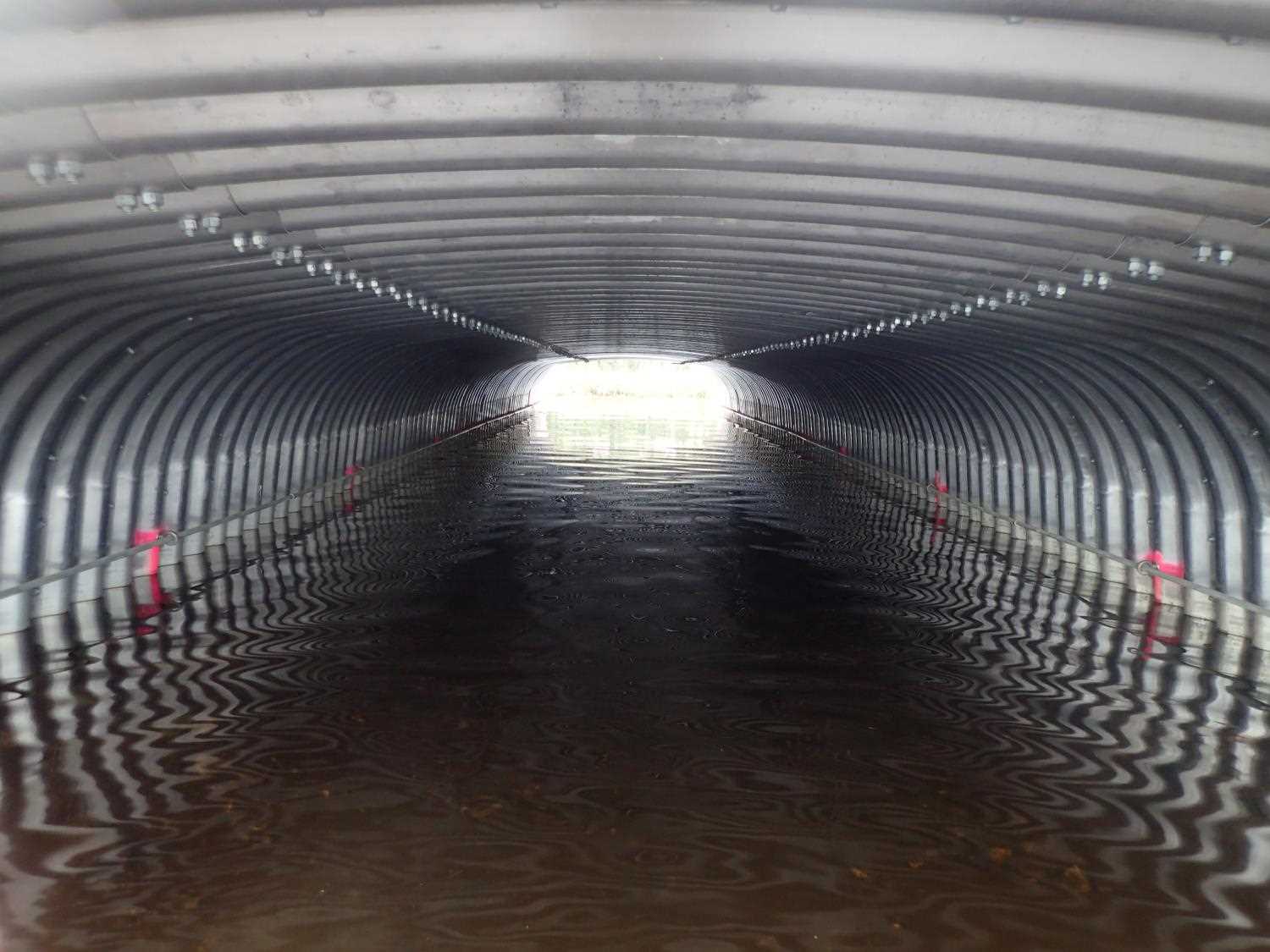
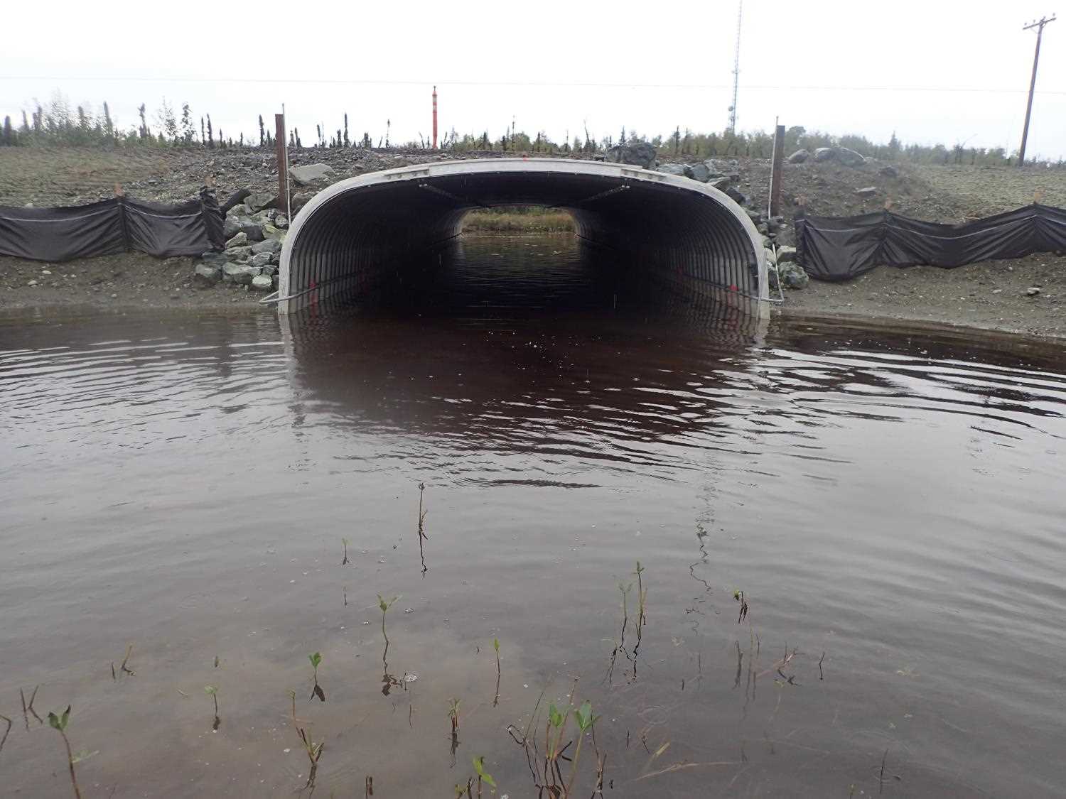
| ID: 1 | Structure Type: Box culvert (Corrugated aluminum) | Fish Passage Rating: | |||||||||||||||||||||||||||||||||||||||||
|
|
|
|||||||||||||||||||||||||||||||||||||||||
Comments: This site used to be the main channel of Goose Creek, but when they replaced this culvert and 20501453, the main channel moved that site (50 yards west of this site) |
|||||||||||||||||||||||||||||||||||||||||||
Culvert Observations:
|
|||||||||||||||||||||||||||||||||||||||||||
Stream Measurements
|
|
No stream width data available.
Elevations
| Locator ID | Culvert Number |
River Distance (ft)1 |
Distance From Crossing (ft)2 |
Relative Elevation (ft) |
|---|---|---|---|---|
| Road Elev | 99.32 | |||
| Inlet Culvert Top | 0.00 | 96.95 | ||
| Inlet Culvert Invert | 0.00 | 90.91 | ||
| U/S Water Surface Elev | 0.00 | 92.61 | ||
| D/S Water Surface Elev | 75.60 | 92.64 | ||
| Outlet Culvert Top | 75.60 | 96.78 | ||
| Outlet Invert | 75.60 | 90.53 |
Notes:
- River distance is measured continuously throughout the survey reach along the thalweg of the stream.
- Measured from each end of the crossing along the thalweg of the stream.
Fish Sampling Efforts
No fish sampling occurred during this survey.
Fish Observations
No fish observations occurred during this survey.
Photos
Questions or comments about this report can be directed to dfg.dsf.webmaster@alaska.gov