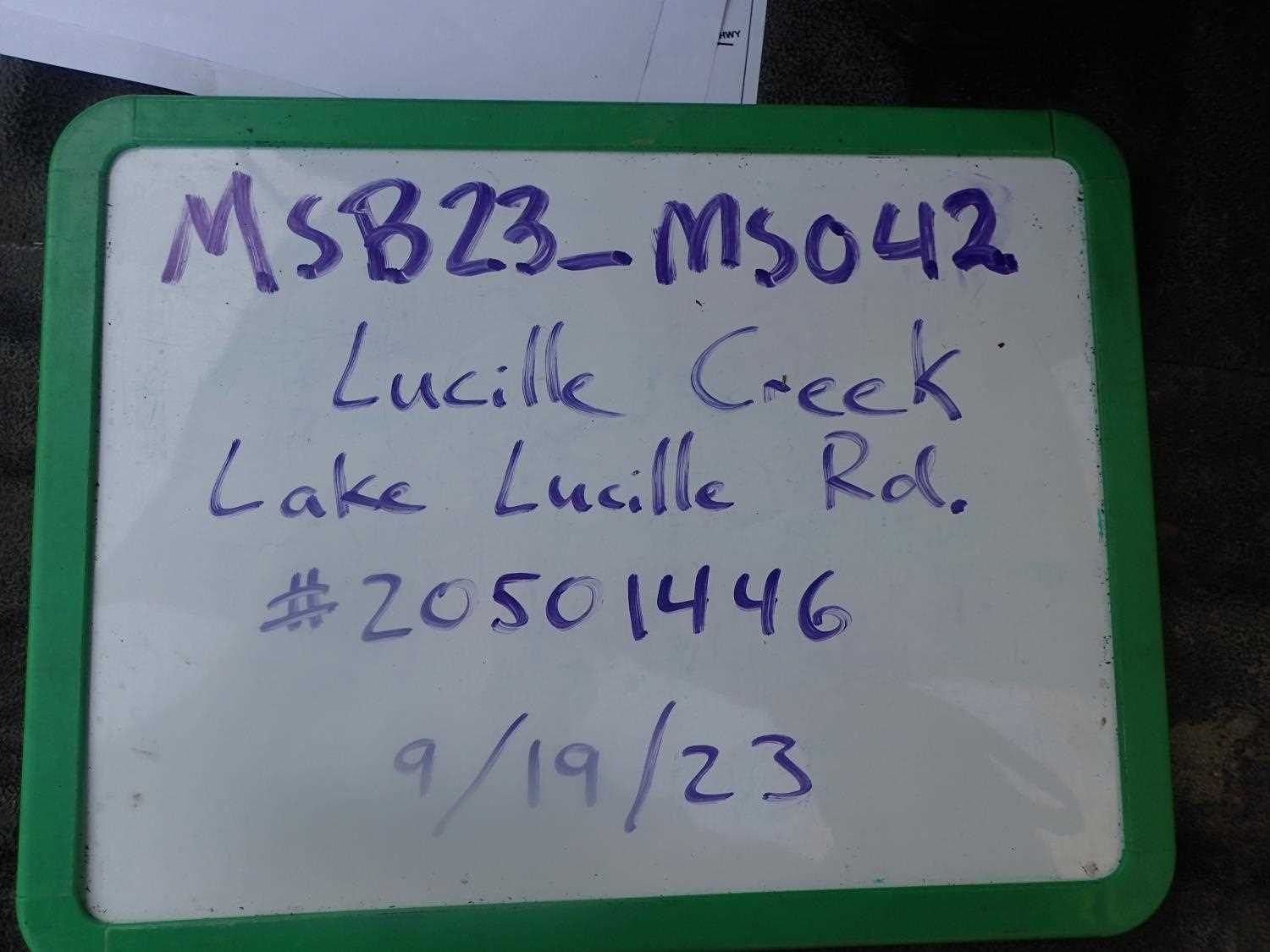
Fish Passage Site 20501446
Coordinates (dec. deg.): 61.57345°, -149.50008°
Legal Description: S017N002W26
Region: South Central
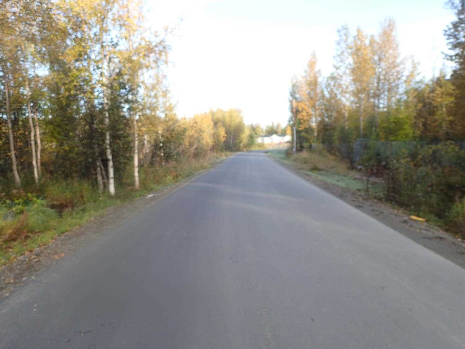
Road Name: Lake Lucille Road
Datum: NAD83
Quad Name / ITM: Anchorage C-7
AWC Stream #:
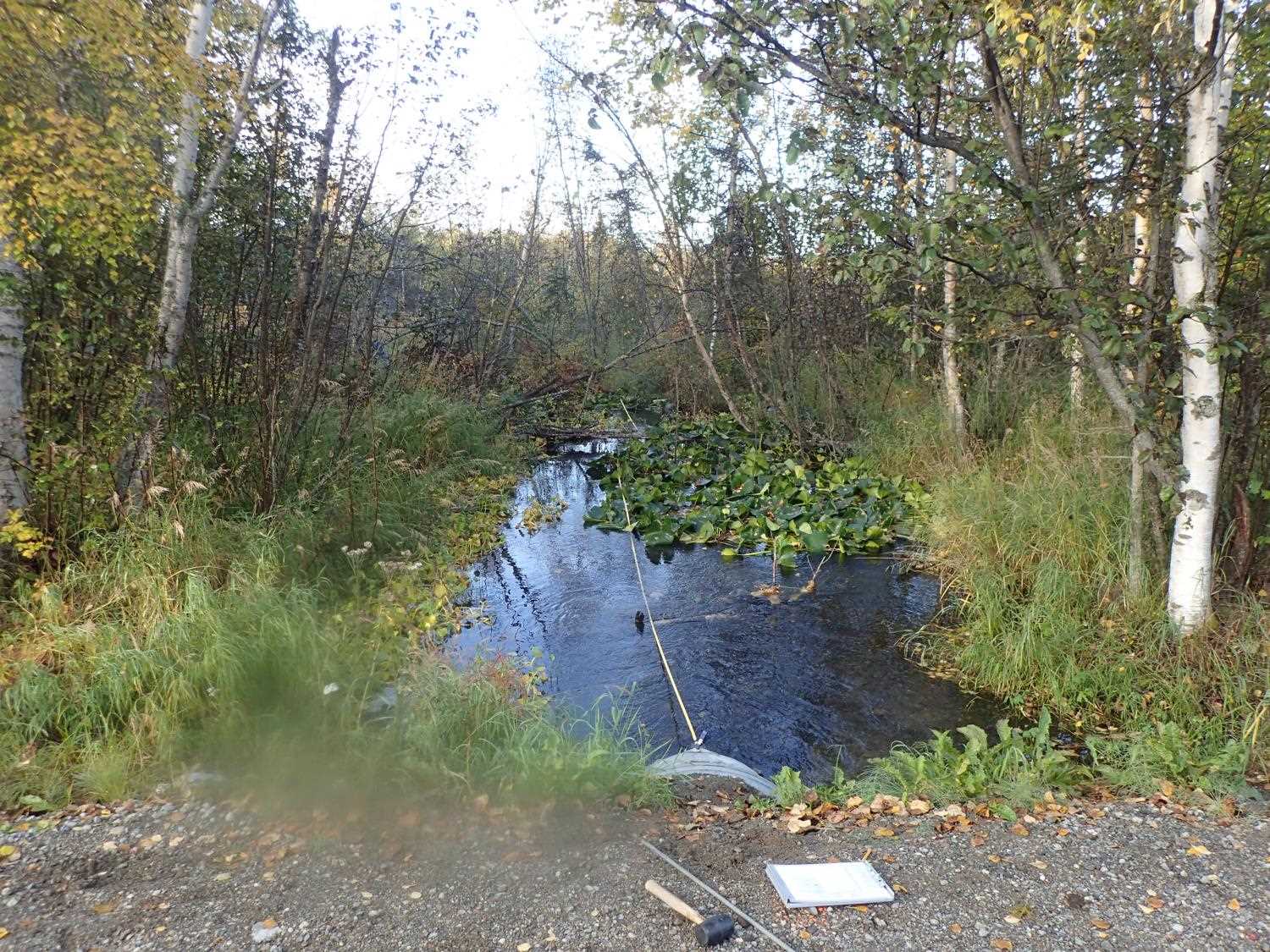
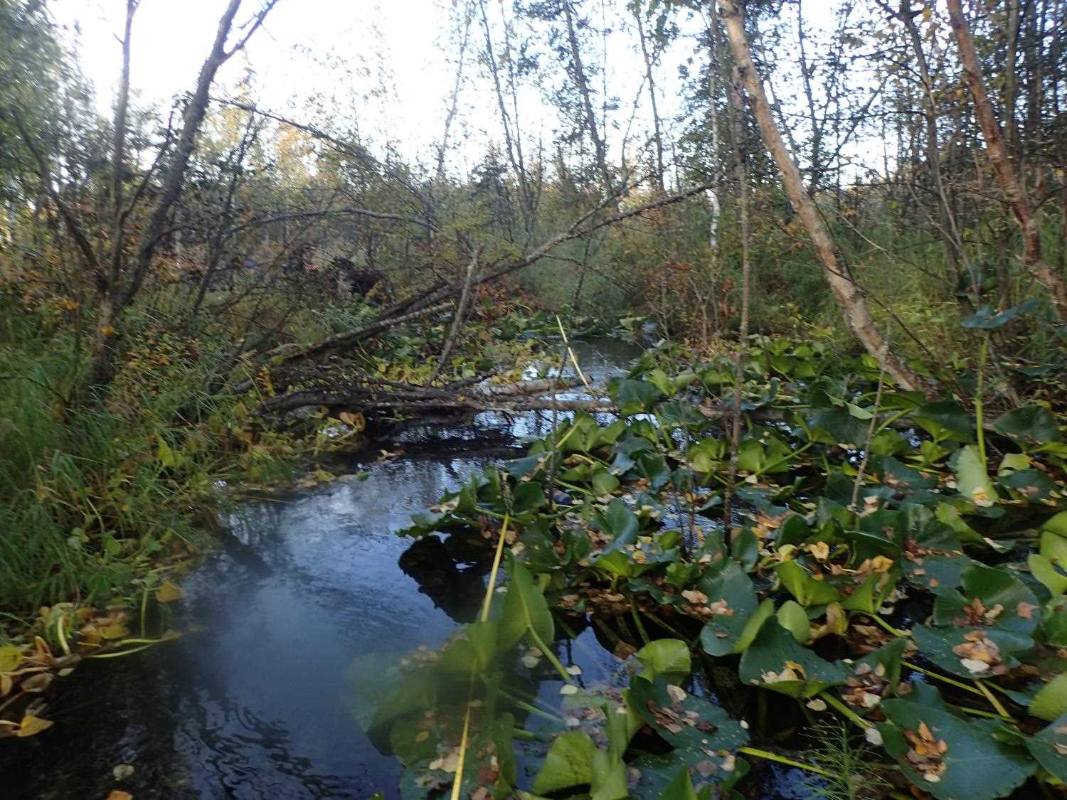
Stream Name: Lucille Creek
Elevation:
Site Comments: LUCILLE CREEK WATERSHED
arrow to the right of the survey date below to choose a different report for this site.
Survey MSB23-MS042
Project Supervisor: Michael Mazzacavallo, Alaska Department of Fish and Game
— Anchorage, AK
Observers: Kevin Keith, Kat Leavitt, Beth Evers
Overall Fish Passage Rating:
Tidal: No
Backwatered: No
Step Pools: No
Construction Year:
Site Observations:
- Culvert gradient red
- Culvert sagging in middle
- Other, including vibrations, cavitation, etc.
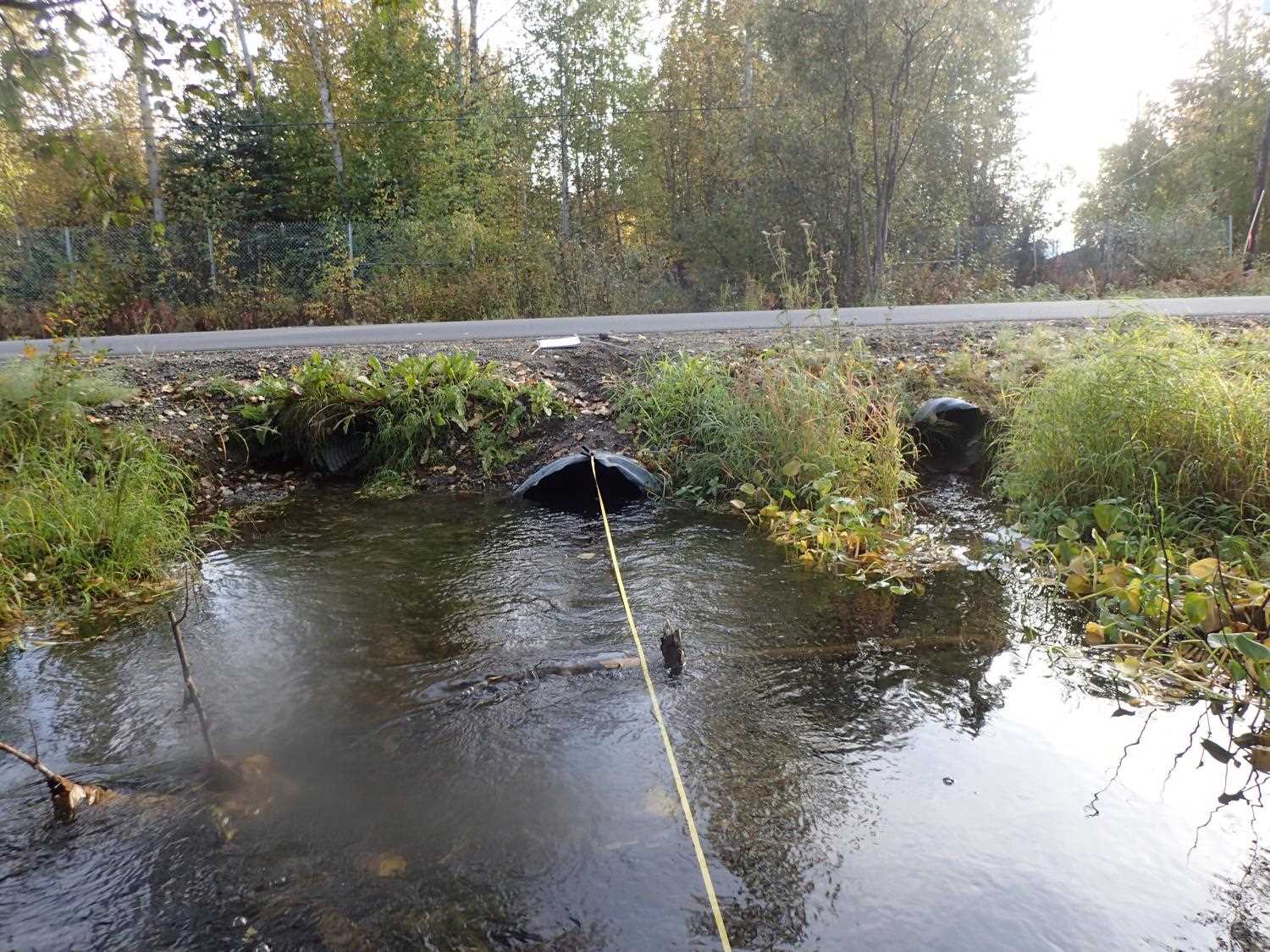
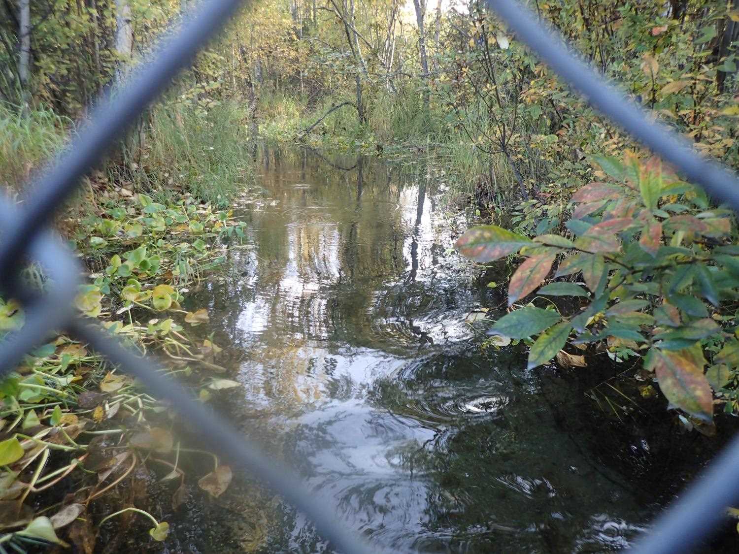
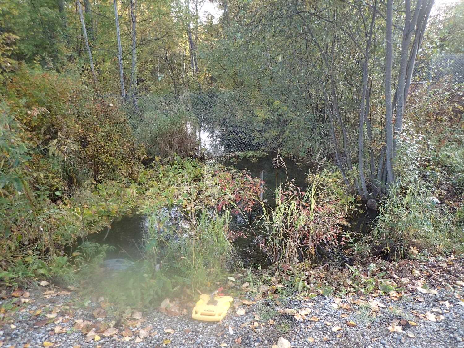
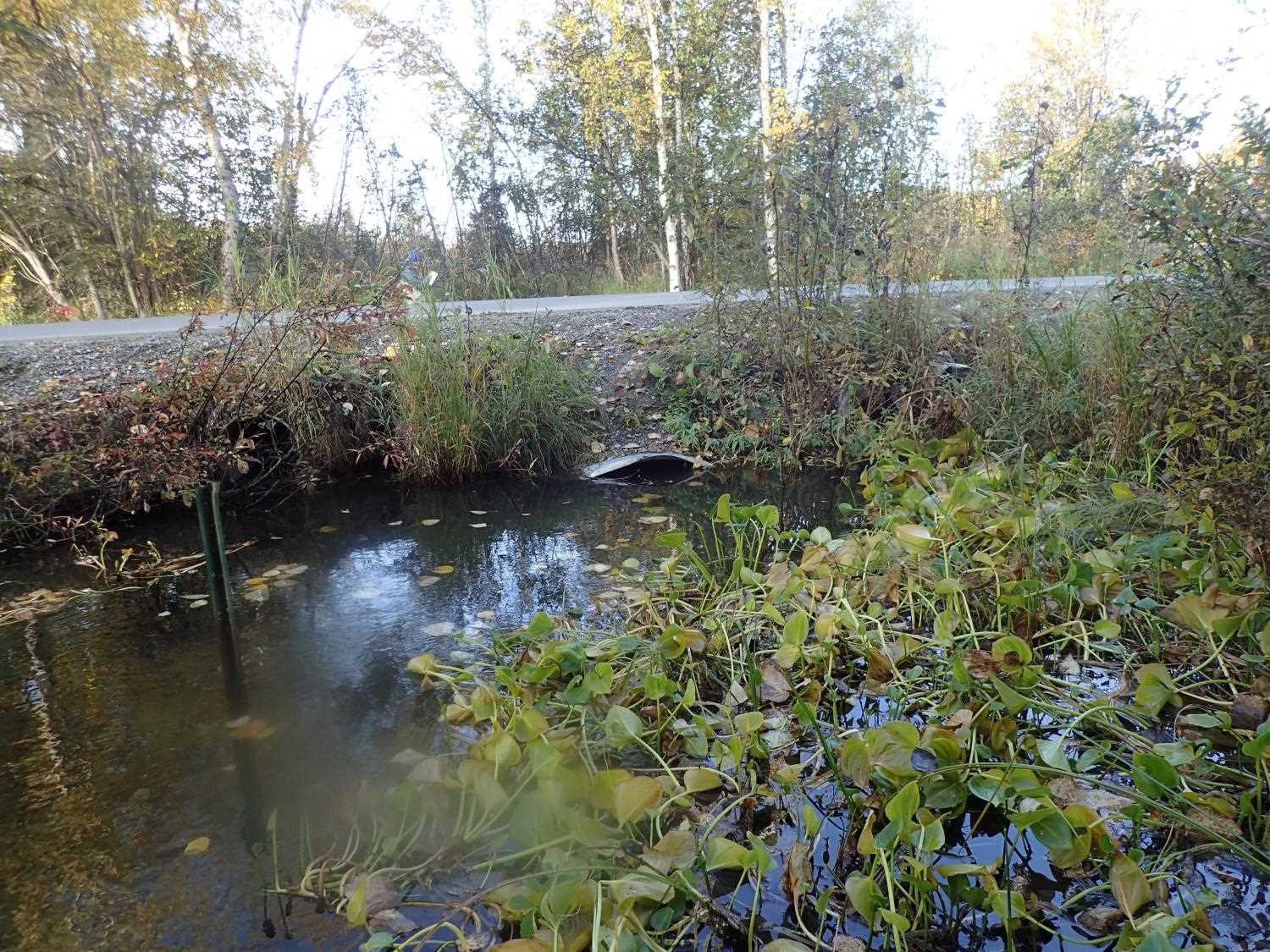
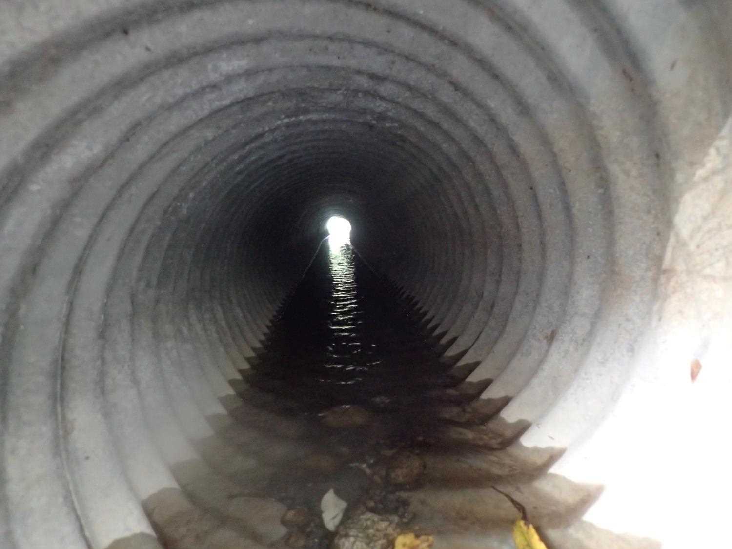
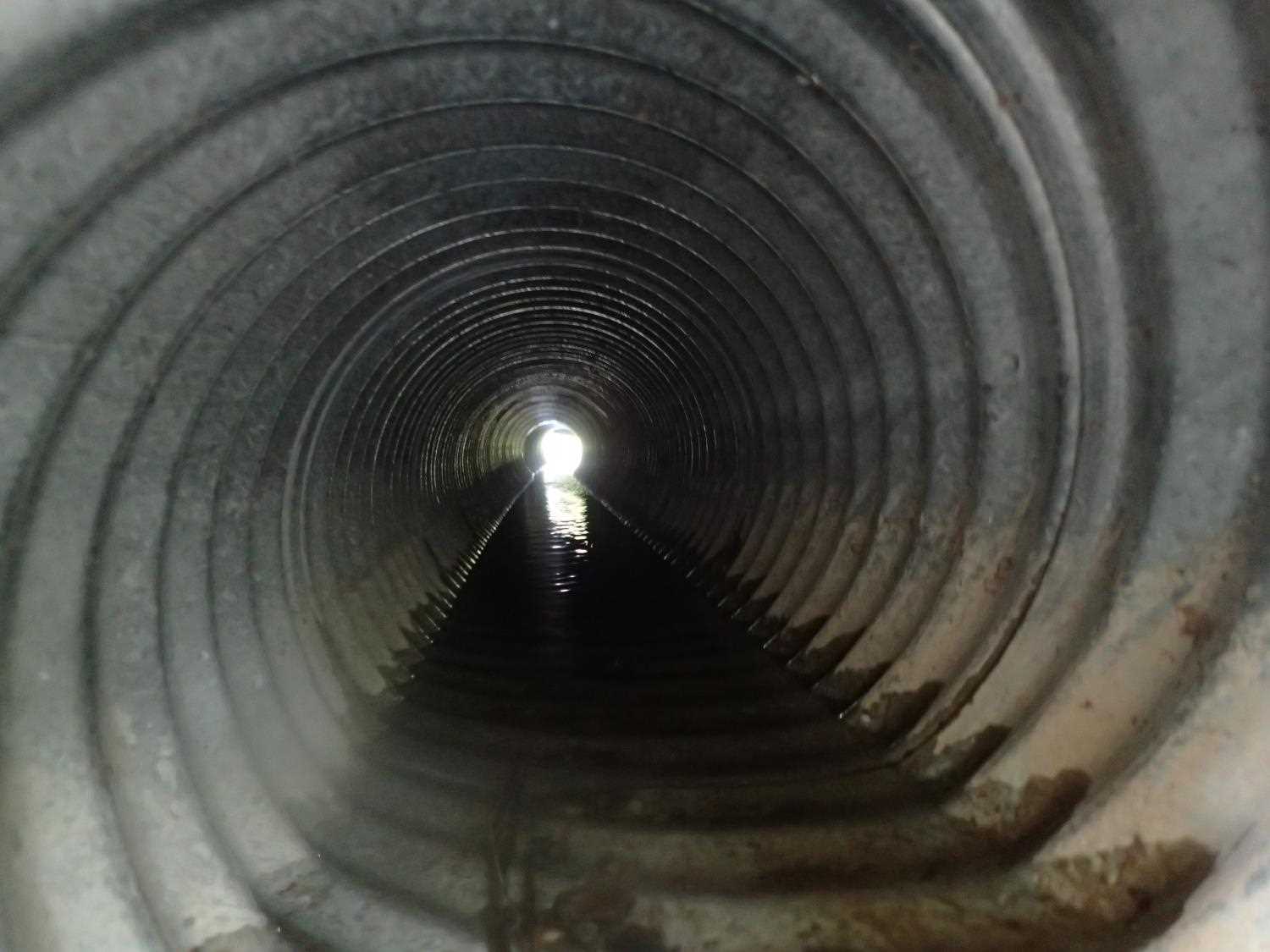
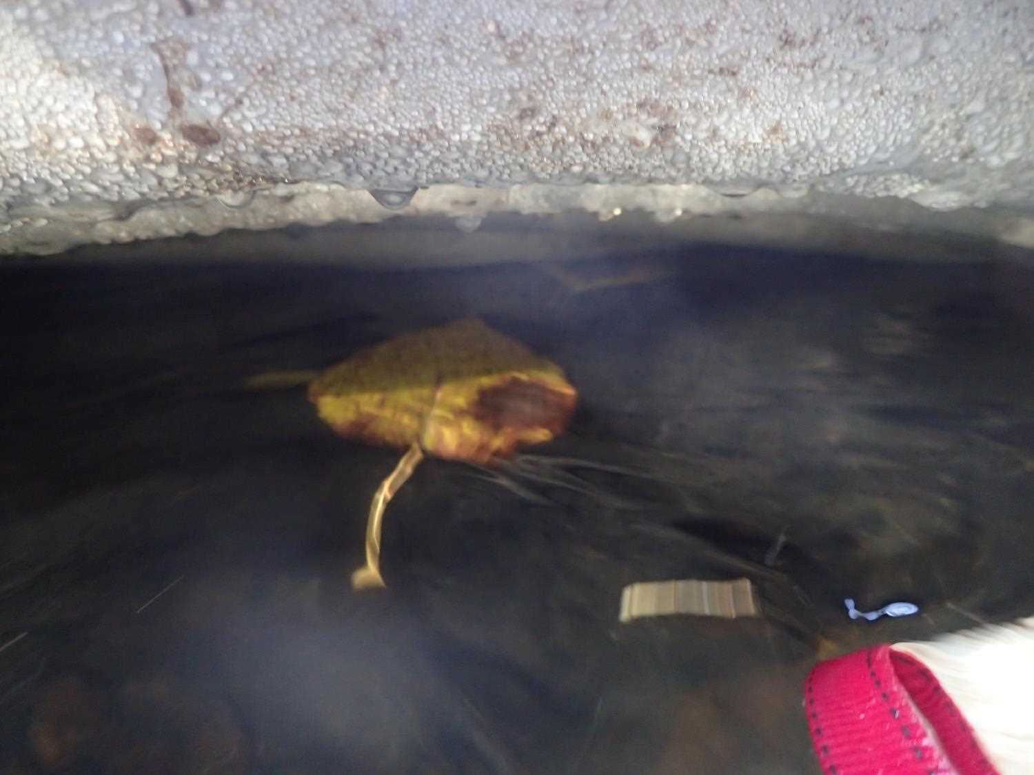
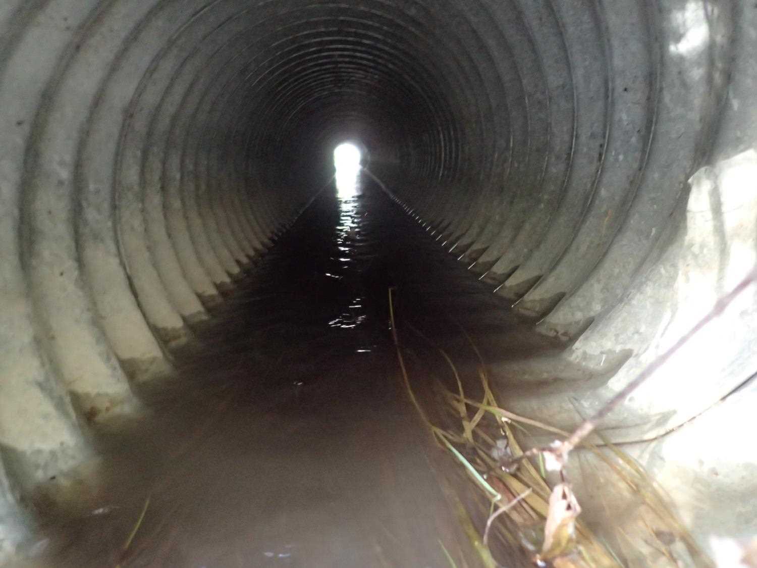
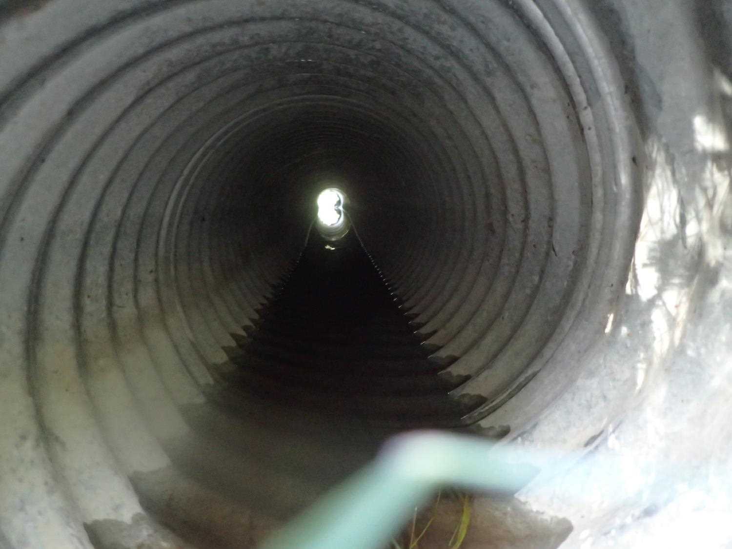
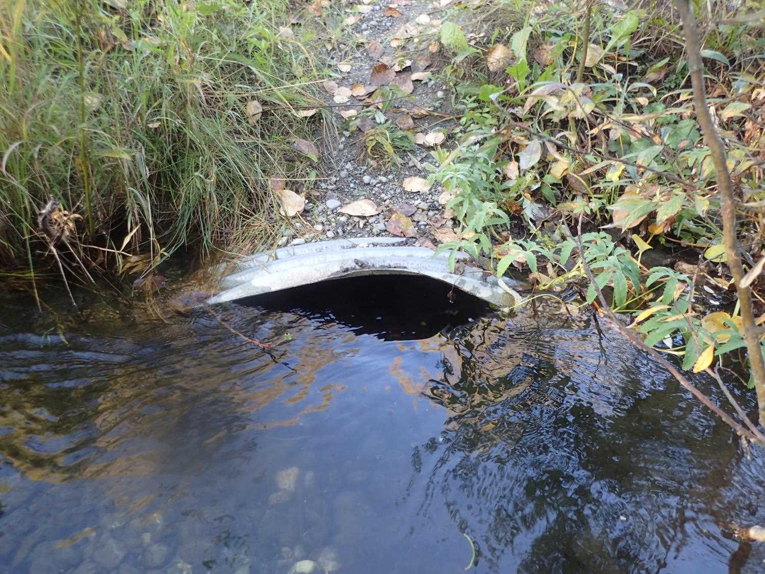
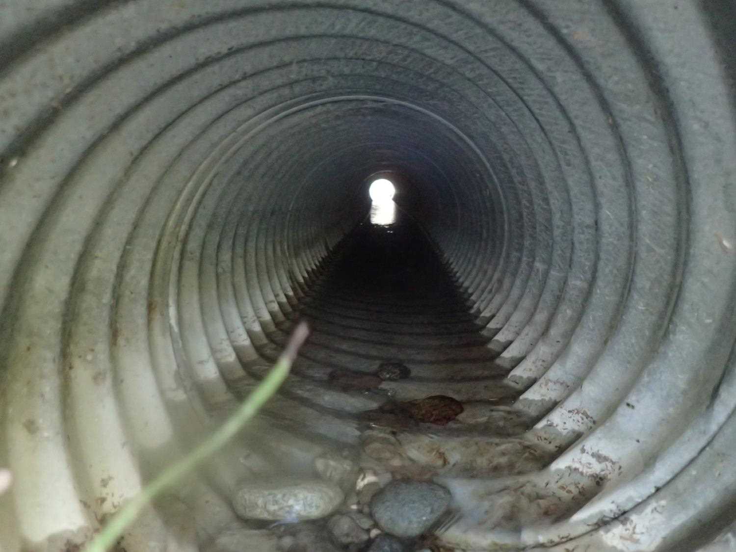
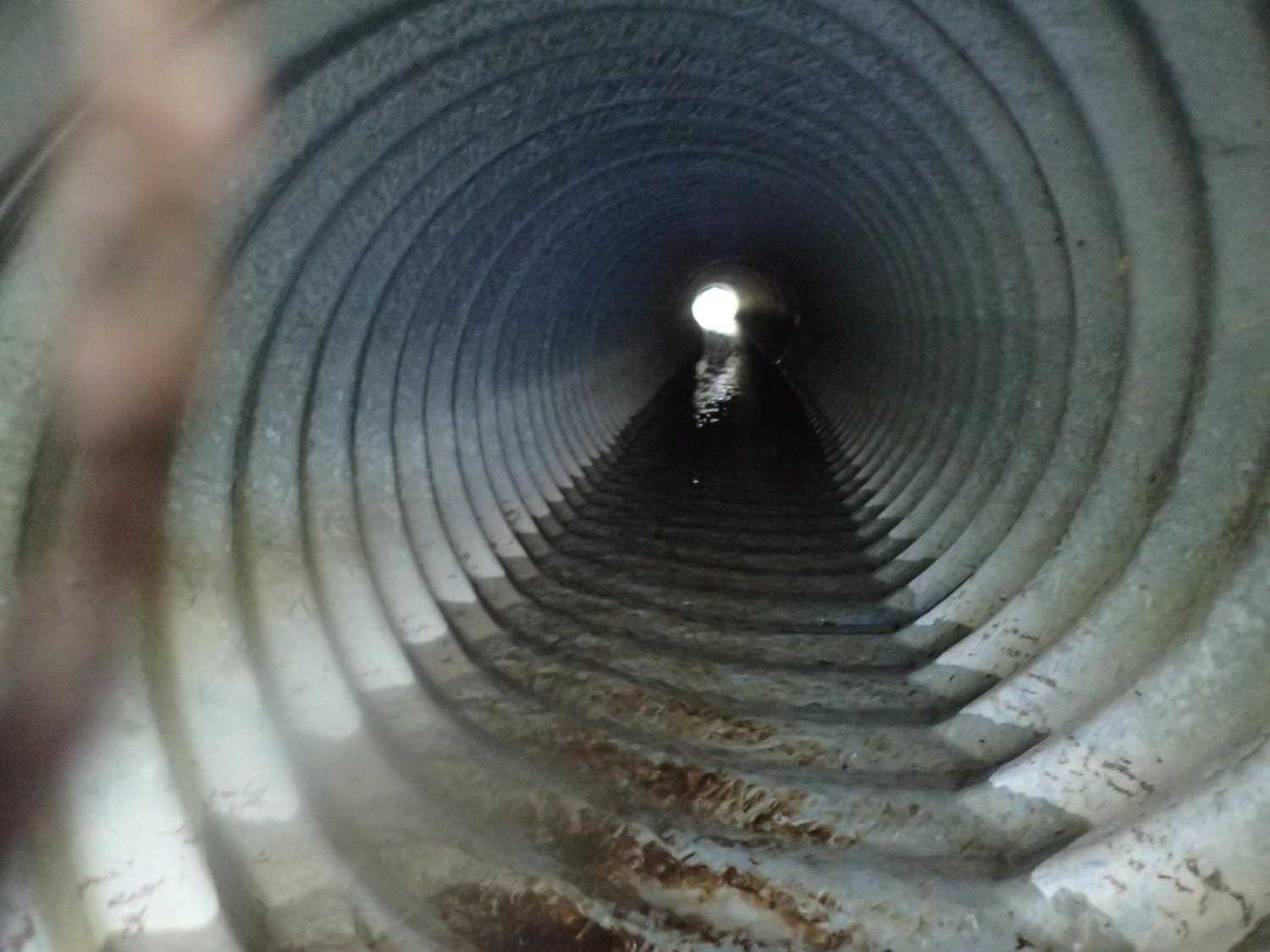
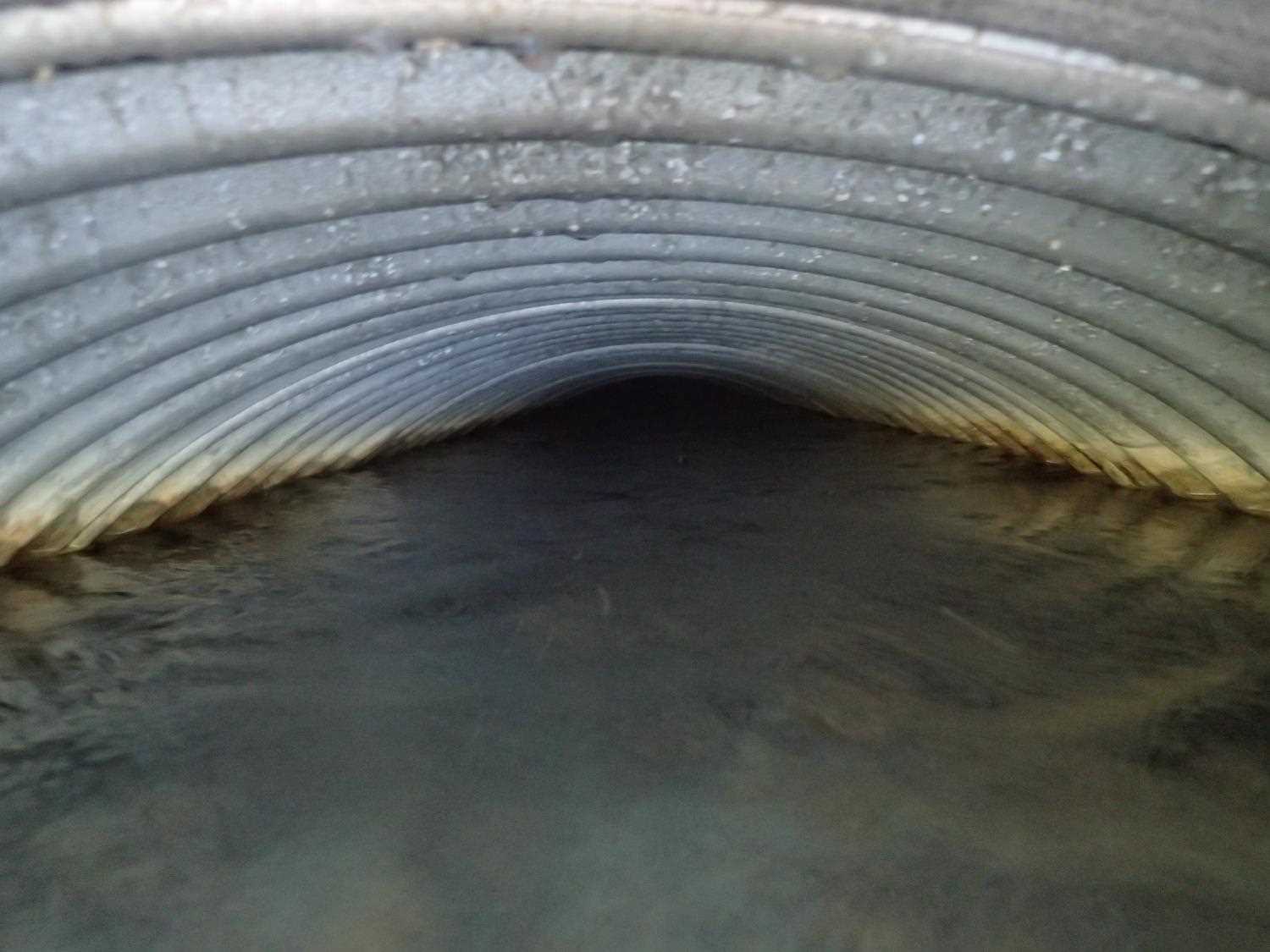
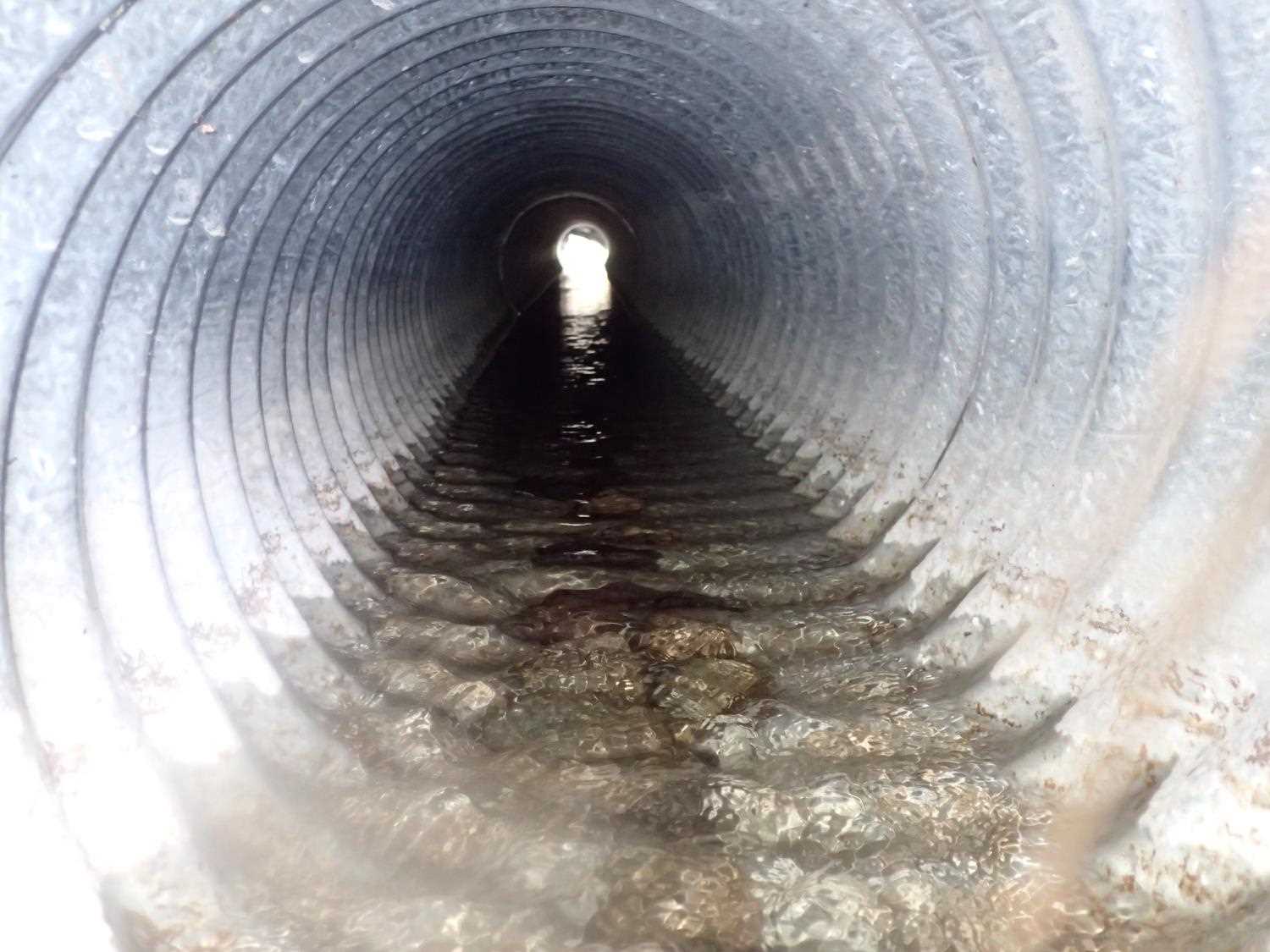
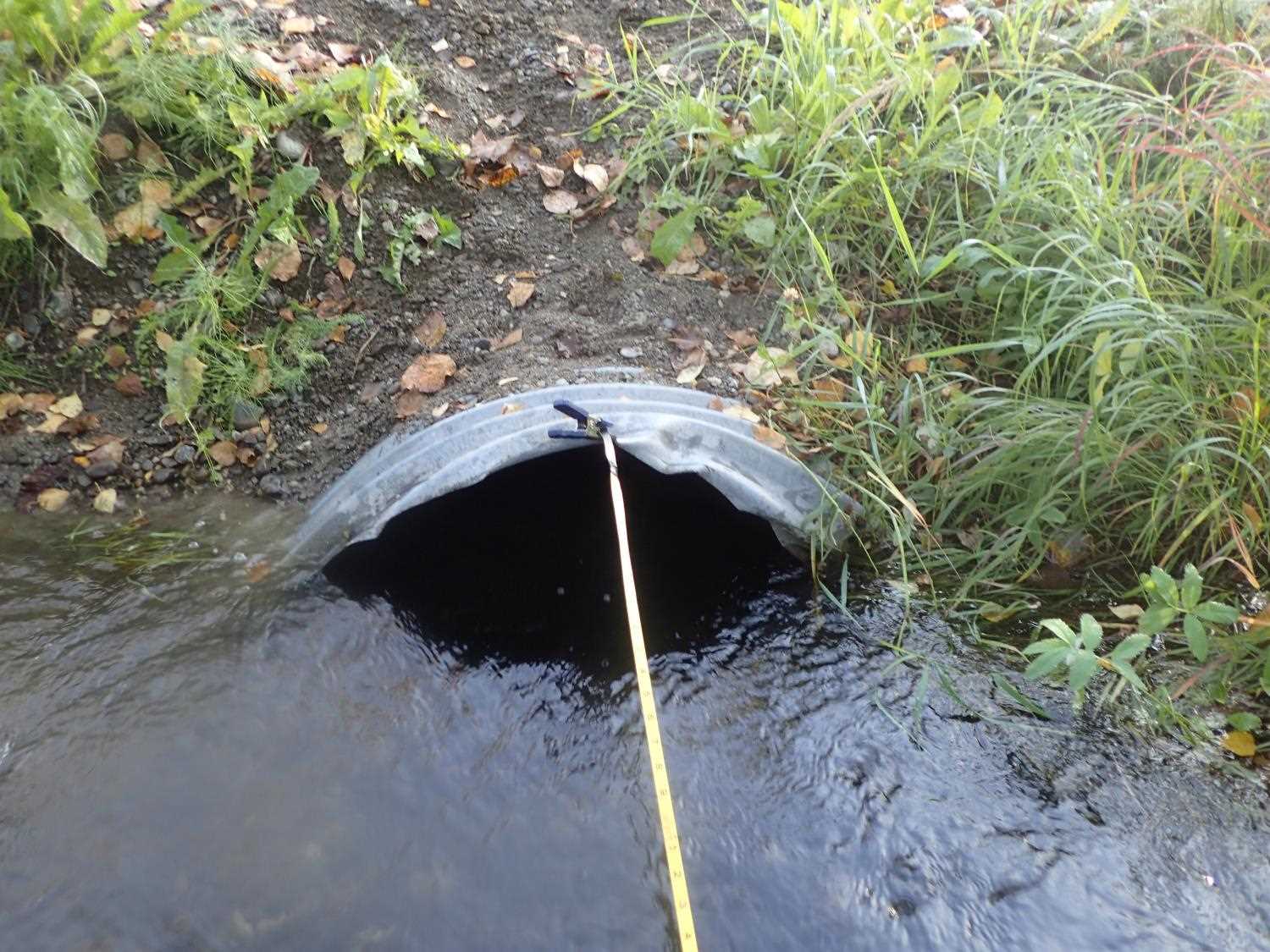
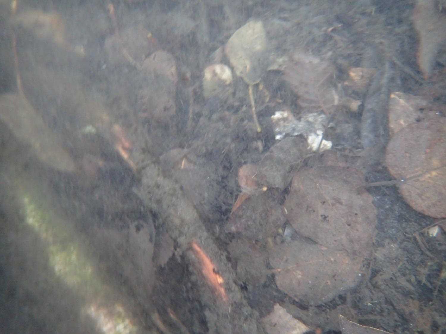
Comments: Lots of minnows, juvenile fish and fresh water mussels observed. All culverts metal have damage to the entrances.
Culvert Measurements
| ID: 1 | Structure Type: Circular pipe (Corrugated steel) | Fish Passage Rating: | ||||||||||||||||||||||||||||||||||||||||||
|
|
|
||||||||||||||||||||||||||||||||||||||||||
Comments: #1 culvert outlet stream is flowing over built up sediment, not currently at stream grade but with more water volume it would. Constriction ratio not applied due to the pond. |
||||||||||||||||||||||||||||||||||||||||||||
Culvert Observations:
|
||||||||||||||||||||||||||||||||||||||||||||
| ID: 2 | Structure Type: Circular pipe (Corrugated steel) | Fish Passage Rating: | ||||||||||||||||||||||||||||||||||||||||||
|
|
|
||||||||||||||||||||||||||||||||||||||||||
Comments: Constriction ratio not applied due to pond. |
||||||||||||||||||||||||||||||||||||||||||||
Culvert Observations:
|
||||||||||||||||||||||||||||||||||||||||||||
| ID: 3 | Structure Type: Circular pipe (Corrugated steel) | Fish Passage Rating: | ||||||||||||||||||||||||||||||||||||||||||
|
|
|
||||||||||||||||||||||||||||||||||||||||||
Comments: #3 Culvert length is approximate an estimation and unable to measure rustline due to high water level. Likewise, there is evidence that there is sagging occuring the middle of the culvert. Since the culvert is bent, WS was used for pipe gradient.Constriction ratio not applied to the pond |
||||||||||||||||||||||||||||||||||||||||||||
Culvert Observations:
|
||||||||||||||||||||||||||||||||||||||||||||
| ID: 4 | Structure Type: Circular pipe (Corrugated steel) | Fish Passage Rating: | ||||||||||||||||||||||||||||||||||||||||||
|
|
|
||||||||||||||||||||||||||||||||||||||||||
Comments: Constriction ratio not applied due to the pond. |
||||||||||||||||||||||||||||||||||||||||||||
Culvert Observations:
|
||||||||||||||||||||||||||||||||||||||||||||
| ID: 5 | Structure Type: Circular pipe (Corrugated steel) | Fish Passage Rating: | ||||||||||||||||||||||||||||||||||||||||||
|
|
|
||||||||||||||||||||||||||||||||||||||||||
Comments: Constriction ratio not applied due to the pond. |
||||||||||||||||||||||||||||||||||||||||||||
Culvert Observations:
|
||||||||||||||||||||||||||||||||||||||||||||
Stream Measurements
|
|
| Stream Width Type | Distance From Crossing (ft) |
Stream Width (ft) |
|---|---|---|
| Downstream ordinary high water | 16.0 | 20.80 |
| Downstream ordinary high water | 36.0 | 19.70 |
| Downstream ordinary high water | 50.0 | 16.90 |
Elevations
| Locator ID | Culvert Number |
River Distance (ft)1 |
Distance From Crossing (ft)2 |
Relative Elevation (ft) |
|---|---|---|---|---|
| Road Elev | 100.28 | |||
| U/S Water Surface Elev | 0.00 | 97.56 | ||
| Inlet Culvert Top | 3 | 20.00 | 97.77 | |
| Inlet Culvert Top | 4 | 20.00 | 98.77 | |
| Inlet Culvert Top | 2 | 20.00 | 98.83 | |
| Inlet Culvert Top | 1 | 20.00 | 98.87 | |
| Inlet Culvert Top | 5 | 20.00 | 98.90 | |
| Inlet Culvert Invert | 3 | 20.00 | 95.93 | |
| Inlet Culvert Invert | 4 | 20.00 | 97.22 | |
| Inlet Culvert Invert | 1 | 20.00 | 97.27 | |
| Inlet Culvert Invert | 2 | 20.00 | 97.30 | |
| Inlet Culvert Invert | 5 | 20.00 | 97.36 | |
| U/S Water Surface Elev | 4 | 20.00 | 97.52 | |
| U/S Water Surface Elev | 2 | 20.00 | 97.52 | |
| U/S Water Surface Elev | 3 | 20.00 | 97.53 | |
| U/S Water Surface Elev | 5 | 20.00 | 97.56 | |
| U/S Water Surface Elev | 1 | 20.00 | 97.56 | |
| Outlet Invert | 2 | 55.93 | 97.21 | |
| Outlet Culvert Top | 2 | 55.93 | 98.72 | |
| D/S Water Surface Elev | 2 | 55.93 | 97.33 | |
| D/S Water Surface Elev | 4 | 56.13 | 97.41 | |
| Outlet Culvert Top | 4 | 56.13 | 98.69 | |
| Outlet Invert | 4 | 56.13 | 97.15 | |
| Outlet Invert | 5 | 56.15 | 97.40 | |
| D/S Water Surface Elev | 5 | 56.15 | 97.57 | |
| Outlet Culvert Top | 5 | 56.15 | 98.72 | |
| Outlet Culvert Top | 1 | 56.89 | 98.76 | |
| D/S Water Surface Elev | 1 | 56.89 | 97.32 | |
| Outlet Invert | 1 | 56.89 | 97.25 | |
| D/S Water Surface Elev | 3 | 60.50 | 97.31 | |
| Outlet Invert | 3 | 60.50 | 96.01 | |
| Outlet Culvert Top | 3 | 60.50 | 98.02 | |
| D/S Water Surface Elev | 147.50 | 97.21 |
Notes:
- River distance is measured continuously throughout the survey reach along the thalweg of the stream.
- Measured from each end of the crossing along the thalweg of the stream.
Fish Sampling Efforts
No fish sampling occurred during this survey.
Fish Observations
No fish observations occurred during this survey.
Photos

Questions or comments about this report can be directed to dfg.dsf.webmaster@alaska.gov