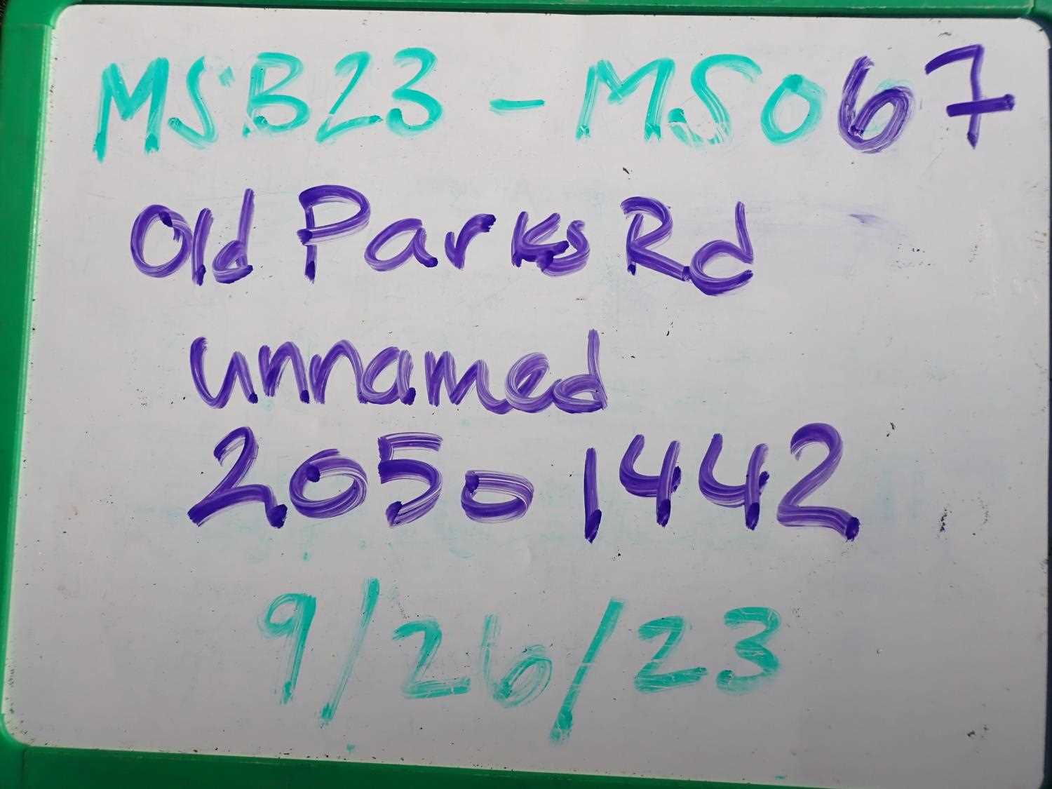
Fish Passage Site 20501442
Coordinates (dec. deg.): 61.70671°, -150.00012°
Legal Description: S019N004W28
Region: South Central
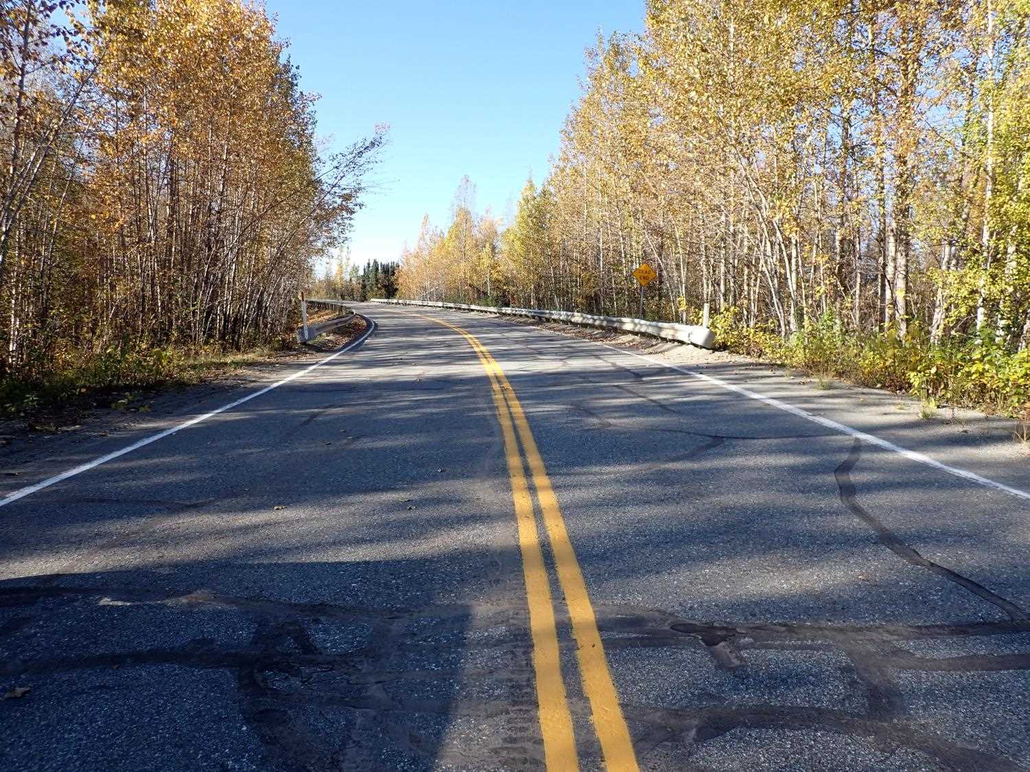
Road Name: Old Parks Highway
Datum: NAD83
Quad Name / ITM: Anchorage C-8
AWC Stream #: 247-41-10100-2231-3080
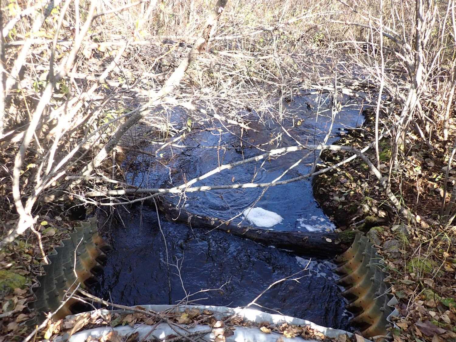
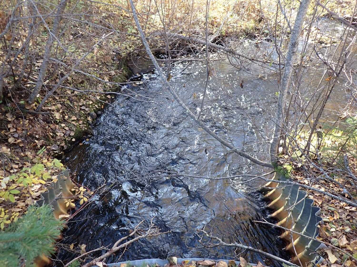
Stream Name: Lilly Creek
Elevation:
Site Comments: SUSITNA RIVER WATERSHED
arrow to the right of the survey date below to choose a different report for this site.
Survey MSB23-MS067
Project Supervisor: Michael Mazzacavallo, Alaska Department of Fish and Game
— Anchorage, AK
Observers: Michael Mazzacavallo, Kat Leavitt, Beth Evers
Overall Fish Passage Rating:
Tidal: No
Backwatered: No
Step Pools: No
Construction Year:
Site Observations:
- Outfall height gray
Comments: None
Culvert Measurements
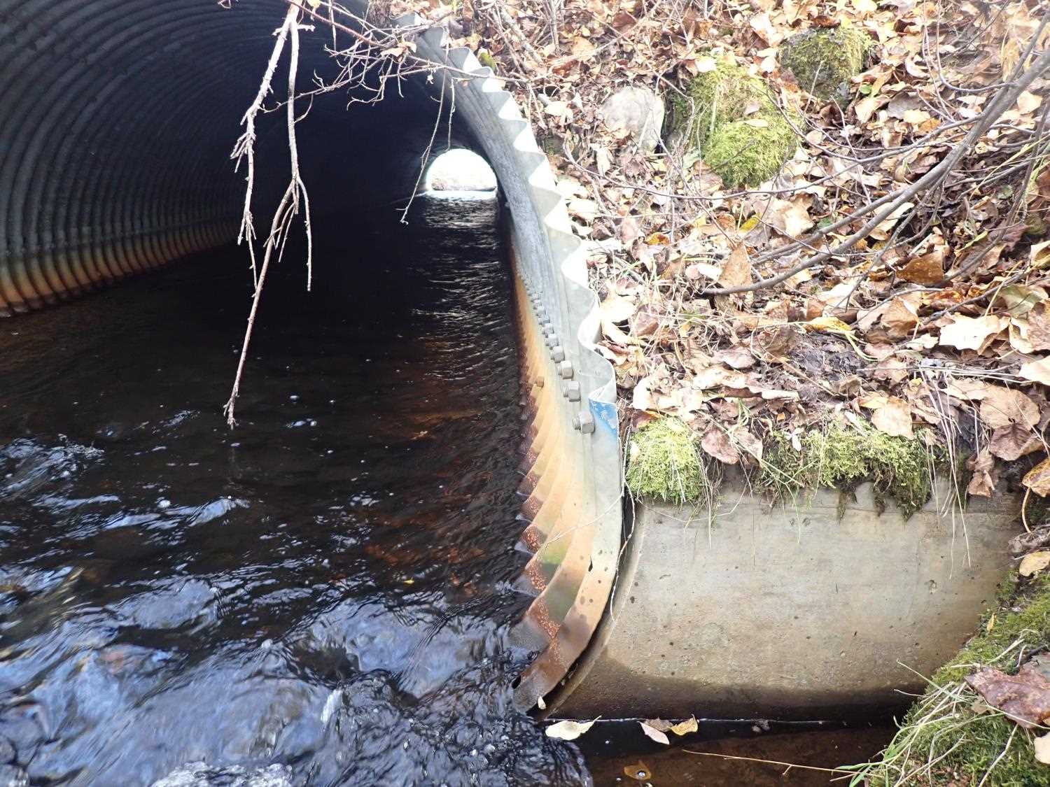
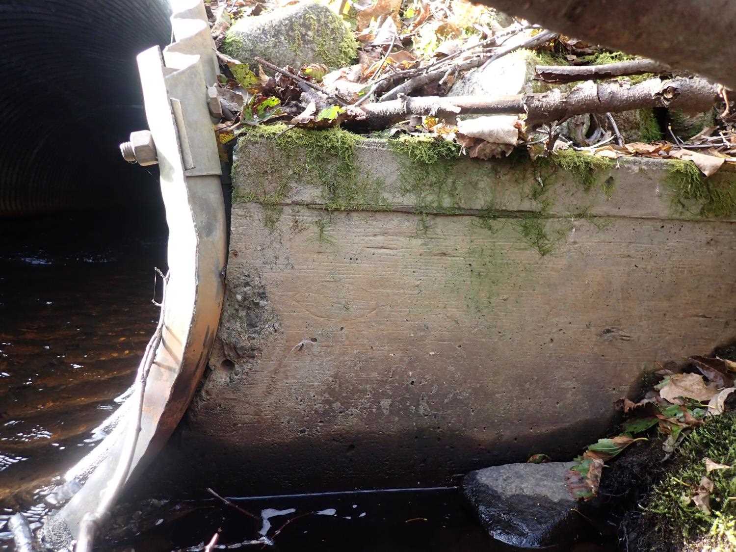
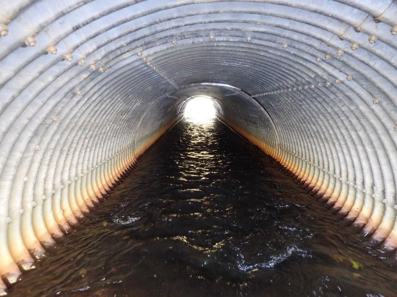
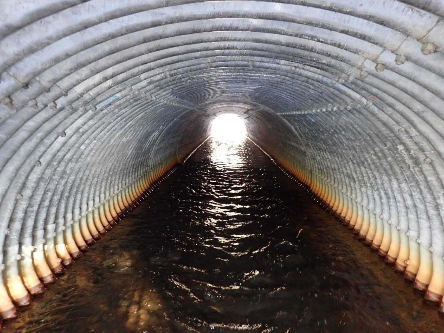
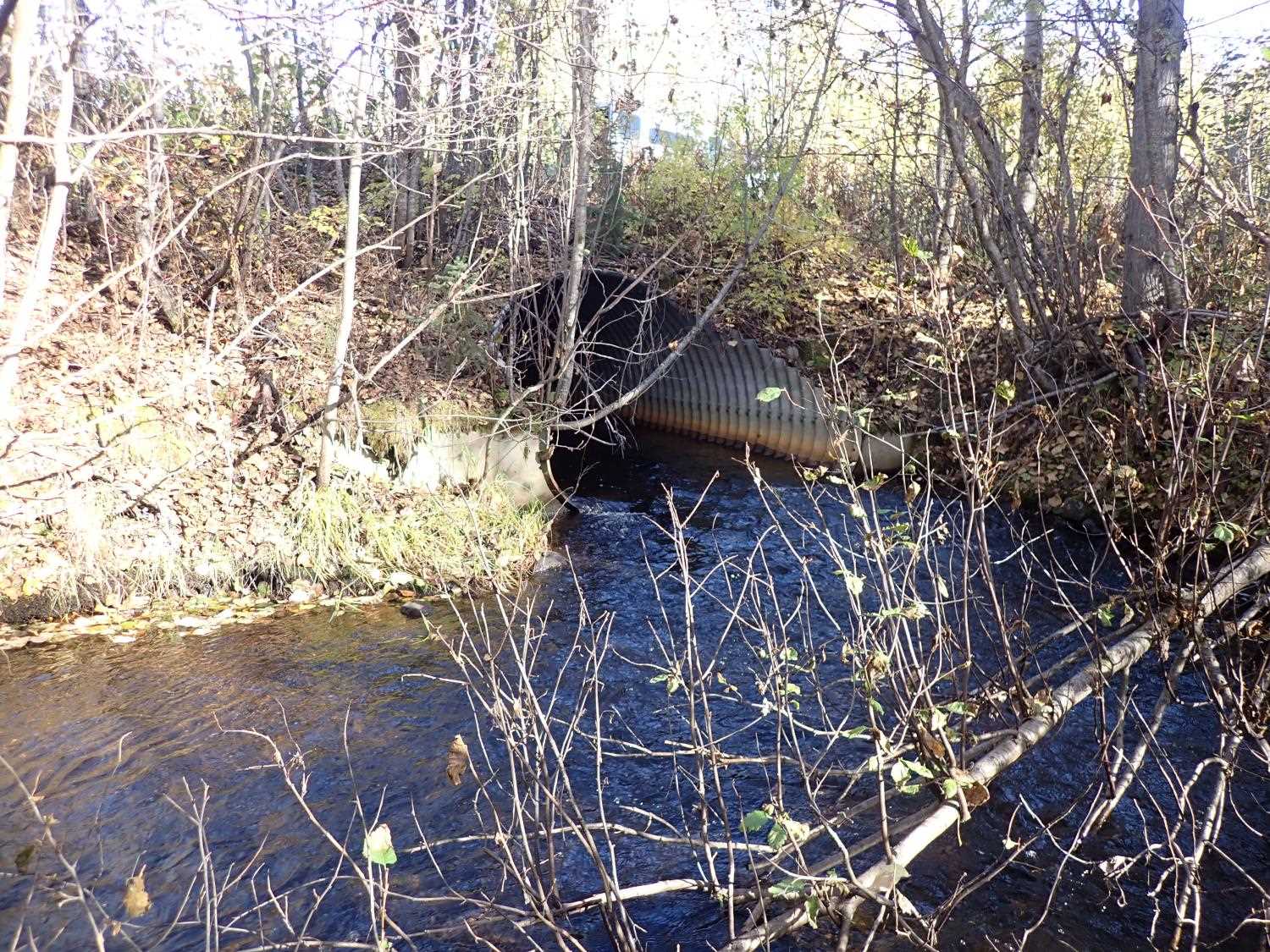
| ID: 1 | Structure Type: Pipe-arch (Structural steel plate) | Fish Passage Rating: | ||||||||||||||||||||||||||||||||||||||||||
|
|
|
||||||||||||||||||||||||||||||||||||||||||
Comments: Mittered with potential headwall at inlet and outlet. Mittered lengths: outlet 5.6, inlet 5.9. Outfall height estimated based off photos. Calculation adjusted/long pro adjusted. |
||||||||||||||||||||||||||||||||||||||||||||
Culvert Observations:
|
||||||||||||||||||||||||||||||||||||||||||||
Stream Measurements
|
|
| Stream Width Type | Distance From Crossing (ft) |
Stream Width (ft) |
|---|---|---|
| Upstream ordinary high water | 67.0 | 12.10 |
| Upstream ordinary high water | 94.0 | 13.90 |
| Upstream ordinary high water | 115.0 | 10.30 |
| Upstream ordinary high water | 150.0 | 9.77 |
Elevations
| Locator ID | Culvert Number |
River Distance (ft)1 |
Distance From Crossing (ft)2 |
Relative Elevation (ft) |
|---|---|---|---|---|
| Road Elev | 101.22 | |||
| D/S Thalweg | 0.00 | 85.99 | ||
| D/S Water Surface Elev | 0.00 | 86.85 | ||
| D/S Water Surface Elev | 9.00 | 87.24 | ||
| D/S Thalweg | 9.00 | 86.47 | ||
| D/S Thalweg | 39.00 | 86.63 | ||
| D/S Water Surface Elev | 39.00 | 87.65 | ||
| D/S Water Surface Elev | 66.00 | 88.06 | ||
| D/S Thalweg | 66.00 | 87.38 | ||
| Outlet Invert | 100.00 | 87.98 | ||
| D/S Water Surface Elev | 100.00 | 88.59 | ||
| Outlet Culvert Top | 100.00 | 94.12 | ||
| Inlet Culvert Top | 207.78 | 94.90 | ||
| U/S Water Surface Elev | 207.78 | 89.37 | ||
| Inlet Culvert Invert | 207.78 | 88.51 | ||
| U/S Thalweg | 262.78 | 89.97 | ||
| U/S Water Surface Elev | 262.78 | 90.27 | ||
| U/S Thalweg | 294.78 | 90.16 | ||
| U/S Water Surface Elev | 294.78 | 90.17 | ||
| U/S Thalweg | 357.78 | 91.27 | ||
| U/S Water Surface Elev | 357.78 | 92.02 |
Notes:
- River distance is measured continuously throughout the survey reach along the thalweg of the stream.
- Measured from each end of the crossing along the thalweg of the stream.
Fish Sampling Efforts
No fish sampling occurred during this survey.
Fish Observations
No fish observations occurred during this survey.
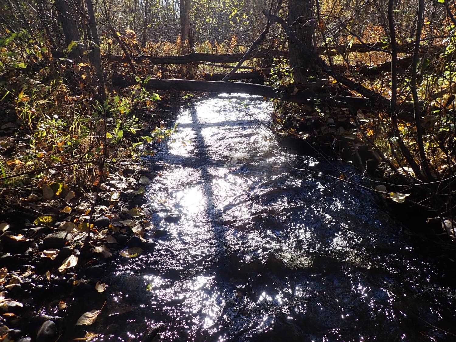
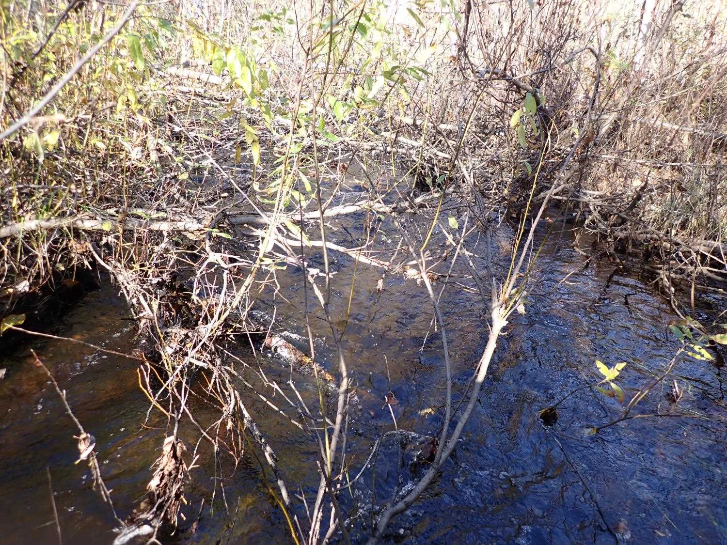
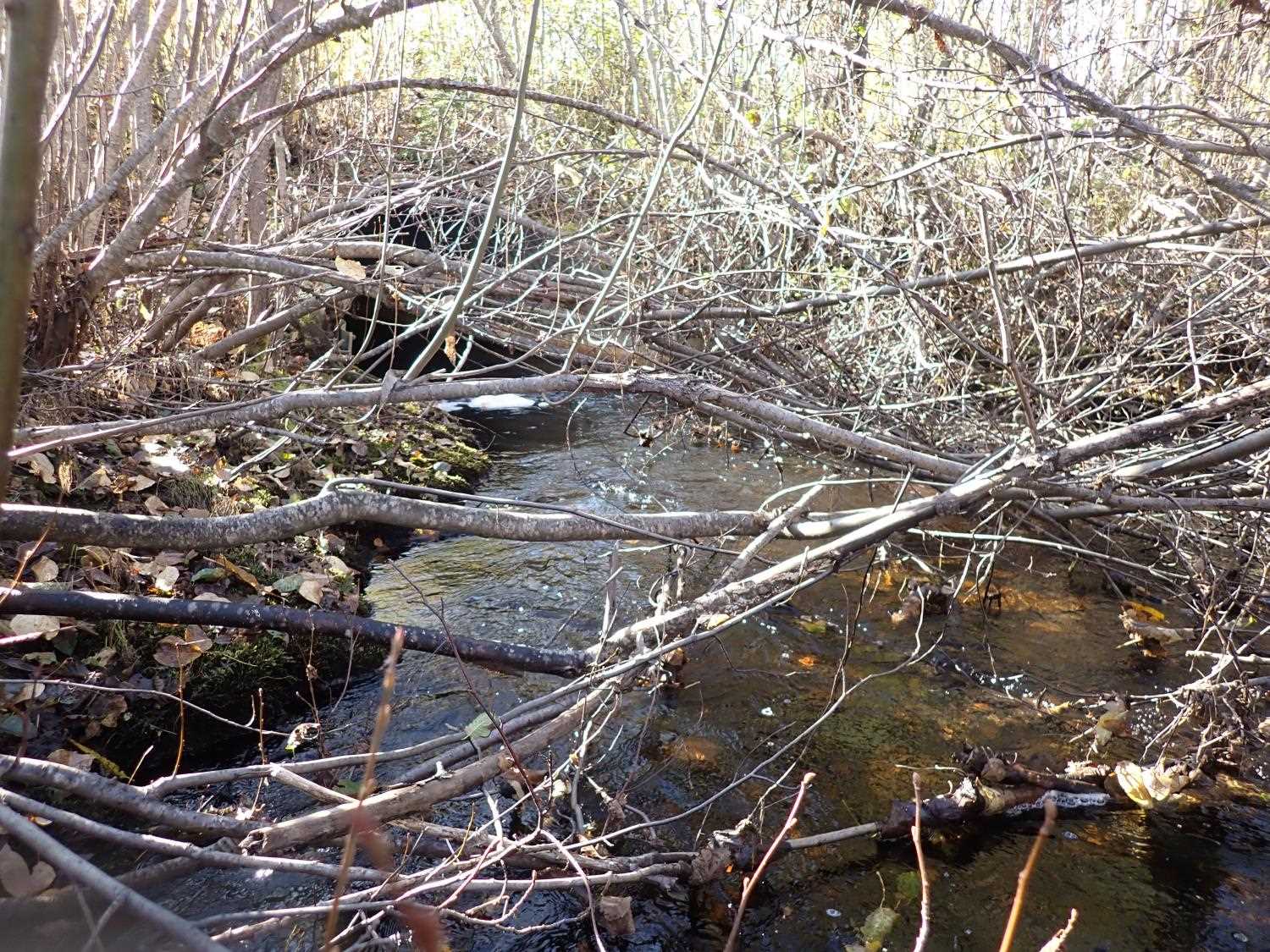
Photos
Questions or comments about this report can be directed to dfg.dsf.webmaster@alaska.gov