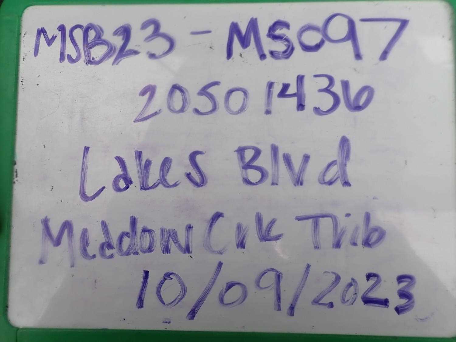
Fish Passage Site 20501436
Coordinates (dec. deg.): 61.56963°, -149.84109°
Legal Description: S017N003W16
Region: South Central
Road Name: Beaver Lake Road
Datum: NAD83
Quad Name / ITM: Anchorage C-8
AWC Stream #: 247-50-10330-2050-3019-4011-5011
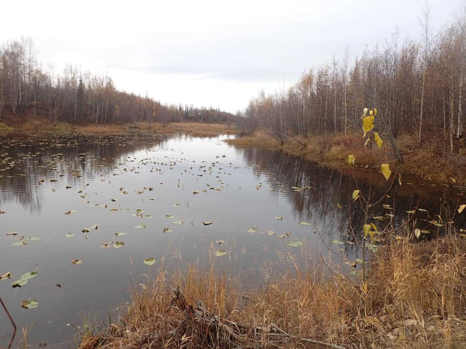
Stream Name: Lynda Lake Portage
Elevation:
Site Comments: SUSITNA RIVER WATERSHED,
arrow to the right of the survey date below to choose a different report for this site.
Survey MSB23-MS097
Project Supervisor: Michael Mazzacavallo, Alaska Department of Fish and Game
— Anchorage, AK
Observers: Michael Mazzacavallo, Kat Leavitt, Amy LaBarre, Beth Evers
Overall Fish Passage Rating:
Tidal: No
Backwatered: No
Step Pools: No
Construction Year:
Site Observations:
- Beaver Activity
- Mechanical damage or joints parting
- Structural Problem
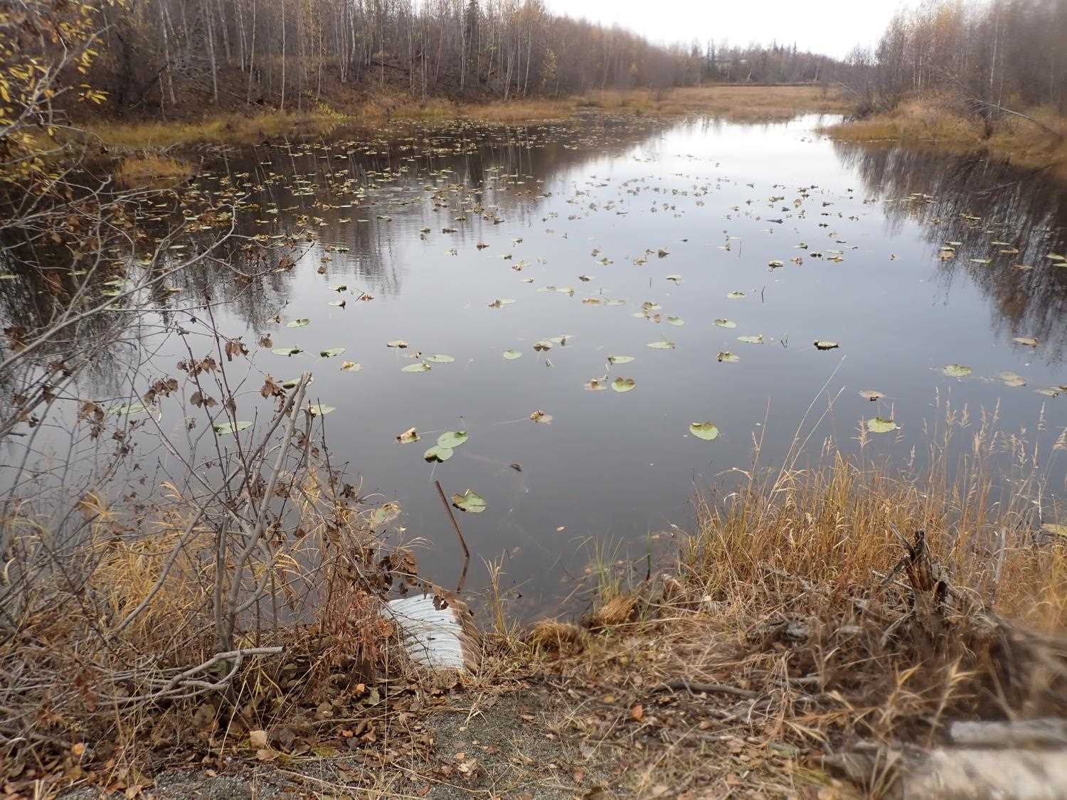
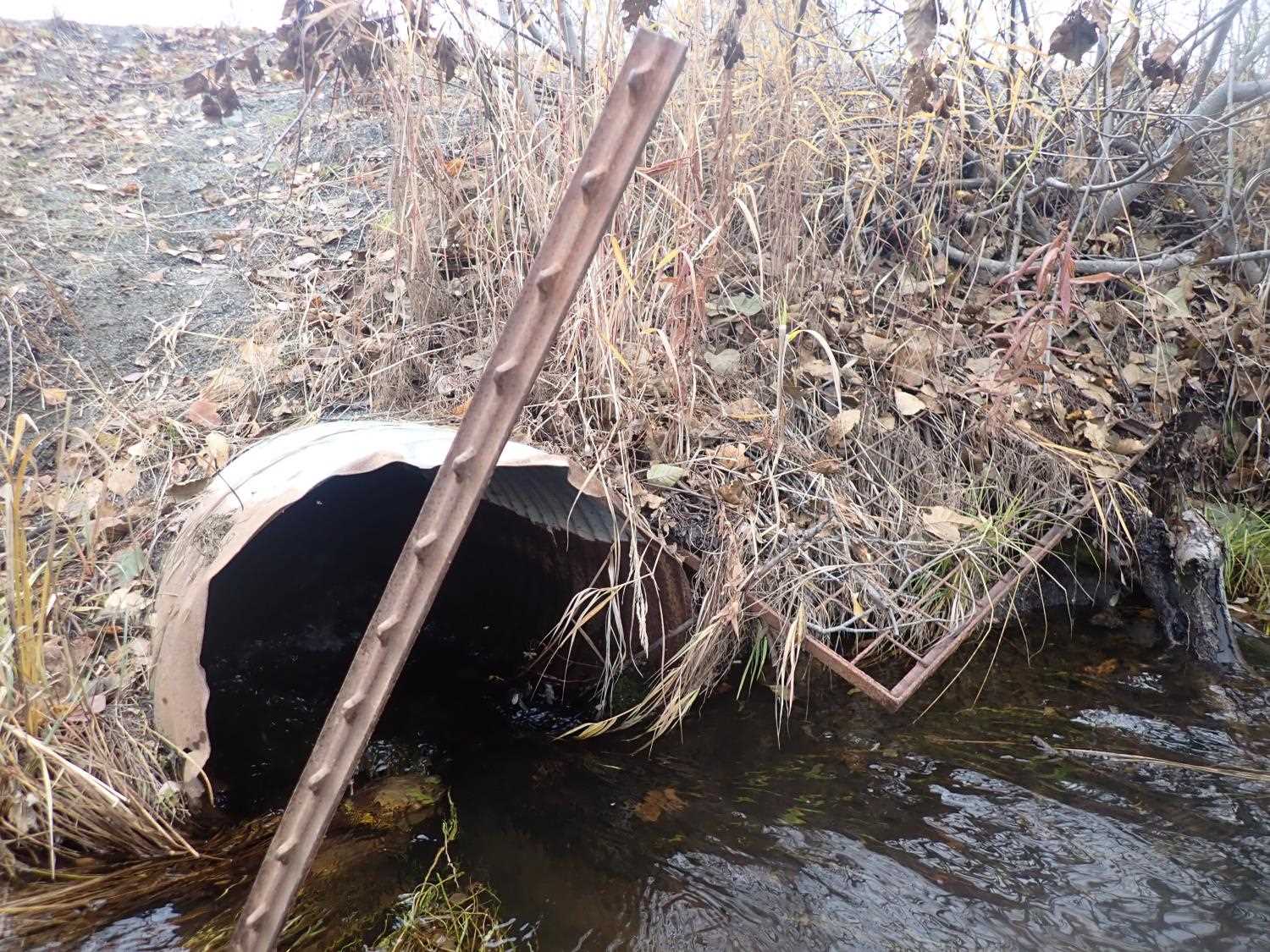
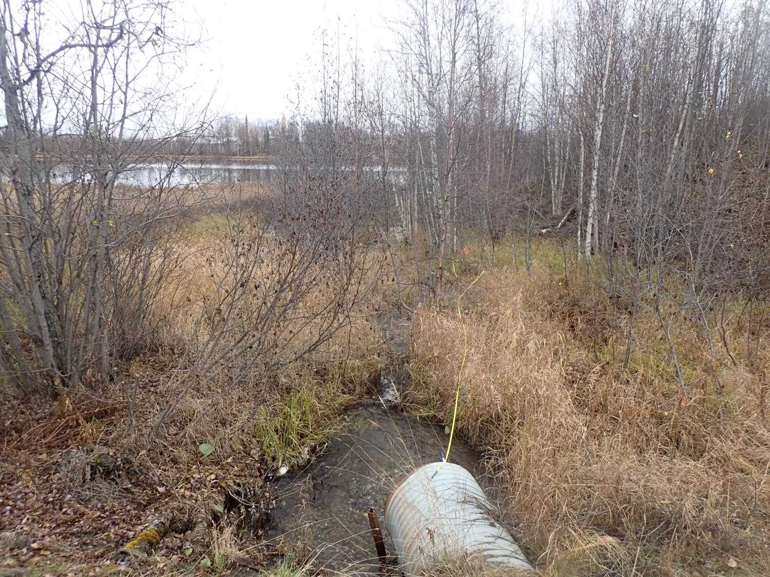
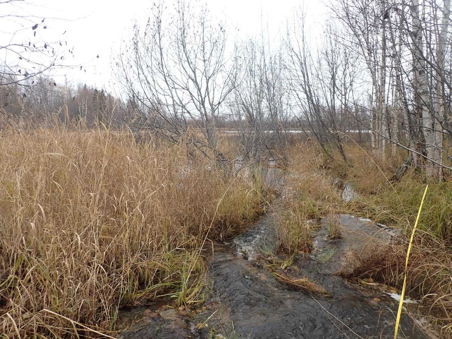
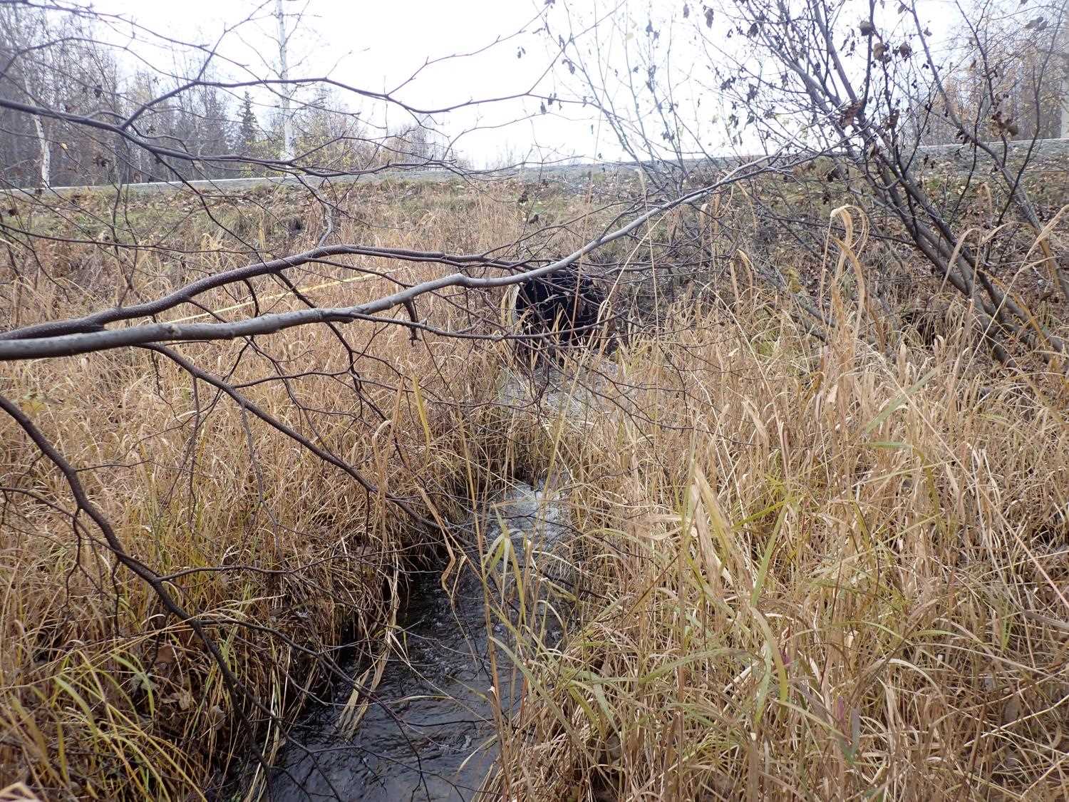
Comments: Beaver gate at inlet (not attached) not in water. Small stream/ channel flows from outlet to pond.
Culvert Measurements
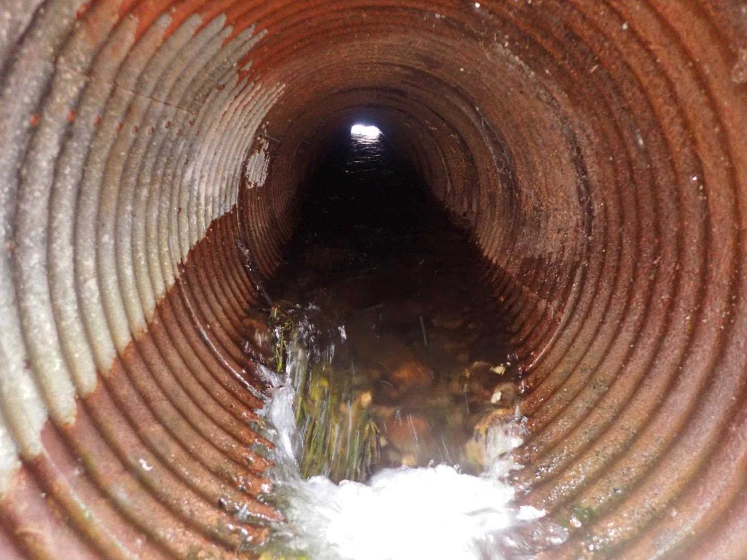
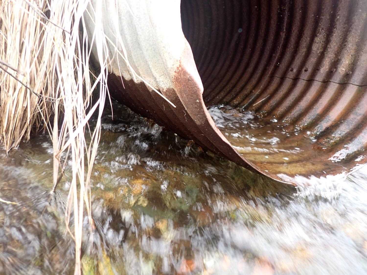
| ID: 1 | Structure Type: Circular pipe (Structural steel plate) | Fish Passage Rating: | ||||||||||||||||||||||||||||||||||||||||||
|
|
|
||||||||||||||||||||||||||||||||||||||||||
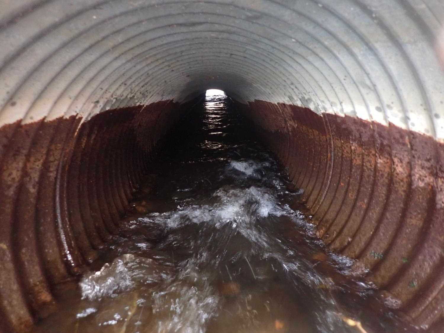
Comments: Outlet has rusted out holes in bottom. Rusted out pipe is 3ft into pipe from mouth of outlet, carving away fill surrounding outlet and creating larger stream/ pond at outlet. Culvert sagging in the middle. |
||||||||||||||||||||||||||||||||||||||||||||
Culvert Observations:
|
||||||||||||||||||||||||||||||||||||||||||||
Stream Measurements
|
|
No stream width data available.
Elevations
| Locator ID | Culvert Number |
River Distance (ft)1 |
Distance From Crossing (ft)2 |
Relative Elevation (ft) |
|---|---|---|---|---|
| U/S Water Surface Elev | 93.84 | |||
| Inlet Culvert Top | 0.00 | 95.41 | ||
| U/S Water Surface Elev (Culvert water surface) | 0.00 | 93.71 | ||
| Inlet Culvert Invert | 0.00 | 92.43 | ||
| Outlet Invert | 59.16 | 92.67 | ||
| D/S Water Surface Elev | 59.16 | 92.74 | ||
| Outlet Culvert Top | 59.16 | 95.67 | ||
| D/S Water Surface Elev | 60.16 | 92.55 | ||
| D/S Thalweg | 60.16 | 92.17 | ||
| D/S Thalweg | 71.16 | 91.66 | ||
| D/S Water Surface Elev | 71.76 | 92.18 | ||
| D/S Thalweg | 102.19 | 90.20 | ||
| D/S Water Surface Elev | 102.19 | 91.47 | ||
| D/S Thalweg | 124.16 | 89.22 | ||
| D/S Water Surface Elev | 124.16 | 90.89 |
Notes:
- River distance is measured continuously throughout the survey reach along the thalweg of the stream.
- Measured from each end of the crossing along the thalweg of the stream.
Fish Sampling Efforts
No fish sampling occurred during this survey.
Fish Observations
No fish observations occurred during this survey.
Photos
Questions or comments about this report can be directed to dfg.dsf.webmaster@alaska.gov