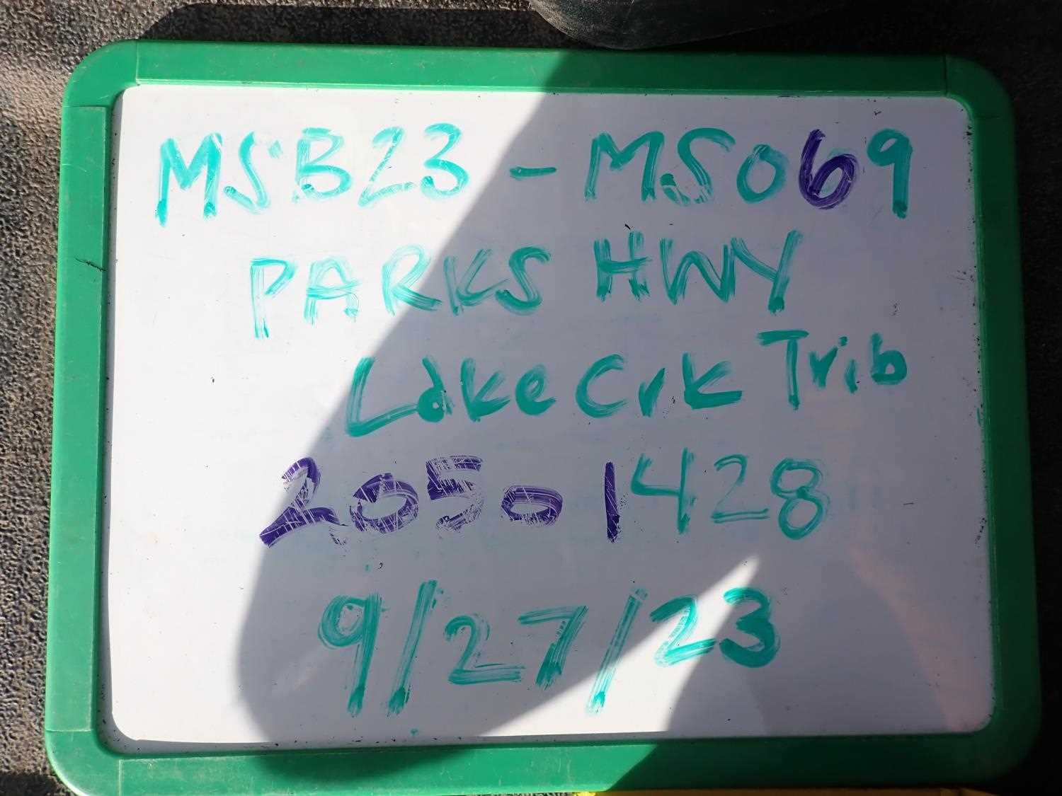
Fish Passage Site 20501428
Coordinates (dec. deg.): 61.65881°, -149.93474°
Legal Description: S018N004W11
Region: South Central
Road Name: Parks Highway
Datum: NAD83
Quad Name / ITM: Anchorage C-8
AWC Stream #:
Stream Name: Lake Creek tributary
Elevation:
Site Comments: SUSITNA RIVER WATERSHED
arrow to the right of the survey date below to choose a different report for this site.
Survey MSB23-MS069
Project Supervisor: Michael Mazzacavallo, Alaska Department of Fish and Game
— Anchorage, AK
Observers: Michael Mazzacavallo, Kat Leavitt, Beth Evers
Overall Fish Passage Rating:
Tidal: No
Backwatered: No
Step Pools: No
Construction Year:
Site Observations:
- Constriction ratio red
- Culvert gradient red
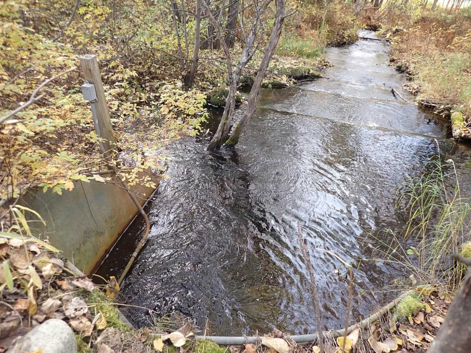
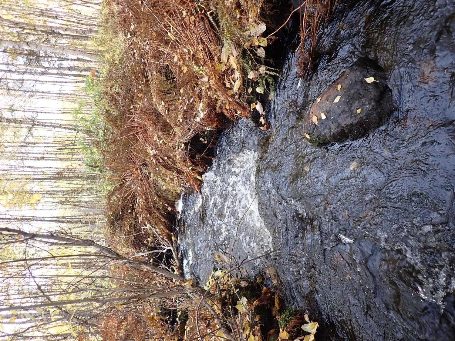
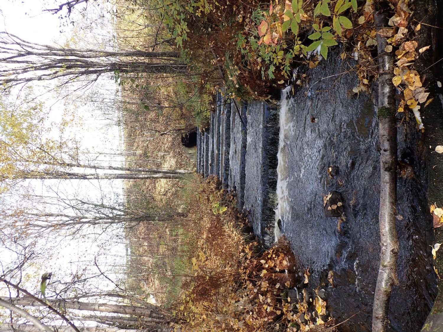
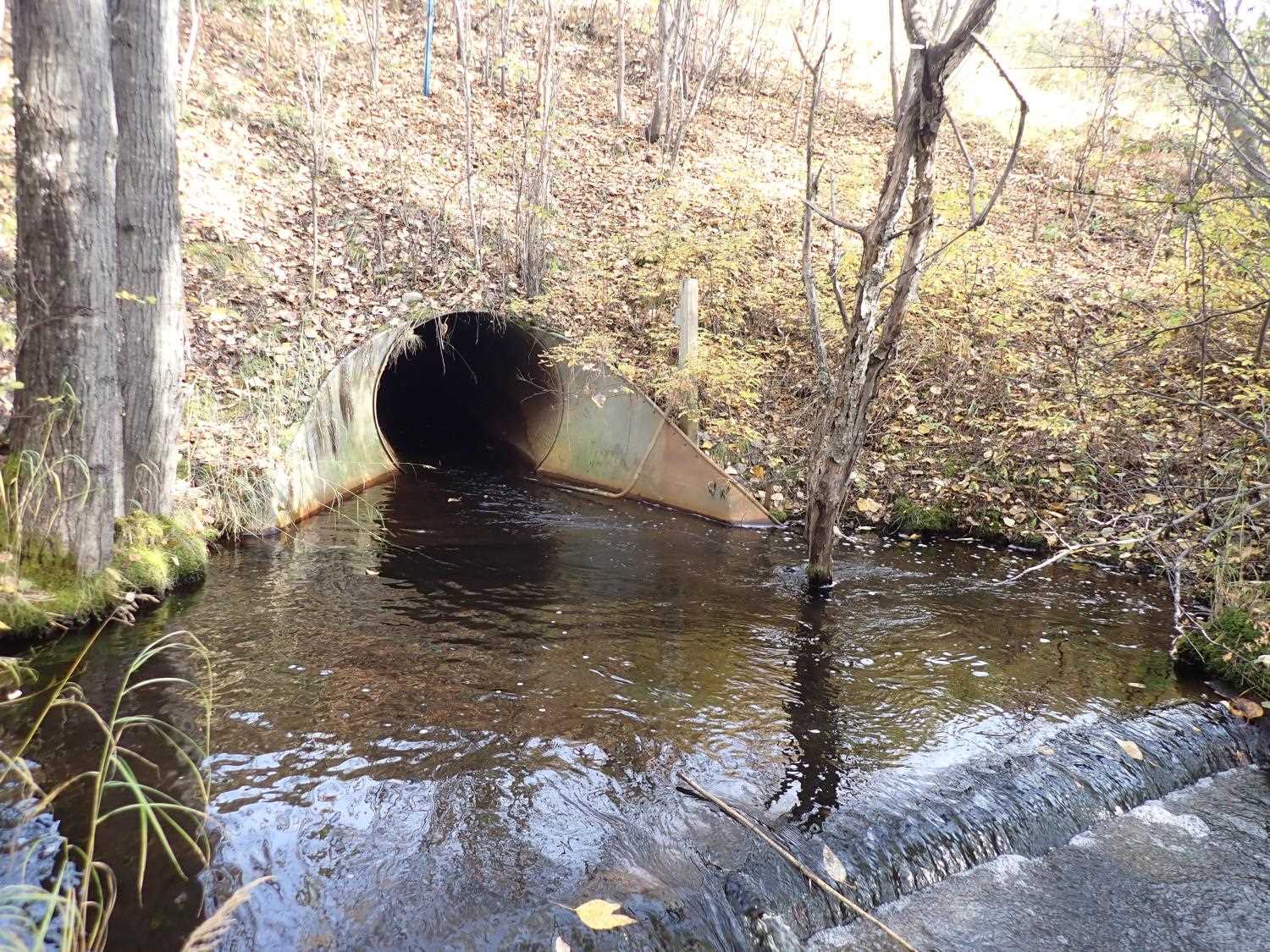
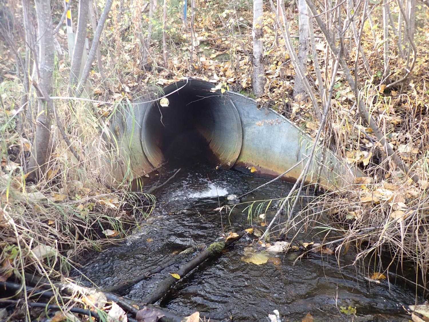
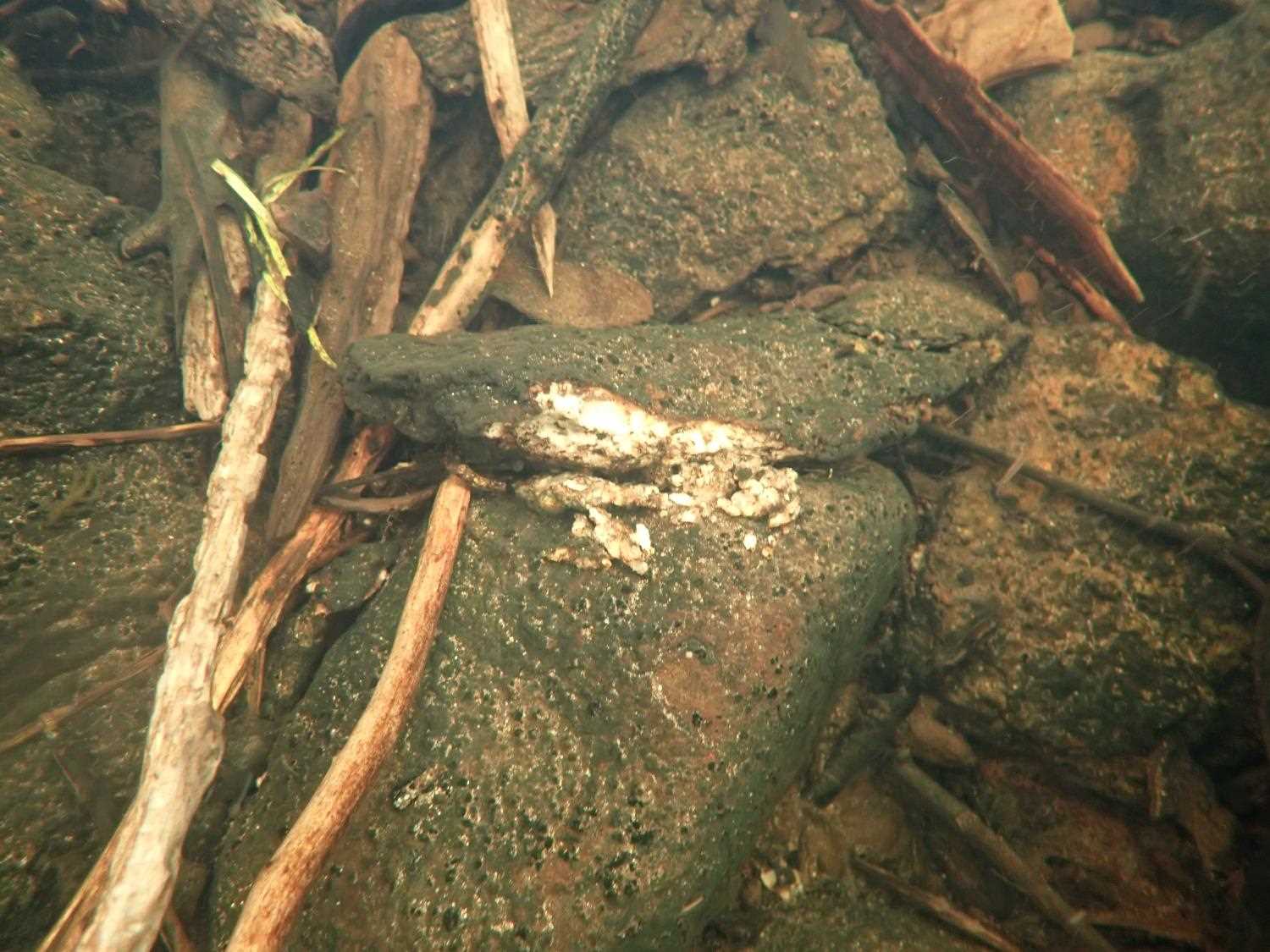
Comments: Outlet flows smooth over apron then steps down into 9 installed man made pools. This was resurveyed on 9/29/23.
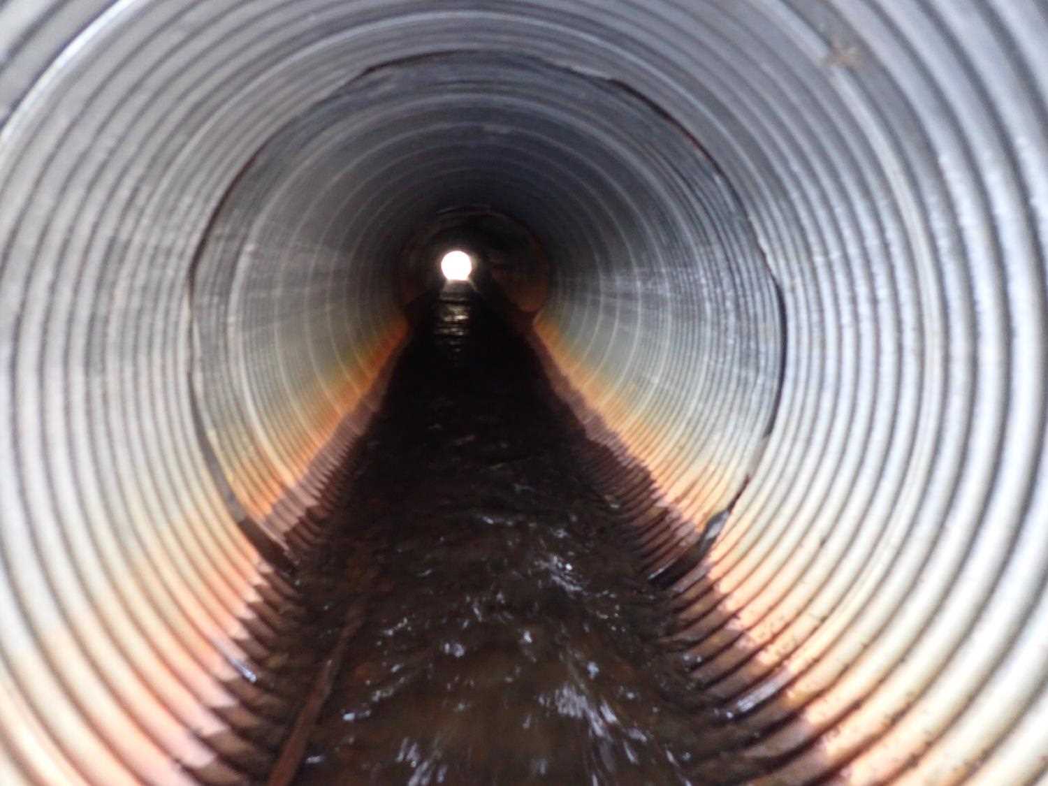
Culvert Measurements
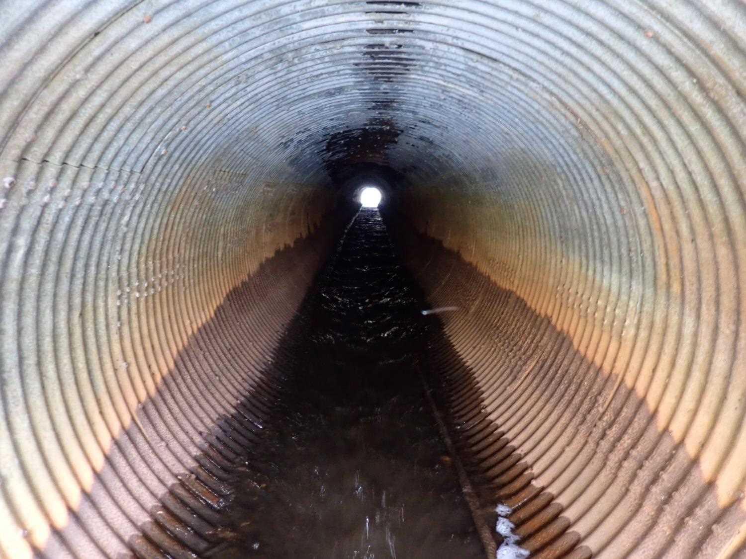
| ID: 1 | Structure Type: Circular pipe (Corrugated steel) | Fish Passage Rating: | ||||||||||||||||||||||||||||||||||||||||||
|
|
|
||||||||||||||||||||||||||||||||||||||||||
Comments: There is a thaw pipe installed through the culvert. |
||||||||||||||||||||||||||||||||||||||||||||
Culvert Observations:
|
||||||||||||||||||||||||||||||||||||||||||||
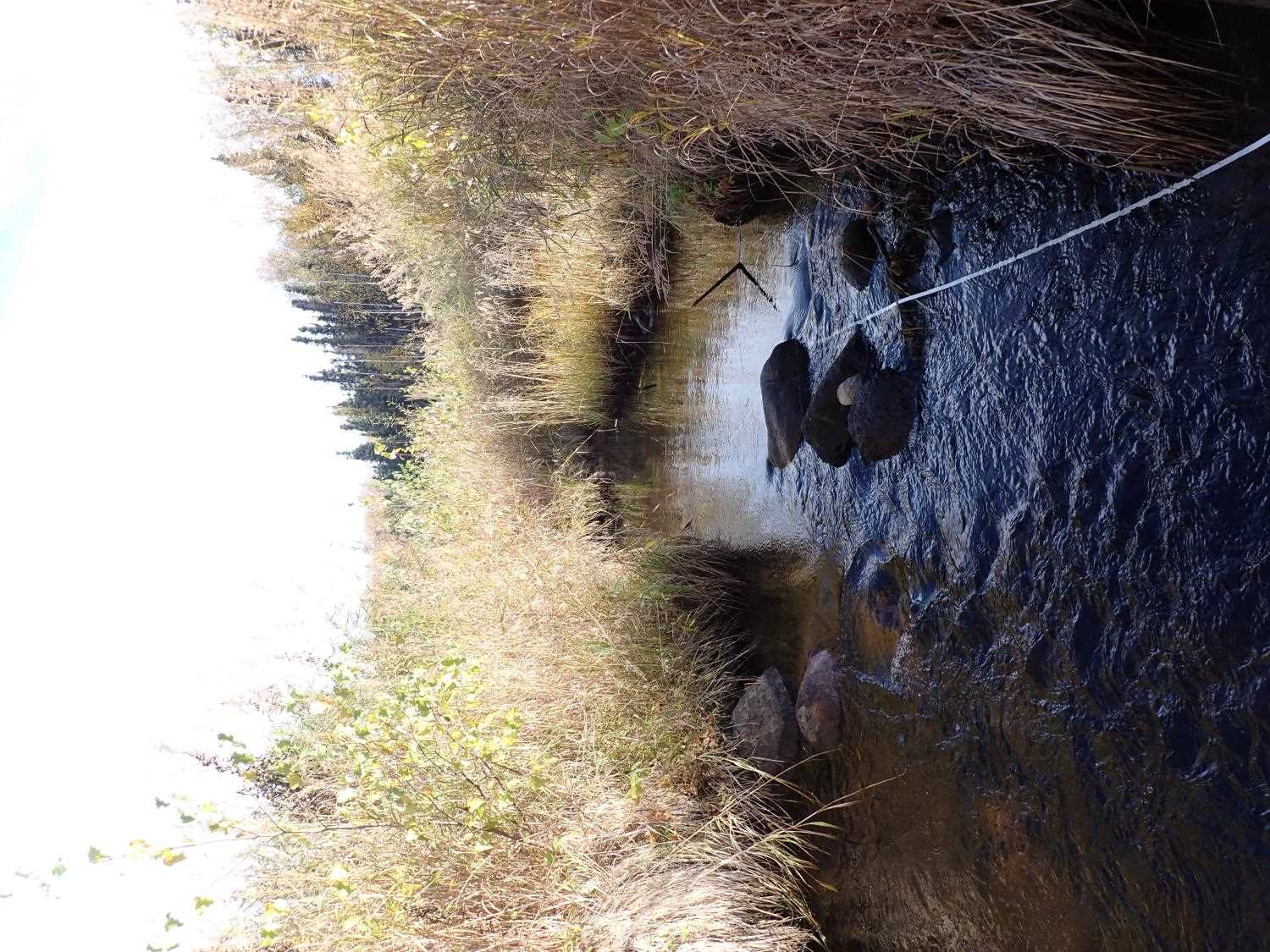
Stream Measurements
|
|
| Stream Width Type | Distance From Crossing (ft) |
Stream Width (ft) |
|---|---|---|
| Upstream ordinary high water | 0.0 | 8.80 |
| Upstream ordinary high water | 12.0 | 6.10 |
| Upstream ordinary high water | 32.0 | 7.50 |
| Upstream ordinary high water | 48.0 | 10.55 |
Elevations
| Locator ID | Culvert Number |
River Distance (ft)1 |
Distance From Crossing (ft)2 |
Relative Elevation (ft) |
|---|---|---|---|---|
| Road Elev | 112.56 | |||
| U/S Water Surface Elev | 18.00 | 86.17 | ||
| U/S Thalweg | 18.00 | 85.21 | ||
| U/S Thalweg | 48.00 | 85.55 | ||
| U/S Water Surface Elev | 48.00 | 86.00 | ||
| Inlet Culvert Top | 100.00 | 89.63 | ||
| Inlet Culvert Invert | 100.00 | 84.49 | ||
| U/S Water Surface Elev | 100.00 | 84.96 | ||
| Outlet Culvert Top | 264.76 | 85.96 | ||
| Outlet Invert | 264.76 | 80.89 | ||
| D/S Water Surface Elev | 264.76 | 81.58 | ||
| D/S Thalweg | 283.76 | 81.49 | ||
| D/S Water Surface Elev | 283.76 | 81.55 | ||
| D/S Thalweg | 290.76 | 80.99 | ||
| D/S Water Surface Elev | 290.76 | 81.06 | ||
| D/S Thalweg | 297.76 | 80.32 | ||
| D/S Water Surface Elev | 297.76 | 80.47 | ||
| D/S Thalweg | 304.76 | 79.79 | ||
| D/S Water Surface Elev | 304.76 | 80.09 | ||
| D/S Thalweg | 312.76 | 78.77 | ||
| D/S Water Surface Elev | 312.76 | 79.38 | ||
| D/S Thalweg | 320.76 | 78.57 | ||
| D/S Water Surface Elev | 320.76 | 78.93 | ||
| D/S Thalweg | 328.76 | 78.13 | ||
| D/S Water Surface Elev | 328.76 | 78.37 | ||
| D/S Water Surface Elev | 333.76 | 77.89 | ||
| D/S Thalweg | 333.76 | 77.52 | ||
| D/S Water Surface Elev | 336.76 | 77.59 | ||
| D/S Thalweg | 336.76 | 77.19 | ||
| D/S Thalweg | 364.76 | 76.04 | ||
| D/S Water Surface Elev | 364.76 | 76.50 |
Notes:
- River distance is measured continuously throughout the survey reach along the thalweg of the stream.
- Measured from each end of the crossing along the thalweg of the stream.
Fish Sampling Efforts
No fish sampling occurred during this survey.
Fish Observations
No fish observations occurred during this survey.
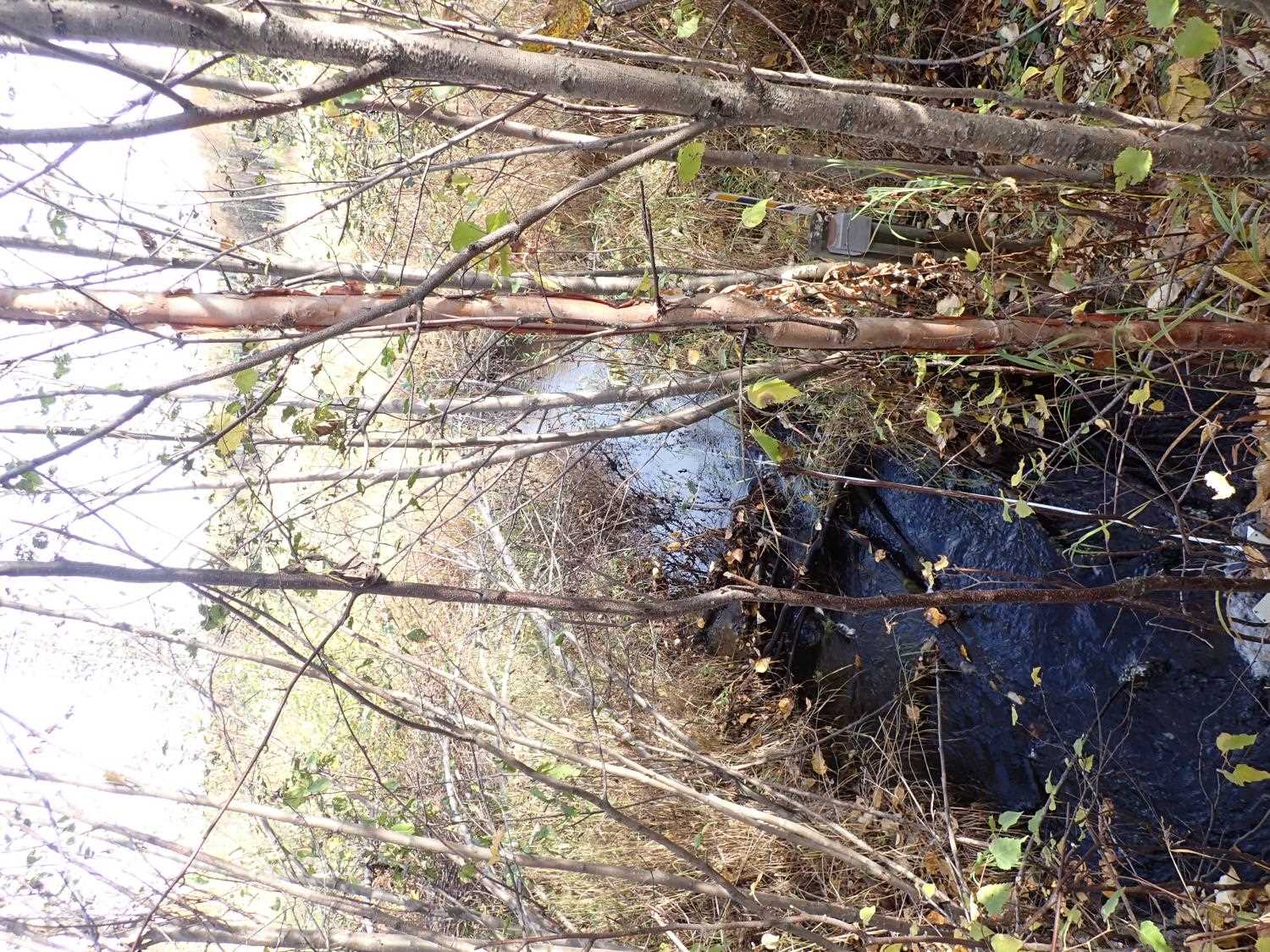
Photos
Questions or comments about this report can be directed to dfg.dsf.webmaster@alaska.gov