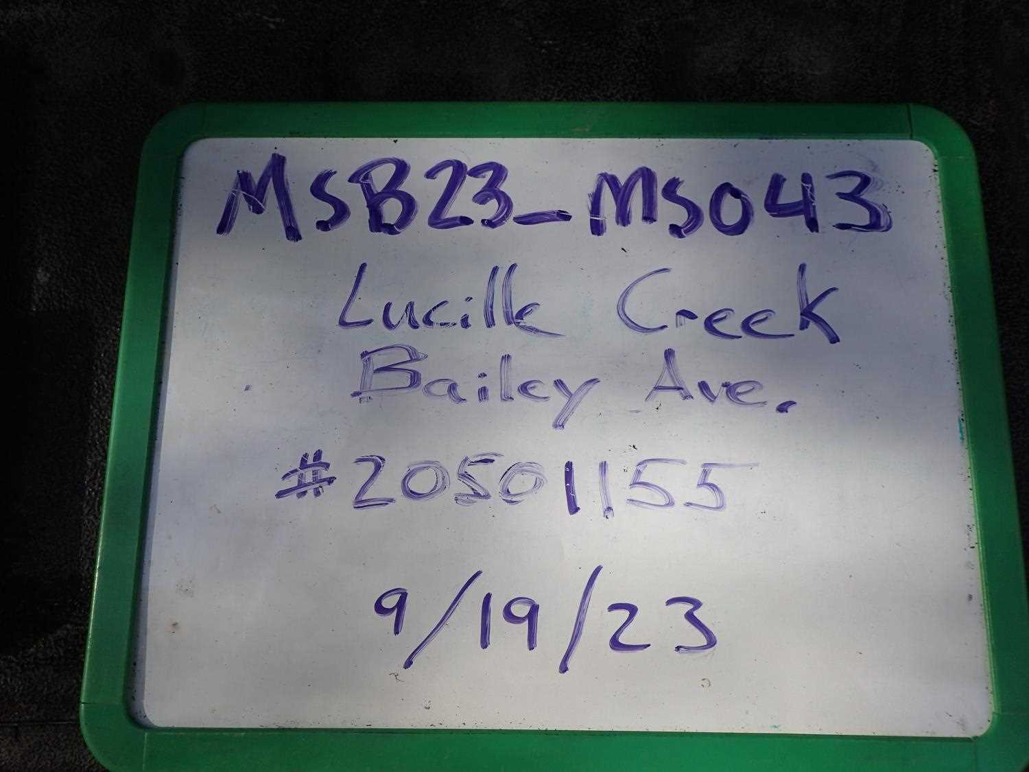
Fish Passage Site 20501155
Coordinates (dec. deg.): 61.57046°, -149.51019°
Legal Description: S017N001W17
Region: South Central
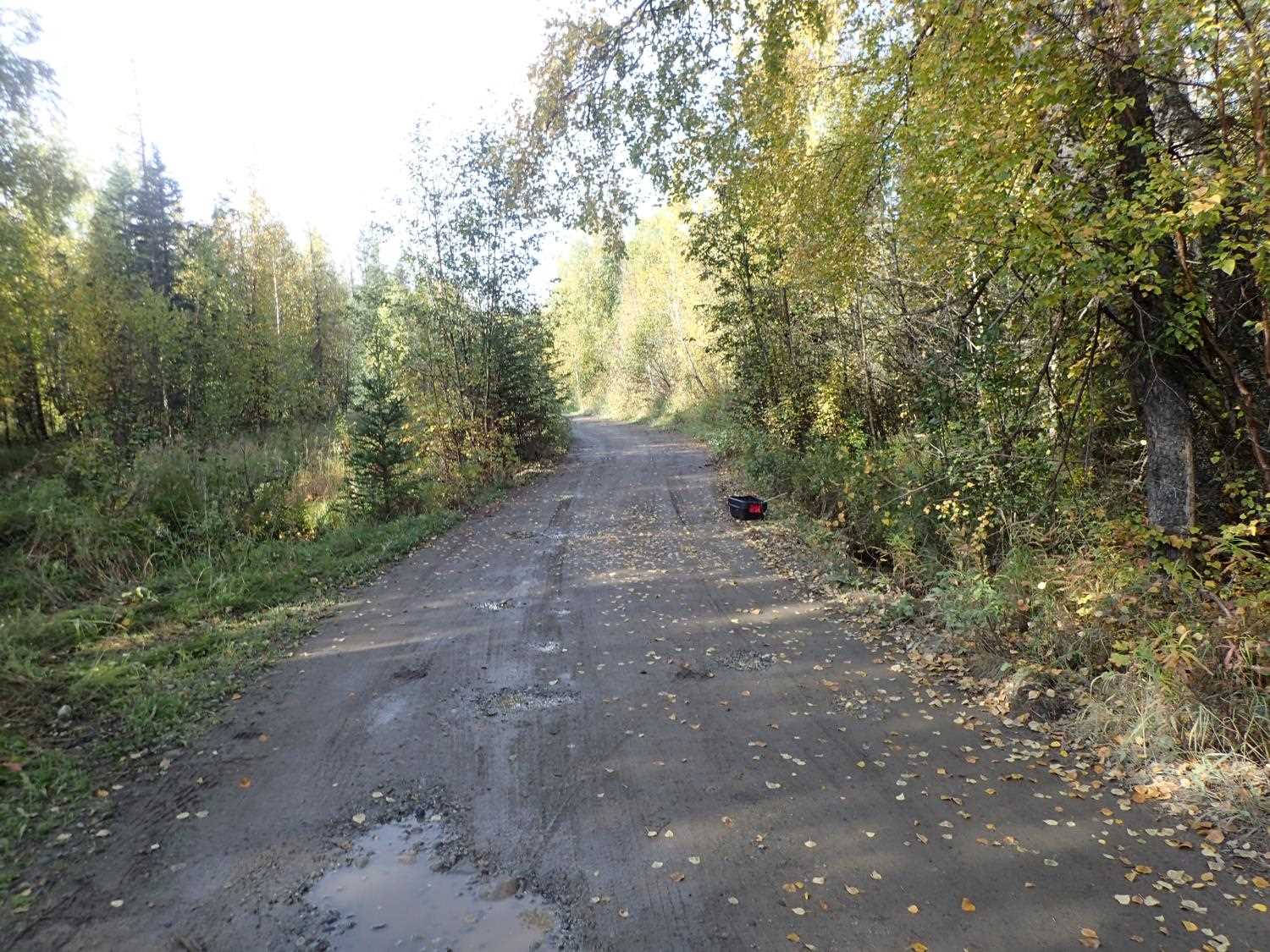
Road Name: Bailey Avenue
Datum: NAD83
Quad Name / ITM: Anchorage C-7
AWC Stream #: 247-50-10330-2050-3030
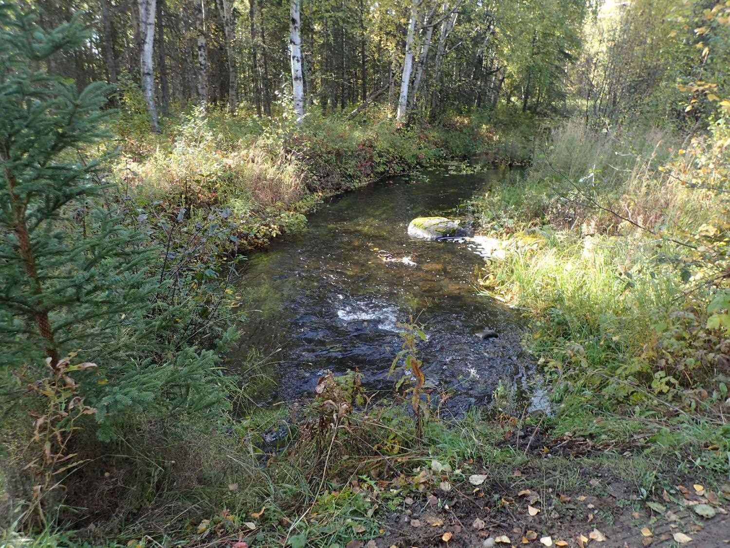
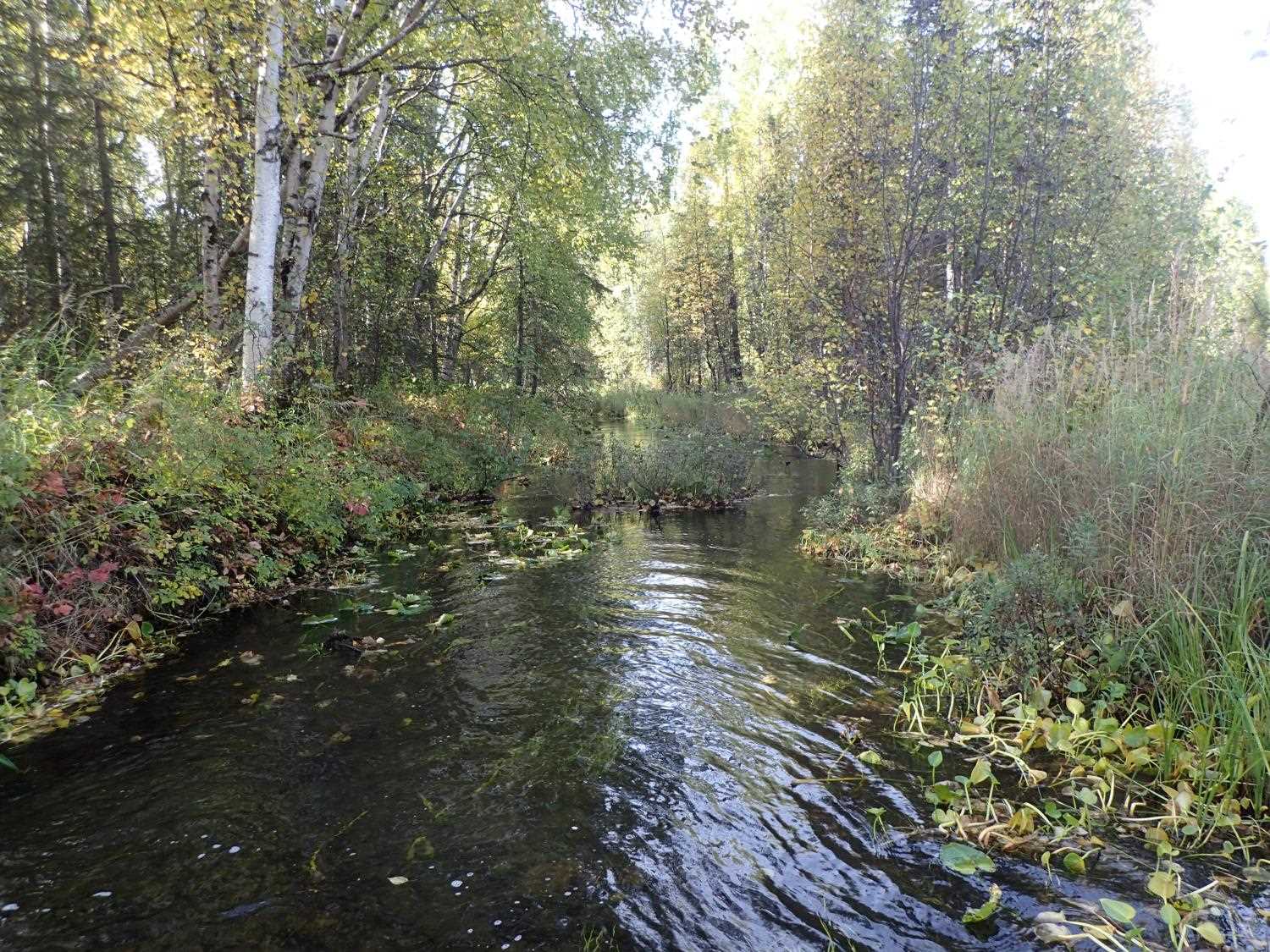
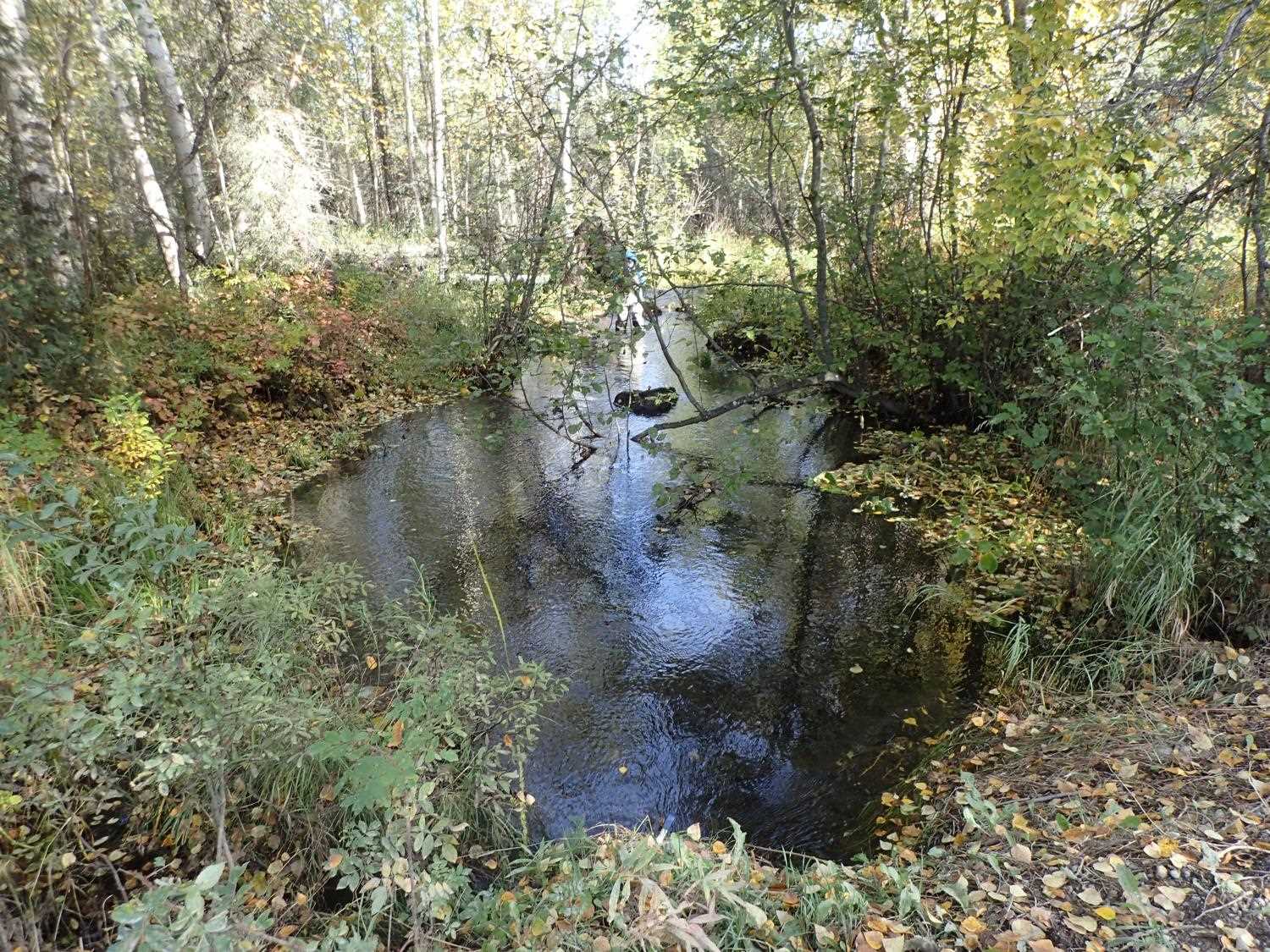
Stream Name: Lucille Creek
Elevation:
Site Comments: None
arrow to the right of the survey date below to choose a different report for this site.
Survey MSB23-MS043
Project Supervisor: Michael Mazzacavallo, Alaska Department of Fish and Game
— Anchorage, AK
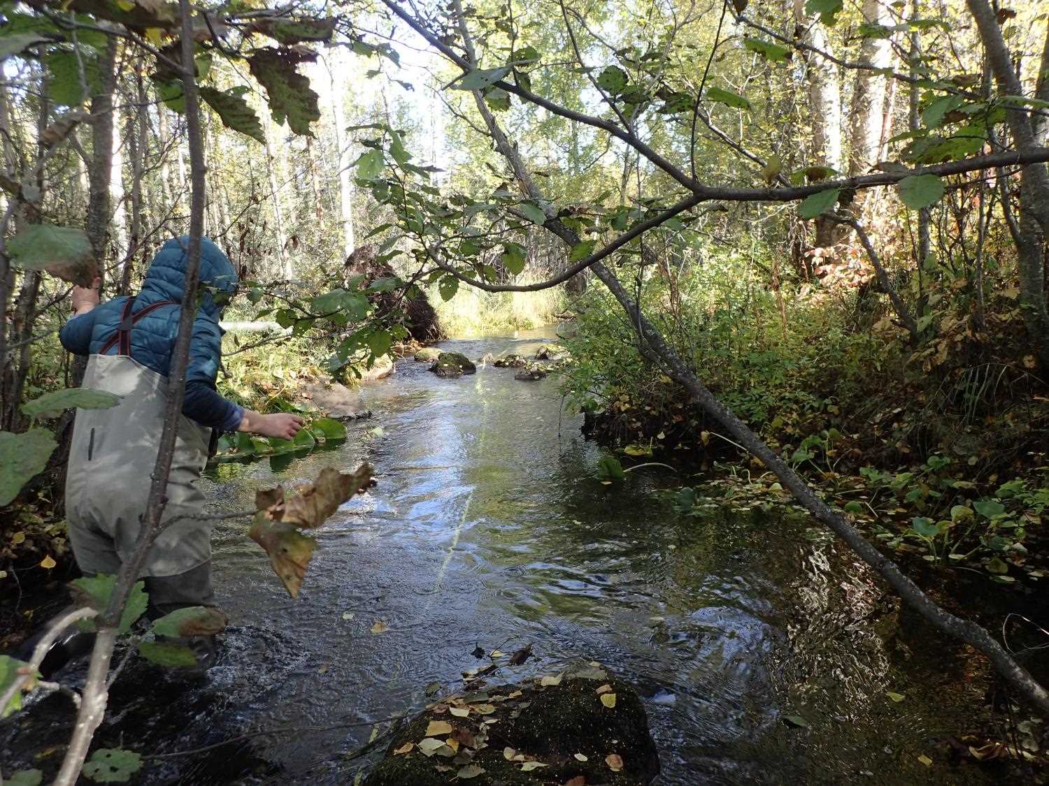
Observers: Kevin Keith, Kat Leavitt
Overall Fish Passage Rating:
Tidal: No
Backwatered: No
Step Pools: No
Construction Year:
Site Observations:
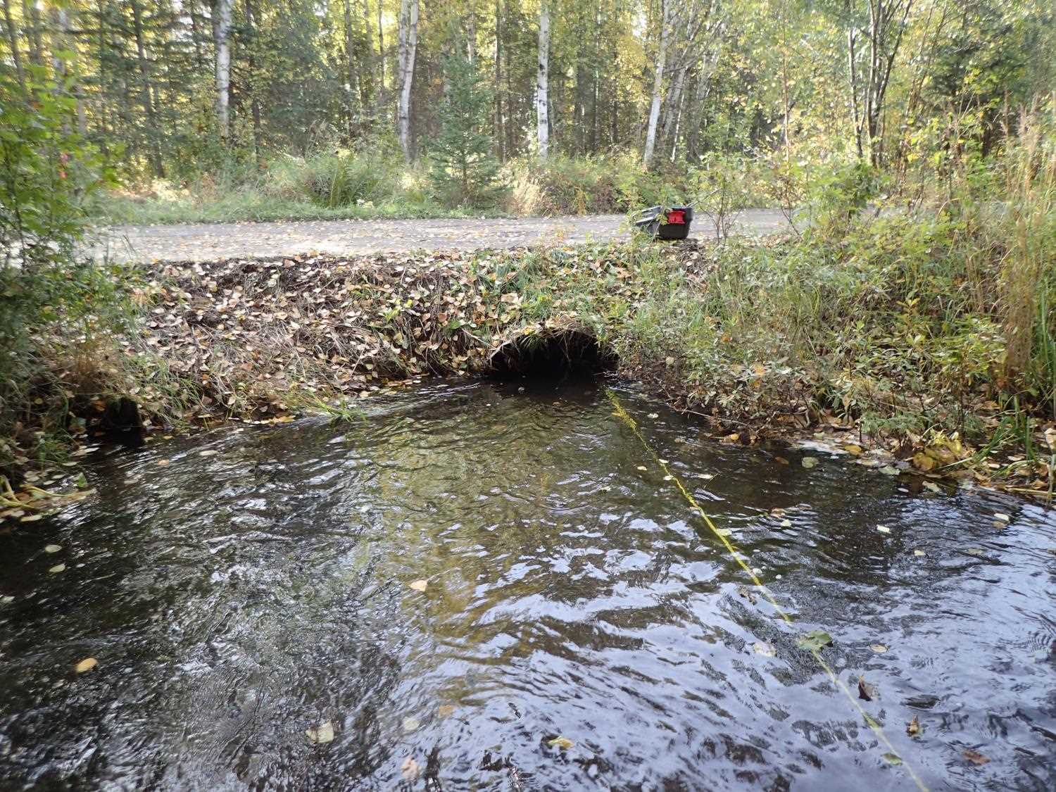
- Constriction ratio red
- Mechanical damage or joints parting
- Culvert sagging in middle
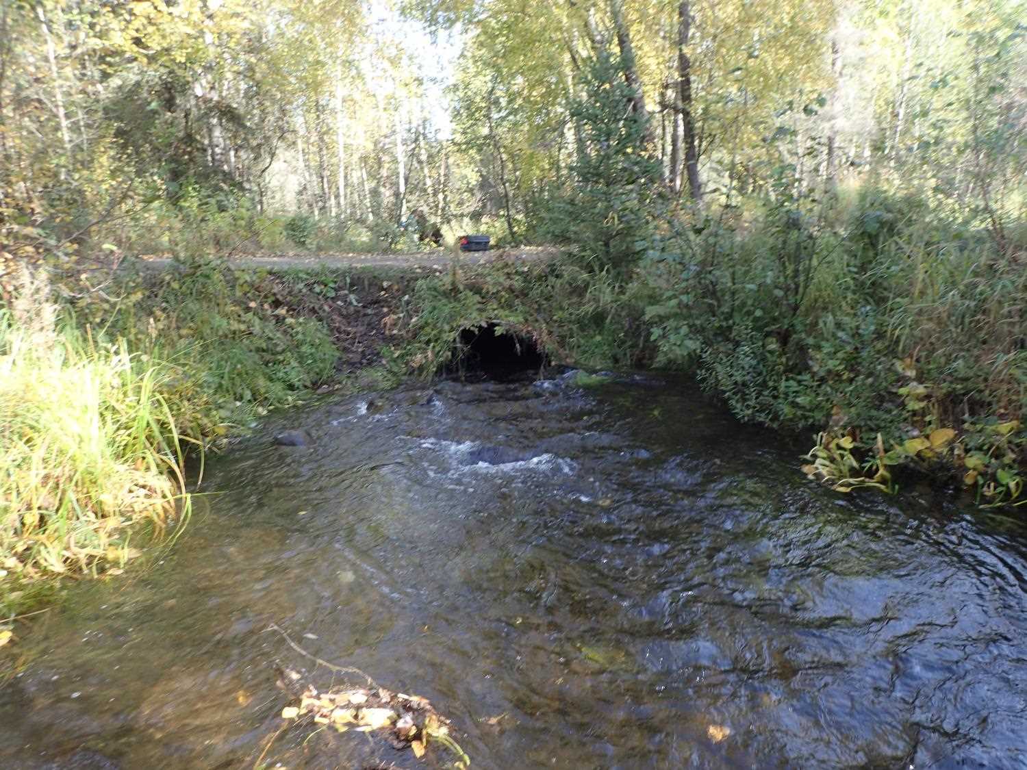
Comments: Juvenile fish spotted upstream, unknown species.
Culvert Measurements
| ID: 1 | Structure Type: Circular pipe (Corrugated steel) | Fish Passage Rating: | ||||||||||||||||||||||||||||||||||||||||||
|
|
|
||||||||||||||||||||||||||||||||||||||||||
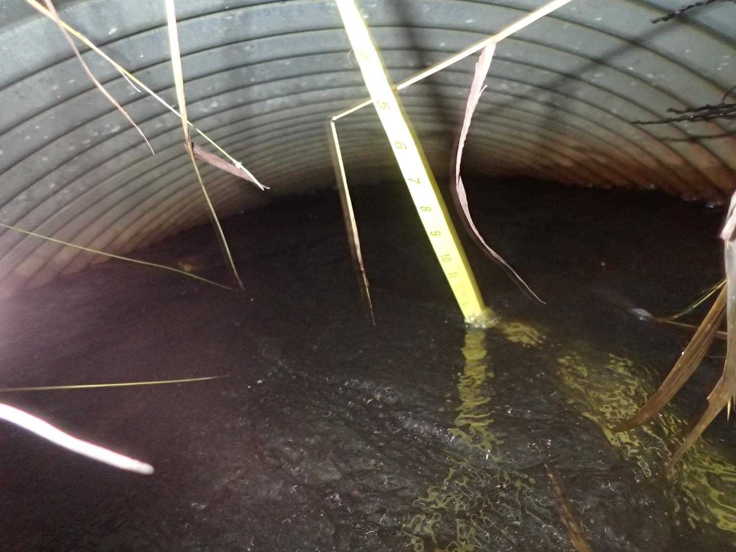
Comments: Culvert is sagging in the middle and full of water, could not use lazer for length; used tape measure. Outlet entry is flarred out from bottom and seperated from top from rust. (11/1/23 KL) |
||||||||||||||||||||||||||||||||||||||||||||
Culvert Observations:
|
||||||||||||||||||||||||||||||||||||||||||||
Stream Measurements
|
|
| Stream Width Type | Distance From Crossing (ft) |
Stream Width (ft) |
|---|---|---|
| Upstream ordinary high water | 15.0 | 15.10 |
| Upstream ordinary high water | 93.0 | 15.50 |
| Upstream ordinary high water | 119.0 | 10.90 |
| Upstream ordinary high water | 140.0 | 16.60 |
Elevations
| Locator ID | Culvert Number |
River Distance (ft)1 |
Distance From Crossing (ft)2 |
Relative Elevation (ft) |
|---|---|---|---|---|
| Road Elev | 95.39 | |||
| D/S Thalweg | 0.00 | 91.16 | ||
| D/S Water Surface Elev | 0.00 | 92.36 | ||
| D/S Water Surface Elev | 56.00 | 92.46 | ||
| D/S Thalweg | 56.00 | 91.18 | ||
| D/S Thalweg | 83.00 | 91.48 | ||
| D/S Water Surface Elev | 83.00 | 92.51 | ||
| Outlet Invert | 100.00 | 91.89 | ||
| D/S Water Surface Elev | 100.00 | 92.65 | ||
| Outlet Culvert Top | 100.00 | 93.91 | ||
| Inlet Culvert Top | 122.70 | 94.03 | ||
| Inlet Culvert Invert | 122.70 | 92.28 | ||
| U/S Water Surface Elev | 122.70 | 93.04 | ||
| D/S Water Surface Elev | 134.70 | 93.15 | ||
| D/S Thalweg | 134.70 | 92.10 | ||
| D/S Thalweg | 180.70 | 92.52 | ||
| D/S Water Surface Elev | 180.70 | 93.29 | ||
| D/S Thalweg | 193.70 | 92.88 | ||
| D/S Water Surface Elev | 193.70 | 93.41 | ||
| D/S Water Surface Elev | 241.70 | 93.87 | ||
| D/S Thalweg | 241.70 | 93.31 |
Notes:
- River distance is measured continuously throughout the survey reach along the thalweg of the stream.
- Measured from each end of the crossing along the thalweg of the stream.
Fish Sampling Efforts
No fish sampling occurred during this survey.
Fish Observations
No fish observations occurred during this survey.
Photos

Questions or comments about this report can be directed to dfg.dsf.webmaster@alaska.gov