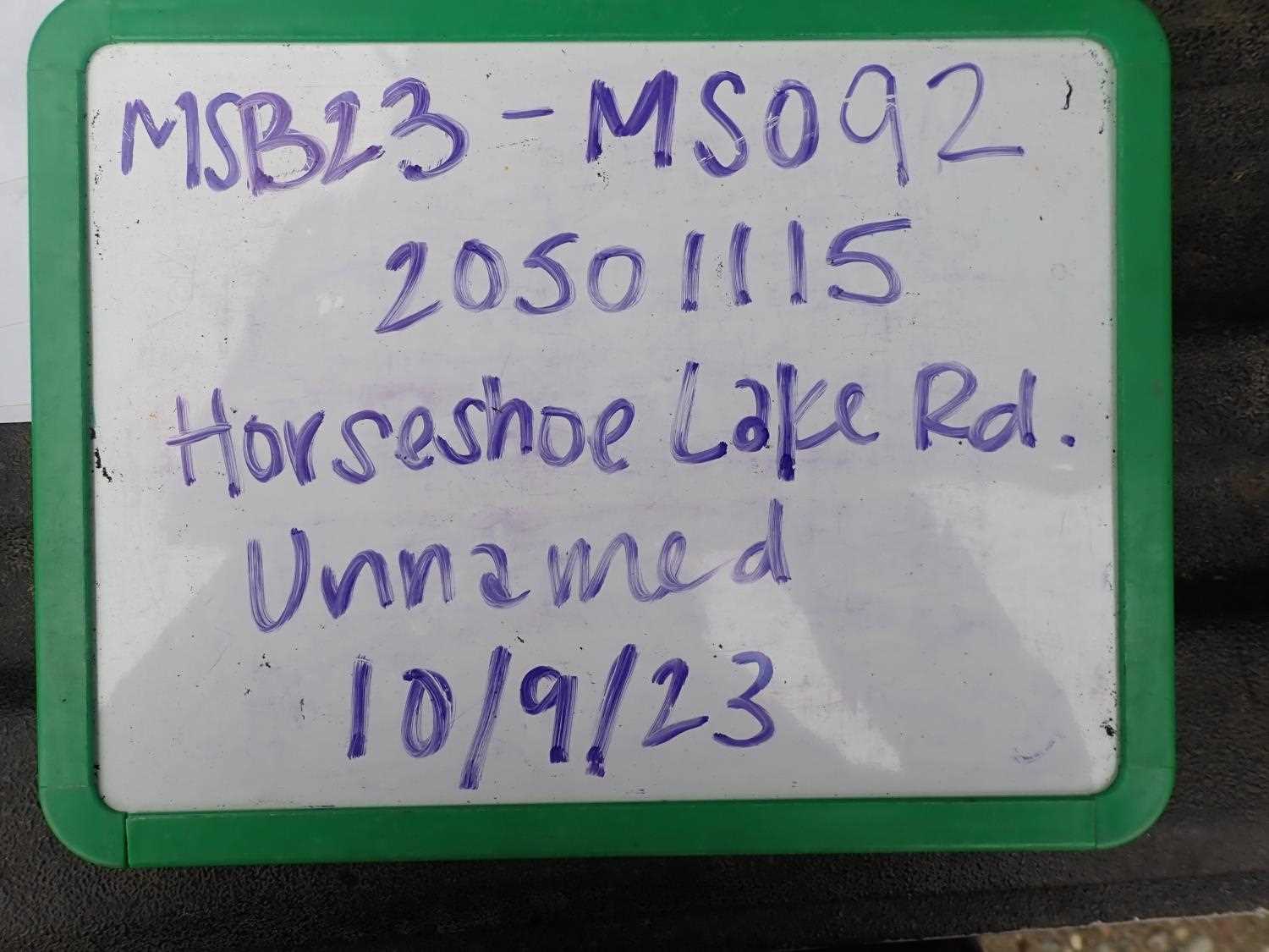
Fish Passage Site 20501115
Coordinates (dec. deg.): 62.48607°, -150.76566°
Legal Description: S028N008W28
Region: South Central
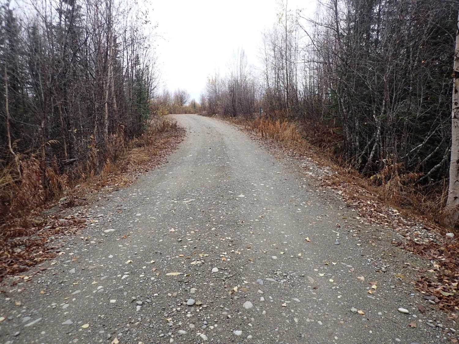
Road Name: Horseshoe Lake Road
Datum: NAD83
Quad Name / ITM: Talkeetna B-2
AWC Stream #:
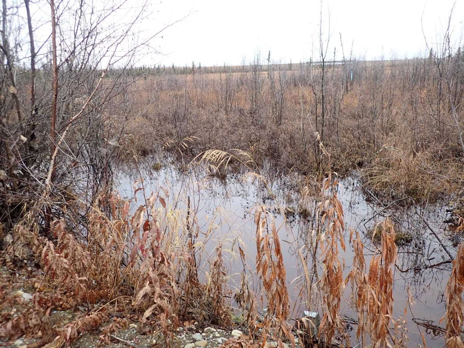
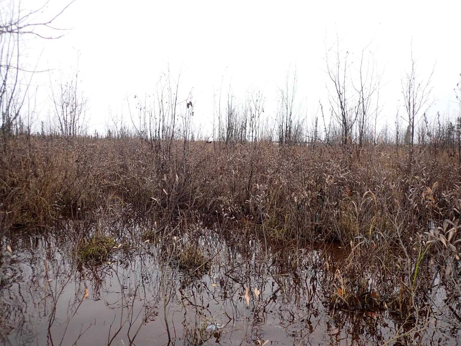
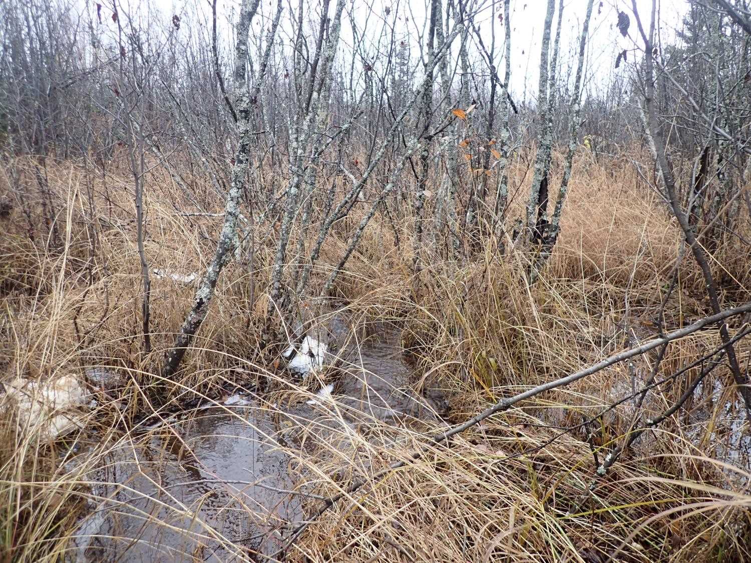
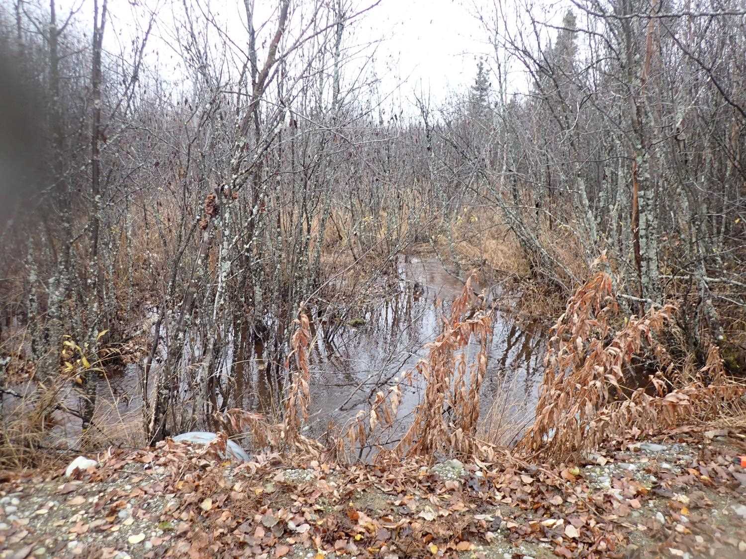
Stream Name: Unnamed
Elevation:
Site Comments: None
arrow to the right of the survey date below to choose a different report for this site.
Survey MSB23-MS092
Project Supervisor: Michael Mazzacavallo, Alaska Department of Fish and Game
— Anchorage, AK
Observers: Michael Mazzacavallo, Kat Leavitt, Beth Evers
Overall Fish Passage Rating:
Tidal: No
Backwatered: Yes
Step Pools: No
Construction Year:
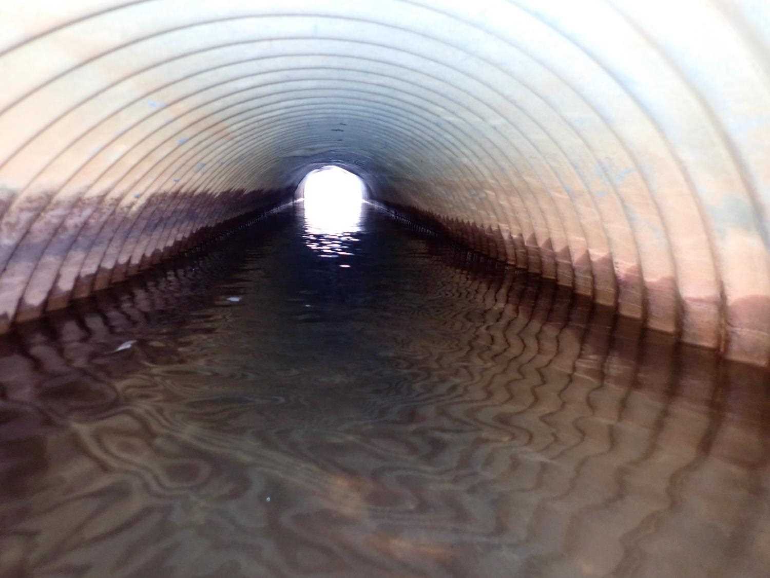
Site Observations:
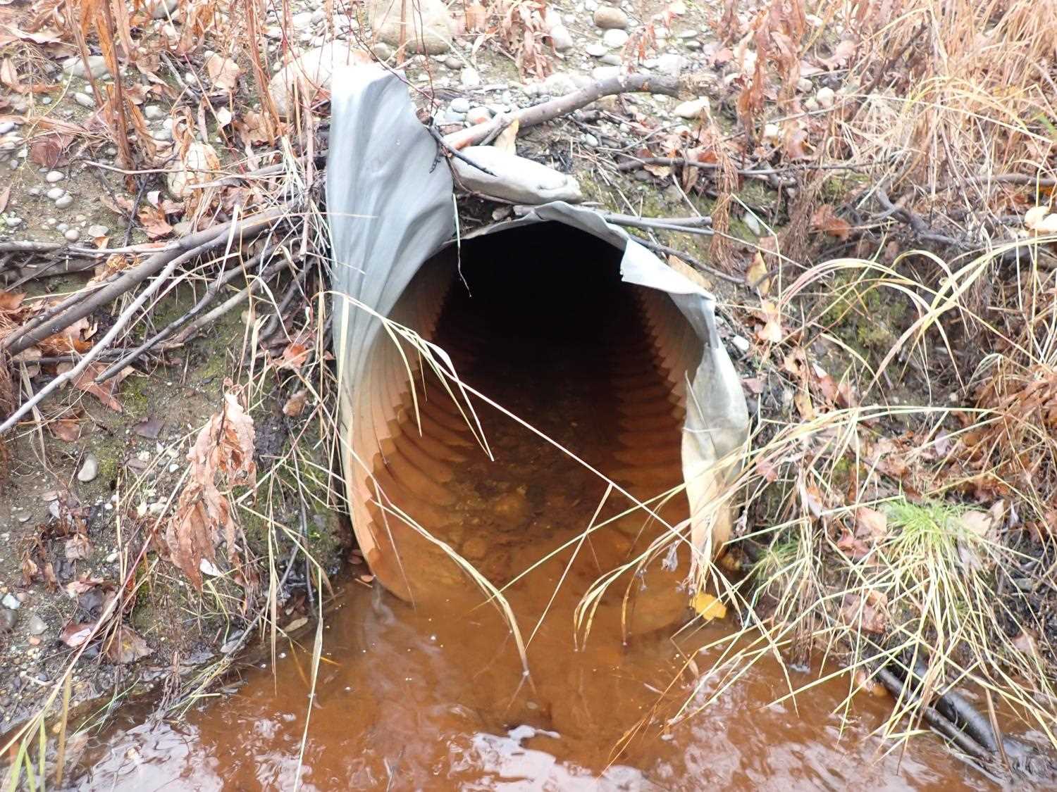
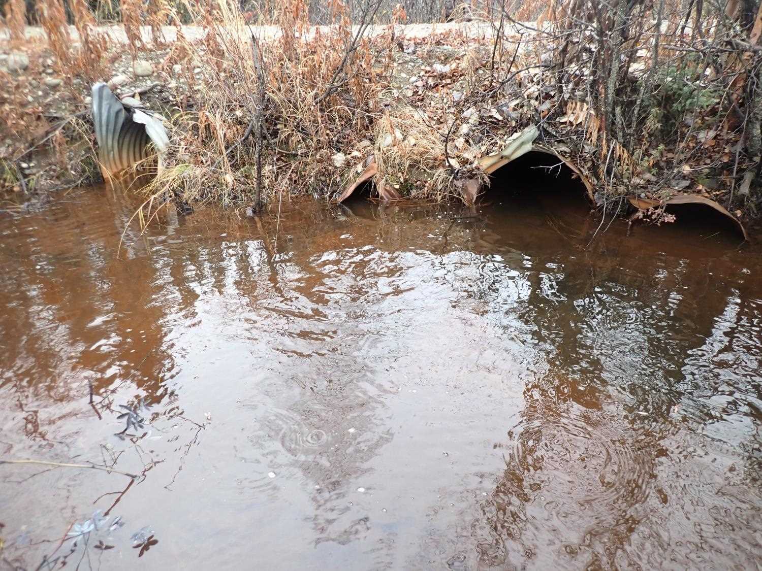
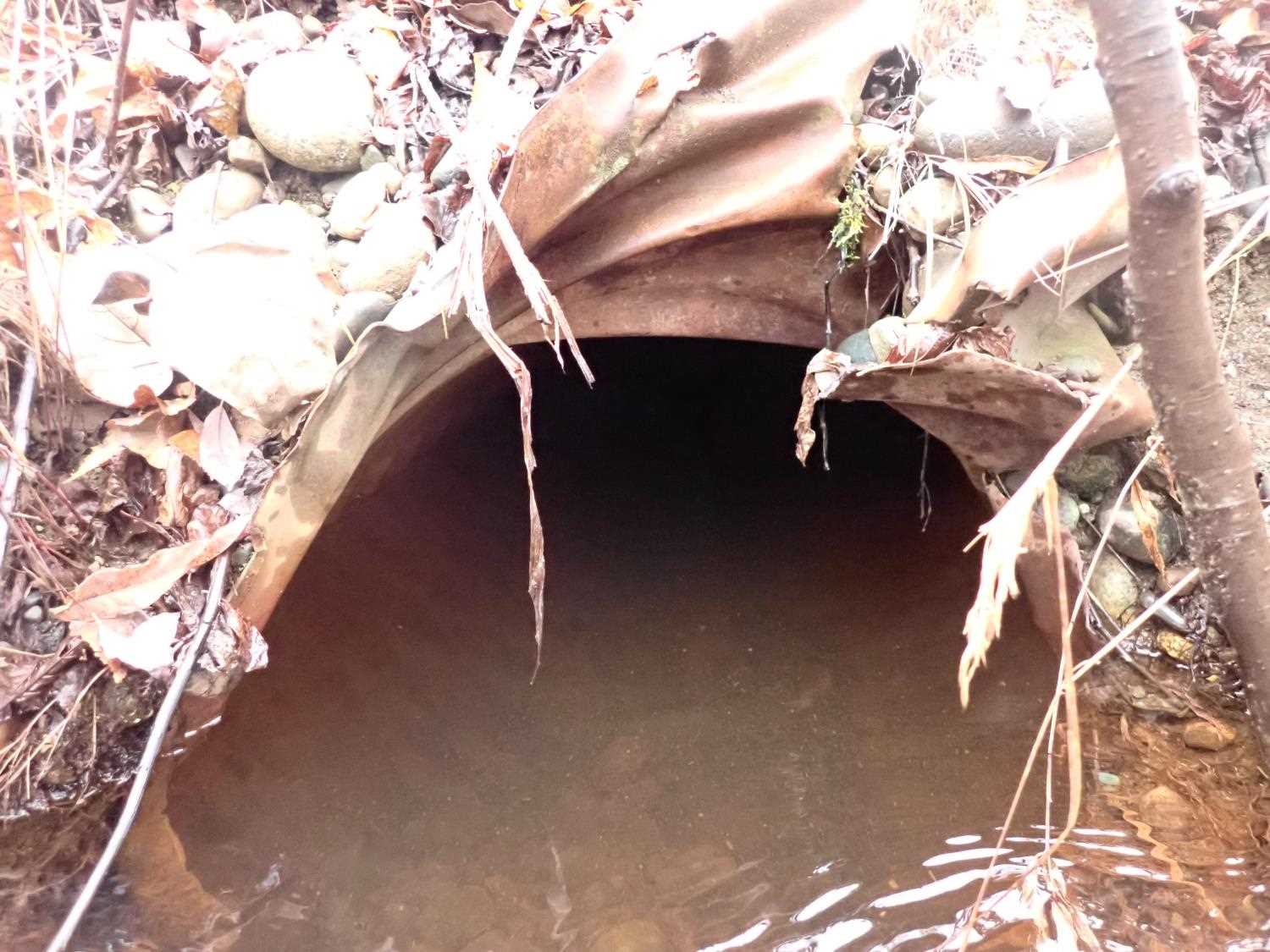
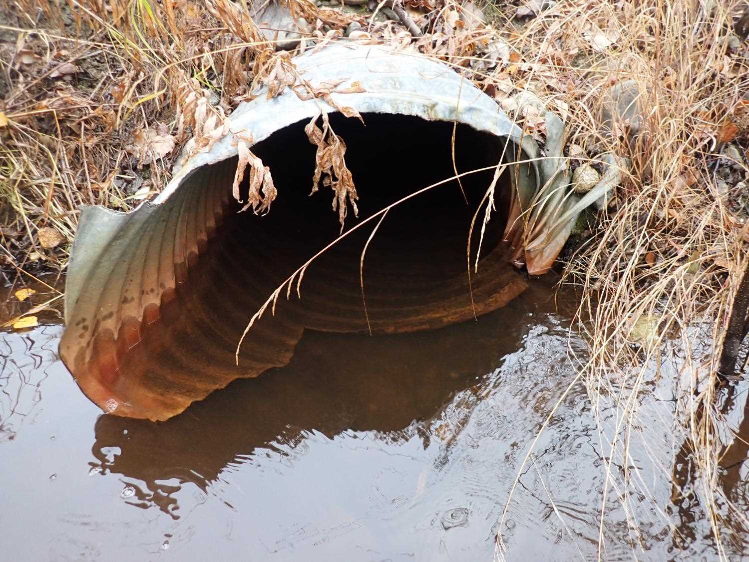
- Inlet perch
- Mechanical damage or joints parting
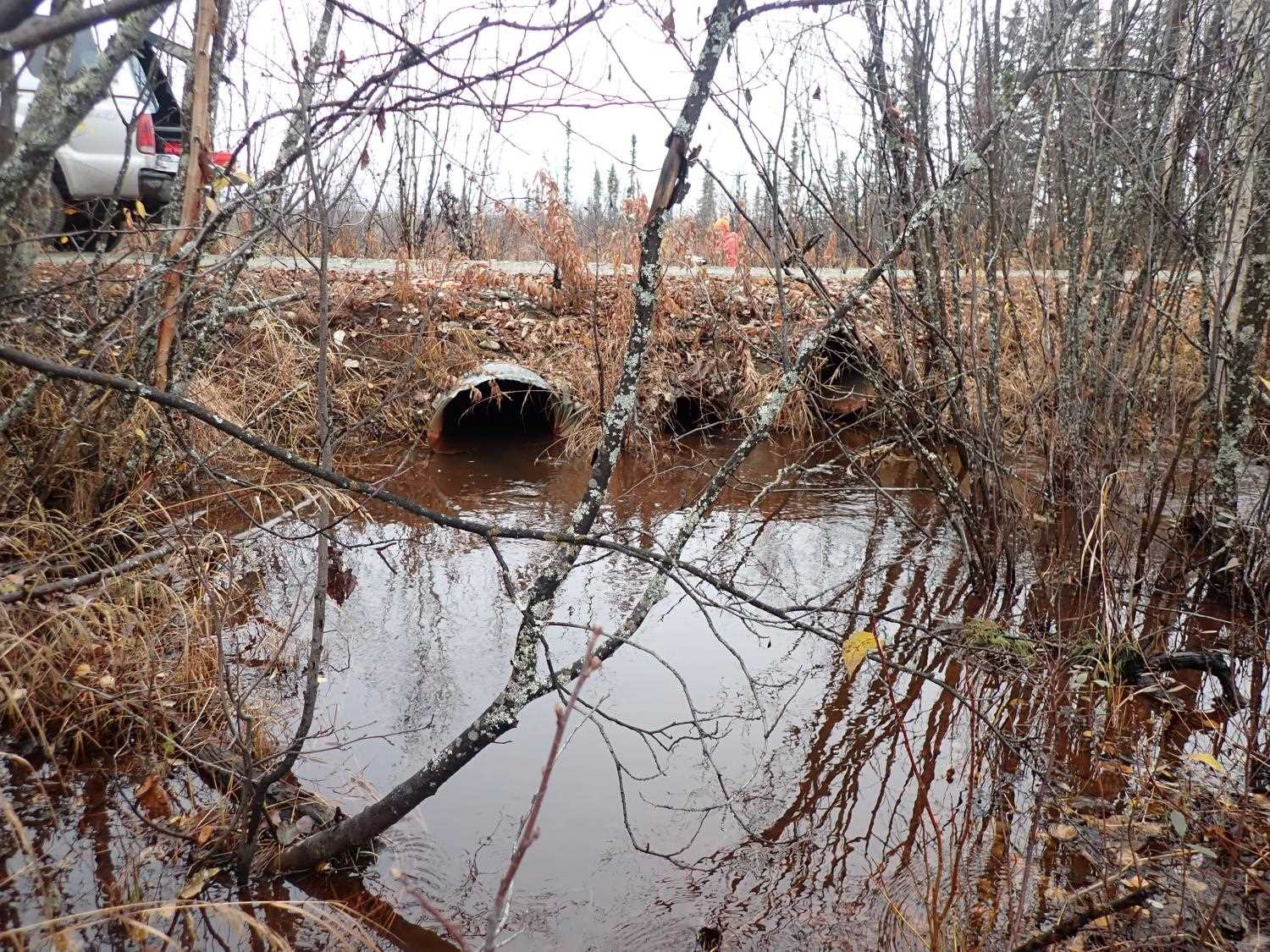
- Road Fill (pushed off road by grader)
- Culvert gradient red
Comments: Landowner stated that they have never seen fish in streams.
Culvert Measurements
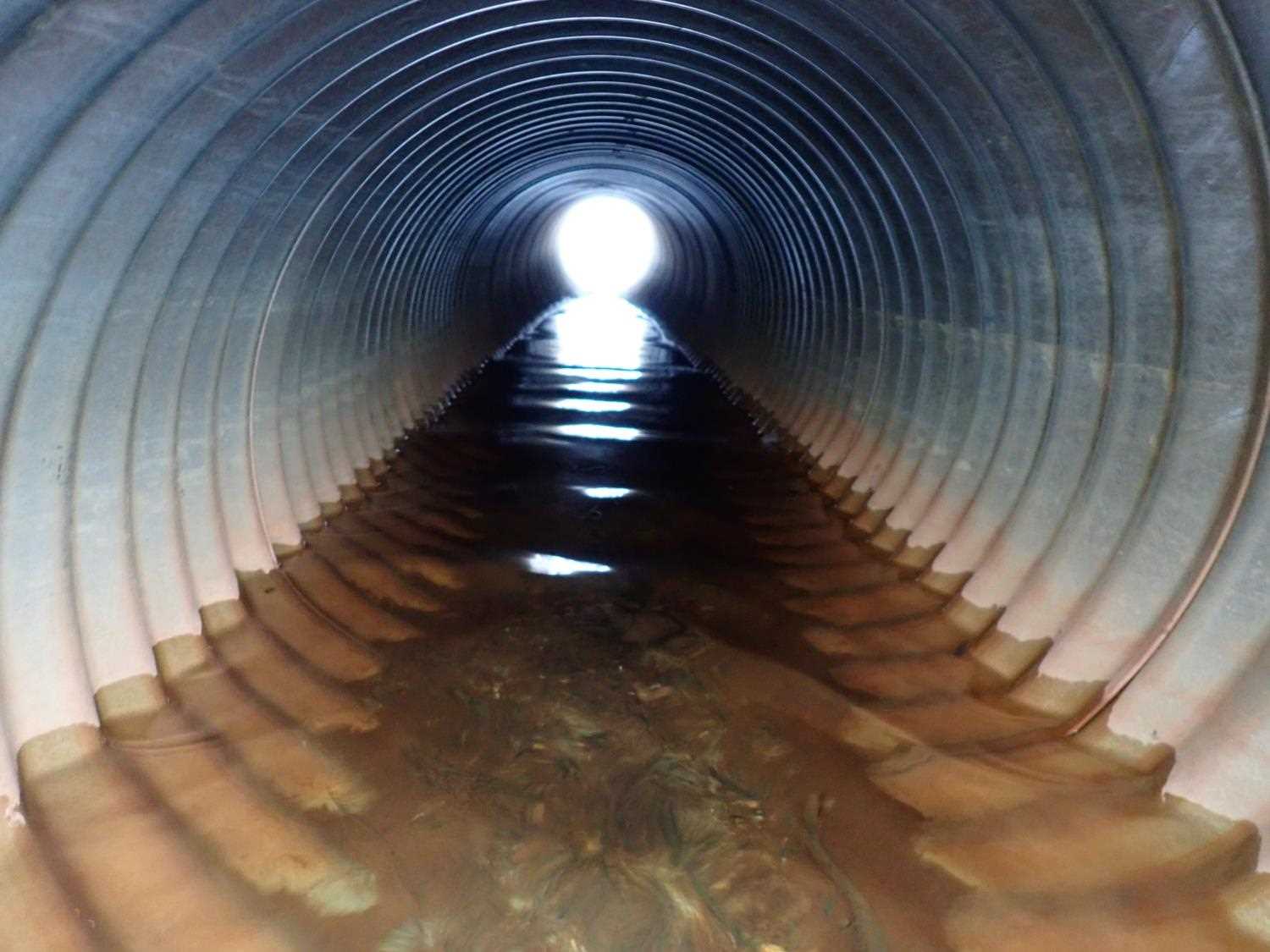
| ID: 1 | Structure Type: Circular pipe (Corrugated steel) | Fish Passage Rating: | ||||||||||||||||||||||||||||||||||||||||||
|
|
|
||||||||||||||||||||||||||||||||||||||||||
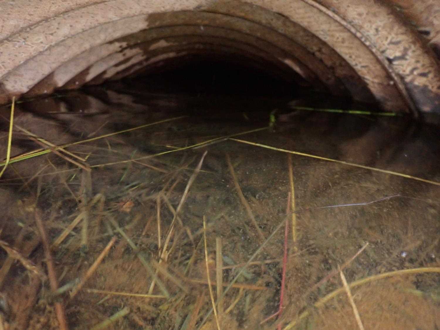
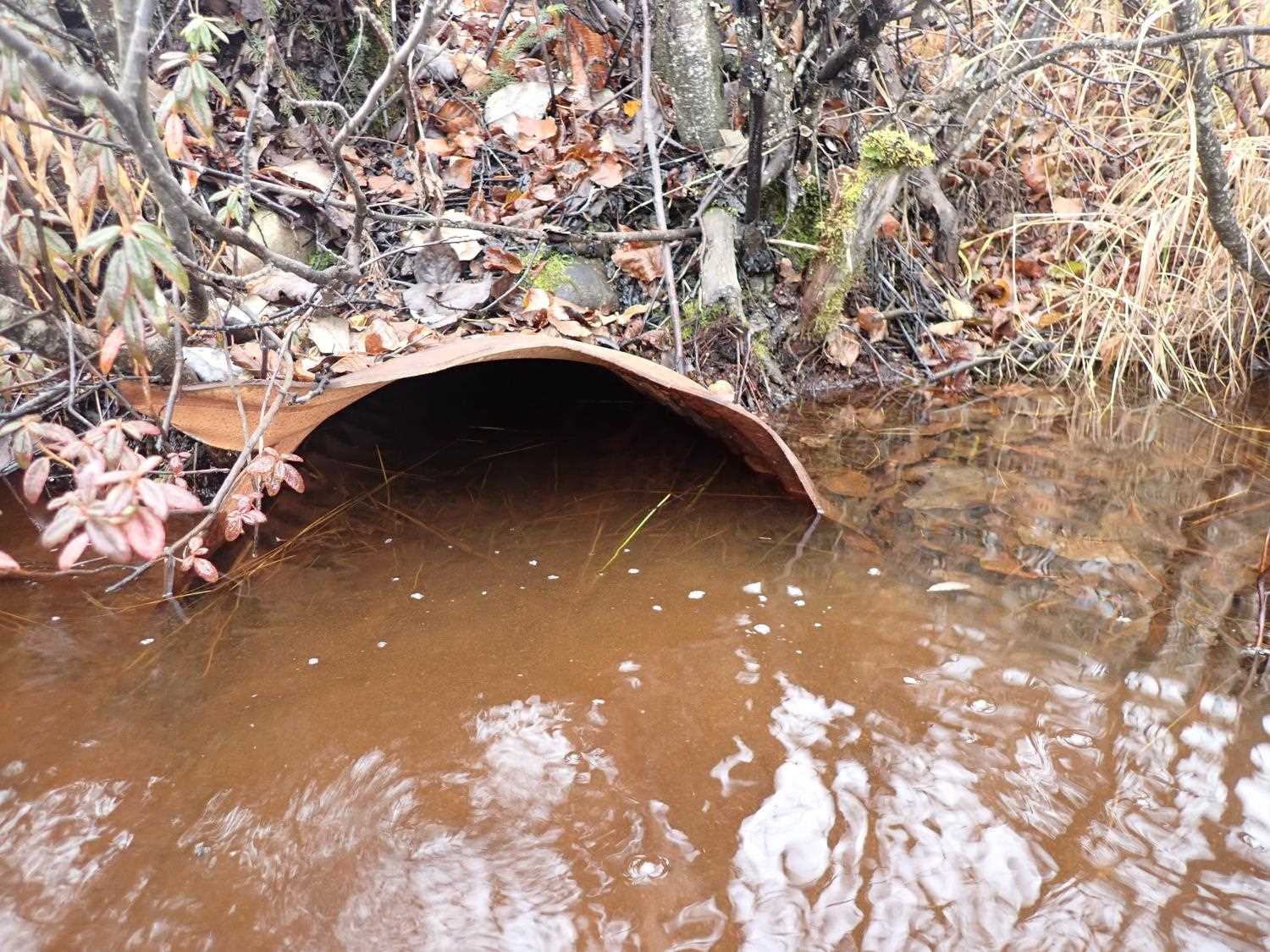
Comments: No flow at outlet #1. Inlet #1 has damaged/ bent entry. |
||||||||||||||||||||||||||||||||||||||||||||
Culvert Observations:
|
||||||||||||||||||||||||||||||||||||||||||||
| ID: 2 | Structure Type: Circular pipe (Corrugated steel) | Fish Passage Rating: | ||||||||||||||||||||||||||||||||||||||||||
|
|
|
||||||||||||||||||||||||||||||||||||||||||
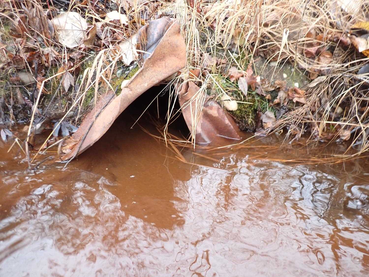
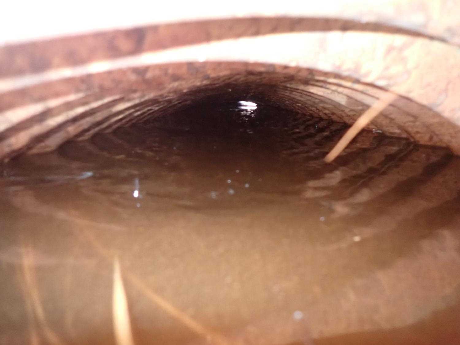
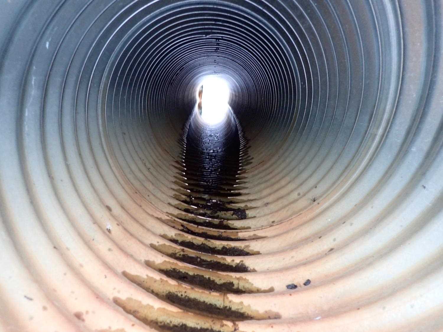
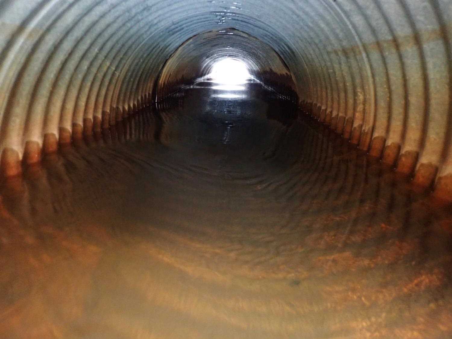
Comments: Culvert #2 outlet and inlet entry is severly damaged/bent; however, still has significant flow. Culvert #2 inlet rustline is 100%, the whole culvert is rusted throughout. |
||||||||||||||||||||||||||||||||||||||||||||
Culvert Observations:
|
||||||||||||||||||||||||||||||||||||||||||||
| ID: 3 | Structure Type: Circular pipe (Corrugated steel) | Fish Passage Rating: | ||||||||||||||||||||||||||||||||||||||||||
|
|
|
||||||||||||||||||||||||||||||||||||||||||
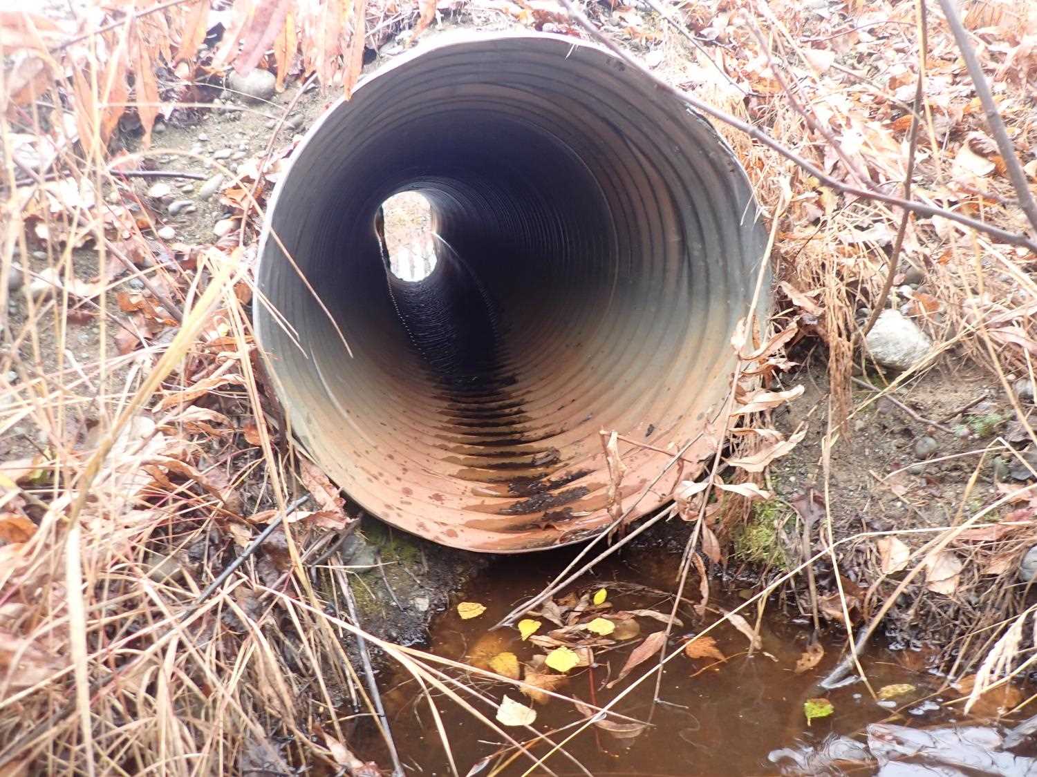
Comments: Culvert#3 outlet is torn apart, severely damaged; however, still has significant flow. |
||||||||||||||||||||||||||||||||||||||||||||
Culvert Observations:
|
||||||||||||||||||||||||||||||||||||||||||||
| ID: 4 | Structure Type: Circular pipe (Corrugated steel) | Fish Passage Rating: | |||||||||||||||||||||||||||||||||||||||||
|
|
|
|||||||||||||||||||||||||||||||||||||||||
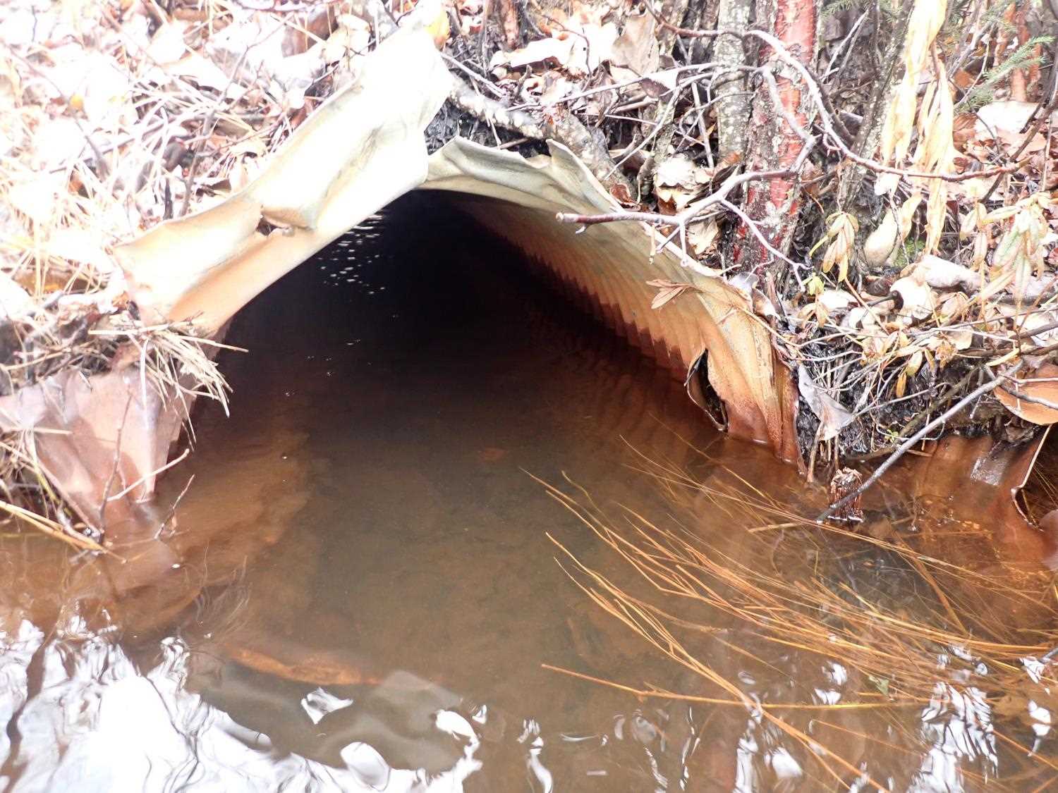
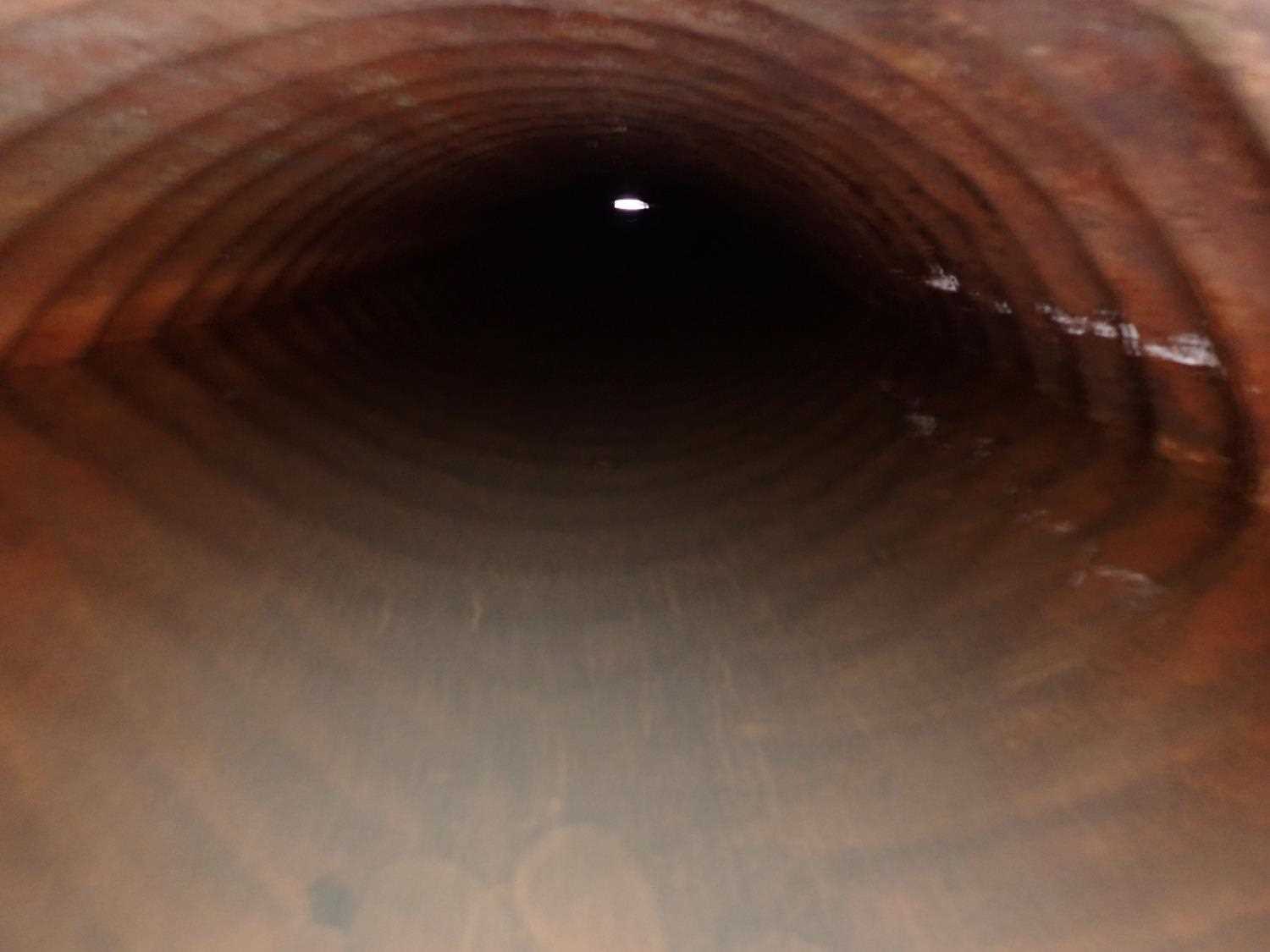
Comments: Rated as black due to outlet being buried and unable to find. It is evident from the inlet side, that the culvert is rusted throughout. Inlet for culvert #4 is damaged and bent severely. |
|||||||||||||||||||||||||||||||||||||||||||
Stream Measurements
|
|
No stream width data available.
Elevations
| Locator ID | Culvert Number |
River Distance (ft)1 |
Distance From Crossing (ft)2 |
Relative Elevation (ft) |
|---|---|---|---|---|
| D/S Thalweg | 25.00 | 96.27 | ||
| D/S Water Surface Elev | 25.00 | 96.84 | ||
| U/S Water Surface Elev | 30.00 | 96.86 | ||
| Top of Pipe Inlet ((-0.3)) | 2 | 30.00 | 97.36 | |
| Inlet Culvert Top | 4 | 30.00 | 97.45 | |
| U/S Water Surface Elev (Culvert water surface) | 1 | 30.00 | 96.88 | |
| U/S Water Surface Elev | 3 | 30.00 | 96.88 | |
| U/S Water Surface Elev | 4 | 30.00 | 96.88 | |
| D/S Water Surface Elev | 30.00 | 96.40 | ||
| Inlet Culvert Invert | 1 | 30.00 | 96.41 | |
| U/S Water Surface Elev | 2 | 30.00 | 96.84 | |
| Inlet Culvert Invert | 2 | 30.00 | 95.26 | |
| Inlet Culvert Invert | 3 | 30.00 | 95.42 | |
| Inlet Culvert Invert | 4 | 30.00 | 95.60 | |
| Inlet Culvert Top ((-0.5)) | 3 | 30.00 | 97.93 | |
| Inlet Culvert Top ((-0.8)) | 1 | 30.00 | 98.43 | |
| Outlet Culvert Top | 1 | 54.30 | 99.07 | |
| Outlet Invert | 1 | 54.30 | 97.06 | |
| Outlet Culvert Top | 3 | 55.90 | 98.29 | |
| Outlet Invert | 3 | 55.90 | 95.40 | |
| D/S Water Surface Elev | 3 | 55.90 | 96.87 | |
| Outlet Culvert Top ((-0.5)) | 2 | 56.00 | 97.70 | |
| D/S Water Surface Elev (Culvert water surface) | 2 | 56.00 | 96.89 | |
| Outlet Invert | 2 | 56.00 | 95.64 |
Notes:
- River distance is measured continuously throughout the survey reach along the thalweg of the stream.
- Measured from each end of the crossing along the thalweg of the stream.
Fish Sampling Efforts
No fish sampling occurred during this survey.
Fish Observations
No fish observations occurred during this survey.
Photos
Questions or comments about this report can be directed to dfg.dsf.webmaster@alaska.gov