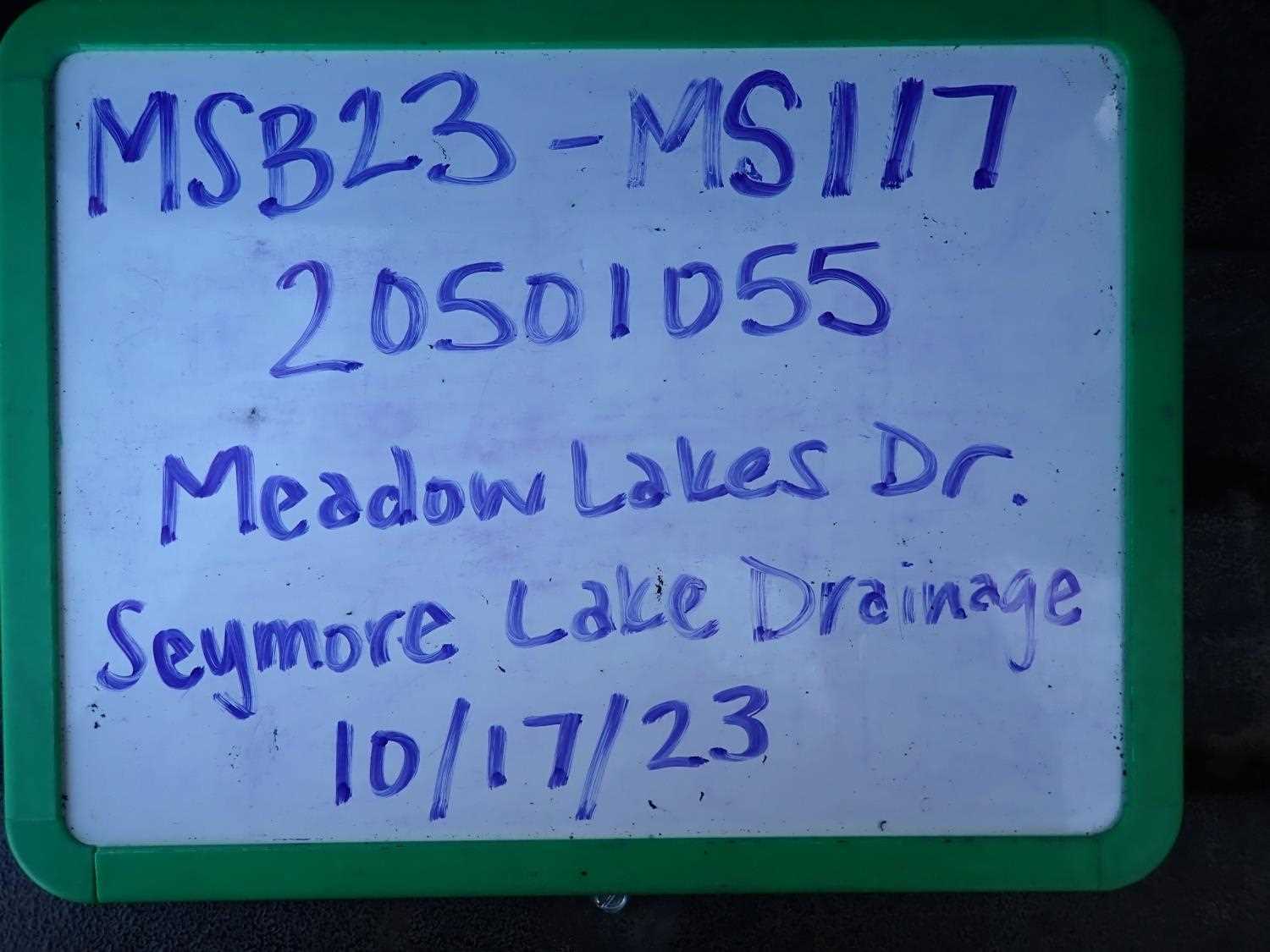
Fish Passage Site 20501055
Coordinates (dec. deg.): 61.59752°, -149.67761°
Legal Description: S017N002W05
Region: South Central
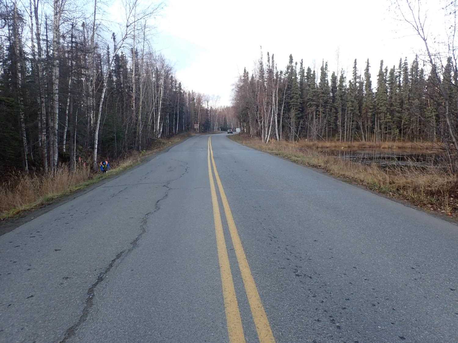
Road Name: Meadow Lakes Drive
Datum: NAD83
Quad Name / ITM: Anchorage C-8
AWC Stream #:
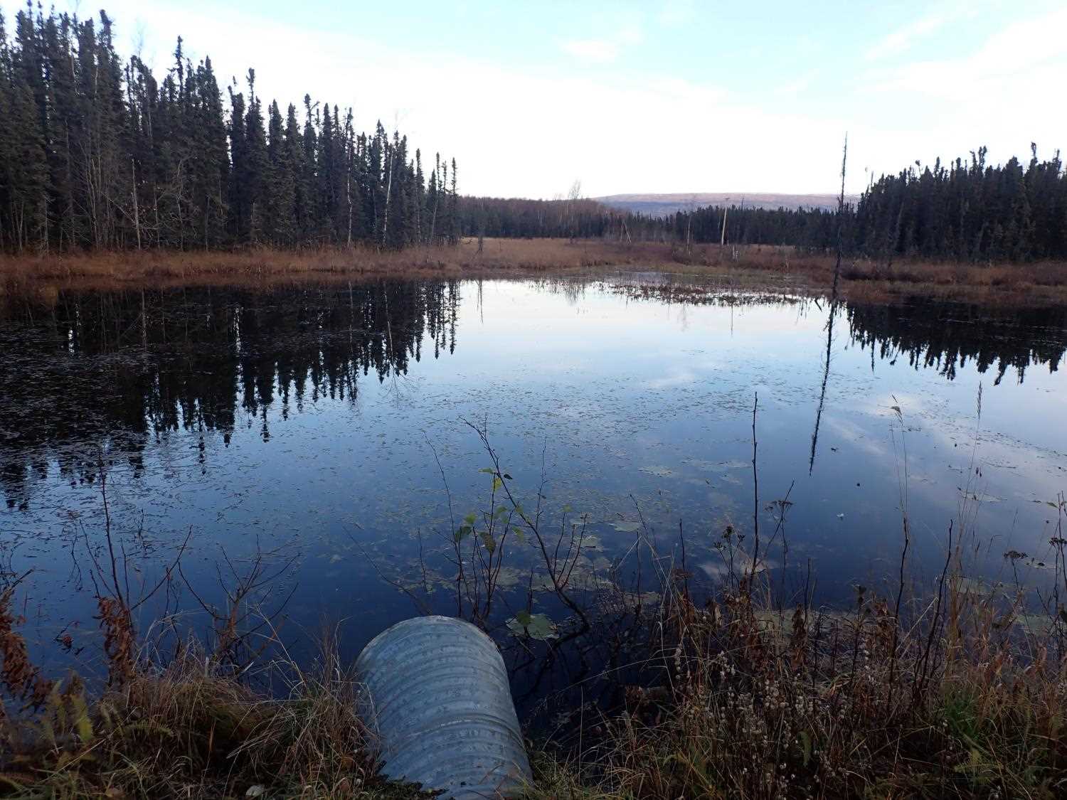
Stream Name: Seymore Lake Drainage
Elevation:
Site Comments: None
arrow to the right of the survey date below to choose a different report for this site.
Survey MSB23-MS117
Project Supervisor: Michael Mazzacavallo, Alaska Department of Fish and Game
— Anchorage, AK
Observers: Michael Mazzacavallo, Kat Leavitt, Beth Evers, Amy LaBarre
Overall Fish Passage Rating:
Tidal: No
Backwatered: No
Step Pools: No
Construction Year:
Site Observations:
- Constriction ratio gray
- Other, including vibrations, cavitation, etc.
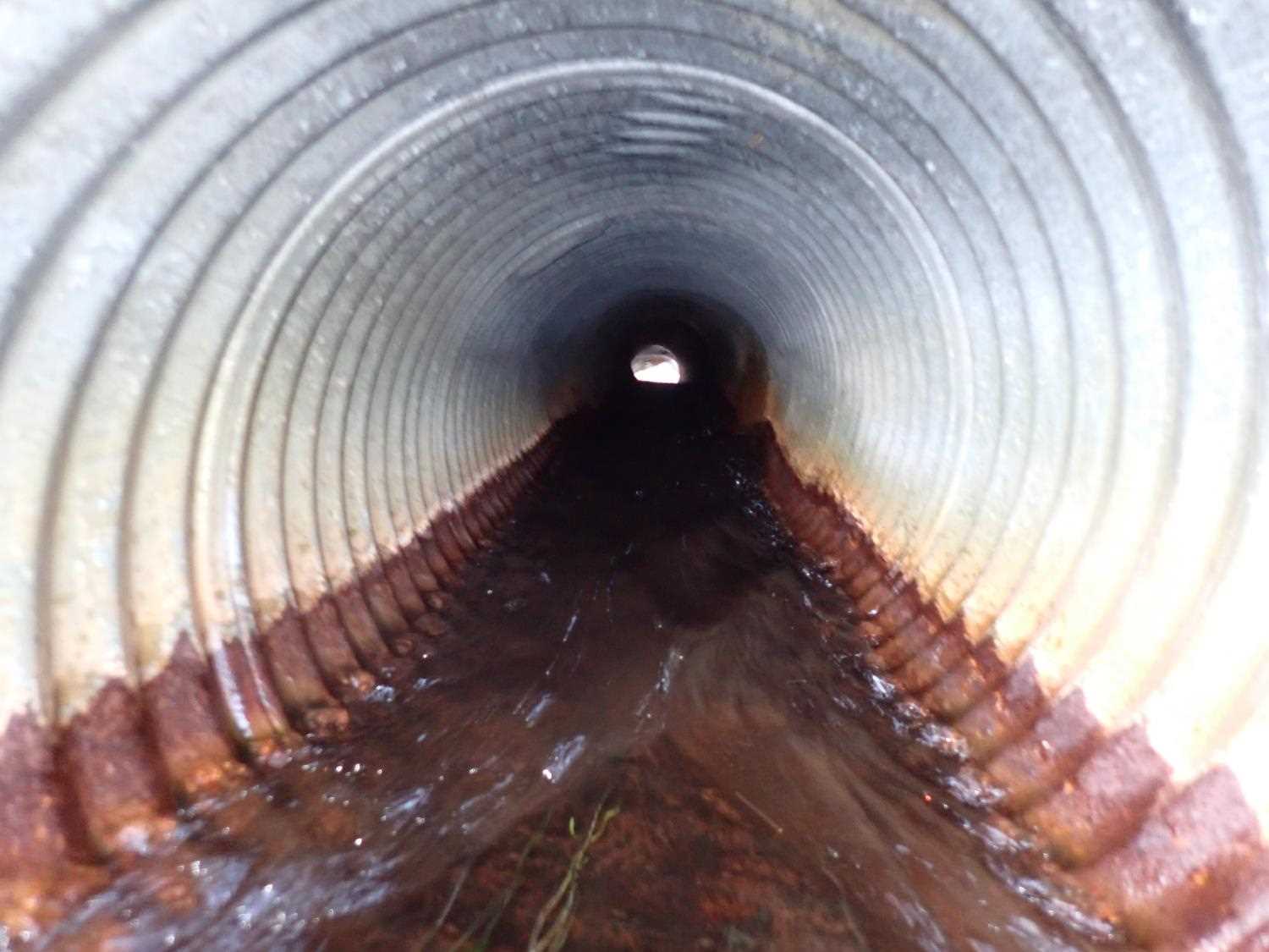
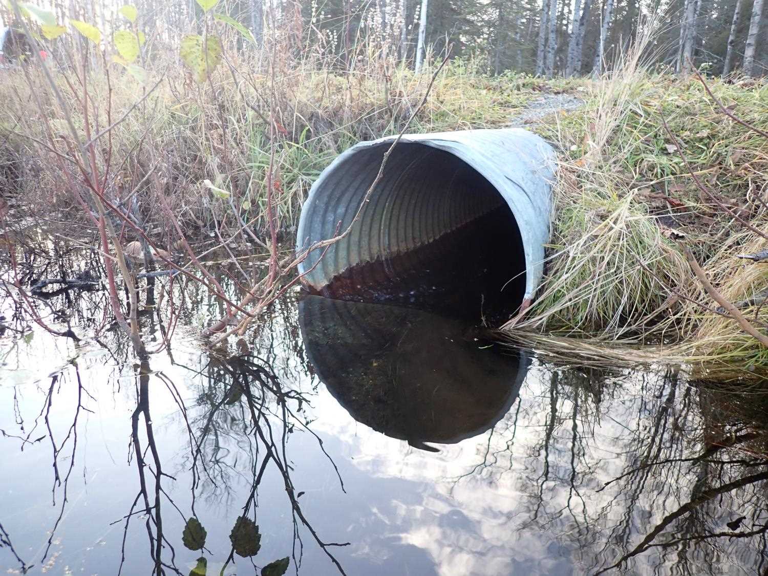
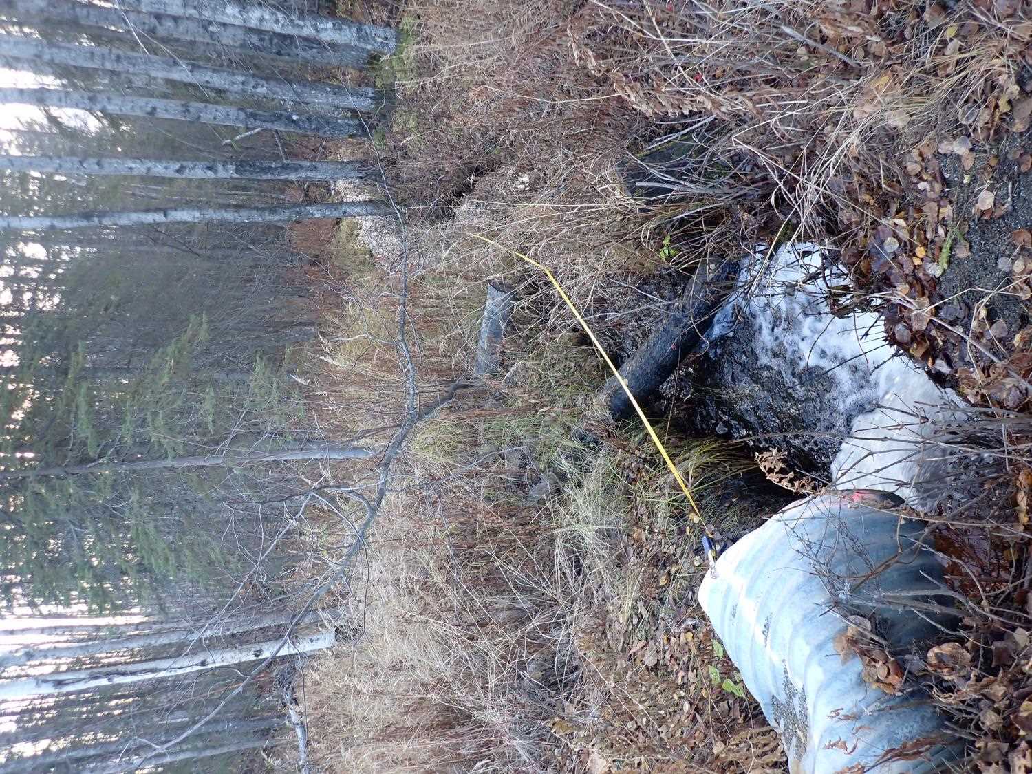
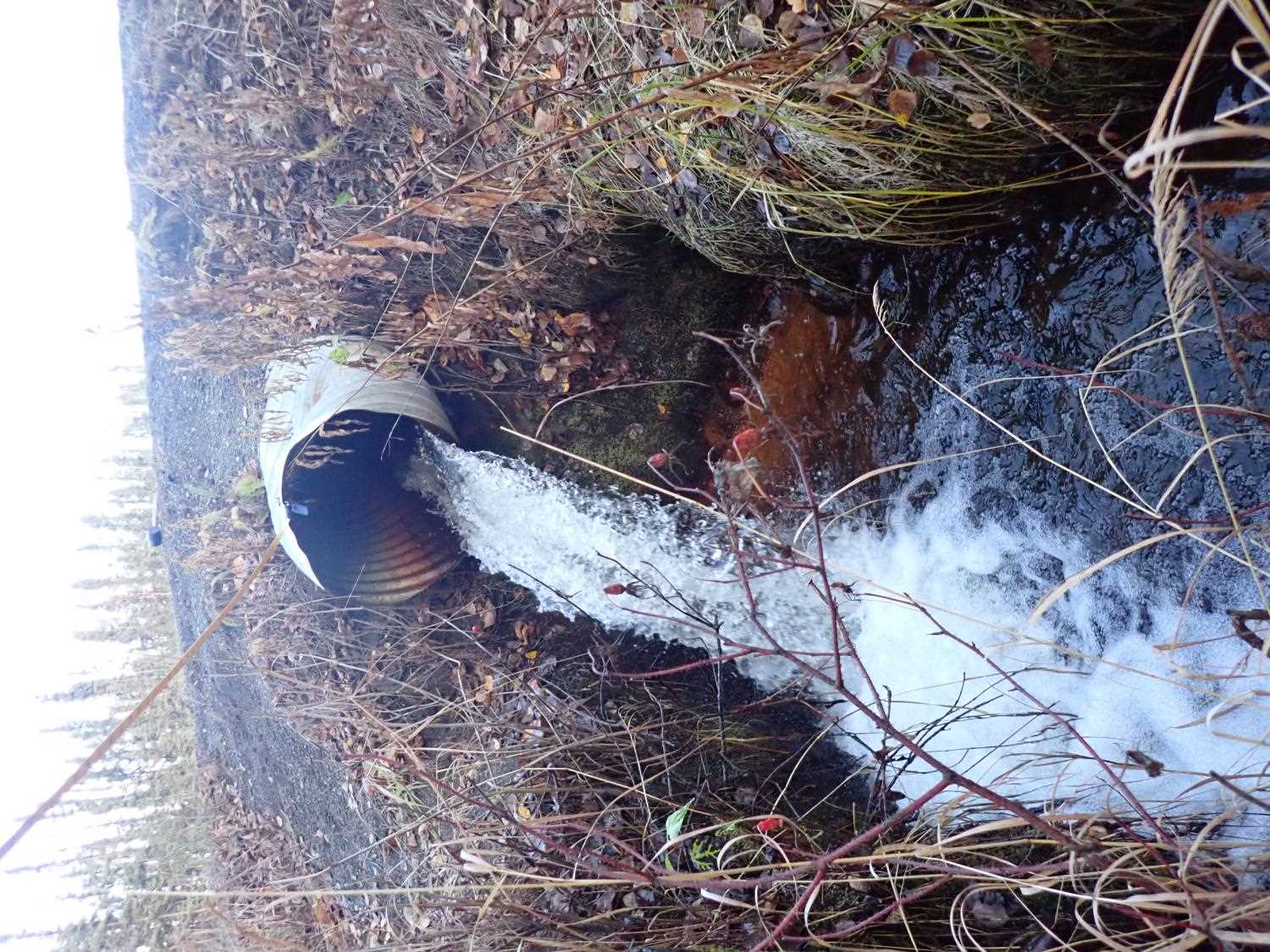
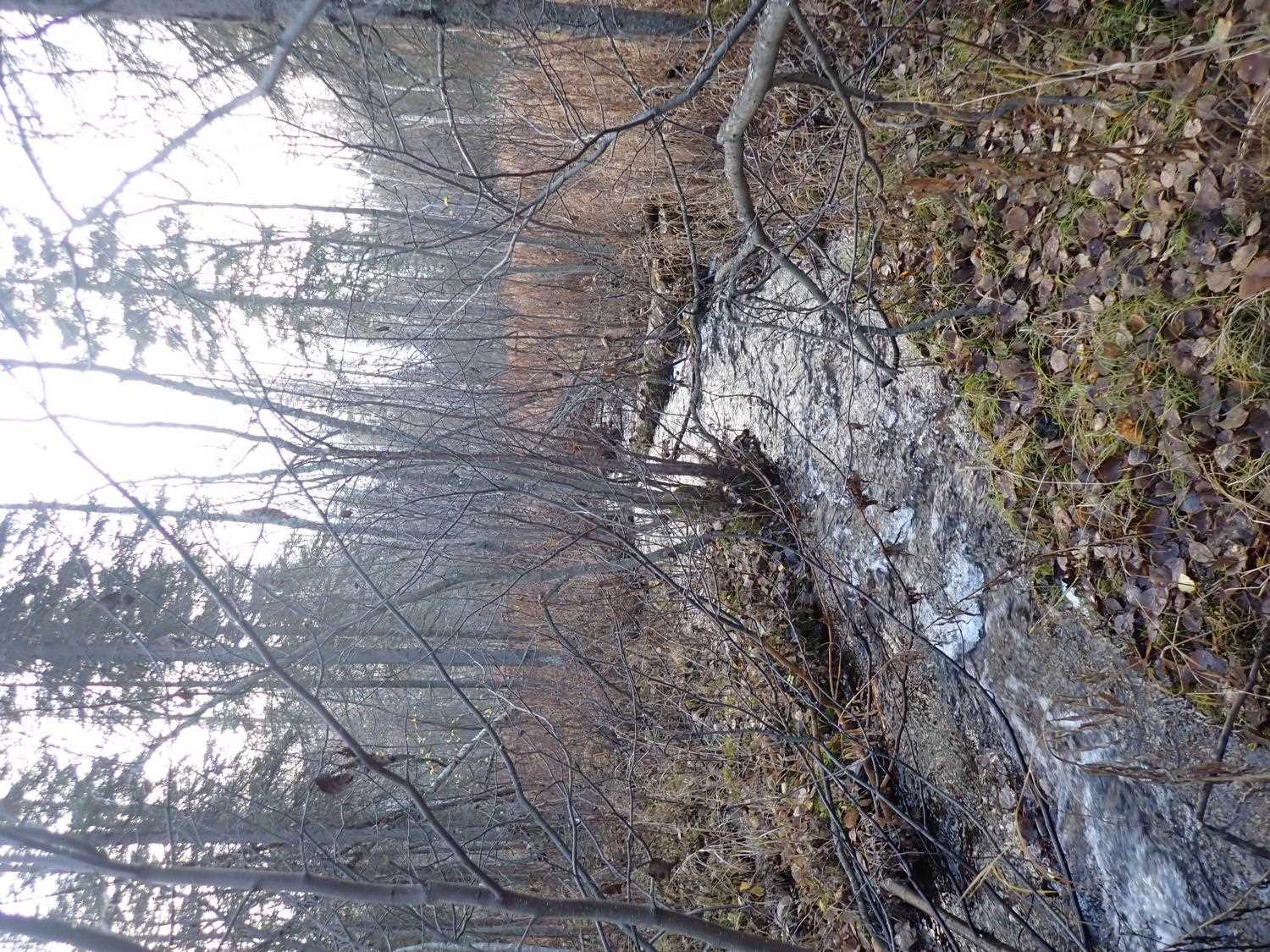
Comments: Landowner stated that he has observed stickleback fish in inlet pond and or juvenile. Outlet has waterfall and deep scouring. Inlet fed by pond.
Culvert Measurements
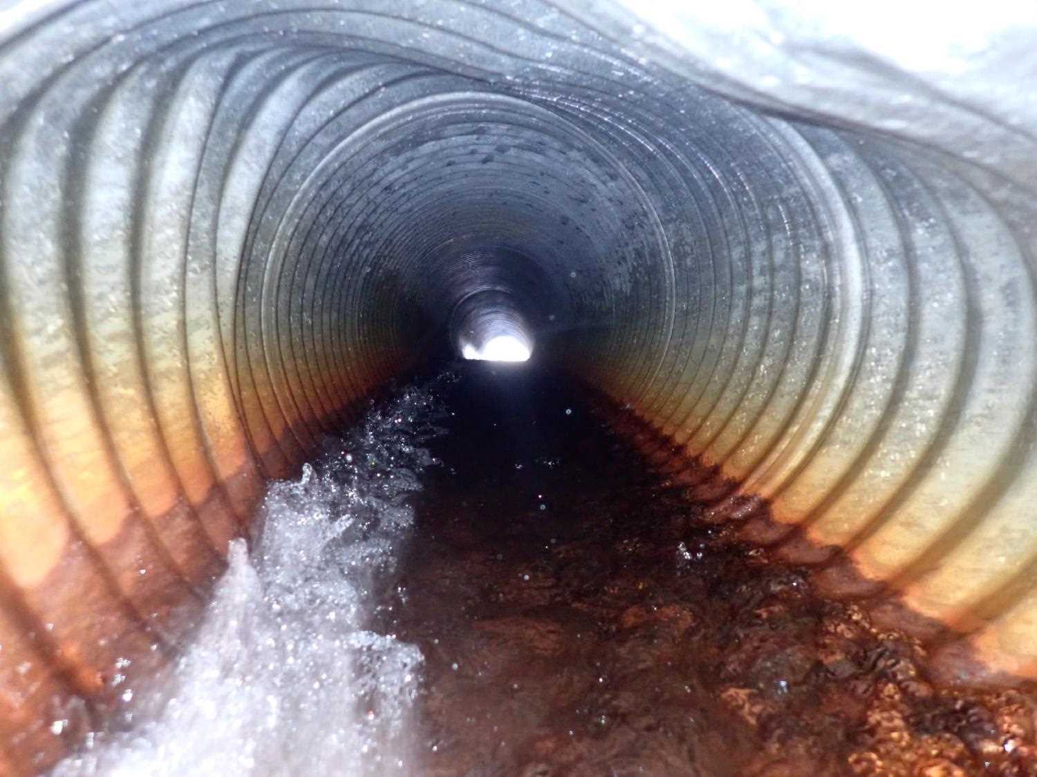
| ID: 1 | Structure Type: Circular pipe (Corrugated steel) | Fish Passage Rating: | ||||||||||||||||||||||||||||||||||||||||||
|
|
|
||||||||||||||||||||||||||||||||||||||||||
Comments: Outlet bent, warped |
||||||||||||||||||||||||||||||||||||||||||||
Culvert Observations:
|
||||||||||||||||||||||||||||||||||||||||||||
Stream Measurements
|
|
| Stream Width Type | Distance From Crossing (ft) |
Stream Width (ft) |
|---|---|---|
| Downstream ordinary high water | 20.0 | 5.30 |
| Downstream ordinary high water | 71.0 | 5.10 |
| Downstream ordinary high water | 106.0 | 5.00 |
Elevations
| Locator ID | Culvert Number |
River Distance (ft)1 |
Distance From Crossing (ft)2 |
Relative Elevation (ft) |
|---|---|---|---|---|
| Road Elev | 100.50 | |||
| U/S Water Surface Elev | 0.00 | 98.53 | ||
| U/S Water Surface Elev | 3.00 | 98.51 | ||
| U/S Thalweg | 3.00 | 97.39 | ||
| Inlet Culvert Invert | 4.00 | 97.89 | ||
| U/S Water Surface Elev | 4.00 | 98.46 | ||
| Inlet Culvert Top | 4.00 | 99.28 | ||
| Outlet Culvert Top | 45.96 | 97.79 | ||
| Outlet Invert | 45.96 | 95.36 | ||
| D/S Water Surface Elev | 45.96 | 96.00 | ||
| Max Pool Depth | 49.96 | 92.01 | ||
| D/S Water Surface Elev | 49.96 | 92.48 | ||
| D/S Thalweg | 116.96 | 89.29 | ||
| D/S Water Surface Elev | 116.96 | 89.89 | ||
| D/S Thalweg | 151.96 | 87.58 | ||
| D/S Water Surface Elev | 151.96 | 88.16 |
Notes:
- River distance is measured continuously throughout the survey reach along the thalweg of the stream.
- Measured from each end of the crossing along the thalweg of the stream.
Fish Sampling Efforts
No fish sampling occurred during this survey.
Fish Observations
No fish observations occurred during this survey.
Photos
Questions or comments about this report can be directed to dfg.dsf.webmaster@alaska.gov