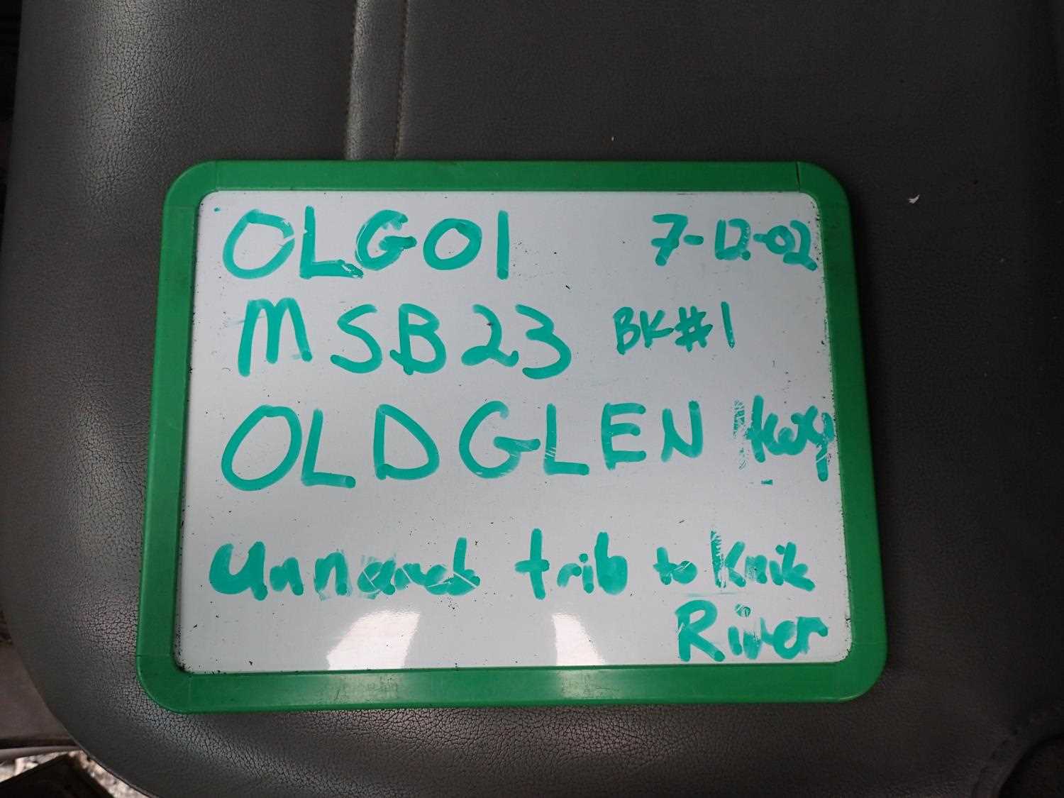
Fish Passage Site 20403972
Coordinates (dec. deg.): 61.48053°, -149.13144°
Legal Description: S016N002E17
Region: South Central
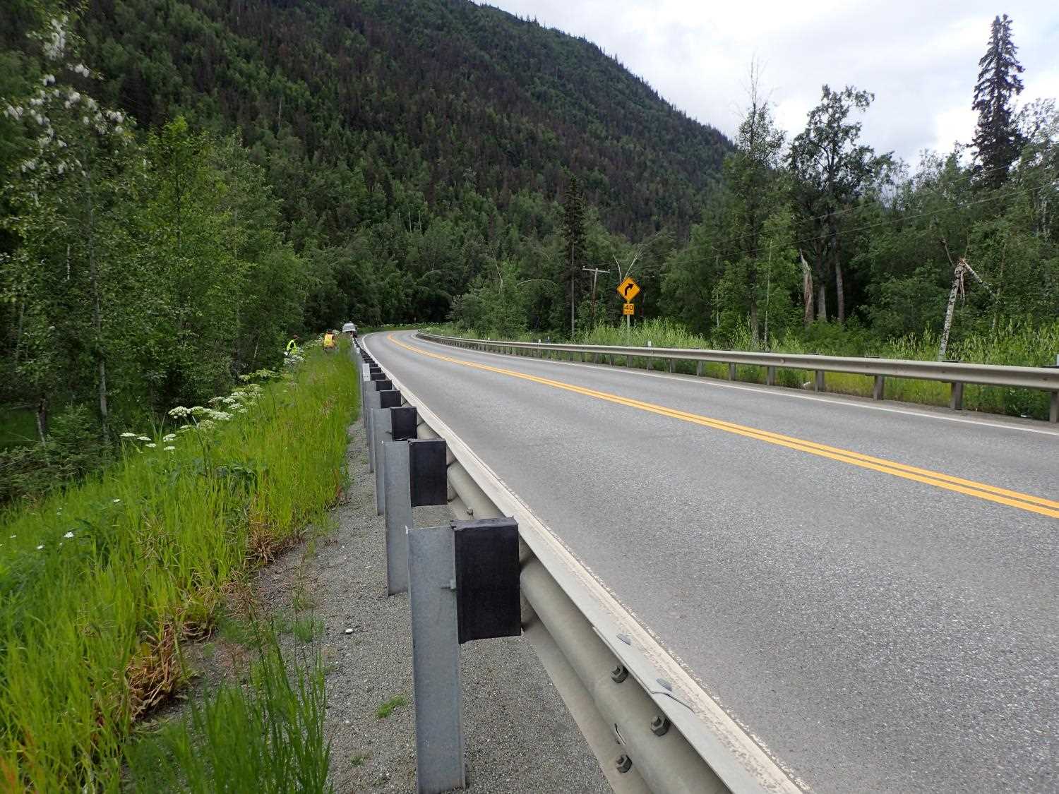
Road Name: Old Glenn Highway
Datum: WGS84
Quad Name / ITM: Anchorage B-6
AWC Stream #:
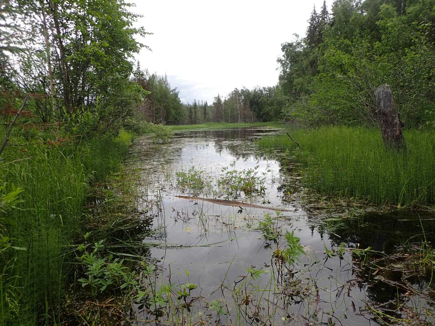
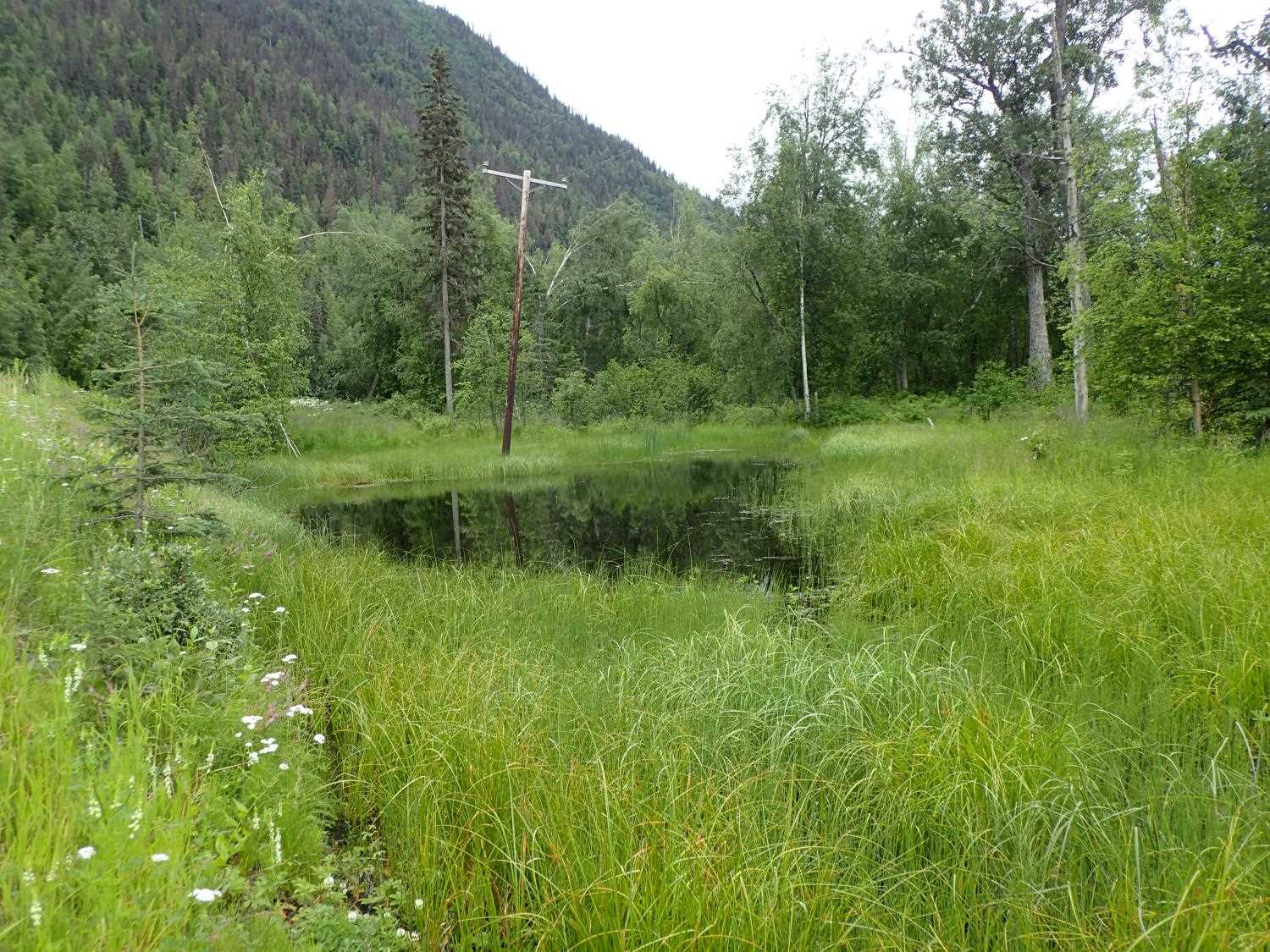
Stream Name: Unnamed
Elevation:
Site Comments: None
arrow to the right of the survey date below to choose a different report for this site.
Survey MSB23-OLG01
Project Supervisor: Michael Mazzacavallo, Alaska Department of Fish and Game
— Anchorage, AK
Observers: Michael Mazzacavallo, Kevin Keith, Amy LaBarre
Overall Fish Passage Rating:
Tidal: No
Backwatered: No
Step Pools: No
Construction Year: 2020
Site Observations:
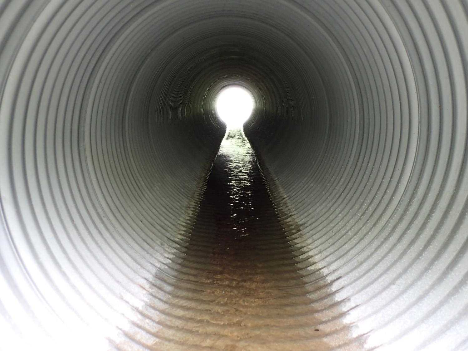
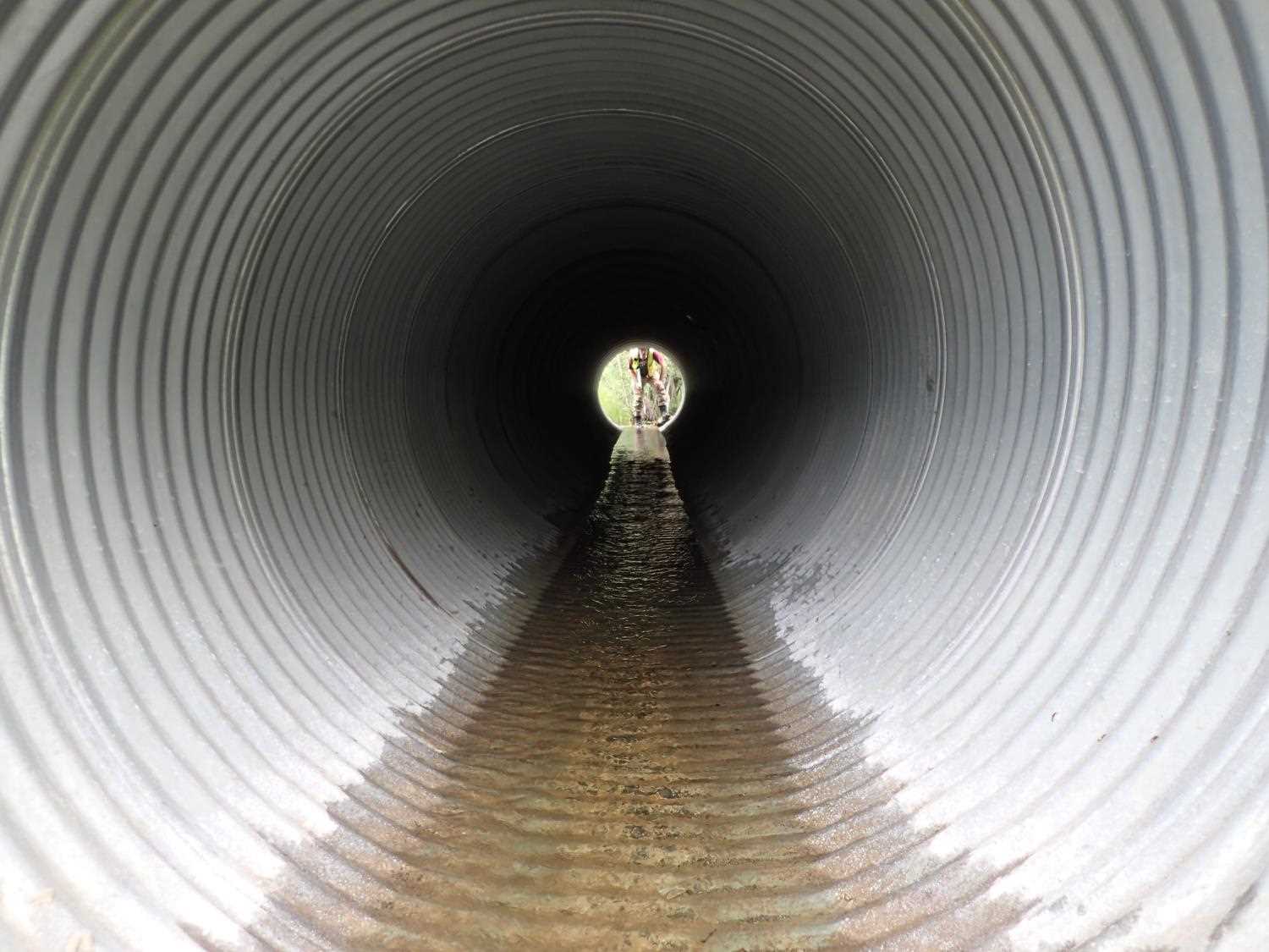
- Compound gradient in pipe
Comments: None
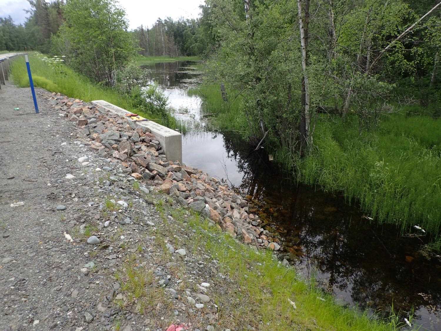
Culvert Measurements
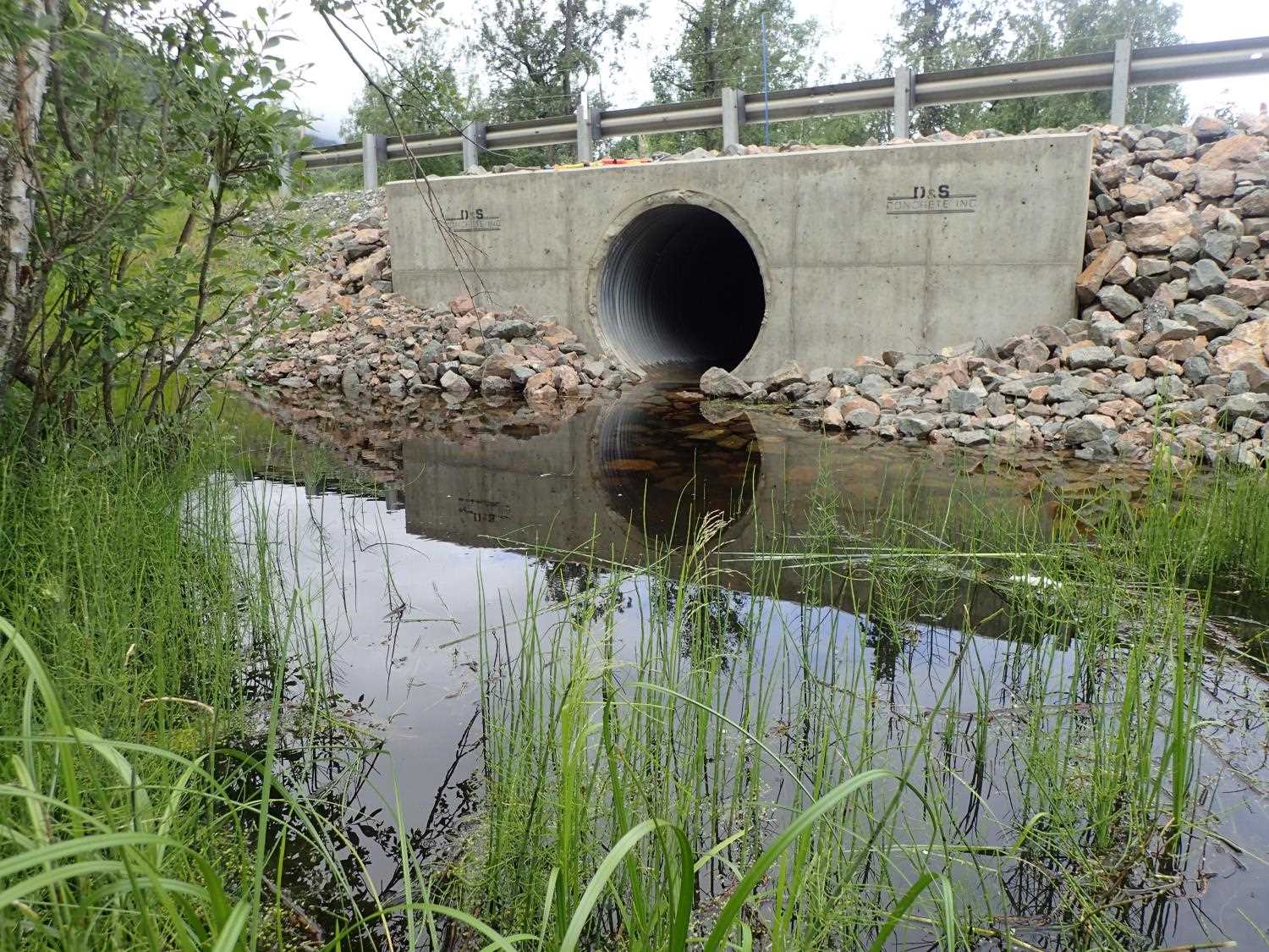
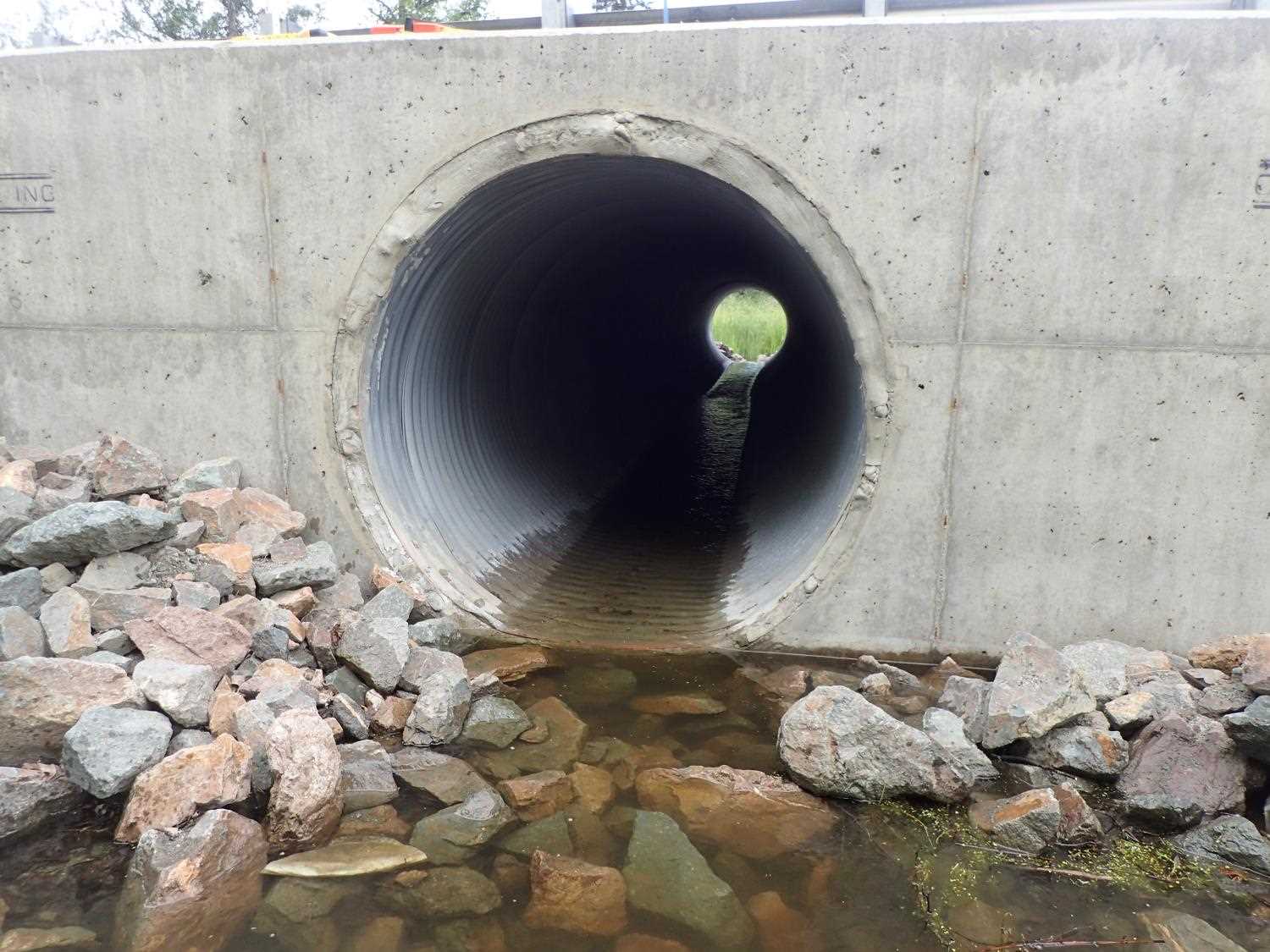
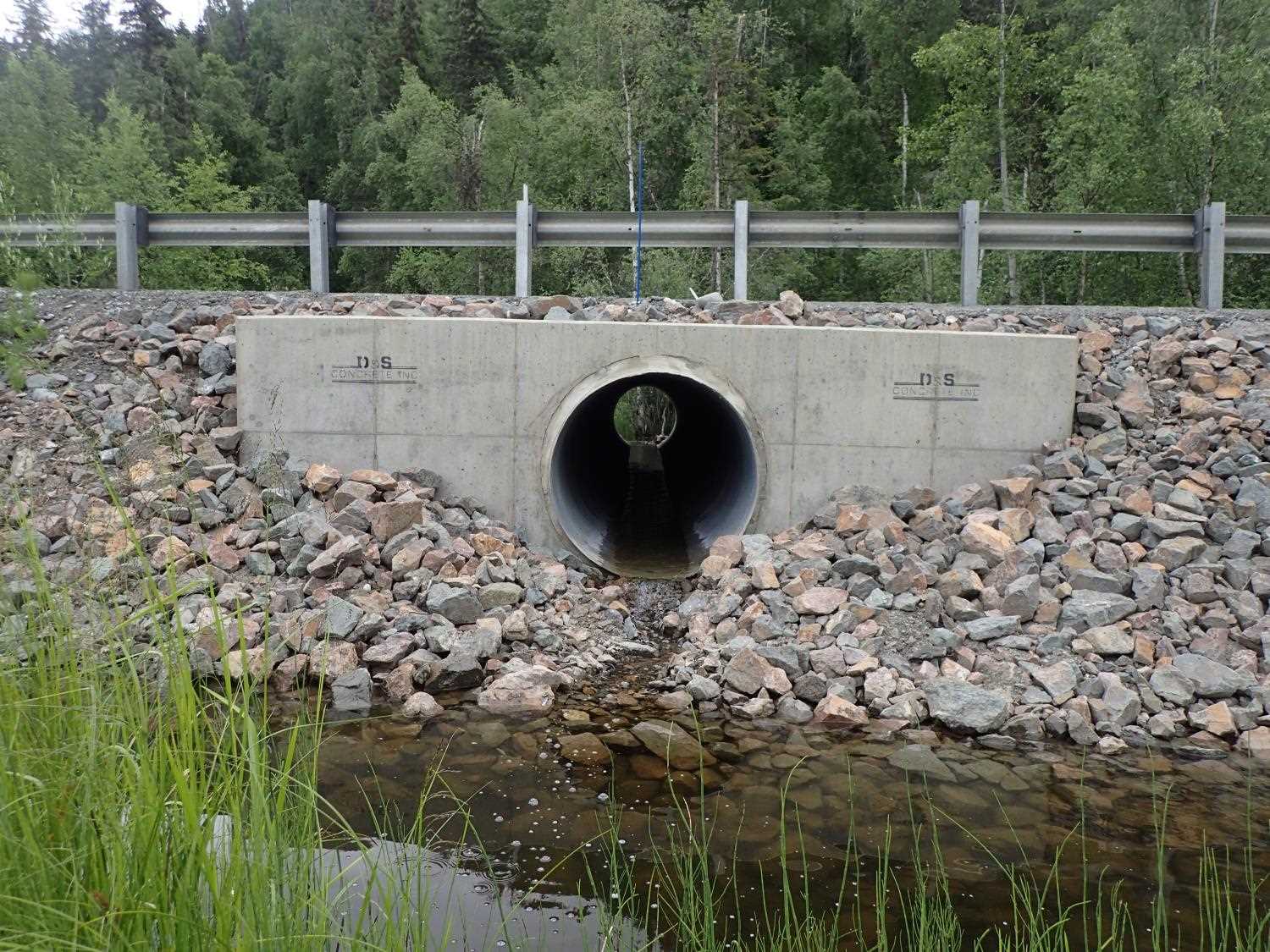
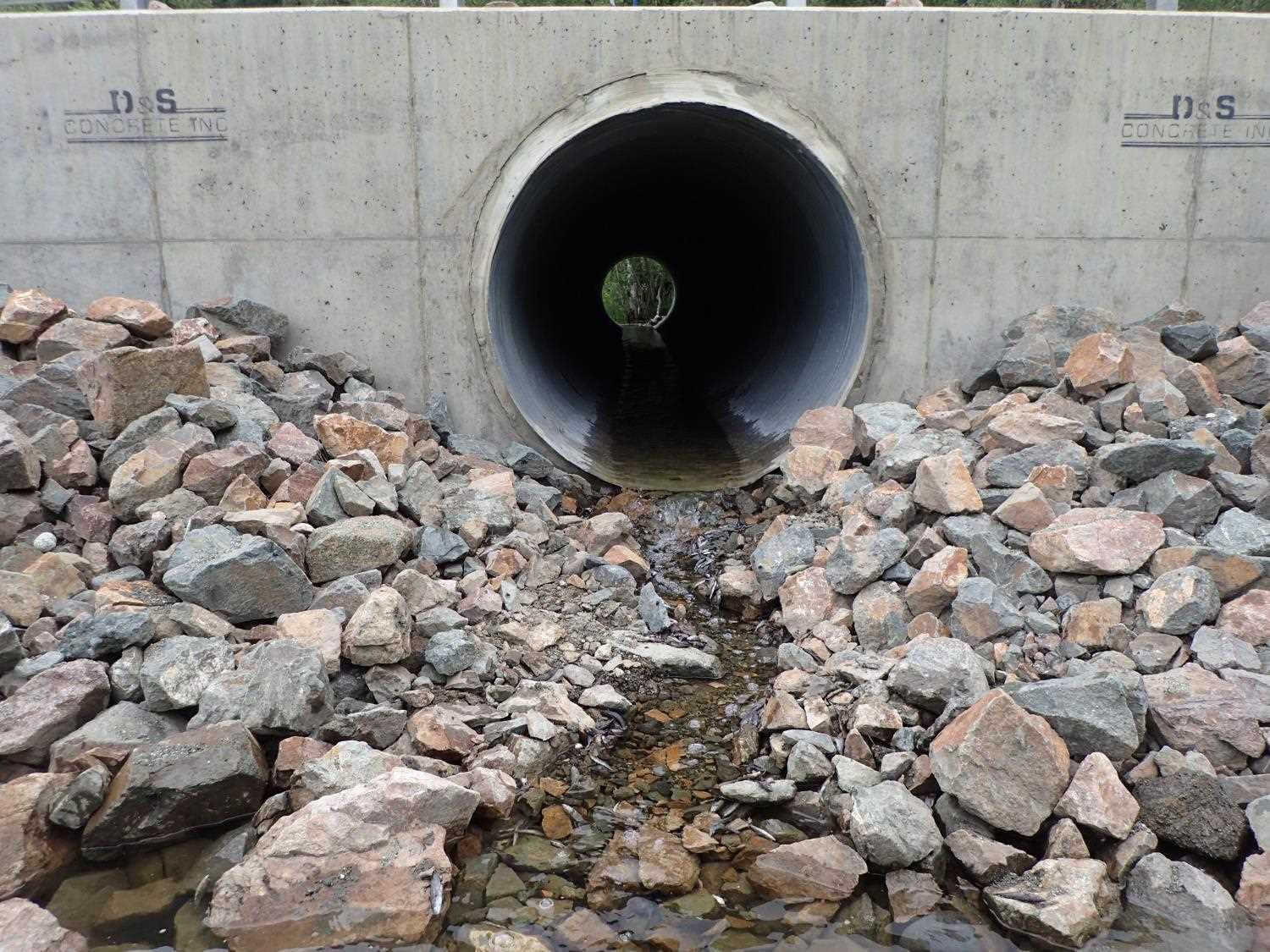
| ID: 1 | Structure Type: Circular pipe (Corrugated steel) | Fish Passage Rating: | |||||||||||||||||||||||||||||||||||||||||
|
|
|
|||||||||||||||||||||||||||||||||||||||||
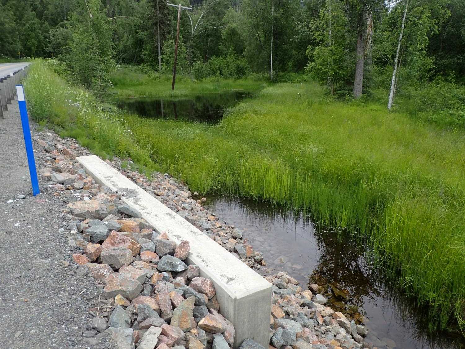
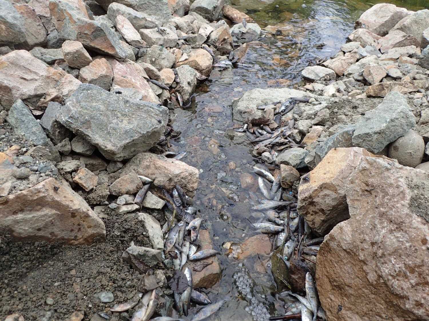
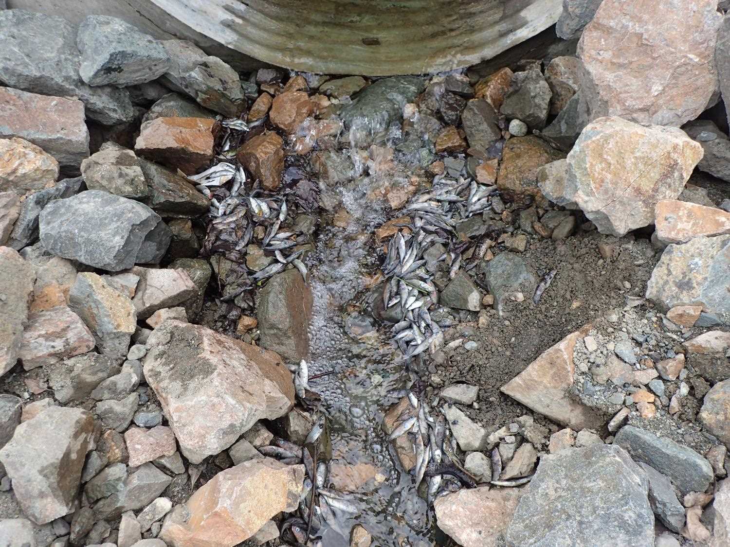
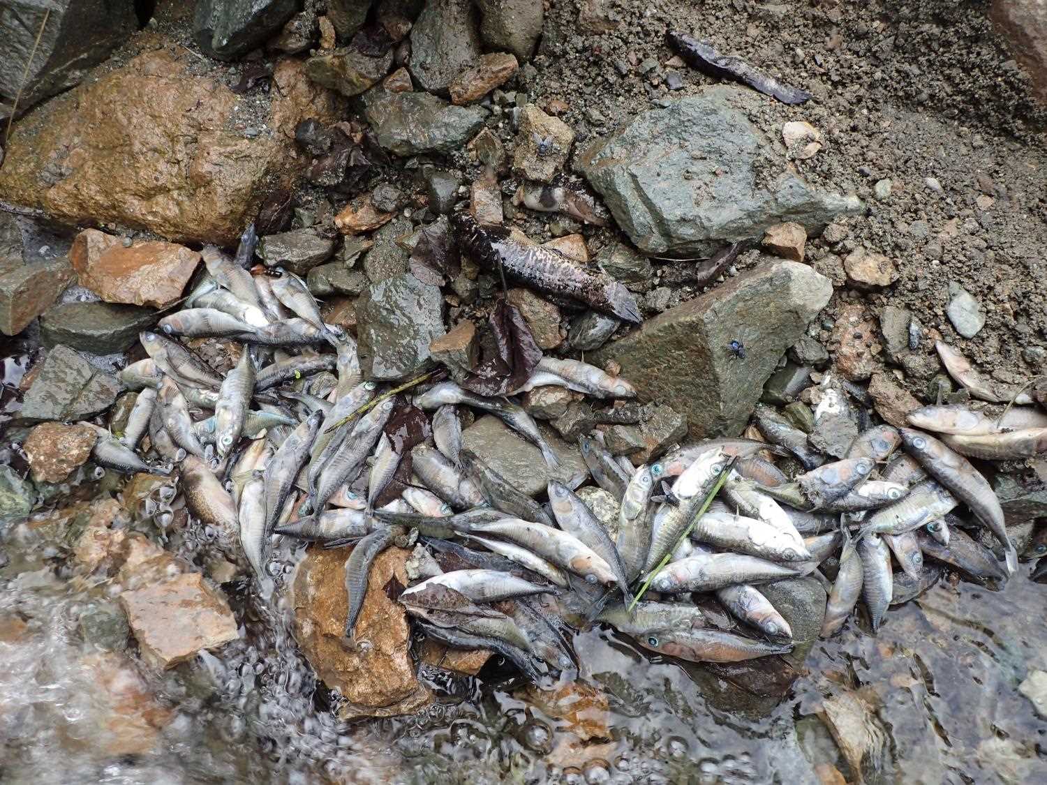
Comments: Cuvlet located between two ponds/wetland complexes, constriction ratio was not calculated. Many dead sickleback and a couple dead black fish along rip rap skirt at the outler. Gradient in culvert gets slightly steeper halfway through culvert. |
|||||||||||||||||||||||||||||||||||||||||||
Culvert Observations:
|
|||||||||||||||||||||||||||||||||||||||||||
Stream Measurements
|
|
No stream width data available.
Elevations
| Locator ID | Culvert Number |
River Distance (ft)1 |
Distance From Crossing (ft)2 |
Relative Elevation (ft) |
|---|---|---|---|---|
| Road Elev | 97.94 | |||
| D/S Water Surface Elev (D/S Pond WS) | 0.00 | 90.72 | ||
| D/S Thalweg (D/S Pond Depth) | 0.00 | 88.71 | ||
| D/S Thalweg | 6.00 | 90.62 | ||
| D/S Thalweg | 11.50 | 90.74 | ||
| D/S Water Surface Elev | 11.50 | 90.85 | ||
| Outlet Invert | 13.20 | 91.07 | ||
| D/S Water Surface Elev | 13.20 | 91.18 | ||
| Outlet Culvert Top | 13.20 | 95.55 | ||
| Inlet Culvert Top | 62.24 | 95.87 | ||
| U/S Water Surface Elev | 62.24 | 91.73 | ||
| Inlet Culvert Invert | 62.24 | 91.37 | ||
| U/S Thalweg | 65.24 | 91.31 | ||
| U/S Water Surface Elev (U/S Pond WS) | 73.24 | 91.61 | ||
| U/S Thalweg (U/S Pond Depth) | 73.24 | 88.12 |
Notes:
- River distance is measured continuously throughout the survey reach along the thalweg of the stream.
- Measured from each end of the crossing along the thalweg of the stream.
Fish Sampling Efforts
No fish sampling occurred during this survey.
Fish Observations
No fish observations occurred during this survey.
Photos
Questions or comments about this report can be directed to dfg.dsf.webmaster@alaska.gov