Fish Passage Site 20401881
Coordinates (dec. deg.): 61.71913°, -149.10321°
Legal Description: S019N002E21
Region: South Central
Road Name: Samovar Way
Datum: NAD83
Quad Name / ITM: Anchorage C-6
AWC Stream #:
Stream Name: Wasilla Creek tributary
Elevation:
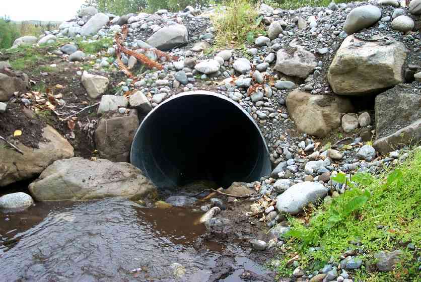
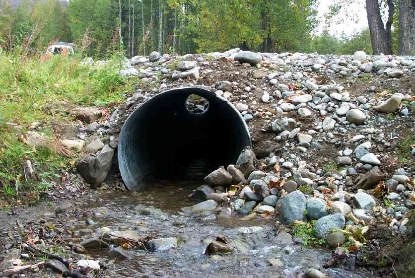
Site Comments: Culvert installed by MSB in 1999.
arrow to the right of the survey date below to choose a different report for this site.
Survey MSCS1-WA041
Observers: Edward Weiss, Doug Hill, Joe Conner, Dennis Gnath
Overall Fish Passage Rating:
Tidal: No
Backwatered: No
Step Pools:
Construction Year: 1999
Site Observations:
- Culvert is poorly aligned
- Other, including vibrations, cavitation, etc.
- Culvert gradient red
Comments: Culvert installed by MSB in 1999. Skewed with road. Channel changed above/below as part of the project. New portion eroding/settling could impact stream.
Culvert Measurements
| ID: 1 | Structure Type: Circular pipe (Corrugated Metal) | Fish Passage Rating: | |||||||||||||||||||||||||||||||||||||||||
|
|
|
|||||||||||||||||||||||||||||||||||||||||
Culvert Observations:
|
|||||||||||||||||||||||||||||||||||||||||||
Stream Measurements
|
|
| Stream Width Type | Distance From Crossing (ft) |
Stream Width (ft) |
|---|---|---|
| Downstream ordinary high water | 49.0 | 4.00 |
| Downstream ordinary high water | 100.0 | 6.00 |
| Upstream ordinary high water | 45.0 | 3.50 |
| Upstream ordinary high water | 100.0 | 3.00 |
Elevations
| Locator ID | Culvert Number |
River Distance (ft)1 |
Distance From Crossing (ft)2 |
Relative Elevation (ft) |
|---|---|---|---|---|
| D/S Thalweg | 74.42 | |||
| Outlet Culvert Top | 1 | 85.46 | ||
| Inlet Culvert Top | 1 | 90.20 | ||
| U/S Thalweg | 95.84 | |||
| D/S Thalweg | 0.00 | 49.0 | 77.87 | |
| D/S Tailcrest or 1st Thalweg | 43.30 | 5.7 | 81.89 | |
| D/S Thalweg | 45.20 | 3.8 | 81.81 | |
| Outlet Invert | 1 | 49.00 | 0.0 | 82.01 |
| Outlet Thalweg | 1 | 49.00 | 0.0 | 82.01 |
| Road Elev | 89.00 | 92.92 | ||
| Road Elev | 89.00 | 87.78 | ||
| Inlet Culvert Invert | 1 | 129.00 | 0.0 | 86.20 |
| Inlet Thalweg | 1 | 129.00 | 0.0 | 86.22 |
| U/S Thalweg | 1 | 130.60 | 1.6 | 87.11 |
| U/S Thalweg | 174.00 | 45.0 | 89.98 |
Notes:
- River distance is measured continuously throughout the survey reach along the thalweg of the stream.
- Measured from each end of the crossing along the thalweg of the stream.
Fish Sampling Efforts
| Gear Type: Minnow Trap (A) | Trap Duration(h): 1 | |
| Gear Type: Minnow Trap (B) | Trap Duration(h): 1 | |
Fish Observations
| Species: no fish collected or observed | Life History: Not Applicable | ||
| Total Fish Observed: 0 | Fish Measured: | Fork Lengths (mm) Min: Max: Mean: | |
| Collected/Observed by Gear Type: Downstream Minnow Trap (0) Upstream Minnow Trap (0) | |||
Photos


Questions or comments about this report can be directed to dfg.dsf.webmaster@alaska.gov