Fish Passage Site 20401455
Coordinates (dec. deg.): 61.55591°, -149.24984°
Legal Description: S017N001E22
Region: South Central
Road Name: Parks Highway
Datum: NAD83
Quad Name / ITM: Anchorage C-6
AWC Stream #: 247-50-10260-2019-3030
Stream Name: Spring Creek
Elevation:
Site Comments: MATANUSKA LAKE WATERSHED
arrow to the right of the survey date below to choose a different report for this site.
Survey MSCS1-SP084
Observers: Olof Jacobsson, Edward Weiss, Joe Conner
Overall Fish Passage Rating:
Tidal: No
Backwatered: No
Step Pools:
Construction Year:
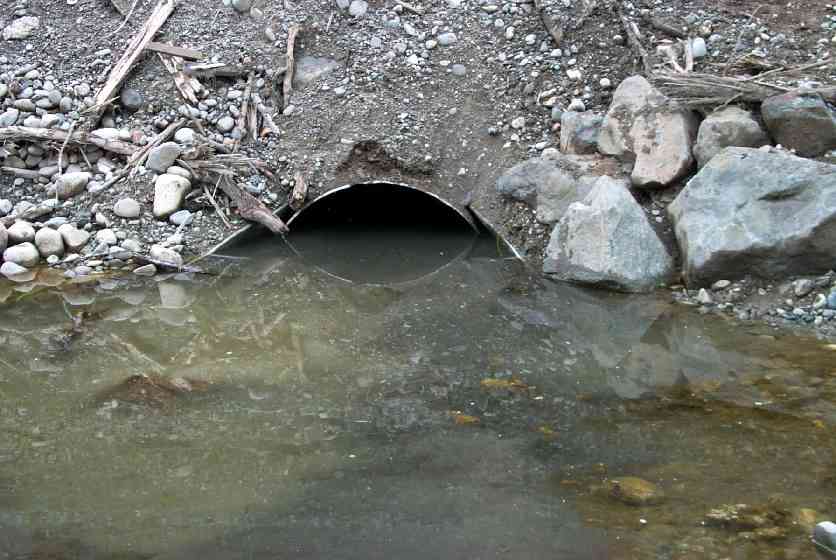
Comments: This pipe was recently extended on both ends from Parks Hwy expansion. STEEP STEEP fill grade sloughing in places fine sands gravel etc. input into stream from grade.
Culvert Measurements
| ID: 1 | Structure Type: Circular pipe (Corrugated Metal) | Fish Passage Rating: | |||||||||||||||||||||||||||||||||||||||||
|
|
|
|||||||||||||||||||||||||||||||||||||||||
Culvert Observations:
|
|||||||||||||||||||||||||||||||||||||||||||
Stream Measurements
|
|
No stream width data available.
Elevations
| Locator ID | Culvert Number |
River Distance (ft)1 |
Distance From Crossing (ft)2 |
Relative Elevation (ft) |
|---|---|---|---|---|
| Inlet Thalweg | 1 | 6.0 | 55.70 | |
| Inlet Culvert Invert | 1 | 0.0 | 55.99 | |
| U/S Thalweg | 31.5 | 56.14 | ||
| U/S Thalweg | 1 | 12.0 | 57.42 | |
| U/S Thalweg | 27.0 | 57.56 | ||
| Inlet Culvert Top | 1 | 59.10 | ||
| D/S Thalweg | 6.5 | 69.00 | ||
| D/S Thalweg | 4.5 | 69.62 | ||
| Max Pool Depth (Edge of Apron) | 4.0 | 69.70 | ||
| Outlet Invert | 1 | 0.0 | 70.79 | |
| D/S Thalweg | 30.0 | 72.31 | ||
| Outlet Culvert Top | 1 | 73.13 |
Notes:
- River distance is measured continuously throughout the survey reach along the thalweg of the stream.
- Measured from each end of the crossing along the thalweg of the stream.
Fish Sampling Efforts
No fish sampling occurred during this survey.
Fish Observations
No fish observations occurred during this survey.
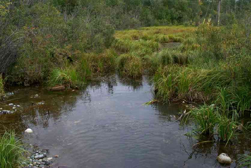
Photos
Questions or comments about this report can be directed to dfg.dsf.webmaster@alaska.gov