Fish Passage Site 20401363
Coordinates (dec. deg.): 61.57583°, -149.29483°
Legal Description: S017N001E09
Region: South Central
Road Name: Private drive near Hyer Road
Datum: NAD83
Quad Name / ITM: Anchorage C-7
AWC Stream #: 247-50-10260-2019-3041
Stream Name: Wasilla Creek tributary
Elevation:
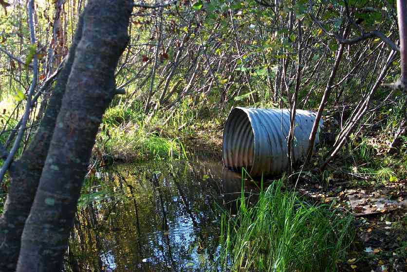
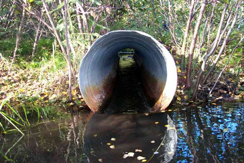
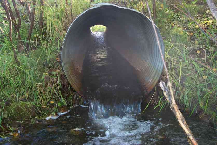
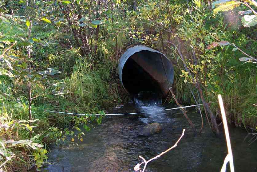
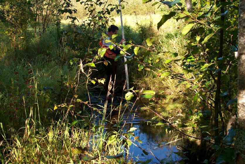
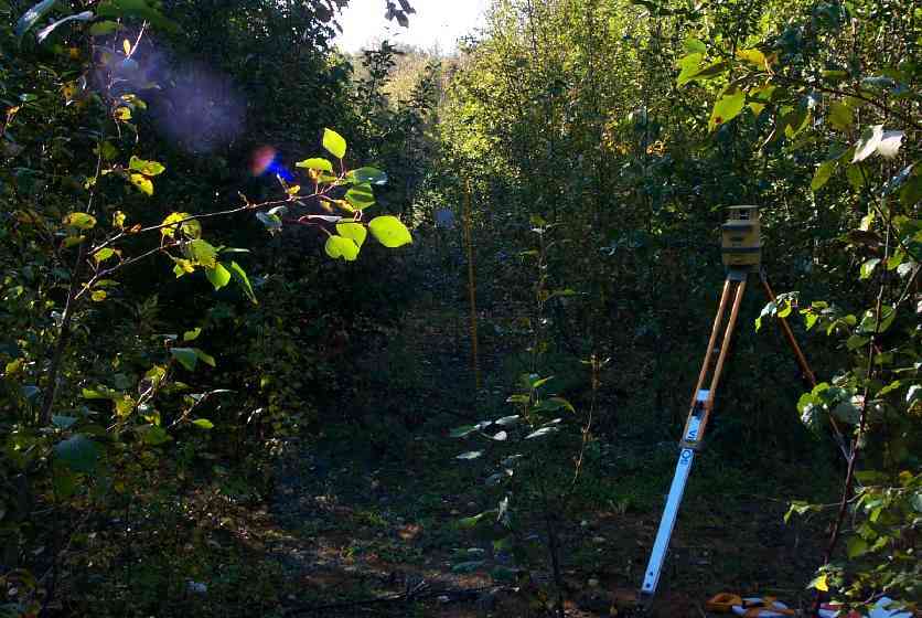
Site Comments: culvert through abandoned roadbed.
arrow to the right of the survey date below to choose a different report for this site.
Survey MSCS1-WA090
Observers: Edward Weiss, Olof Jacobsson
Overall Fish Passage Rating:
Tidal: No
Backwatered: No
Step Pools:
Construction Year:
Site Observations:
- Outfall height red
- Culvert gradient red
- Mechanical damage or joints parting
- Improper bedding
Comments: Site 050 (D1/U1) is 80' upstream - juvenile coho abundant at site 050. culvert through abandoned roadbed. Pipe is damaged resulting in 2 distinct grades through the pipe. Inlet end is tipped up severely. Roadbed is caving in over culvert. Landowner had 8 in plywood sheet blocking inlet to create "duck pond" upstream.
Culvert Measurements
| ID: 1 | Structure Type: Circular pipe (Corrugated Metal) | Fish Passage Rating: | |||||||||||||||||||||||||||||||||||||||||
|
|
|
|||||||||||||||||||||||||||||||||||||||||
Culvert Observations:
|
|||||||||||||||||||||||||||||||||||||||||||
Stream Measurements
|
|
| Stream Width Type | Distance From Crossing (ft) |
Stream Width (ft) |
|---|---|---|
| Downstream ordinary high water | 44.0 | 7.00 |
| Downstream ordinary high water | 100.0 | 5.00 |
Elevations
| Locator ID | Culvert Number |
River Distance (ft)1 |
Distance From Crossing (ft)2 |
Relative Elevation (ft) |
|---|---|---|---|---|
| Outlet Culvert Top | 1 | 94.12 | ||
| Inlet Culvert Top | 1 | 95.83 | ||
| D/S Thalweg | 0.00 | 100.0 | 88.01 | |
| D/S Thalweg | 56.00 | 44.0 | 90.28 | |
| D/S Tailcrest or 1st Thalweg | 95.00 | 5.0 | 90.66 | |
| OHW Left Bank | 96.00 | 4.0 | 90.26 | |
| D/S Thalweg | 97.80 | 2.2 | 89.79 | |
| Max Pool Depth | 98.70 | 1.3 | 89.98 | |
| Outlet Thalweg | 1 | 100.00 | 0.0 | 90.51 |
| Outlet Invert | 1 | 100.00 | 0.0 | 91.07 |
| Road Elev | 120.00 | 95.16 | ||
| Inlet Thalweg | 1 | 140.00 | 0.0 | 91.77 |
| Inlet Culvert Invert | 1 | 140.00 | 0.0 | 92.90 |
| U/S Thalweg | 1 | 144.20 | 4.2 | 91.29 |
| U/S Thalweg | 195.00 | 55.0 | 91.05 | |
| U/S Thalweg | 223.00 | 83.0 | 90.20 |
Notes:
- River distance is measured continuously throughout the survey reach along the thalweg of the stream.
- Measured from each end of the crossing along the thalweg of the stream.
Fish Sampling Efforts
| Gear Type: Visual Observation, Ground (C) | ||
| Gear Type: Visual Observation, Ground (D) | Trap Duration(h): 20 | |
Fish Observations
| Species: juvenile coho salmon | Life History: Anadromous | ||
| Total Fish Observed: | Fish Measured: | Fork Lengths (mm) Min: Max: Mean: | |
| Collected/Observed by Gear Type: Upstream Visual Observation, Ground () | |||
| Species: adult sockeye salmon | Life History: Anadromous | ||
| Total Fish Observed: | Fish Measured: | Fork Lengths (mm) Min: Max: Mean: | |
| Collected/Observed by Gear Type: Downstream Visual Observation, Ground () | |||
Photos
Questions or comments about this report can be directed to dfg.dsf.webmaster@alaska.gov