Fish Passage Site 20401361
Coordinates (dec. deg.): 61.56716°, -149.31146°
Legal Description: S017N001E17
Region: South Central
Road Name: Parks Highway
Datum: NAD83
Quad Name / ITM: Anchorage C-7
AWC Stream #: 247-50-10260-2019-3038
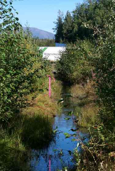
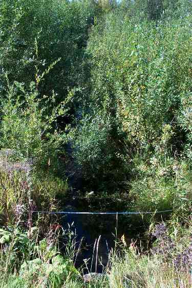
Stream Name: Wasilla Creek tributary
Elevation:
Site Comments: None
arrow to the right of the survey date below to choose a different report for this site.
Survey MSCS1-WA081
Observers: Edward Weiss, Olof Jacobsson
Overall Fish Passage Rating:
Tidal: No
Backwatered: Maybe
Step Pools:
Construction Year:
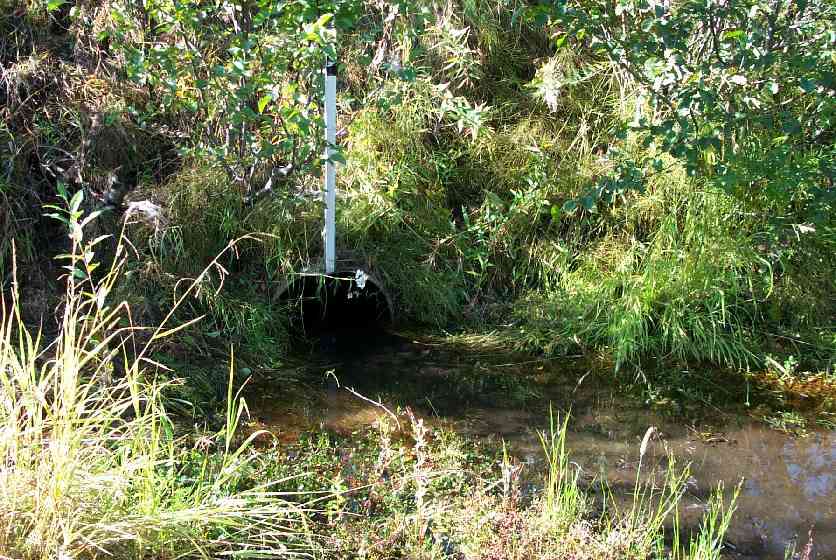
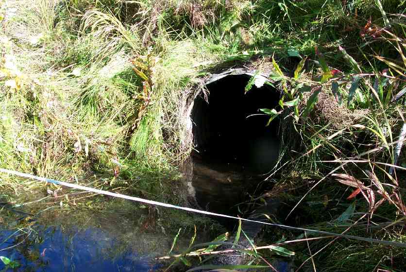
Comments: Site Cond=OTH=channeled drainage upstrm & dwnstrm/culvert upstream under feed store lot
Culvert Measurements
| ID: 1 | Structure Type: Circular pipe (Corrugated Metal) | Fish Passage Rating: | |||||||||||||||||||||||||||||||||||||||||
|
|
|
|||||||||||||||||||||||||||||||||||||||||
Culvert Observations:
|
|||||||||||||||||||||||||||||||||||||||||||
Stream Measurements
|
|
| Stream Width Type | Distance From Crossing (ft) |
Stream Width (ft) |
|---|---|---|
| Downstream ordinary high water | 4.5 | 6.20 |
| Downstream ordinary high water | 140.0 | 17.00 |
| Upstream ordinary high water | 1.0 | 4.50 |
| Upstream ordinary high water | 50.0 | 4.00 |
| Upstream ordinary high water | 105.0 | 4.50 |
Elevations
| Locator ID | Culvert Number |
River Distance (ft)1 |
Distance From Crossing (ft)2 |
Relative Elevation (ft) |
|---|---|---|---|---|
| U/S Thalweg | 86.49 | |||
| Inlet Culvert Top | 1 | 88.06 | ||
| Outlet Culvert Top | 1 | 88.50 | ||
| D/S Thalweg | 0.00 | 140.0 | 85.74 | |
| D/S Thalweg | 90.00 | 50.0 | 85.89 | |
| D/S Tailcrest or 1st Thalweg | 135.50 | 4.5 | 86.54 | |
| OHW Left Bank | 136.00 | 4.0 | 86.14 | |
| D/S Thalweg | 137.80 | 2.2 | 86.00 | |
| Outlet Invert | 1 | 140.00 | 0.0 | 86.50 |
| Outlet Thalweg | 1 | 140.00 | 0.0 | 86.27 |
| Road Elev | 179.50 | 95.85 | ||
| Road Elev | 179.50 | 98.08 | ||
| Inlet Culvert Invert | 1 | 219.00 | 0.0 | 86.28 |
| Inlet Thalweg | 1 | 219.00 | 0.0 | 86.28 |
| U/S Thalweg | 1 | 220.00 | 1.0 | 86.28 |
| U/S Thalweg | 324.00 | 105.0 | 86.45 |
Notes:
- River distance is measured continuously throughout the survey reach along the thalweg of the stream.
- Measured from each end of the crossing along the thalweg of the stream.
Fish Sampling Efforts
| Gear Type: Minnow Trap (A) | Trap Duration(h): 20 | |
| Comments: Set in inlet. | ||
| Gear Type: Minnow Trap (B) | Trap Duration(h): 20 | |
| Comments: Slow water set. | ||
Fish Observations
| Species: juvenile/adult Dolly Varden | Life History: Unknown | ||
| Total Fish Observed: 4 | Fish Measured: 2 | Fork Lengths (mm) Min: 137 Max: 138 Mean: 137 | |
| Collected/Observed by Gear Type: Downstream Minnow Trap (2) Upstream Minnow Trap (2) | |||
| Species: juvenile coho salmon | Life History: Anadromous | ||
| Total Fish Observed: 26 | Fish Measured: 11 | Fork Lengths (mm) Min: 64 Max: 119 Mean: 92 | |
| Collected/Observed by Gear Type: Downstream Minnow Trap (24) Upstream Minnow Trap (2) | |||
| Species: juvenile/adult sculpin-unspecified | Life History: Resident | ||
| Total Fish Observed: 2 | Fish Measured: 1 | Fork Lengths (mm) Min: 86 Max: 86 Mean: 86 | |
| Collected/Observed by Gear Type: Downstream Minnow Trap (2) | |||
Photos
Questions or comments about this report can be directed to dfg.dsf.webmaster@alaska.gov