Fish Passage Site 20401356
Coordinates (dec. deg.): 61.57644°, -149.28456°
Legal Description: S017N001E09
Region: South Central
Road Name: Lower Road
Datum: NAD83
Quad Name / ITM: Anchorage C-7
AWC Stream #: 247-50-10260-2019
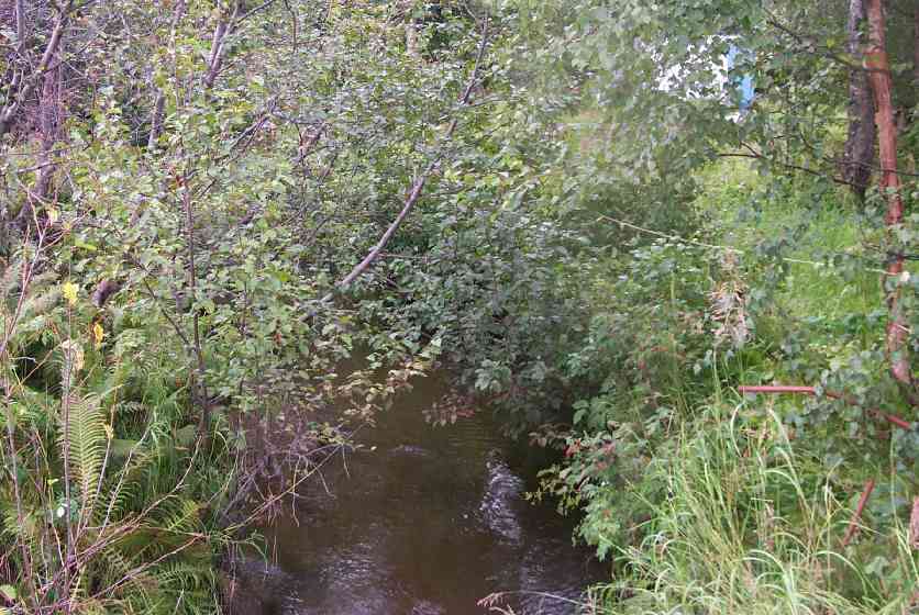
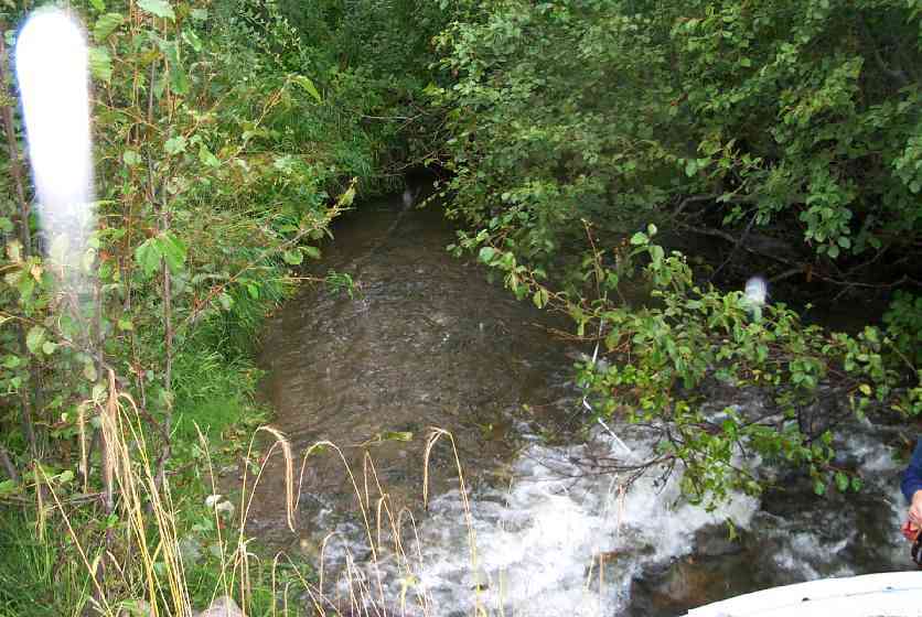
Stream Name: Wasilla Creek
Elevation:
Site Comments: Lower Road - near Hyer Road
Multiple surveys have been conducted at this site — click on the drop down
arrow to the right of the survey date below to choose a different report for this site.
arrow to the right of the survey date below to choose a different report for this site.
Survey MSCS1-WA053
Observers: Olof Jacobsson, Edward Weiss
Overall Fish Passage Rating:
Tidal: No
Backwatered: No
Step Pools:
Construction Year:
Comments: None
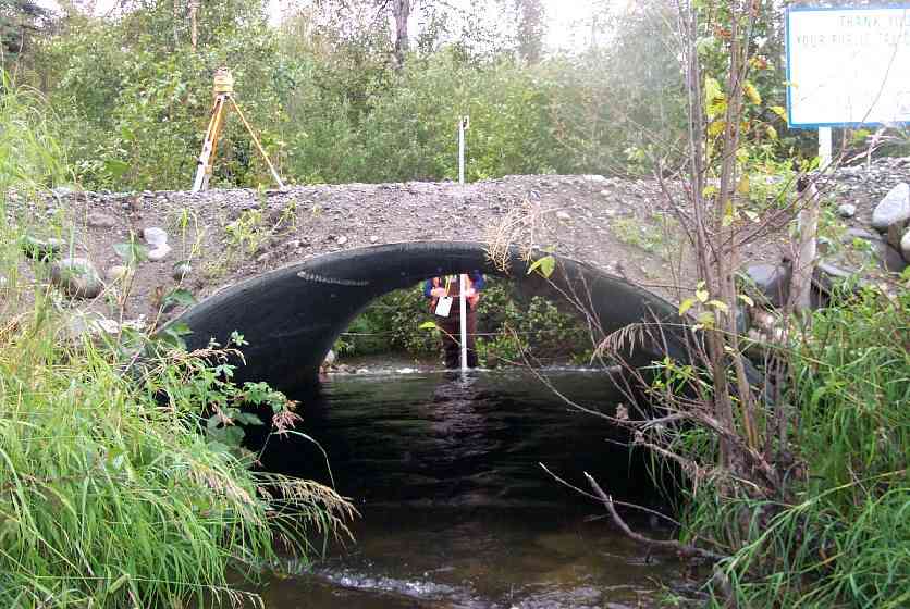
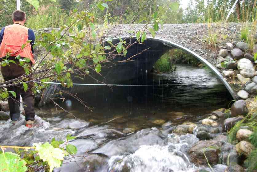
Culvert Measurements
| ID: 1 | Structure Type: Open-bottom arch (Strutural Metal Plate) | Fish Passage Rating: | |||||||||||||||||||||||||||||||||||||||||
|
|
|
|||||||||||||||||||||||||||||||||||||||||
Culvert Observations:
|
|||||||||||||||||||||||||||||||||||||||||||
Stream Measurements
|
|
| Stream Width Type | Distance From Crossing (ft) |
Stream Width (ft) |
|---|---|---|
| Downstream ordinary high water | 2.0 | 13.10 |
| Downstream ordinary high water | 27.0 | 12.00 |
| Downstream ordinary high water | 98.0 | 15.00 |
| Upstream ordinary high water | 50.0 | 15.00 |
| Upstream ordinary high water | 80.0 | 16.50 |
Elevations
| Locator ID | Culvert Number |
River Distance (ft)1 |
Distance From Crossing (ft)2 |
Relative Elevation (ft) |
|---|---|---|---|---|
| Outlet Culvert Top | 1 | 93.78 | ||
| Inlet Culvert Top | 1 | 93.85 | ||
| D/S Thalweg | 0.00 | 98.0 | 87.18 | |
| D/S Thalweg | 71.00 | 27.0 | 87.35 | |
| D/S Thalweg (Base of cascade) | 85.00 | 13.0 | 87.97 | |
| OHW Left Bank | 96.00 | 2.0 | 88.56 | |
| D/S Tailcrest or 1st Thalweg | 96.00 | 2.0 | 89.19 | |
| Outlet Thalweg | 1 | 98.00 | 0.0 | 88.16 |
| Road Elev | 113.00 | 94.74 | ||
| Road Elev | 113.00 | 94.76 | ||
| Inlet Thalweg | 1 | 128.00 | 0.0 | 88.30 |
| U/S Thalweg | 178.00 | 50.0 | 88.12 | |
| U/S Thalweg | 208.00 | 80.0 | 88.38 |
Notes:
- River distance is measured continuously throughout the survey reach along the thalweg of the stream.
- Measured from each end of the crossing along the thalweg of the stream.
Fish Sampling Efforts
| Gear Type: Visual Observation, Ground (C) | ||
Fish Observations
| Species: general fish observation, no species information | Life History: Not Recorded | ||
| Total Fish Observed: 2 | Fish Measured: | Fork Lengths (mm) Min: Max: Mean: | |
| Collected/Observed by Gear Type: Upstream Visual Observation, Ground (2) | |||
| Comments: 2 adult Coho (?) or sockeye (?) observation | |||
Photos

Questions or comments about this report can be directed to dfg.dsf.webmaster@alaska.gov