Fish Passage Site 20401353
Coordinates (dec. deg.): 61.57587°, -149.29474°
Legal Description: S017N001E09
Region: South Central
Road Name: Hyer Road
Datum: NAD83
Quad Name / ITM: Anchorage C-7
AWC Stream #: 247-50-10260-2019-3041
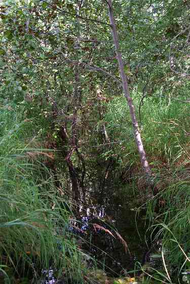
Stream Name: Wasilla Creek tributary
Elevation:
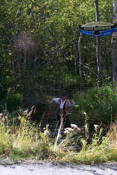
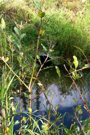
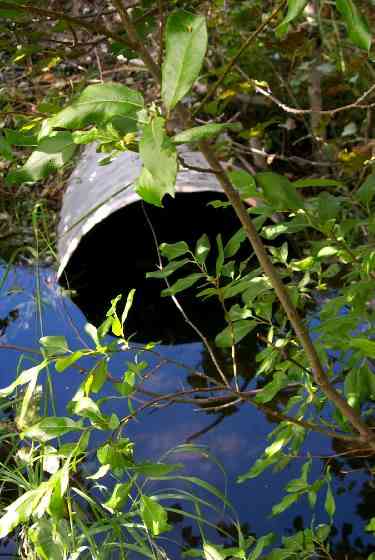
Site Comments: Upstream of culvert under abandoned road on private land.
arrow to the right of the survey date below to choose a different report for this site.
Survey MSCS1-WA050
Observers: Edward Weiss, Olof Jacobsson, Joe Conner
Overall Fish Passage Rating:
Tidal: No
Backwatered: No
Step Pools:
Construction Year:
Comments: Something going on downstream at culvert under abandoned road on private land. Water is backed up above #50. Slow and ponded. Outlet perched - dammed at inlet w/ plywood. Adult chums holding below culvert. Pulled boards @ 14:15.
Culvert Measurements
| ID: 1 | Structure Type: Circular pipe (Corrugated Metal) | Fish Passage Rating: | |||||||||||||||||||||||||||||||||||||||||
|
|
|
|||||||||||||||||||||||||||||||||||||||||
Culvert Observations:
|
|||||||||||||||||||||||||||||||||||||||||||
Stream Measurements
|
|
| Stream Width Type | Distance From Crossing (ft) |
Stream Width (ft) |
|---|---|---|
| Upstream ordinary high water | 48.0 | 7.00 |
| Upstream ordinary high water | 85.0 | 11.00 |
Elevations
| Locator ID | Culvert Number |
River Distance (ft)1 |
Distance From Crossing (ft)2 |
Relative Elevation (ft) |
|---|---|---|---|---|
| Outlet Culvert Top | 1 | 90.42 | ||
| Inlet Culvert Top | 1 | 90.94 | ||
| OHW Left Bank | 0.00 | 8.0 | 87.66 | |
| Outlet Invert | 1 | 8.00 | 0.0 | 87.74 |
| Outlet Thalweg | 1 | 8.00 | 0.0 | 87.79 |
| Road Elev | 34.50 | 94.39 | ||
| Road Elev | 34.50 | 94.60 | ||
| Inlet Culvert Invert | 1 | 61.00 | 0.0 | 88.03 |
| U/S Thalweg | 63.00 | 2.0 | 87.82 | |
| U/S Thalweg | 109.00 | 48.0 | 88.50 | |
| U/S Thalweg | 146.00 | 85.0 | 88.55 |
Notes:
- River distance is measured continuously throughout the survey reach along the thalweg of the stream.
- Measured from each end of the crossing along the thalweg of the stream.
Fish Sampling Efforts
| Gear Type: Minnow Trap (A) | Trap Duration(h): 1 | |
| Gear Type: Minnow Trap (B) | Trap Duration(h): 1 | |
| Gear Type: Visual Observation, Ground (D) | ||
Fish Observations
| Species: juvenile/adult stickleback-unspecified | Life History: Resident | ||
| Total Fish Observed: 1 | Fish Measured: | Fork Lengths (mm) Min: Max: Mean: | |
| Collected/Observed by Gear Type: Downstream Minnow Trap () Upstream Minnow Trap (1) | |||
| Species: juvenile Chinook salmon | Life History: Anadromous | ||
| Total Fish Observed: 6 | Fish Measured: 3 | Fork Lengths (mm) Min: 83 Max: 113 Mean: 95 | |
| Collected/Observed by Gear Type: Downstream Minnow Trap (6) | |||
| Species: adult chum salmon | Life History: Anadromous | ||
| Total Fish Observed: | Fish Measured: | Fork Lengths (mm) Min: Max: Mean: | |
| Collected/Observed by Gear Type: Downstream Visual Observation, Ground () | |||
| Comments: Adult chum holding below culvert - pulled boards at approx. 1415 hrs. | |||
| Species: juvenile coho salmon | Life History: Anadromous | ||
| Total Fish Observed: 67 | Fish Measured: 20 | Fork Lengths (mm) Min: 49 Max: 118 Mean: 83 | |
| Collected/Observed by Gear Type: Downstream Minnow Trap (26) Upstream Minnow Trap (41) | |||
Photos
Questions or comments about this report can be directed to dfg.dsf.webmaster@alaska.gov