Fish Passage Site 20401352
Coordinates (dec. deg.): 61.57486°, -149.29478°
Legal Description: S017N001E09
Region: South Central
Road Name: Hyer Road
Datum: NAD83
Quad Name / ITM: Anchorage C-7
AWC Stream #: 247-50-10260-2019
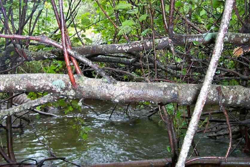
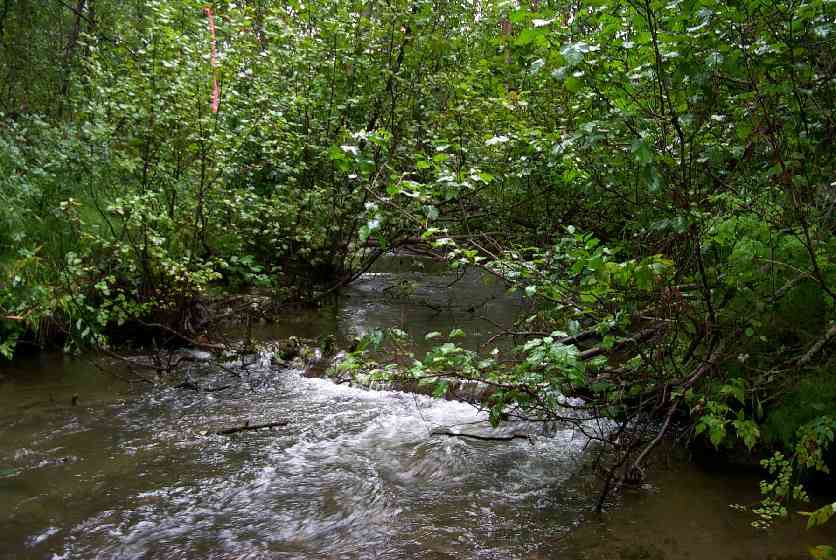
Stream Name: Wasilla Creek
Elevation:
Site Comments: None
Multiple surveys have been conducted at this site — click on the drop down
arrow to the right of the survey date below to choose a different report for this site.
arrow to the right of the survey date below to choose a different report for this site.
Survey MSCS1-WA049
Observers: Edward Weiss, Olof Jacobsson, Joe Conner
Overall Fish Passage Rating:
Tidal: No
Backwatered: Yes
Step Pools:
Construction Year:
Comments: Fine sands in road fill exposed at crossing running downhill into stream with rains.
Culvert Measurements
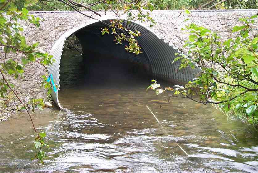
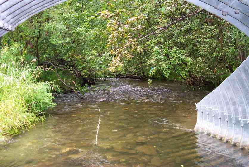
| ID: 1 | Structure Type: Pipe-arch (Structural steel plate) | Fish Passage Rating: | |||||||||||||||||||||||||||||||||||||||||
|
|
|
|||||||||||||||||||||||||||||||||||||||||
Culvert Observations:
|
|||||||||||||||||||||||||||||||||||||||||||
Stream Measurements
|
|
| Stream Width Type | Distance From Crossing (ft) |
Stream Width (ft) |
|---|---|---|
| Downstream ordinary high water | 60.0 | 21.00 |
| Downstream ordinary high water | 105.0 | 23.00 |
| Upstream ordinary high water | 50.0 | 25.00 |
| Upstream ordinary high water | 90.0 | 18.00 |
Elevations
| Locator ID | Culvert Number |
River Distance (ft)1 |
Distance From Crossing (ft)2 |
Relative Elevation (ft) |
|---|---|---|---|---|
| Outlet Culvert Top | 1 | 93.03 | ||
| Inlet Culvert Top | 1 | 93.36 | ||
| U/S Thalweg | 86.72 | |||
| U/S Thalweg | 86.97 | |||
| D/S Thalweg | 0.00 | 105.0 | 85.27 | |
| D/S Thalweg | 45.00 | 60.0 | 86.11 | |
| D/S Tailcrest or 1st Thalweg | 92.00 | 13.0 | 87.14 | |
| OHW Left Bank | 96.00 | 9.0 | 86.61 | |
| D/S Thalweg | 103.00 | 2.0 | 86.24 | |
| Outlet Invert | 1 | 105.00 | 0.0 | 86.09 |
| Outlet Thalweg | 1 | 105.00 | 0.0 | 86.09 |
| Road Elev | 128.00 | 93.86 | ||
| Road Elev | 128.00 | -12.0 | 94.97 | |
| Inlet Culvert Invert | 1 | 151.00 | 0.0 | 86.16 |
| Inlet Thalweg | 1 | 152.00 | 1.0 | 86.13 |
| U/S Thalweg | 1 | 159.00 | 8.0 | 85.94 |
Notes:
- River distance is measured continuously throughout the survey reach along the thalweg of the stream.
- Measured from each end of the crossing along the thalweg of the stream.
Fish Sampling Efforts
| Gear Type: Visual Observation, Ground (C) | ||
| Gear Type: Visual Observation, Ground (D) | ||
Fish Observations
| Species: juvenile/adult Dolly Varden | Life History: Unknown | ||
| Total Fish Observed: | Fish Measured: | Fork Lengths (mm) Min: Max: Mean: | |
| Collected/Observed by Gear Type: Downstream Visual Observation, Ground () | |||
| Species: adult chum salmon | Life History: Anadromous | ||
| Total Fish Observed: | Fish Measured: | Fork Lengths (mm) Min: Max: Mean: | |
| Collected/Observed by Gear Type: Downstream Visual Observation, Ground () Upstream Visual Observation, Ground () | |||
| Comments: Adult chum salmon observed | |||
| Species: juvenile/adult chum salmon | Life History: Unknown | ||
| Total Fish Observed: | Fish Measured: | Fork Lengths (mm) Min: Max: Mean: | |
| Collected/Observed by Gear Type: Upstream Visual Observation, Ground () | |||
Photos
Questions or comments about this report can be directed to dfg.dsf.webmaster@alaska.gov