Fish Passage Site 20401347
Coordinates (dec. deg.): 61.72003°, -149.11873°
Legal Description: S019N002E20
Region: South Central
Road Name: ATV Trail
Datum: NAD83
Quad Name / ITM: Anchorage C-6
AWC Stream #:
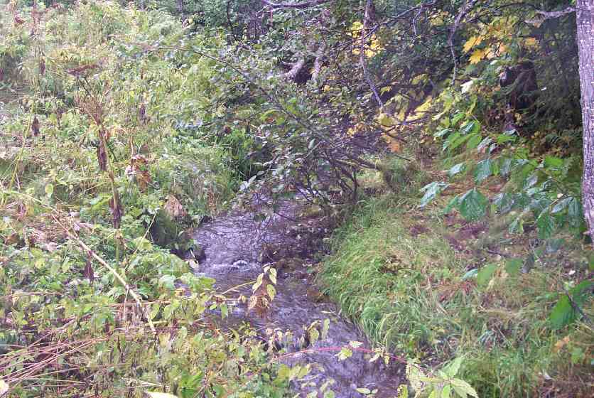
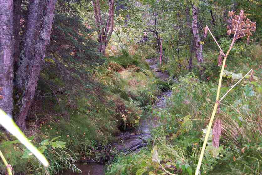
Stream Name: Wasilla Creek tributary
Elevation:
Site Comments: Trib to Wasilla Ck. ATV trail off of Murphy Road.
arrow to the right of the survey date below to choose a different report for this site.
Survey MSCS1-WA043
Observers: Edward Weiss, Olof Jacobsson
Overall Fish Passage Rating:
Tidal: No
Backwatered: No
Step Pools:
Construction Year:
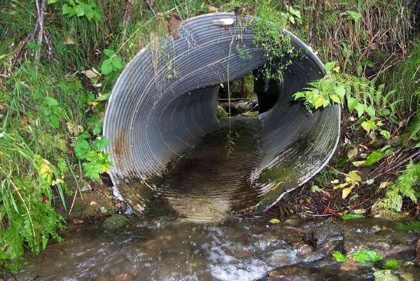
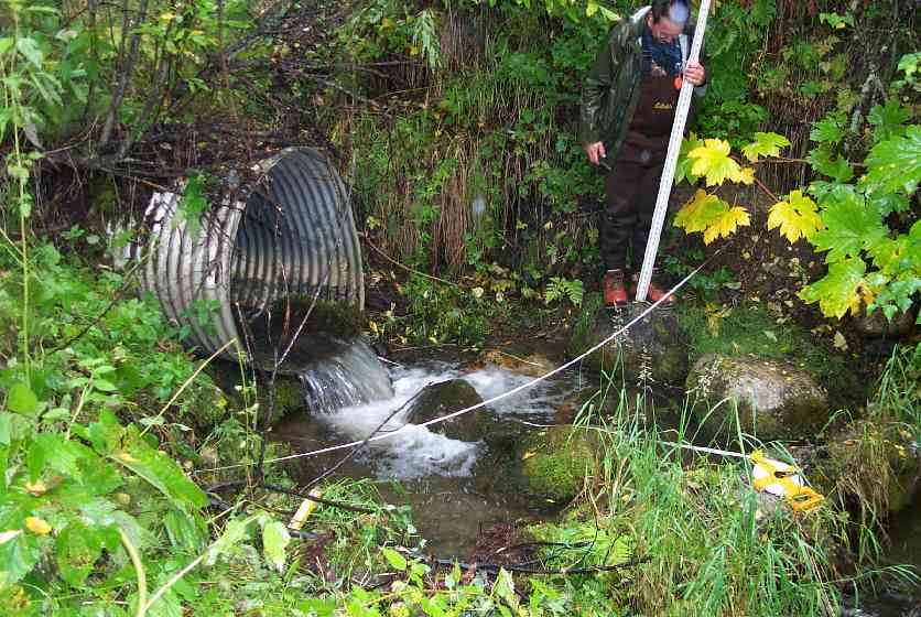
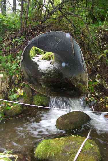
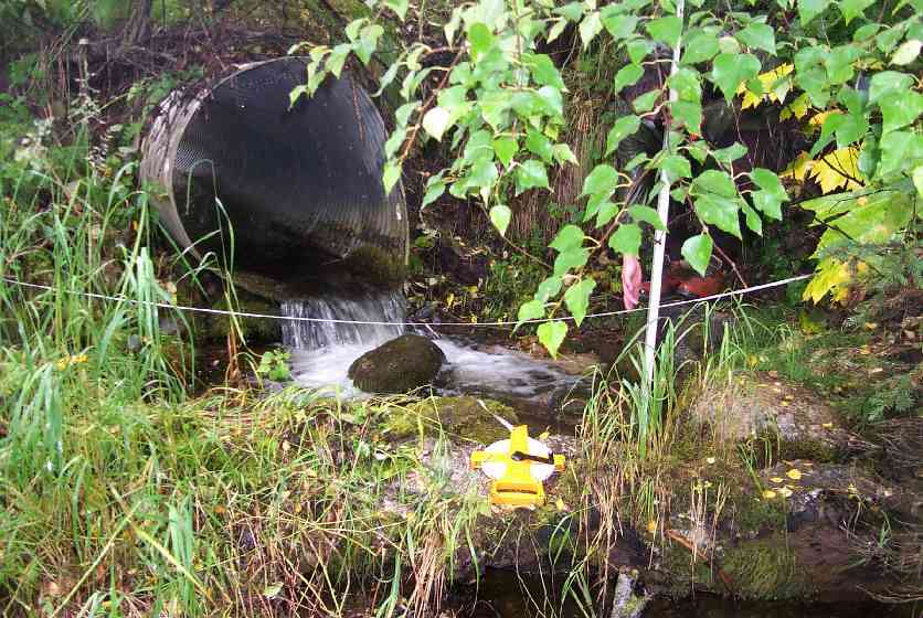
Comments: Water running around and under pipe at the inlet. Top of road also had a divet as if losing material. Perched inlet and outlet. Pipe partially squashed.
Culvert Measurements
| ID: 1 | Structure Type: Circular pipe (Corrugated Metal) | Fish Passage Rating: | |||||||||||||||||||||||||||||||||||||||||
|
|
|
|||||||||||||||||||||||||||||||||||||||||
Stream Measurements
|
|
| Stream Width Type | Distance From Crossing (ft) |
Stream Width (ft) |
|---|---|---|
| Downstream ordinary high water | 50.0 | 7.00 |
| Upstream ordinary high water | 35.0 | 7.50 |
| Upstream ordinary high water | 75.0 | 11.00 |
Elevations
| Locator ID | Culvert Number |
River Distance (ft)1 |
Distance From Crossing (ft)2 |
Relative Elevation (ft) |
|---|---|---|---|---|
| D/S Thalweg | 80.0 | 86.81 | ||
| D/S Thalweg | 50.0 | 87.33 | ||
| Max Pool Depth | 1.5 | 87.68 | ||
| OHW Left Bank | 2.7 | 87.96 | ||
| D/S Thalweg | 13.0 | 88.42 | ||
| Outlet Thalweg | 1 | 0.0 | 88.48 | |
| D/S Tailcrest or 1st Thalweg | 5.5 | 89.02 | ||
| U/S Thalweg | 1 | 89.03 | ||
| Outlet Invert | 1 | 0.0 | 89.49 | |
| Inlet Culvert Invert | 1 | 0.0 | 90.04 | |
| Inlet Thalweg | 1 | 0.0 | 90.09 | |
| U/S Thalweg | 1 | 3.0 | 90.48 | |
| U/S Thalweg | 35.0 | 91.86 | ||
| Outlet Culvert Top | 1 | 93.44 | ||
| Inlet Culvert Top | 1 | 94.00 | ||
| U/S Thalweg | 75.0 | 94.50 | ||
| Road Elev | 95.25 | |||
| Road Elev | 95.25 |
Notes:
- River distance is measured continuously throughout the survey reach along the thalweg of the stream.
- Measured from each end of the crossing along the thalweg of the stream.
Fish Sampling Efforts
| Gear Type: Minnow Trap (A) | Trap Duration(h): 2 | |
| Gear Type: Minnow Trap (B) | Trap Duration(h): 18 | |
Fish Observations
| Species: juvenile/adult Dolly Varden | Life History: Unknown | ||
| Total Fish Observed: 14 | Fish Measured: 7 | Fork Lengths (mm) Min: 89 Max: 148 Mean: 115 | |
| Collected/Observed by Gear Type: Downstream Minnow Trap (8) Upstream Minnow Trap (6) | |||
Photos

Questions or comments about this report can be directed to dfg.dsf.webmaster@alaska.gov