Fish Passage Site 20401344
Coordinates (dec. deg.): 61.71796°, -149.12068°
Legal Description: S019N002E20
Region: South Central
Road Name: Murphy Road
Datum: NAD83
Quad Name / ITM: Anchorage C-6
AWC Stream #: 247-50-10260-2019-3120
Stream Name: Wasilla Creek tributary
Elevation:
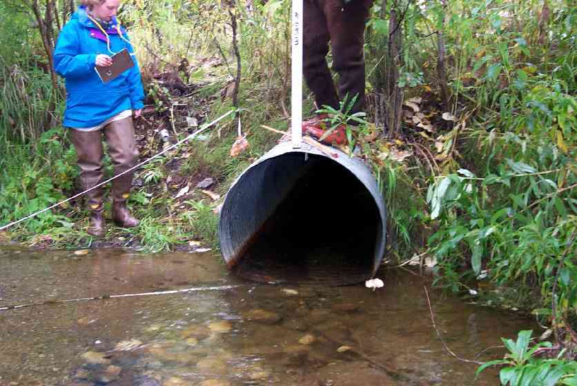
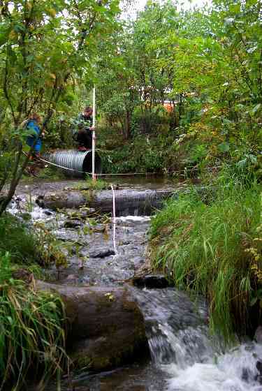
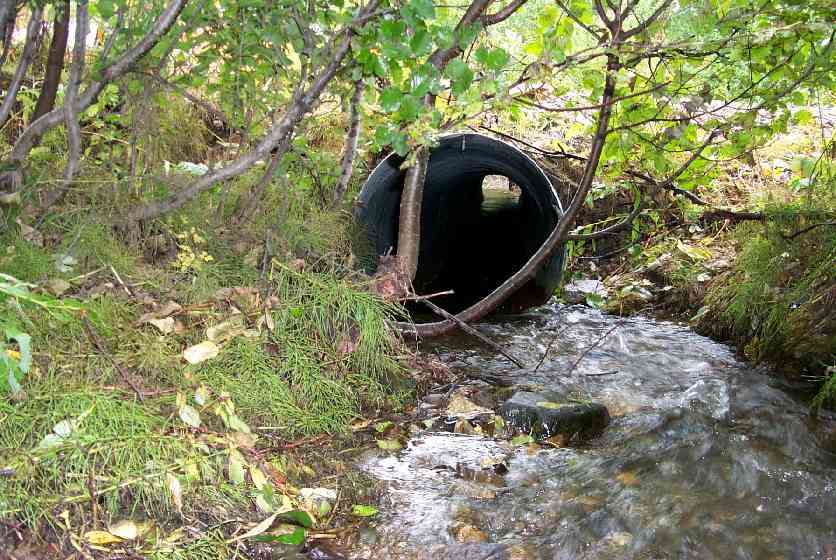
Site Comments: The outlet area consists of three step pools created by piled cobble/boulders with one pool at the outlet.
arrow to the right of the survey date below to choose a different report for this site.
Survey MSCS1-WA040
Observers: Edward Weiss, Olof Jacobsson
Overall Fish Passage Rating:
Tidal: No
Backwatered: No
Step Pools: Yes
Construction Year:
Site Observations:
- Improper bedding
- Structural Problem
Comments: Culvert sags in the middle - slight damage in the middle of pipe. Steep outlet has step log structure below. Tailcrest is C-shaped - 2 channels around gravel bar. SEE EXCELLENT FIELD SKETCHES IN ORIGINAL FIELD FORMS
Culvert Measurements
| ID: 1 | Structure Type: Circular pipe (Corrugated steel) | Fish Passage Rating: | ||||||||||||||||||||||||||||||||||||||||||
|
|
|
||||||||||||||||||||||||||||||||||||||||||
Culvert Observations:
|
||||||||||||||||||||||||||||||||||||||||||||
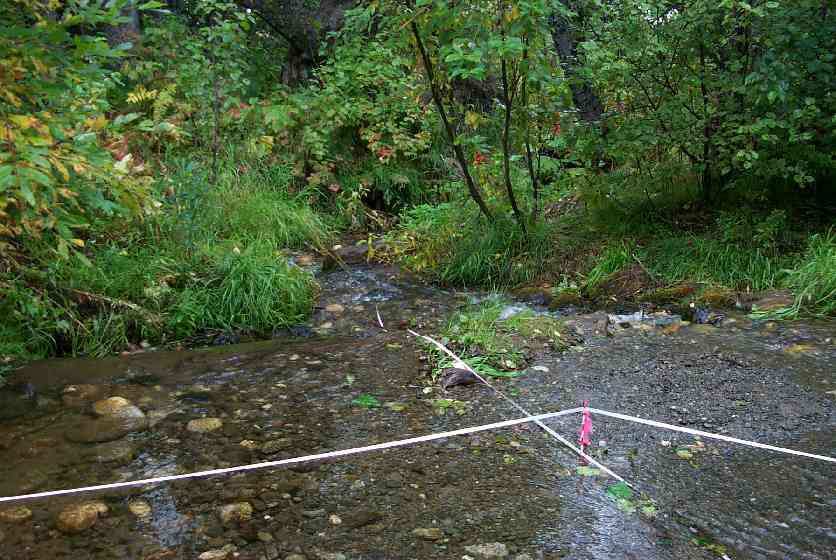
Stream Measurements
|
|
No stream width data available.
Elevations
| Locator ID | Culvert Number |
River Distance (ft)1 |
Distance From Crossing (ft)2 |
Relative Elevation (ft) |
|---|---|---|---|---|
| Inlet Road Edge (inlet edge of road) | 97.07 | |||
| U/S Thalweg (upst thalweg) | 0.00 | 95.72 | ||
| U/S OHW elevation (upst OHW mark elev) | 0.00 | 96.47 | ||
| U/S Thalweg (upst thalweg) | 40.00 | 94.69 | ||
| U/S OHW elevation (upst OHW mark elev) | 40.00 | 95.38 | ||
| U/S Thalweg (upst thalweg) | 88.00 | 93.32 | ||
| U/S Thalweg (upst thalweg) | 88.00 | 93.68 | ||
| Top of Pipe Inlet | 90.00 | 96.16 | ||
| U/S Thalweg (culvert inlet thalweg) | 90.00 | 93.14 | ||
| Inlet Culvert Invert (inlet invert) | 90.00 | 93.18 | ||
| Outlet Invert (outlet invert) | 146.80 | 90.66 | ||
| D/S Thalweg (culvert outlet thalweg) | 146.80 | 90.57 | ||
| Outlet Culvert Top | 146.80 | 93.68 | ||
| Outlet Road Edge (outlet edge of road) | 146.80 | 97.08 | ||
| Max Pool Depth (dwst outlet pool) | 148.30 | 90.18 | ||
| Max Pool Depth (max pool depth) | 149.30 | 90.16 | ||
| Misc. (outlet pool) | 152.30 | 90.63 | ||
| D/S Grade Ctrl (Thalweg) (notch in 1st step pool overflow) | 159.80 | 90.35 | ||
| D/S Grade Ctrl (Thalweg) (top of 1st step pool outlet) | 159.80 | 91.17 | ||
| D/S Grade Ctrl (Thalweg) (notch in 2nd step pool overflow) | 172.80 | 88.86 | ||
| D/S Grade Ctrl (Thalweg) (top of 2nd step pool outlet) | 172.80 | 89.69 | ||
| D/S Thalweg (thalweg of pool below 2nd step pool) | 174.80 | 87.27 | ||
| D/S Tailcrest or 1st Thalweg (tailcrest of pool below 2nd step pool) | 179.80 | 87.69 | ||
| D/S OHW Elev (dwst OHW mark elev) | 179.80 | 88.88 | ||
| D/S Thalweg (dwst thalweg) | 194.80 | 86.88 | ||
| D/S OHW Elev (dwst OHW mark elev) | 194.80 | 88.60 | ||
| D/S Thalweg (dwst thalweg) | 236.80 | 85.33 | ||
| D/S OHW Elev (dwst OHW mark elev) | 236.80 | 86.38 |
Notes:
- River distance is measured continuously throughout the survey reach along the thalweg of the stream.
- Measured from each end of the crossing along the thalweg of the stream.
Fish Sampling Efforts
| Gear Type: Minnow Trap (A) | Trap Duration(h): 18 | |
| Gear Type: Minnow Trap (B) | Trap Duration(h): 28 | |
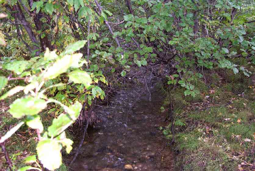
| Comments: Trap set downstream of culvert & cottonwood log step structures. | ||
Fish Observations
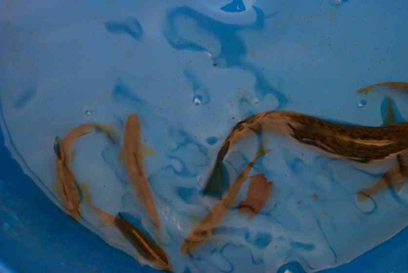
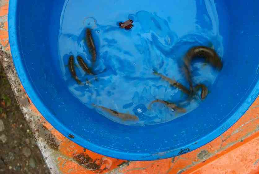
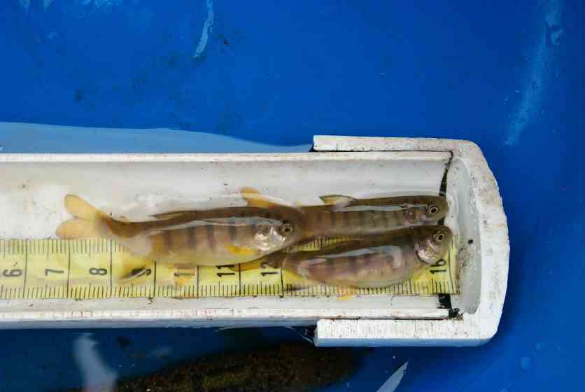
| Species: juvenile/adult Dolly Varden | Life History: Unknown | ||
| Total Fish Observed: 10 | Fish Measured: 5 | Fork Lengths (mm) Min: 98 Max: 107 Mean: 103 | |
| Collected/Observed by Gear Type: Downstream Minnow Trap (10) | |||
| Species: juvenile coho salmon | Life History: Anadromous | ||
| Total Fish Observed: 14 | Fish Measured: 7 | Fork Lengths (mm) Min: 45 Max: 58 Mean: 49 | |
| Collected/Observed by Gear Type: Downstream Minnow Trap (14) | |||
| Species: no fish collected or observed | Life History: Not Applicable | ||
| Total Fish Observed: 0 | Fish Measured: | Fork Lengths (mm) Min: Max: Mean: | |
| Collected/Observed by Gear Type: Upstream Minnow Trap (0) | |||
Photos
Questions or comments about this report can be directed to dfg.dsf.webmaster@alaska.gov