Fish Passage Site 20401343
Coordinates (dec. deg.): 61.71077°, -149.11888°
Legal Description: S019N002E29
Region: South Central
Road Name: Murphy Road
Datum: NAD83
Quad Name / ITM: Anchorage C-6
AWC Stream #: 247-50-10260-2019-3120
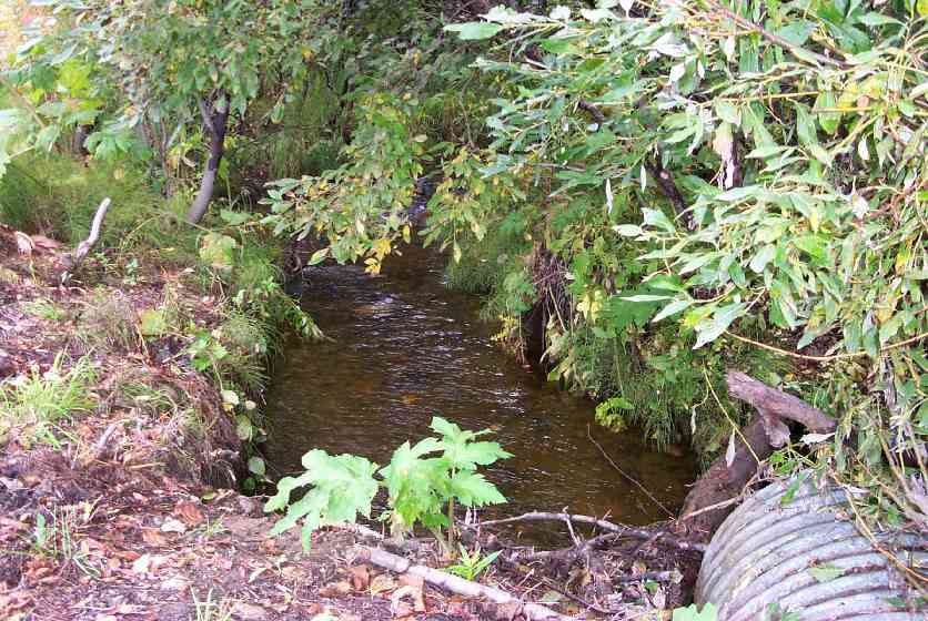
Stream Name: Wasilla Creek tributary
Elevation:
Site Comments: None
Multiple surveys have been conducted at this site — click on the drop down
arrow to the right of the survey date below to choose a different report for this site.
arrow to the right of the survey date below to choose a different report for this site.
Survey MSCS1-WA039
Observers: Edward Weiss, Olof Jacobsson, Joe Conner
Overall Fish Passage Rating:
Tidal: No
Backwatered: No
Step Pools:
Construction Year:
Site Observations:
- Culvert gradient red
Comments: None
Culvert Measurements
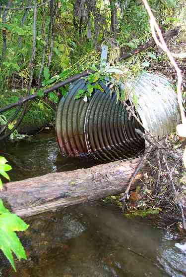
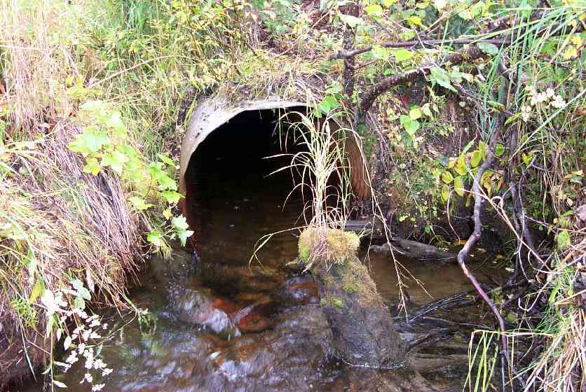
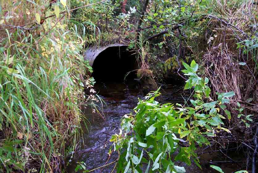
| ID: 1 | Structure Type: Circular pipe (Corrugated steel) | Fish Passage Rating: | |||||||||||||||||||||||||||||||||||||||||
|
|
|
|||||||||||||||||||||||||||||||||||||||||
Stream Measurements
|
|
| Stream Width Type | Distance From Crossing (ft) |
Stream Width (ft) |
|---|---|---|
| Downstream ordinary high water | 47.0 | 8.00 |
| Downstream ordinary high water | 95.0 | 7.50 |
| Upstream ordinary high water | 32.0 | 12.00 |
Elevations
| Locator ID | Culvert Number |
River Distance (ft)1 |
Distance From Crossing (ft)2 |
Relative Elevation (ft) |
|---|---|---|---|---|
| Misc. (thalweg of top of beaver dam upst) | 0.00 | 91.28 | ||
| Misc. (depth of beaver pool) | 3.00 | 89.46 | ||
| U/S OHW elevation (bankfull OHW mark elevation) | 16.00 | 91.12 | ||
| U/S Thalweg (upst thalweg) | 16.00 | 89.41 | ||
| U/S Thalweg (upst thalweg) | 46.00 | 88.75 | ||
| U/S Thalweg (culvert inlet thalweg) | 48.00 | 88.83 | ||
| Inlet Culvert Invert (invert of inlet) | 48.00 | 89.19 | ||
| Inlet Road Edge (edge of road near inlet) | 48.00 | 94.42 | ||
| Inlet Culvert Top | 48.00 | 92.17 | ||
| Outlet Road Edge (edge of road near outlet) | 128.50 | 94.35 | ||
| Outlet Culvert Top | 128.50 | 89.53 | ||
| D/S Thalweg (culvert outlet thalweg) | 128.50 | 86.49 | ||
| Outlet Invert (invert of outlet) | 128.50 | 86.53 | ||
| Max Pool Depth (culvert thalweg outlet pool depth) | 133.50 | 86.12 | ||
| D/S Thalweg (dwst thalweg) | 175.50 | 86.13 | ||
| D/S OHW Elev (dwst OHW mark elevation) | 175.50 | 88.49 | ||
| D/S Thalweg (dwst thalweg) | 223.50 | 86.15 | ||
| D/S OHW Elev (dwst OHW mark elevation) | 223.50 | 88.12 |
Notes:
- River distance is measured continuously throughout the survey reach along the thalweg of the stream.
- Measured from each end of the crossing along the thalweg of the stream.
Fish Sampling Efforts
| Gear Type: Minnow Trap (A) | Trap Duration(h): 18 | |
| Comments: Trapsite upstream of beaver dam. | ||
| Gear Type: Minnow Trap (B) | Trap Duration(h): 1 | |
| Comments: Trap site 50' downstream of beaver dam. Small salmonid observed in culvert outlet | ||
Fish Observations
| Species: juvenile/adult Dolly Varden | Life History: Unknown | ||
| Total Fish Observed: 4 | Fish Measured: 2 | Fork Lengths (mm) Min: 95 Max: 105 Mean: 100 | |
| Collected/Observed by Gear Type: Upstream Minnow Trap (4) | |||
| Species: juvenile coho salmon | Life History: Anadromous | ||
| Total Fish Observed: 10 | Fish Measured: 5 | Fork Lengths (mm) Min: 83 Max: 110 Mean: 92 | |
| Collected/Observed by Gear Type: Upstream Minnow Trap (10) | |||
| Species: no fish collected or observed | Life History: Not Applicable | ||
| Total Fish Observed: | Fish Measured: | Fork Lengths (mm) Min: Max: Mean: | |
| Collected/Observed by Gear Type: Downstream Minnow Trap () | |||
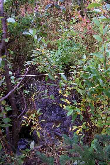
Photos
Questions or comments about this report can be directed to dfg.dsf.webmaster@alaska.gov